|
Eastern Brazil Marine Ecoregion
The Eastern Brazil marine ecoregion covers the coastal marine environment along the middle of the east coast of Brazil. The ecoregion extends south from the Bay of All Saints (about 15 degrees south latitude) to Cabo Frio (about 23 degrees south latitude) just east of the city of Rio de Janeiro. The Brazil Current enters from the east, feeding warm subtropical water to the south along the coast. The influence of the tropical waters leaves the ecoregion relatively oligotrophic (nutrient poor). The Eastern Brazil ecoregion is one of two coastal marine ecoregions (along with the Northeastern Brazil marine ecoregion) in the Tropical Southwest Atlantic marine province. It is thus part of the Tropical Atlantic realm. . Physical setting The ecoregion reaches out into the Atlantic Ocean for 200–250 miles from the coast. The ecoregion is bounded on the north at the Bay of All Saints, and stretches for 1,000 coastal miles to the south at Cabo Frio, where the ecoregion transi ... [...More Info...] [...Related Items...] OR: [Wikipedia] [Google] [Baidu] |
Tropical Atlantic
The Tropical Atlantic realm is one of twelve marine realms that cover the world's coastal seas and continental shelves. The Tropical Atlantic covers both sides of the Atlantic. In the western Atlantic, it extends from Bermuda, southern Florida, and the southern Gulf of Mexico through the Caribbean and along South America's Atlantic coast to Cape Frio in Brazil's Rio de Janeiro state. In the Eastern Atlantic, it extends along the African coast from Cape Blanco in Mauritania to the Tigres Peninsula on the coast of Angola. It also includes the seas around St. Helena and Ascension islands. The Tropical Atlantic is bounded on the north and south by temperate ocean realms. The Temperate Northern Atlantic realm lies to the north on both the North American and African-European shores of the Atlantic. To the south, the ocean realms conform to the continental margins, not the ocean basins; the Temperate South America realm lies to the south along the South American coast, and th ... [...More Info...] [...Related Items...] OR: [Wikipedia] [Google] [Baidu] |
Doce River
The Doce River (literally the "sweet river"; pt, Rio Doce ) is a river in southeast Brazil with a length of . The river basin is economically important. In 2015 the collapse of a dam released highly contaminated water from mining into the river, causing an ecological disaster. Course The Doce River is formed by the junction of the Piranga and the Carmo near the historical city of Ouro Preto, whose sources are located in the foothills of the Mantiqueira and Espinhaço mountain chains at altitudes of about 1,200 m. It flows in a northeastern direction via Ipatinga, makes a wide curve near Governador Valadares, and flows in a southeastern direction passing through Conselheiro Pena, to enter the Atlantic Ocean near Linhares in Espírito Santo state. Its main tributaries are the Piracicaba, Casca, Matipó, Caratinga-Cuieté, Manhuaçu, Santo Antônio and Suaçuí Grande, in Minas Gerais; the Pancas, Guandu, and São José, in Espírito Santo. Part of the river basin is contained ... [...More Info...] [...Related Items...] OR: [Wikipedia] [Google] [Baidu] |
Artisanal Fishing
Artisanal fishing (or traditional/subsistence fishing) consists of various small-scale, low-technology, low-capital, fishing practices undertaken by individual fishing households (as opposed to commercial fishing). Many of these households are of coastal or island ethnic groups. These households make short (rarely overnight) fishing trips close to the shore. Their produce is usually not processed and is mainly for local consumption. Artisan fishing uses traditional fishing techniques such as rod and tackle, fishing arrows and harpoons, cast nets, and small (if any) traditional fishing boats. For that reason, socio-economic status of artisanal fishing community has become an interest of the authorities in recent years. Artisan fishing may be undertaken for both commercial and subsistence reasons. It contrasts with large-scale modern commercial fishing practices in that it is often less wasteful and less stressful on fish populations than modern industrial fishing. Target 1 ... [...More Info...] [...Related Items...] OR: [Wikipedia] [Google] [Baidu] |
Sverdrup
In oceanography, the sverdrup (symbol: Sv) is a non- SI metric unit of volumetric flow rate, with equal to . It is equivalent to the SI derived unit cubic hectometer per second (symbol: hm3/s or hm3⋅s−1): 1 Sv is equal to 1 hm3/s. It is used almost exclusively in oceanography to measure the volumetric rate of transport of ocean currents. It is named after Harald Sverdrup. One sverdrup is about five times what is carried by the world’s largest river, the Amazon. In the context of ocean currents, a volume of one million cubic meters may be imagined as a "slice" of ocean with dimensions × × (width × length × thickness). At this scale, these units can be more easily compared in terms of width of the current (several km), depth (hundreds of meters), and current speed (as meters per second). Thus, a hypothetical current wide, 500 m (0.5 km) deep, and moving at 2 m/s would be transporting of water. The sverdrup is distinct from the SI sievert unit ... [...More Info...] [...Related Items...] OR: [Wikipedia] [Google] [Baidu] |
Western Boundary Current
Boundary currents are ocean currents with dynamics determined by the presence of a coastline, and fall into two distinct categories: western boundary currents and eastern boundary currents. Eastern boundary currents Eastern boundary currents are relatively shallow, broad and slow-flowing. They are found on the eastern side of oceanic basins (adjacent to the western coasts of continents). Subtropical eastern boundary currents flow equatorward, transporting cold water from higher latitudes to lower latitudes; examples include the Benguela Current, the Canary Current, the Humboldt (Peru) Current, and the California Current. Coastal upwelling often brings nutrient-rich water into eastern boundary current regions, making them productive areas of the ocean. Western boundary currents Western boundary currents may themselves be divided into sub-tropical or low-latitude western boundary currents. Sub-tropical western boundary currents are warm, deep, narrow, and fast-flowing current ... [...More Info...] [...Related Items...] OR: [Wikipedia] [Google] [Baidu] |
North Brazil Current
The North Brazil Current (NBC) is a warm water ocean current that is part of the southwestern North Atlantic Gyre. It begins when the westward moving Atlantic South Equatorial Current splits in half and flows northwestward, following the coastline of north Brazil. It ends at the border of Brazil and Guiana, where it is renamed the Guiana Current. It is predominantly a salt water current, but it does help transport fresh water from the Amazon River northward. Track The current begins around 10°S and 31°W, where the split of the South Equatorial Current becomes apparent. The split is forced once the continental shelf begins, and happens quite abruptly. At this point, the current moves quite quickly at 21-23 Sv. Around 5°S, it merges with a northern branch of the South Equatorial Current (SEC) and increases its volume to 37 Sv, with its peak between 100m and 200m deep. Here, the current is at its maximum extent of about 300 kilometers wide. The current continues to about 7°N ... [...More Info...] [...Related Items...] OR: [Wikipedia] [Google] [Baidu] |
Cape São Roque
Cape São Roque ( Port. ''Cabo de São Roque'') or Cape of Saint Roch, is a cape in the northeastern tip of Brazil. Cape São Roque is located in the municipality of Maxaranguape, 51 km north of Natal, in the state of Rio Grande do Norte in Brazil. Cape São Roque is the "point" on the bend of the Brazilian mainland coast that is closest to the continent of Africa.http://www.terra.com.br/turismo/roteiros/2000/09/29/004.htm The cape was first officially visited by European navigators in 1501, in the 1501–1502 Portuguese mapping expedition led by André Gonçalves and Amerigo Vespucci, who named the spot after the saint of the day, St. Roch Roch (lived c. 1348 – 15/16 August 1376/79 (traditionally c. 1295 – 16 August 1327, also called Rock in English, is a Catholic saint, a confessor whose death is commemorated on 16 August and 9 September in Italy; he is especially invoked ..., whose feast day is August 16. References Landforms of Rio Grande do N ... [...More Info...] [...Related Items...] OR: [Wikipedia] [Google] [Baidu] |
South Atlantic Ocean
The Atlantic Ocean is the second-largest of the world's five oceans, with an area of about . It covers approximately 20% of Earth's surface and about 29% of its water surface area. It is known to separate the "Old World" of Africa, Europe and Asia from the "New World" of the Americas in the European perception of the World. The Atlantic Ocean occupies an elongated, S-shaped basin extending longitudinally between Europe and Africa to the east, and North and South America to the west. As one component of the interconnected World Ocean, it is connected in the north to the Arctic Ocean, to the Pacific Ocean in the southwest, the Indian Ocean in the southeast, and the Southern Ocean in the south (other definitions describe the Atlantic as extending southward to Antarctica). The Atlantic Ocean is divided in two parts, by the Equatorial Counter Current, with the North(ern) Atlantic Ocean and the South(ern) Atlantic Ocean split at about 8°N. Scientific explorations of the Atlan ... [...More Info...] [...Related Items...] OR: [Wikipedia] [Google] [Baidu] |
South Equatorial Current
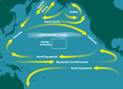
The South Equatorial Current are ocean currents in the Pacific, Atlantic, and Indian Ocean that flow east-to-west between the equator and about 20 degrees south. In the Pacific and Atlantic Oceans, it extends across the equator to about 5 degrees north. Within the southern hemisphere, the South Equatorial Current is the westward limb of the very large-scale subtropical gyres. These gyres are driven by the combination of trade winds in the tropics and westerly winds that are found south of about 30 degrees south, through a rather complicated process that includes western boundary current intensification. On the equator, the South Equatorial Current is driven directly by the trade winds which blow from east to west. In the Indian Ocean, the westward-flowing South Equatorial Current is well-developed only south of the equator. Directly on the equator, the winds reverse twice a year due to the monsoons, and so the surface current can be either eastward or westward. See also ... [...More Info...] [...Related Items...] OR: [Wikipedia] [Google] [Baidu] |
Trindade Hotspot
The Trindade hotspot is a working hypothesis supposing that the submarine volcanic chain Vitória-Trindade, off the eastern coast of Brazil in the southern Atlantic Ocean, is a volcanic hotspot chain. It was considered that the supposed hot-spot should be responsible for the creation of the east-west trending Vitória-Trindade seamount chain, which includes the Trindade and Martim Vaz archipelago at its easternmost end. Trindade, a small island in the archipelago, is the hotspot's most recent eruptive center. This ideas was based on the geochemical data, especially of the highly silica-undersaturated alkaline ultramafic rocks of the Trindade Island and Martim Vaz Island. The isotopic data is OIB-type, which is favourable to the hot-spot hypothesis. However, the volcanic chain direction is E-W and the absolute motion vector of the South America Plate is NW. Therefore, the volcanic chain cannot be a hot-spot chain. Recent research papers, such as and , proposed that the hot mantle ... [...More Info...] [...Related Items...] OR: [Wikipedia] [Google] [Baidu] |
Coralline Algae
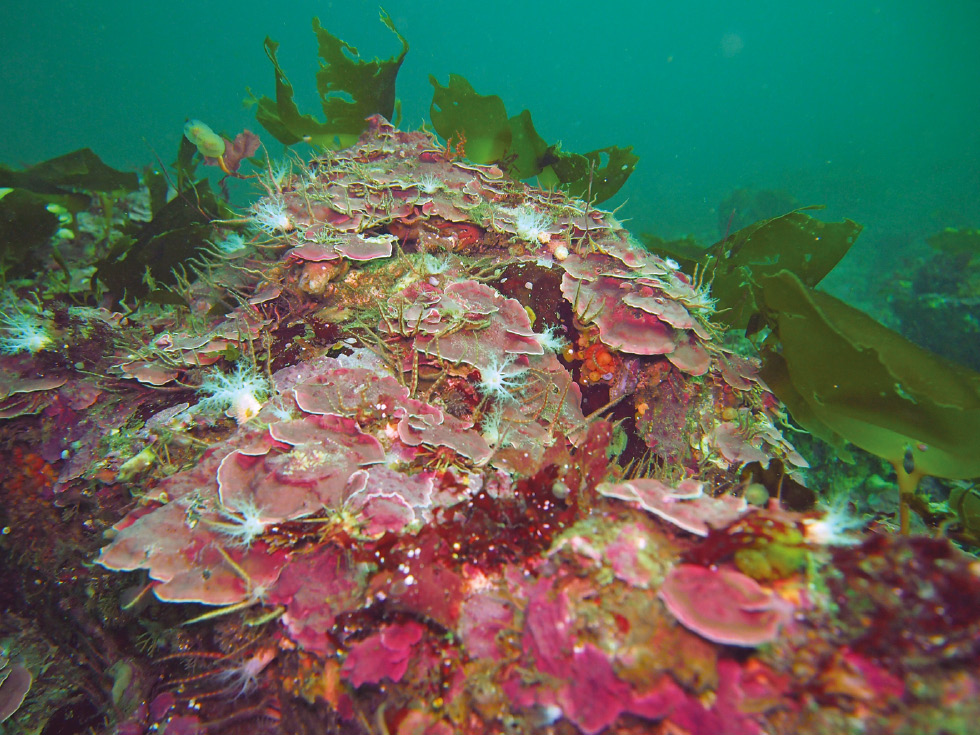
Coralline algae are red algae in the order Corallinales. They are characterized by a thallus that is hard because of calcareous deposits contained within the cell walls. The colors of these algae are most typically pink, or some other shade of red, but some species can be purple, yellow, blue, white, or gray-green. Coralline algae play an important role in the ecology of coral reefs. Sea urchins, parrot fish, and limpets and chitons (both mollusks) feed on coralline algae. In the temperate Mediterranean Sea, coralline algae are the main builders of a typical algal reef, the ''Coralligène'' ("coralligenous"). Many are typically encrusting and rock-like, found in marine waters all over the world. Only one species lives in freshwater. Unattached specimens (maerl, rhodoliths) may form relatively smooth compact balls to warty or fruticose thalli. A close look at almost any intertidal rocky shore or coral reef will reveal an abundance of pink to pinkish-grey patches, distributed ... [...More Info...] [...Related Items...] OR: [Wikipedia] [Google] [Baidu] |
Calcareous
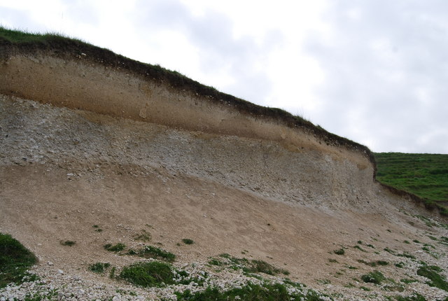
Calcareous () is an adjective meaning "mostly or partly composed of calcium carbonate", in other words, containing lime or being chalky. The term is used in a wide variety of scientific disciplines. In zoology ''Calcareous'' is used as an adjectival term applied to anatomical structures which are made primarily of calcium carbonate, in animals such as gastropods, i.e., snails, specifically about such structures as the operculum, the clausilium, and the love dart. The term also applies to the calcium carbonate tests of often more or less microscopic Foraminifera. Not all tests are calcareous; diatoms and radiolaria have siliceous tests. The molluscs are calcareous, as are calcareous sponges (Porifera), that have spicules which are made of calcium carbonate. In botany ''Calcareous grassland'' is a form of grassland characteristic of soils containing much calcium carbonate from underlying chalk or limestone rock. In medicine The term is used in pathology, for ... [...More Info...] [...Related Items...] OR: [Wikipedia] [Google] [Baidu] |


