|
East Dart River
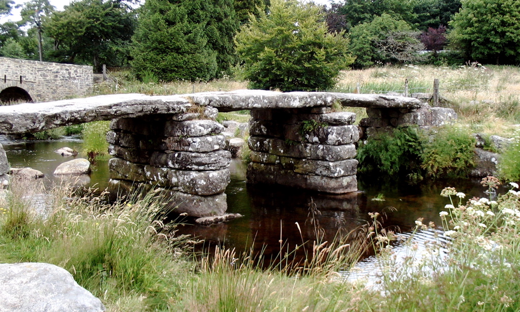
The East Dart River is one of the two main tributaries of the River Dart in Devon, England. Its source is to the west of Whitehorse Hill and slightly south of Cranmere Pool on Dartmoor. It flows south and then south-west for around 9 km to reach the village of Postbridge where it is spanned by a well-known clapper bridge. Before reaching Postbridge the river swings to the east, and then to north-east, flowing between clitter (boulder) strewn steep slopes before once again flowing south. Just above Postbridge the river drops around 2 metres in a short distance and the point is referred to as "Waterfall". It continues south past Bellever to Dartmeet where it joins the West Dart. References Rivers of Devon, Dart Dartmoor, Dart River Dart Dart catchment, 1EastDart {{England-river-stub ... [...More Info...] [...Related Items...] OR: [Wikipedia] [Google] [Baidu] |
Clapper Bridge
A clapper bridge is an ancient form of bridge found on the moors of the English West Country (Bodmin Moor, Dartmoor and Exmoor) and in other upland areas of the United Kingdom including Snowdonia and Anglesey, Cumbria, Derbyshire, Yorkshire, Lancashire, and in northern Wester Ross and north-west Sutherland in Scotland. It is formed by large flat slabs of stone, often granite or schist. These can be supported on stone piers across rivers, or rest on the banks of streams. History Although often credited with prehistoric origin, most were erected in medieval times, and some in later centuries. They are often situated close to a ford where carts could cross. According to the Dartmoor National Park, the word 'clapper' derives ultimately from an Anglo-Saxon word, , meaning 'bridging the stepping stones'; the ''Oxford English Dictionary'' gives the intermediate Medieval Latin form , , "of Gaulish origin", with an initial meaning of "a pile of stones".French and Provençal ''clapier ... [...More Info...] [...Related Items...] OR: [Wikipedia] [Google] [Baidu] |
Postbridge
Postbridge is a hamlet in the heart of Dartmoor in the English county of Devon. It lies on the B3212, roughly midway between Princetown and Moretonhampstead. Postbridge is on the East Dart river, one of two main tributaries of the River Dart, and consists of a few houses, a shop, a pub and hotel, and a national park tourist information centre. Postbridge is best known for its fine example of an ancient clapper bridge over the river. First recorded in the 14th century, the bridge is believed to have been built in the 13th century to enable pack horses to cross, carrying tin to the stannary town of Tavistock. The clapper bridge, a Grade II* listed structure In the United Kingdom, a listed building is a structure of particular architectural or historic interest deserving of special protection. Such buildings are placed on one of the four statutory lists maintained by Historic England in England, Hi ..., stands alongside a Grade II-listed bridge built in the 1780s. The ... [...More Info...] [...Related Items...] OR: [Wikipedia] [Google] [Baidu] |
England
England is a Countries of the United Kingdom, country that is part of the United Kingdom. It is located on the island of Great Britain, of which it covers about 62%, and List of islands of England, more than 100 smaller adjacent islands. It shares Anglo-Scottish border, a land border with Scotland to the north and England–Wales border, another land border with Wales to the west, and is otherwise surrounded by the North Sea to the east, the English Channel to the south, the Celtic Sea to the south-west, and the Irish Sea to the west. Continental Europe lies to the south-east, and Ireland to the west. At the 2021 United Kingdom census, 2021 census, the population was 56,490,048. London is both List of urban areas in the United Kingdom, the largest city and the Capital city, capital. The area now called England was first inhabited by modern humans during the Upper Paleolithic. It takes its name from the Angles (tribe), Angles, a Germanic peoples, Germanic tribe who settled du ... [...More Info...] [...Related Items...] OR: [Wikipedia] [Google] [Baidu] |
Devon
Devon ( ; historically also known as Devonshire , ) is a ceremonial county in South West England. It is bordered by the Bristol Channel to the north, Somerset and Dorset to the east, the English Channel to the south, and Cornwall to the west. The city of Plymouth is the largest settlement, and the city of Exeter is the county town. The county has an area of and a population of 1,194,166. The largest settlements after Plymouth (264,695) are the city of Exeter (130,709) and the Seaside resort, seaside resorts of Torquay and Paignton, which have a combined population of 115,410. They all are located along the south coast, which is the most populous part of the county; Barnstaple (31,275) and Tiverton, Devon, Tiverton (22,291) are the largest towns in the north and centre respectively. For local government purposes Devon comprises a non-metropolitan county, with eight districts, and the Unitary authorities of England, unitary authority areas of Plymouth City Council, Plymouth an ... [...More Info...] [...Related Items...] OR: [Wikipedia] [Google] [Baidu] |
Dartmeet
Dartmeet is a popular tourist spot in the centre of Dartmoor, Devon, England at . It lies at the end of the B3357 road, about east of Two Bridges. From here, the road continues eastwards as a minor road with restrictions on the size of vehicles, past Poundsgate and over Holne Bridge and New Bridge to Ashburton on the edge of the moor. Immediately east of the river crossing, this road ascends Dartmeet Hill, a long steep hill that climbs up the valley side. As the name suggests, Dartmeet is the meeting point of the two major tributaries of the River Dart: the East Dart and West Dart. The road bridge, built in 1792, spans the East Dart; just above it, at the side of the large carpark is an earlier, possibly medieval, clapper bridge, now partially collapsed. The actual confluence of the two rivers is just downstream of the bridge. Dartmeet is the official put in for the Upper Dart section of the River Dart for whitewater kayakers and canoeists. History Dartmeet is at th ... [...More Info...] [...Related Items...] OR: [Wikipedia] [Google] [Baidu] |
Tributaries
A tributary, or an ''affluent'', is a stream or river that flows into a larger stream ('' main stem'' or ''"parent"''), river, or a lake. A tributary does not flow directly into a sea or ocean. Tributaries, and the main stem river into which they flow, drain the surrounding drainage basin of its surface water and groundwater, leading the water out into an ocean, another river, or into an endorheic basin. The Irtysh is a chief tributary of the Ob river and is also the longest tributary river in the world with a length of . The Madeira River is the largest tributary river by volume in the world with an average discharge of . A confluence, where two or more bodies of water meet, usually refers to the joining of tributaries. The opposite to a tributary is a distributary, a river or stream that branches off from and flows away from the main stream. [...More Info...] [...Related Items...] OR: [Wikipedia] [Google] [Baidu] |
River Dart
The River Dart is a river in Devon, England, that source (river), rises high on Dartmoor and flows for to the sea at Dartmouth, Devon, Dartmouth. Name Most hydronyms in England derive from the Common Brittonic, Brythonic language (from which the river's subsequent names ultimately derive from an original Celtic languages, Celtic etymology. As the lower stretches of the river are still covered in ancient oak woodlands, it is accepted that the first element derives from , meaning 'oak' (, ). However the second element (evident in the hard consonantal termination of ''Dar-t'') is less certain, with postulated etymologies from / ('sacred place of oak') or / ('oak stream'). The Ravenna Cosmography records a number of Latinisation of names, Latinised names for the area, and may represent corrupted doublets of a ('station') on a river named . Although the name is otherwise unattested for the river, it is an established etymology throughout Britain, found at the River Darent, ... [...More Info...] [...Related Items...] OR: [Wikipedia] [Google] [Baidu] |
Cranmere Pool
Cranmere Pool is a small depression within a peat bog in the northern half of Dartmoor, Devon, England, at . It lies above sea level on the western flank of Hangingstone Hill, close to the source of the West Okement River, about north west of the source of the East Dart River, and about the same distance west of the River Taw's source. Location and history The pool lies within the Okehampton Artillery Range, one of the Ministry of Defence ranges. A military access road which made it possible to drive to within of the pool was closed for civilian use in 2010. Walking distance from the closest civilian road access is now about , from the north, at , at a starting height of above sea level and using the existing military access road. Cranmere Pool was once a permanent pool of water, but William Crossing, writing early in the 20th century, stated that it had been over a hundred years since this had been the case. The only time there is standing water today is after heavy rai ... [...More Info...] [...Related Items...] OR: [Wikipedia] [Google] [Baidu] |
Dartmoor
Dartmoor is an upland area in southern Devon, South West England. The moorland and surrounding land has been protected by National Park status since 1951. Dartmoor National Park covers . The granite that forms the uplands dates from the Carboniferous Period of geological history. The landscape consists of moorland capped with many exposed granite hilltops known as tors, providing habitats for wildlife. The highest point is High Willhays, above sea level. The entire area is rich in antiquities and archaeological artefacts. Dartmoor National Park is managed by the Dartmoor National Park Authority, whose 22 members are drawn from Devon County Council, local district councils and Government. The Dartmoor Commoners' Council exists to create and enforce regulations regarding commoners' rights. Parts of Dartmoor have been used as military firing ranges for over 200 years. The public is granted extensive land access rights on Dartmoor (including restricted access to the fi ... [...More Info...] [...Related Items...] OR: [Wikipedia] [Google] [Baidu] |
R Dart Waterfall
R, or r, is the eighteenth letter of the Latin alphabet, used in the modern English alphabet, the alphabets of other western European languages and others worldwide. Its name in English is ''ar'' (pronounced ), plural ''ars''. The letter is the eighth most common letter in English and the fourth-most common consonant, after , , and . Name The name of the letter in Latin was (), following the pattern of other letters representing continuants, such as , , , , and . This name is preserved in French and many other languages. In Middle English, the name of the letter changed from to , following a pattern exhibited in many other words such as ''farm'' (compare French ) and ''star'' (compare German ). In Hiberno-English, the letter is called or , somewhat similar to ''oar'', ''ore'', ''orr''. The letter R is sometimes referred to as the 'canine letter', often rendered in English as the dog's letter. This Latin term referred to the Latin that was trilled to sound lik ... [...More Info...] [...Related Items...] OR: [Wikipedia] [Google] [Baidu] |
Bellever
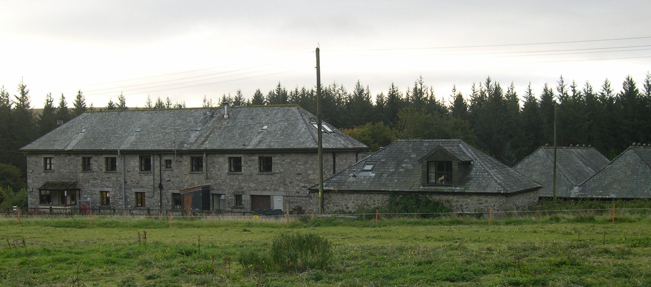
Bellever is a hamlet in Dartmoor, Devon, England. It is located on the river East Dart about south of Postbridge. The first mention of a settlement at this location is in a Duchy of Cornwall record from 1355 which gives the name of a farm here as Welford, a contraction of ''wielle'' (spring) and ''ford''. However, in his ''High Dartmoor'' (1983), Eric Hemery proposed that the name comes from ''bal'' (mine) and ''ford'', meaning ''the mine by the ford''. Until the period after World War II the hamlet consisted of Bellever Farm (owned by the Duchy of Cornwall) and its outbuildings, with a small number of cottages for the farm workers. The farm gained a reputation for the introduction of Galloway and Aberdeen Angus cattle onto Dartmoor. However, in 1931 the Forestry Commission, now Forestry England bought the farm and began a large planting scheme here; several houses were built in the 1950s to house the forestry workers. The coniferous plantation known as Bellever Forest surrou ... [...More Info...] [...Related Items...] OR: [Wikipedia] [Google] [Baidu] |
West Dart
The West Dart River is one of the two main tributaries of the River Dart in Devon, England. Its source is about 2 km north of Rough Tor on north Dartmoor. It flows south to Two Bridges, then south east past Hexworthy to meet the East Dart River at Dartmeet. On the left bank of the river about a mile above Two Bridges is the broadleaved Wistman's Wood, "fascinating high-level woods that are quite unlike anywhere else". Tributaries include the Cowsic River which rises near Devils Tor and flows south below Lydford Tor, to join the West Dart at Two Bridges. Other right bank tributaries include the Blackbrook River, River Swincombe and the O Brook The O Brook is a short right-bank tributary of the West Dart River on Dartmoor in Devon, England. It lies near the village of Hexworthy, and the lower part of the stream forms the boundary between the parishes of Holne and Dartmoor Forest D .... The Cherry Brook joins the West Dart on the left bank near Sherberton. Ref ... [...More Info...] [...Related Items...] OR: [Wikipedia] [Google] [Baidu] |


