|
Earth Resources Technology Satellite
Landsat 1 (LS-1), formerly named Earth Resources Technology Satellite ERTS-A or ERTS-1, was the first satellite of the United States' Landsat program. It was a modified version of the Nimbus 4 meteorological satellite and was launched on July 23, 1972, by a Delta 900 rocket from Vandenberg Air Force Base in California. It was the first satellite to carry a Multispectral Scanner. The near-polar orbiting spacecraft served as a stabilized, Earth-oriented platform for obtaining information on agricultural and forestry resources, geology and mineral resources, hydrology and water resources, geography, cartography, environmental pollution, oceanography and marine resources, and meteorological phenomena. Background The multi-agency Earth Resources Satellites Program was begun in 1966 by the Department of the Interior. The goal of the program was to gather data from the Earth via remote sensing techniques. The following year a feasibility study was performed for the Earth Resources ... [...More Info...] [...Related Items...] OR: [Wikipedia] [Google] [Baidu] |
NASA
The National Aeronautics and Space Administration (NASA ) is an independent agencies of the United States government, independent agency of the federal government of the United States, US federal government responsible for the United States's civil list of government space agencies, space program, aeronautics research and outer space, space research. National Aeronautics and Space Act, Established in 1958, it succeeded the National Advisory Committee for Aeronautics (NACA) to give the American space development effort a distinct civilian orientation, emphasizing peaceful applications in space science. It has since led most of America's space exploration programs, including Project Mercury, Project Gemini, the 1968–1972 Apollo program missions, the Skylab space station, and the Space Shuttle. Currently, NASA supports the International Space Station (ISS) along with the Commercial Crew Program and oversees the development of the Orion (spacecraft), Orion spacecraft and the Sp ... [...More Info...] [...Related Items...] OR: [Wikipedia] [Google] [Baidu] |
Remote Sensing
Remote sensing is the acquisition of information about an physical object, object or phenomenon without making physical contact with the object, in contrast to in situ or on-site observation. The term is applied especially to acquiring information about Earth and other planets. Remote sensing is used in numerous fields, including geophysics, geography, land surveying and most Earth science disciplines (e.g. exploration geophysics, hydrology, ecology, meteorology, oceanography, glaciology, geology). It also has military, intelligence, commercial, economic, planning, and humanitarian applications, among others. In current usage, the term ''remote sensing'' generally refers to the use of satellite- or airborne-based sensor technologies to detect and classify objects on Earth. It includes the surface and the atmosphere and oceans, based on wave propagation, propagated signals (e.g. electromagnetic radiation). It may be split into "active" remote sensing (when a signal is emitted b ... [...More Info...] [...Related Items...] OR: [Wikipedia] [Google] [Baidu] |
Normalized Difference Vegetation Index
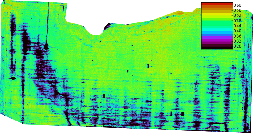
The normalized difference vegetation index (NDVI) is a widely-used metric for quantifying the health and density of vegetation using sensor data. It is calculated from spectrometric data at two specific bands: red and near-infrared. The spectrometric data is usually sourced from remote sensors, such as satellites. The metric is popular in industry because of its accuracy. It has a high correlation with the true state of vegetation on the ground. The index is easy to interpret: NDVI will be a value between -1 and 1. An area with nothing growing in it will have an NDVI of zero. NDVI will increase in proportion to vegetation growth. An area with dense, healthy vegetation will have an NDVI of one. NDVI values less than 0 suggest a lack of dry land. An ocean will yield an NDVI of -1 Brief history The exploration of outer space started in earnest with the launch of Sputnik 1 by the Soviet Union on 4 October 1957. This was the first man-made satellite orbiting the Earth. Subseq ... [...More Info...] [...Related Items...] OR: [Wikipedia] [Google] [Baidu] |
Landsat Island
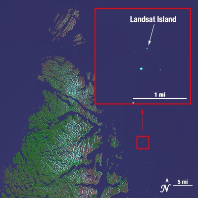
Landsat Island is a small, uninhabited island located at approximately 60°10'37"N 64°02'30"W, off the northeast coast of Labrador (part of the Canadian province of Newfoundland and Labrador). It was discovered in 1976 during the analysis of imagery from the Landsat 1 satellite. The island is only , with a total area of . Discovery In 1976, a Canadian coastal survey was carried out using data from the Landsat 1 satellite. Analysis of the data revealed several previously uncharted features; this includes Landsat Island, which was subsequently named after the satellite. Verification of the island's existence fell to Frank Hall of the Canadian Hydrographic Service ''Retired Canadian Hydrographic Service logo or crest'' The Canadian Hydrographic Service (CHS) is part of the federal department of Fisheries and Oceans Canada and is Canada's authoritative hydrographic office. The CHS represents Canada in ...: Following Hall's encounter with the polar bear, it was suggested ... [...More Info...] [...Related Items...] OR: [Wikipedia] [Google] [Baidu] |
Landsat 1 Launch
The Landsat program is the longest-running enterprise for acquisition of satellite imagery of Earth. It is a joint NASA / USGS program. On 23 July 1972, the Earth Resources Technology Satellite was launched. This was eventually renamed to Landsat 1 in 1975. The most recent, Landsat 9, was launched on 27 September 2021. The instruments on the Landsat satellites have acquired millions of images. The images, archived in the United States and at Landsat receiving stations around the world, are a unique resource for global change research and applications in agriculture, cartography, geology, forestry, regional planning, surveillance and education, and can be viewed through the U.S. Geological Survey (USGS) "EarthExplorer" website. Landsat 7 data has eight spectral bands with spatial resolutions ranging from ; the temporal resolution is 16 days. Landsat images are usually divided into scenes for easy downloading. Each Landsat scene is about 115 miles long and 115 miles wide (or 10 ... [...More Info...] [...Related Items...] OR: [Wikipedia] [Google] [Baidu] |
Virginia T
Virginia, officially the Commonwealth of Virginia, is a U.S. state, state in the Southeastern United States, Southeastern and Mid-Atlantic (United States), Mid-Atlantic regions of the United States between the East Coast of the United States, Atlantic Coast and the Appalachian Mountains. The state's List of capitals in the United States, capital is Richmond, Virginia, Richmond and its most populous city is Virginia Beach, Virginia, Virginia Beach. Its most populous subdivision is Fairfax County, Virginia, Fairfax County, part of Northern Virginia, where slightly over a third of Virginia's population of more than 8.8million live. Eastern Virginia is part of the Atlantic Plain, and the Middle Peninsula forms the mouth of the Chesapeake Bay. Central Virginia lies predominantly in the Piedmont (United States), Piedmont, the foothill region of the Blue Ridge Mountains, which cross the western and southwestern parts of the state. The fertile Shenandoah Valley fosters the state's mo ... [...More Info...] [...Related Items...] OR: [Wikipedia] [Google] [Baidu] |
Near Infrared
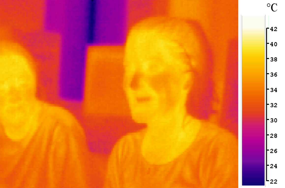
Infrared (IR; sometimes called infrared light) is electromagnetic radiation (EMR) with wavelengths longer than that of visible light but shorter than microwaves. The infrared spectral band begins with the waves that are just longer than those of red light (the longest waves in the visible spectrum), so IR is invisible to the human eye. IR is generally (according to ISO, CIE) understood to include wavelengths from around to . IR is commonly divided between longer-wavelength thermal IR, emitted from terrestrial sources, and shorter-wavelength IR or near-IR, part of the solar spectrum. Longer IR wavelengths (30–100 μm) are sometimes included as part of the terahertz radiation band. Almost all black-body radiation from objects near room temperature is in the IR band. As a form of EMR, IR carries energy and momentum, exerts radiation pressure, and has properties corresponding to both those of a wave and of a particle, the photon. It was long known that fires emit invis ... [...More Info...] [...Related Items...] OR: [Wikipedia] [Google] [Baidu] |
Visible Light
Light, visible light, or visible radiation is electromagnetic radiation that can be perceived by the human eye. Visible light spans the visible spectrum and is usually defined as having wavelengths in the range of 400–700 nanometres (nm), corresponding to frequencies of 750–420 terahertz. The visible band sits adjacent to the infrared (with longer wavelengths and lower frequencies) and the ultraviolet (with shorter wavelengths and higher frequencies), called collectively '' optical radiation''. In physics, the term "light" may refer more broadly to electromagnetic radiation of any wavelength, whether visible or not. In this sense, gamma rays, X-rays, microwaves and radio waves are also light. The primary properties of light are intensity, propagation direction, frequency or wavelength spectrum, and polarization. Its speed in vacuum, , is one of the fundamental constants of nature. All electromagnetic radiation exhibits some properties of both particles and waves ... [...More Info...] [...Related Items...] OR: [Wikipedia] [Google] [Baidu] |
Vidicon
Video camera tubes are devices based on the cathode-ray tube that were used in television cameras to capture television images, prior to the introduction of charge-coupled device (CCD) image sensors in the 1980s. Several different types of tubes were in use from the early 1930s, and as late as the 1990s. In these tubes, an electron beam is scanned across an image of the scene to be broadcast focused on a target. This generated a current that is dependent on the brightness of the image on the target at the scan point. The size of the striking ray is tiny compared to the size of the target, allowing 480–486 horizontal scan lines per image in the NTSC format, 576 lines in PAL, and as many as 1035 lines in Hi-Vision. Cathode-ray tube Any vacuum tube which operates using a focused beam of electrons, originally called cathode rays, is known as a cathode-ray tube (CRT). These are usually seen as display devices as used in older (i.e., non- flat panel) television receivers and comp ... [...More Info...] [...Related Items...] OR: [Wikipedia] [Google] [Baidu] |
Video Tape
Videotape is magnetic tape used for storing video and usually sound in addition. Information stored can be in the form of either an analog or digital signal. Videotape is used in both video tape recorders (VTRs) and, more commonly, videocassette recorders (VCRs) and camcorders. Videotapes have also been used for storing scientific or medical data, such as the data produced by an electrocardiogram. Because video signals have a very high bandwidth, and stationary heads would require extremely high tape speeds, in most cases, a helical-scan video head rotates against the moving tape to record the data in two dimensions. Tape is a linear method of storing information and thus imposes delays to access a portion of the tape that is not already against the heads. The early 2000s saw the introduction and rise to prominence of high-quality random-access video recording media such as hard disks and flash memory. Since then, videotape has been increasingly relegated to archival and s ... [...More Info...] [...Related Items...] OR: [Wikipedia] [Google] [Baidu] |
Valley Forge, Pennsylvania
The village of Valley Forge is an unincorporated settlement. It is located on the west side of Valley Forge National Historical Park at the confluence of Valley Creek and the Schuylkill River in Pennsylvania. The remaining village is in Schuylkill Township of Chester County. It once spanned Valley Creek into Montgomery County. The name Valley Forge is often used to refer to anywhere in the general vicinity of the park. Many places will use the name even though they are actually in King of Prussia, Trooper, Oaks, and other nearby communities. This leads to some ambiguity on the actual location of the modern village. There is a partial re-creation of the historic village from the time of the American Revolution that is located just within the outskirts of the park. History In 1751, there was a forge at the mouth of the East Valley creek used to convert pig iron into bar iron. It was advertised for sale as the property of Daniel Walker, Stephen Evans, and Joseph Williams. ... [...More Info...] [...Related Items...] OR: [Wikipedia] [Google] [Baidu] |


