|
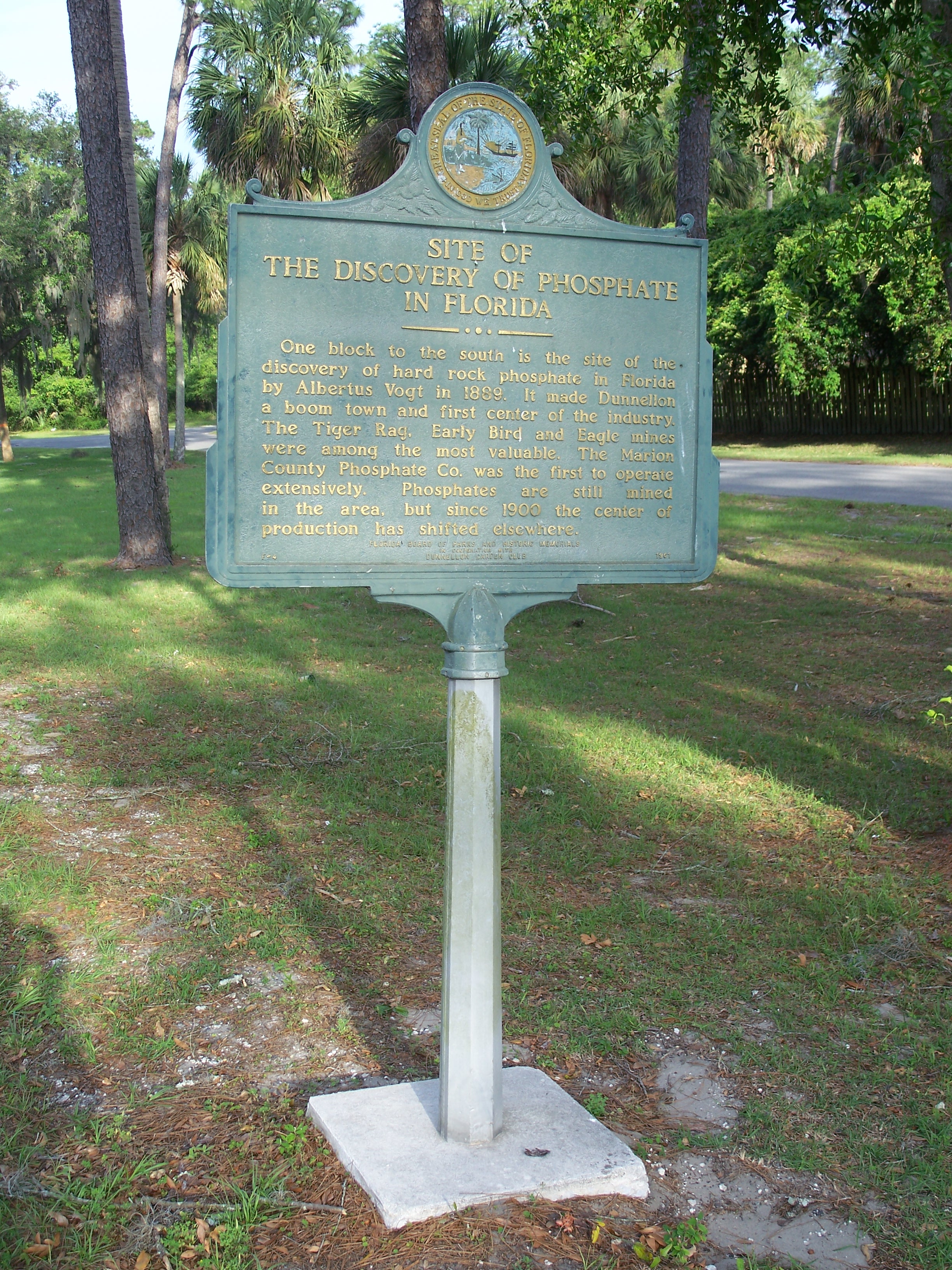
Dunnellon Boomtown Historic District
The Dunnellon Boomtown Historic District is a U.S. historic district (designated as such on December 8, 1988) located in Dunnellon, Florida Florida ( ; ) is a U.S. state, state in the Southeastern United States, Southeastern region of the United States. It borders the Gulf of Mexico to the west, Alabama to the northwest, Georgia (U.S. state), Georgia to the north, the Atlantic .... The district is bounded by McKinney Avenue, Illinois Street, Pennsylvania Avenue, and Cedar Street. It contains 70 historic buildings. References External links Marion County listingsaNational Register of Historic Places National Register of Historic Places in Marion County, Florida Historic districts on the National Register of Historic Places in Florida {{MarionCountyFL-NRHP-stub ... [...More Info...] [...Related Items...] OR: [Wikipedia] [Google] [Baidu] |
Dunnellon, Florida
Dunnellon () is a city in Marion County, Florida, Marion County, Florida, United States. The population was 1,928 at the 2020 United States census, 2020 census, up from 1,733 in 2010 United States census, 2010. It is part of the Ocala, Florida Metropolitan Statistical Area, Ocala Metropolitan Statistical Area. History Dunnellon was founded in 1887, two years before the 1889 discovery of phosphate in the area. It was officially incorporated as a city in 1891. The subsequent mining boom, the first of its kind in Florida, lasted until the early 1910s. The original mining took place in and around the Rainbow River (then called Blue Run,) using the river's natural flow to transport phosphates. One of the original mining pits is now called the 'Blue Cove' subdivision. Phosphate industry operations began to shift south to the Polk County area, and by the 1960s, Dunnellon's last mine closed. Dunnellon survived the bust period, unlike other nearby phosphate towns including Romeo, LeRoy, B ... [...More Info...] [...Related Items...] OR: [Wikipedia] [Google] [Baidu] |
Florida
Florida ( ; ) is a U.S. state, state in the Southeastern United States, Southeastern region of the United States. It borders the Gulf of Mexico to the west, Alabama to the northwest, Georgia (U.S. state), Georgia to the north, the Atlantic Ocean to the east, the Straits of Florida to the south, and The Bahamas to the southeast. About two-thirds of Florida occupies a peninsula between the Gulf of Mexico and the Atlantic Ocean. It has the List of U.S. states by coastline, longest coastline in the contiguous United States, spanning approximately , not including its many barrier islands. It is the only state that borders both the Gulf of Mexico and the Atlantic Ocean. With a population of over 23 million, it is the List of U.S. states and territories by population, third-most populous state in the United States and ranks List of states and territories of the United States by population density, seventh in population density as of 2020. Florida spans , ranking List of U.S. states ... [...More Info...] [...Related Items...] OR: [Wikipedia] [Google] [Baidu] |
United States
The United States of America (USA), also known as the United States (U.S.) or America, is a country primarily located in North America. It is a federal republic of 50 U.S. state, states and a federal capital district, Washington, D.C. The 48 contiguous states border Canada to the north and Mexico to the south, with the semi-exclave of Alaska in the northwest and the archipelago of Hawaii in the Pacific Ocean. The United States asserts sovereignty over five Territories of the United States, major island territories and United States Minor Outlying Islands, various uninhabited islands in Oceania and the Caribbean. It is a megadiverse country, with the world's List of countries and dependencies by area, third-largest land area and List of countries and dependencies by population, third-largest population, exceeding 340 million. Its three Metropolitan statistical areas by population, largest metropolitan areas are New York metropolitan area, New York, Greater Los Angeles, Los Angel ... [...More Info...] [...Related Items...] OR: [Wikipedia] [Google] [Baidu] |
Historic District (United States)
Historic districts in the United States are designated historic districts recognizing a group of buildings, archaeological resources, or other properties as historically or architecturally significant. Buildings, structures, objects, and sites within a historic district are normally divided into two categories, Contributing property, contributing and non-contributing. Districts vary greatly in size and composition: a historic district could comprise an entire neighborhood with hundreds of buildings, or a smaller area with just one or a few resources. Historic districts can be created by federal, state, or Local government, local governments. At the federal level, they are designated by the National Park Service and listed on the National Register of Historic Places; this is a largely honorary designation that does not restrict what property owners may do with a property. U.S. state, State-level historic districts usually do not include restrictions, though this depends on the s ... [...More Info...] [...Related Items...] OR: [Wikipedia] [Google] [Baidu] |
National Register Of Historic Places In Marion County, Florida
__NOTOC__ This is a list of the National Register of Historic Places listings in Marion County, Florida. This is intended to be a complete list of the properties and districts on the National Register of Historic Places in Marion County, Florida, United States. The locations of National Register properties and districts for which the latitude and longitude coordinates are included below, may be seen in a map. There are 33 properties and districts listed on the National Register in the county, including 1 National Historic Landmark. Current listings See also * List of National Historic Landmarks in Florida * National Register of Historic Places listings in Florida __NOTOC__ Image:Florida counties map.png, 300px, Florida counties (clickable map) poly 42 38 86 40 79 44 74 47 71 55 69 69 74 72 76 87 77 90 87 97 87 102 87 108 78 111 77 115 80 117 53 122 49 117 55 109 62 105 56 95 60 85 61 77 52 72 38 53 43 4 ... References {{DEFA ... [...More Info...] [...Related Items...] OR: [Wikipedia] [Google] [Baidu] |

