|
Dublin Heuston Railway Station
Heuston Station, ( ; ; formerly Kingsbridge Station) also known as Dublin Heuston, is one of Dublin's largest train station, railway stations and links the capital with the south, southwest and west of Ireland. It is operated by Iarnród Éireann (IÉ), the national railway operator. It also houses the head office of its parent company, CIÉ, Córas Iompair Éireann (CIÉ). The station is named in honour of Seán Heuston, an executed leader of the 1916 Easter Rising, who had worked in the station's offices. History In 1836, a committee of Commissioners was appointed by the British Government to identify a system of rail routes throughout Ireland which would best serve the interests of the country as a whole. In their report of 1838, Kingsbridge, or 'King's Bridge', was selected as the optimum location for a terminus in Dublin which would most conveniently serve a main trunk railway line to the southern and western districts of Ireland. The site had been known as ''Kingsbrid ... [...More Info...] [...Related Items...] OR: [Wikipedia] [Google] [Baidu] |
Dublin
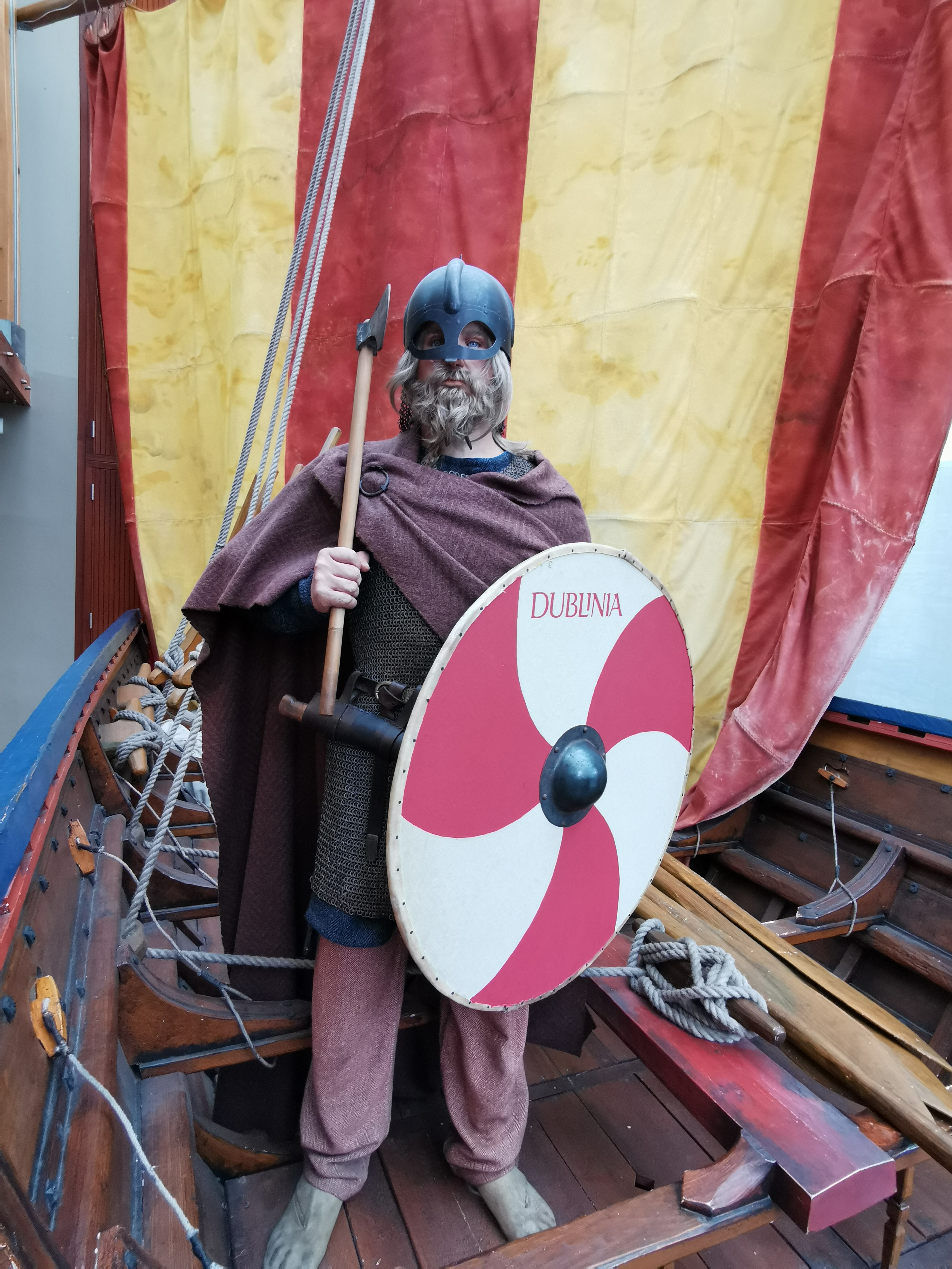
Dublin is the capital and largest city of Republic of Ireland, Ireland. Situated on Dublin Bay at the mouth of the River Liffey, it is in the Provinces of Ireland, province of Leinster, and is bordered on the south by the Dublin Mountains, part of the Wicklow Mountains range. Dublin is the largest city by population on the island of Ireland; at the 2022 census of Ireland, 2022 census, the city council area had a population of 592,713, while the city including suburbs had a population of 1,263,219, County Dublin had a population of 1,501,500. Various definitions of a metropolitan Greater Dublin Area exist. A settlement was established in the area by the Gaels during or before the 7th century, followed by the Vikings. As the Kingdom of Dublin grew, it became Ireland's principal settlement by the 12th century Anglo-Norman invasion of Ireland. The city expanded rapidly from the 17th century and was briefly the second largest in the British Empire and sixth largest in Western Europ ... [...More Info...] [...Related Items...] OR: [Wikipedia] [Google] [Baidu] |
CIÉ
, or CIÉ, is a statutory corporation of Ireland, answerable to the Irish Government and responsible for most public transport within the Republic of Ireland and jointly with its Northern Ireland counterpart, the Northern Ireland Transport Holding Company (which trades as Translink), for the railway service between Dublin and Belfast, via Drogheda, Dundalk, Newry and Portadown. The company is headquartered at Heuston Station, Dublin. It is a statutory corporation whose members are appointed by the Minister for Transport. Services Since the enactment of the ''Transport (Re-organisation of Córas Iompair Éireann) Act, 1986'', CIÉ has been the holding company for Bus Éireann, Dublin Bus and Iarnród Éireann/Irish Rail, the three largest internal transport companies in Ireland. It was originally to have operated the Luas tram system in Dublin, but that project was transferred to the newly created Railway Procurement Agency (RPA). CIÉ's services are provided through th ... [...More Info...] [...Related Items...] OR: [Wikipedia] [Google] [Baidu] |
Irish Measure
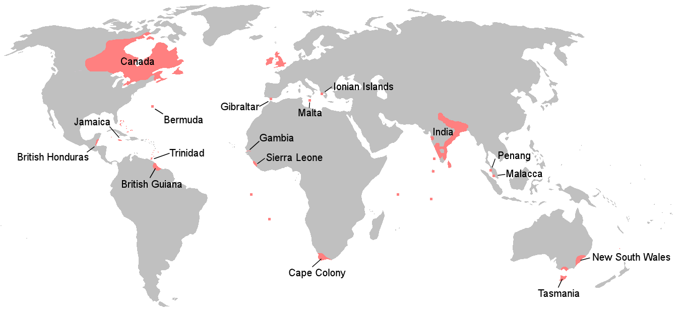
Irish measure or plantation measure was a system of units of land measurement used in Ireland from the 16th century plantations until the 19th century, with residual use into the 20th century. The units were based on " English measure" but used a linear perch measuring as opposed to the English rod of . Thus, linear units such as the furlong and mile, which were defined in terms of perches, were longer by a factor of 14:11 (~27% more) in Irish measure, while units of area, such as the rood or acre, were larger by 196:121 (~62% more). The Weights and Measures Act 1824 ( 5 Geo. 4. c. 74) mandated the use throughout the British Empire of " Imperial measure", also called "statute measure", based on English measure. Imperial measure soon replaced Irish measure in the use of the Dublin Castle administration, but Irish measure persisted in local government, and longer still in private use. History The size of the mile and acre are derived from the length of the surveyor's rod, ... [...More Info...] [...Related Items...] OR: [Wikipedia] [Google] [Baidu] |
Henry John Temple, 3rd Viscount Palmerston
Henry John Temple, 3rd Viscount Palmerston (20 October 1784 – 18 October 1865), known as Lord Palmerston, was a British statesman and politician who served as prime minister of the United Kingdom from 1855 to 1858 and from 1859 to 1865. A member of the Tories (British political party), Tory, Whigs (British political party), Whig and Liberal Party (UK), Liberal parties, Palmerston was the first Liberal prime minister. He dominated British foreign policy from 1830 to 1865, when Britain stood at the height of its imperial power. He held office almost continuously from 1807 until his death in 1865. He began his parliamentary career as a Tory, defected to the Whigs in 1830, and became the first prime minister from the newly formed Liberal Party in 1859. He was highly popular with the British public. David Brown argues that "an important part of Palmerston's appeal lay in his dynamism and vigour". Temple succeeded to Henry Temple, 2nd Viscount Palmerston, his father's Irish peera ... [...More Info...] [...Related Items...] OR: [Wikipedia] [Google] [Baidu] |
Carlow
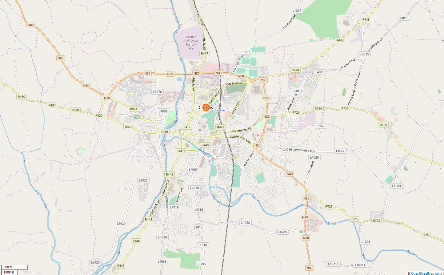
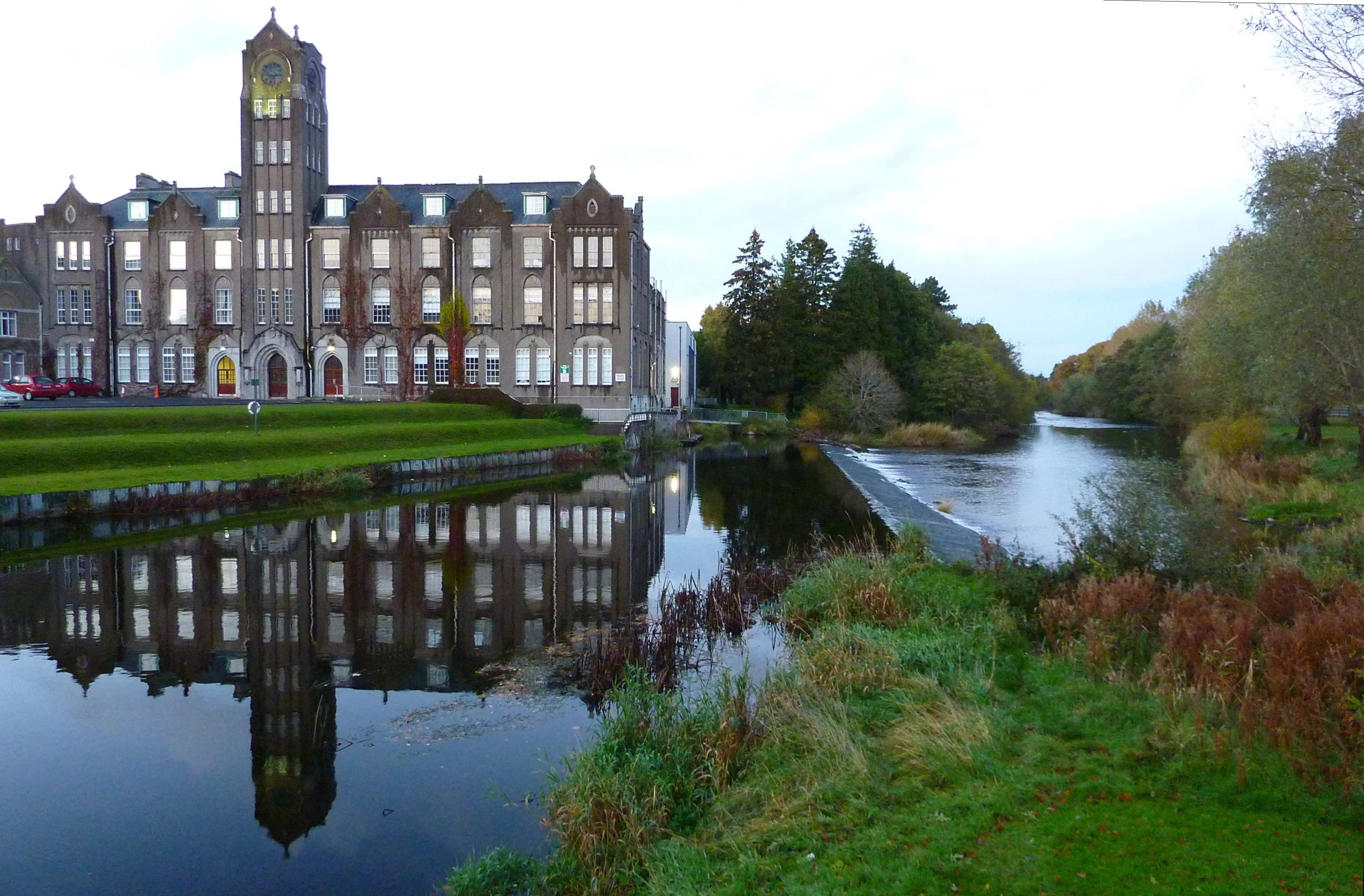
Carlow ( ; ) is the county town of County Carlow, in the south-east of Republic of Ireland, Ireland, from Dublin. At the 2022 census of Ireland, 2022 census, it had a population of 27,351, the List of urban areas in the Republic of Ireland, twelfth-largest urban center in Ireland. The River Barrow flows through the town and forms the historic boundary between counties County Laois, Laois and Carlow. However, the Local Government (Ireland) Act 1898 included the town entirely in County Carlow. The settlement of Carlow is thousands of years old and pre-dates written Irish history. The town has played a major role in Irish history, serving as the capital of the country in the 14th century. The town is in a townland and Civil parishes in Ireland, civil parish of the same name. Etymology The name is an anglicisation of the Irish language, Irish ''Ceatharlach''. Historically, it was anglicised as ''Caherlagh'', ''Caterlagh'' and ''Catherlagh'', which are closer to the Irish spell ... [...More Info...] [...Related Items...] OR: [Wikipedia] [Google] [Baidu] |
Collins Barracks, Dublin
Collins Barracks () is a former military barracks in the Arbour Hill area of Dublin, Ireland. The buildings now house the National Museum of Ireland – Decorative Arts and History. Previously housing first British Armed Forces and later Irish Army garrisons through three centuries, the barracks were the oldest continuously occupied example in the world. Built in 1702, and further extended in the late 18th century and 19th century, the complex's main buildings are neo-classical in style. Originally called simply The Barracks, and later The Royal Barracks, the name was changed in 1922 by the Irish Free State to "Collins Barracks", in honour of Michael Collins, who had been killed earlier that year. Since 1997 the barracks have been home to collections of the National Museum of Ireland (for ''Decorative Arts and History'' exhibits), and the original structures have seen some award-winning redevelopment and conservation work to support this new role. History 18th century to 1 ... [...More Info...] [...Related Items...] OR: [Wikipedia] [Google] [Baidu] |
Linenhall, Dublin
The Linenhall along with the adjacent Yarnhall was a large complex of Georgian buildings and streets associated with the linen and cloth trade in Dublin, Ireland which later gave its name to a surrounding area. It was also temporarily a barracks and as a result, was largely destroyed during the Easter Rising in 1916. Today surrounding streets which were built on or beside the site include Linenhall Street, Linenhall Parade and Linenhall Terrace as well as Yarnhall Street. History Foundation The complex was located to the rear of Henrietta Street, Bolton Street and North King Street. The selection of this three-acre site as a centralised Linen Hall for Dublin was decided by the Board on 17 March 1722 following the rejection of sites in Drumcondra and Ballybough. Thomas Burgh was chosen as architect and the first Linenhall constructed was opened for business on 14 November 1728. Yarnhalls and cottonhalls and other manufactories were later constructed and opened over the fo ... [...More Info...] [...Related Items...] OR: [Wikipedia] [Google] [Baidu] |
Smithfield, Dublin
Smithfield () is an area on the Northside, Dublin, Northside of Dublin, Ireland. Its focal point is a public square, formerly an open market and Common land, common, now officially called Smithfield Plaza, but known locally as Smithfield Square or Smithfield Market. Historically, Smithfield formed the western part of Oxmantown and lay close to Oxmantown Green. Originally, Smithfield lay within the civil parish of St. Paul's, and was served by the Church of Ireland St. Paul's Church (Church of Ireland), St. Paul's Church, on North King Street, now the SPADE Business Centre, and the Catholic St. Paul's (Roman Catholic) Church, Dublin, St. Paul's Church, on Arran Quay, now used by the Catholic Youth Council, and Mission Ministry. The area known as Smithfield roughly incorporates the area bounded by the River Liffey to the south, Bow Street to the east, Queen Street, Dublin, Queen Street to the west, and North Brunswick Street in the suburb of Grangegorman to the north. Notable lan ... [...More Info...] [...Related Items...] OR: [Wikipedia] [Google] [Baidu] |
Dublin Quays
The Dublin quays () refers to the two roadways and quays that run along the north and south banks of the River Liffey in Dublin, Ireland. The stretches of the two continuous streets have several different names. However, all but two of the names (Bachelors Walk and Usher's Island) share the same "quay" designation. The quays have played an important part in Dublin's history. Much of the southern roadway and about half of the northern roadway is part of the R148 road, while the other half of the northern roadway is part of the R801 road. Routes description Both roadways run approximately 4.3 km (2.7 mi) from Sean Heuston Bridge in the west. The eastern end of the north roadway is at East-Link Bridge while the south roadway turns southward at the Grand Canal. Seventeen bridges cross the river along the line of the quays; three of them for pedestrian use only, one a railway bridge, two on which Luas trams run, and the remainder for vehicular and pedestrian use. ... [...More Info...] [...Related Items...] OR: [Wikipedia] [Google] [Baidu] |
Portobello, Dublin
Portobello (, meaning 'beautiful harbour') is an area of Dublin in Ireland, within the southern city centre and bounded to the south by the Grand Canal (Ireland), Grand Canal. It came into existence as a small suburb south of the city in the 18th century, centred on Richmond Street. As a fast-expanding suburb during the 19th century, Portobello attracted many upwardly mobile families whose members went on to play important roles in politics, the arts and science. Towards the end of the century, many Ashkenazi Jews, fleeing pogroms in Russia and Eastern Europe, settled in the area; this led to Portobello being known as Dublin's "Little Jerusalem". Portobello is in the List of Dublin postal districts#Dublin 8 (D8), Dublin 8 postal district, which is rendered as D08 under the Eircode system, as well as in the local electoral area of Dublin South East Inner City and the Dáil constituency of Dublin Bay South (Dáil constituency), Dublin Bay South. History The name Portobello also ... [...More Info...] [...Related Items...] OR: [Wikipedia] [Google] [Baidu] |
Cashel, County Tipperary
Cashel (; ) is a town in County Tipperary in Ireland. Its population was 4,422 in the 2016 census of Ireland, 2016 census. The town gives its name to the ecclesiastical province of ''Cashel''. Additionally, the ''cathedra'' of the Roman Catholic Archdiocese of Cashel and Emly was originally in the town prior to the English Reformation. It is part of the parish of Cashel and Rosegreen in the same archdiocese. One of the six cathedrals of the Anglican Bishop of Cashel and Ossory, who currently resides in Kilkenny, is located in the town. It is in the civil parishes in Ireland, civil parish of St. Patricksrock which is in the historical Barony (Ireland), barony of Middle Third (South Tipperary), Middle Third. Location and access The town is situated in the Golden Vale, an area of rolling pastureland in the province of Munster. Roads It is located off the M8 motorway (Ireland), M8 Dublin to Cork (city), Cork Motorways in Ireland, motorway. Prior to the construction of the motorway ... [...More Info...] [...Related Items...] OR: [Wikipedia] [Google] [Baidu] |
River Liffey
The River Liffey (Irish language, Irish: ''An Life'', historically ''An Ruirthe(a)ch'') is a river in eastern Ireland that ultimately flows through the centre of Dublin to its mouth within Dublin Bay. Its major Tributary, tributaries include the River Dodder, the River Poddle and the River Camac. The river supplies much of Dublin's water and supports a range of recreational activities. Name While Ptolemy's ''Geography (Ptolemy), Geography'' (2nd century AD) describes a river which he labels Οβοκα (''Oboka''), this is not the Liffey: ultimately it leads to the name of the River Avoca in County Wicklow. According to "Place Names from our Older Literature - IV." by Boswell, C. S. (1904 Connradh na Gaedhilge) the river takes its name from Magh Life, i.e. the plain of Kildare through which the Life flows. This in turn takes its name from Life, daughter of Canann Curthach, who eloped with and married Deltbanna mac Druchta, cup-bearer to Conaire Mór High King of Ireland. Life ... [...More Info...] [...Related Items...] OR: [Wikipedia] [Google] [Baidu] |


