|
Djupvatnet
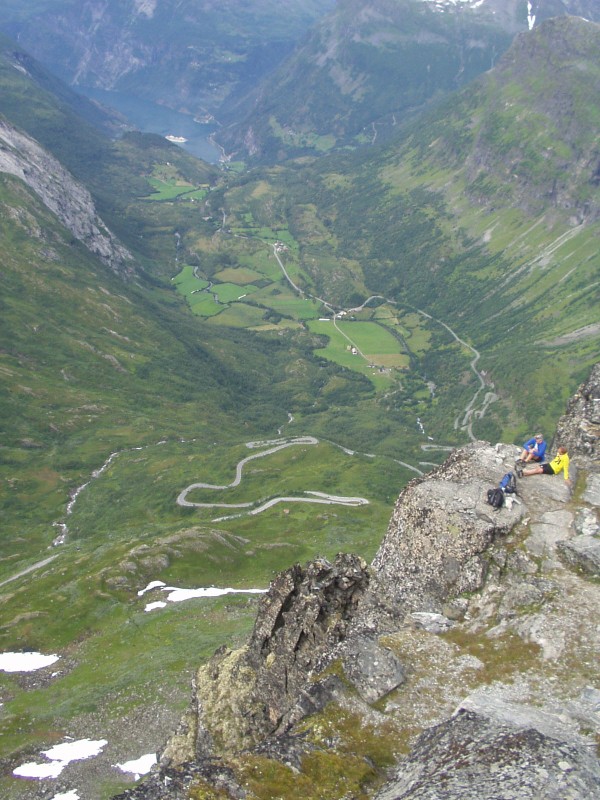
Djupvatnet is a lake in extreme southeastern Stranda Municipality in Møre og Romsdal county, Norway. The lake lies at above sea level. The lake is part of the headwaters of the Otta river system which flows southeast into the lake Breiddalsvatnet and on into Oppland county. Norwegian County Road 63 follows the northern shore of the lake. The tourist village of Geiranger and the Geirangerfjorden are located about to the north of the lake. The mountain Dalsnibba is located immediately northwest of the lake, and there is a road leading to the top that begins on the northwest side of the lake. See also *List of lakes in Norway This is a list of lakes and reservoirs in Norway, sorted by county. For the geography and history of lakes in that country, see Lakes in Norway, including: * List of largest lakes in Norway * List of deepest lakes in Norway Akershus *Bjørk ... References Stranda Lakes of Møre og Romsdal {{MøreRomsdal-geo-stub ... [...More Info...] [...Related Items...] OR: [Wikipedia] [Google] [Baidu] |
Norwegian County Road 63
Norwegian County Road 63 ( no, Fylkesvei 63 or ) is a Norwegian county road in Møre og Romsdal county and a very small part in Innlandet county, Norway. It begins at Norwegian National Road 15 along the lake Langvatnet in Skjåk Municipality in Innlandet county and it heads north where it ends at the junction with the European route E136 highway near the town of Åndalsnes in Rauma Municipality, Møre og Romsdal county. The route runs for including a single ferry crossing over the Norddalsfjorden. The vast majority of the road is in Møre og Romsdal county, only the southernmost lie in the extreme western part of Innlandet county. Both the Langvatnet–Geiranger and Trollstigen sections of the road are closed during winter and spring (usually early November to late May) due to the weather conditions (snow and avalanches). The road passes by a number of notable landmarks, which has led to the earmarking of the route as national tourist route. Path (from south to north ... [...More Info...] [...Related Items...] OR: [Wikipedia] [Google] [Baidu] |
Otta (river)
Otta is a river in Innlandet county, Norway. The river flows through the Ottadalen valley which includes the municipalities of Skjåk, Lom, Vågå, and Sel. The watershed of the Otta drains an area of beginning in the Breheimen mountains and emptying into the large river Gudbrandsdalslågen. The Otta River is known for rafting. The rafting season begins in mid-May and lasts until the end of September. The Norwegian National Road 15 runs along the river for almost its entire course. Course The river technically begins at the lake Djupvatnet in Stranda Municipality which is in Vestland county, about west of the border with Skjåk Municipality in Innlandet county. The river flows through the Billingsdalen valley heading to the east, including through several lakes including the Breiddalsvatnet, Skim, and Vågåvatn. After the Vågåvatn lake at Vågåmo, it enters the Ottadalen valley and heads to the southeast to the town of Otta in Sel Municipality. At Otta, the ... [...More Info...] [...Related Items...] OR: [Wikipedia] [Google] [Baidu] |
Stranda
Stranda is a municipality in Møre og Romsdal county, Norway. It is part of the Sunnmøre region. The administrative centre of the municipality is the village of Stranda. Stranda consists of three smaller villages and one larger central village. The smaller villages are Hellesylt, Geiranger, and Liabygda. The central village, Stranda (same name as the municipality), has about 2,600 inhabitants. Stranda Municipality is known for tourist attractions like the Geirangerfjorden Sunnylvsfjorden and its skiarea at Strandafjellet The municipality is the 134th largest by area out of the 356 municipalities in Norway. Stranda is the 192nd most populous municipality in Norway with a population of 4,467. The municipality's population density is and its population has decreased by 2.9% over the previous 10-year period. General information The parish of ''Stranden'' was established as a municipality on 1 January 1838 (see formannskapsdistrikt law). On 1 January 1892, the northern distr ... [...More Info...] [...Related Items...] OR: [Wikipedia] [Google] [Baidu] |
Geiranger
Geiranger is a small tourist village in Sunnmøre region of Møre og Romsdal county in the western part of Norway. It is in the municipality of Stranda at the head of the Geirangerfjorden, which is a branch of the large Storfjorden. The nearest city is Ålesund. Geiranger is home to spectacular scenery, and has been named the best travel destination in Scandinavia by Lonely Planet. Since 2005, the Geirangerfjord area has been listed as a UNESCO World Heritage Site. The Seven Sisters waterfall is located just west of Geiranger, directly across another waterfall called "The Suitor." Norwegian County Road 63 passes through the village. Geiranger Church is the main church for the village and surrounding area. Geiranger is under constant threat from landslides from the mountain Åkerneset into the fjord. A collapse would cause a tsunami that could destroy downtown Geiranger. For this reason, sirens have been installed to warn residents if a landslide should occur. Name The O ... [...More Info...] [...Related Items...] OR: [Wikipedia] [Google] [Baidu] |
Dalsnibba
Dalsnibba is a mountain in Stranda Municipality in Møre og Romsdal county, Norway. It is located at the end of the Geiranger valley, about south of the village of Geiranger and the Geirangerfjorden. The lake Djupvatnet lies directly to the southeast of the mountain. The mountain is located very near the county border with both Oppland and Sogn og Fjordane counties, in the southeastern part of Møre og Romsdal county. Dalsnibba offers a good view and is therefore a popular tourist destination. Dalsnibba is often covered by snow even in the summer. The Norwegian County Road 63 passes along the south side of the mountain, and from that road, there is a private toll road called Nibbevegen, owned and operated by Geiranger Skysslag, that goes up to the summit of Dalsnibba, a drive of about from Geiranger. It was completed in 1939 but due to the Second World War its official opening was delayed until July 19 1948. The road was tarmacked in 2013. The Geiranger – From Fjord to S ... [...More Info...] [...Related Items...] OR: [Wikipedia] [Google] [Baidu] |
List Of Lakes In Norway
This is a list of lakes and reservoirs in Norway, sorted by Counties of Norway, county. For the geography and history of lakes in that country, see Lakes in Norway, including: *Lakes in Norway#Largest lakes, List of largest lakes in Norway *Lakes in Norway#Deepest lakes, List of deepest lakes in Norway Akershus *Bjørkelangen (lake), Bjørkelangen *Bogstadvannet *Dælivannet *Engervannet *Hallangen *Hurdalsjøen *Lyseren *Mangen *Mjøsa *Øgderen *Østernvann *Øyangen (Gran) *Øyeren *Rødenessjøen *Setten Aust-Agder *Åraksfjorden *Blåsjø *Botnsvatnet *Botsvatn *Breidvatn *Byglandsfjorden *Fisstøylvatnet *Grøssæ *Gyvatn *Hartevatnet *Herefossfjorden *Holmavatnet (Vinje), Holmavatnet *Holmevatnet *Homstølvatnet *Hovatn *Høvringsvatnet *Kilefjorden *Kolsvatnet *Kvifjorden *Longerakvatnet *Måvatn *Myklevatnet *Nasvatn *Nelaug (lake), Nelaug *Nesvatn *Nystølfjorden *Ogge *Ormsavatnet *Østre Grimevann *Øyarvatnet *Ramvatn *Reinevatn *Rore (lake), Rore *Rosskreppfj ... [...More Info...] [...Related Items...] OR: [Wikipedia] [Google] [Baidu] |
Møre Og Romsdal
Møre og Romsdal (; en, Møre and Romsdal) is a county in the northernmost part of Western Norway. It borders the counties of Trøndelag, Innlandet, and Vestland. The county administration is located in the town of Molde, while Ålesund is the largest town. The county is governed by the Møre og Romsdal County Municipality which includes an elected county council and a county mayor. The national government is represented by the county governor. Name The name ''Møre og Romsdal'' was created in 1936. The first element refers to the districts of Nordmøre and Sunnmøre, and the last element refers to Romsdal. Until 1919, the county was called "Romsdalens amt", and from 1919 to 1935 "Møre fylke". For hundreds of years (1660-1919), the region was called ''Romsdalen amt'', after the Romsdalen valley in the present-day Rauma Municipality. The Old Norse form of the name was ''Raumsdalr''. The first element is the genitive case of the name ''Raumr'' derived from the nam ... [...More Info...] [...Related Items...] OR: [Wikipedia] [Google] [Baidu] |
Norway
Norway, officially the Kingdom of Norway, is a Nordic country in Northern Europe, the mainland territory of which comprises the western and northernmost portion of the Scandinavian Peninsula. The remote Arctic island of Jan Mayen and the archipelago of Svalbard also form part of Norway. Bouvet Island, located in the Subantarctic, is a dependency of Norway; it also lays claims to the Antarctic territories of Peter I Island and Queen Maud Land. The capital and largest city in Norway is Oslo. Norway has a total area of and had a population of 5,425,270 in January 2022. The country shares a long eastern border with Sweden at a length of . It is bordered by Finland and Russia to the northeast and the Skagerrak strait to the south, on the other side of which are Denmark and the United Kingdom. Norway has an extensive coastline, facing the North Atlantic Ocean and the Barents Sea. The maritime influence dominates Norway's climate, with mild lowland temperatures on the ... [...More Info...] [...Related Items...] OR: [Wikipedia] [Google] [Baidu] |
Norwegian Water Resources And Energy Directorate
The Norwegian Water Resources and Energy Directorate ( no, Norges vassdrags- og energidirektorat or NVE) is a Norwegian government agency established in 1921. It is under the Ministry of Petroleum and Energy and regulates the country's water resources and energy supply. Its mandate includes contingency planning for floods, serving as a centre of expertise for hydrology, research and development, and increasing energy efficiency. It is a member of the Council of European Energy Regulators. The directorate is based in Oslo, and has regional offices in Hamar, Førde, Tønsberg, Trondheim and Narvik. It also establishes international contacts and undertakes work abroad in developing countries for the Norwegian Agency for Development Cooperation. , it has over 400 employees. Its website includes statistics on Norwegian energy consumption, production and prices and a database of Norwegian lakes and water catchment areas. The directorate holds administrative responsibility for ... [...More Info...] [...Related Items...] OR: [Wikipedia] [Google] [Baidu] |
Breiddalsvatnet
Breiddalsvatnet is a lake in Skjåk Municipality in Innlandet county, Norway. The lake lies just west of the village of Grotli. The Norwegian National Road 15 runs along the north side of the lake. The mountains Helleggi and Krosshø are located just north of the lake and the Breheimen National Park lies just south of the lake. See also *List of lakes in Norway This is a list of lakes and reservoirs in Norway, sorted by Counties of Norway, county. For the geography and history of lakes in that country, see Lakes in Norway, including: *Lakes in Norway#Largest lakes, List of largest lakes in Norway *L ... References Skjåk Lakes of Innlandet {{Innlandet-lake-stub ... [...More Info...] [...Related Items...] OR: [Wikipedia] [Google] [Baidu] |
Oppland
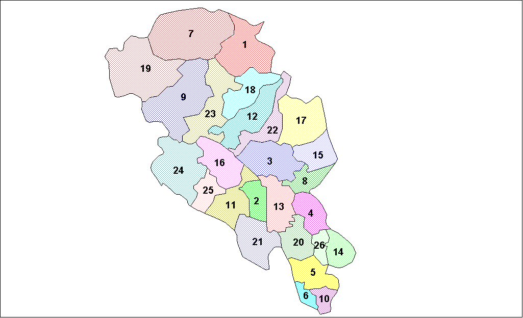
Oppland is a former county in Norway which existed from 1781 until its dissolution on 1 January 2020. The old Oppland county bordered the counties of Trøndelag, Møre og Romsdal, Sogn og Fjordane, Buskerud, Akershus, Oslo and Hedmark. The county administration was located in the town of Lillehammer. Merger On 1 January 2020, the neighboring counties of Oppland and Hedmark were merged to form the new Innlandet county. Both Oppland and Hedmark were the only landlocked counties of Norway, and the new Innlandet county is the only landlocked county in Norway. The two counties had historically been one county that was divided in 1781. Historically, the region was commonly known as " Opplandene". In 1781, the government split the area into two: Hedemarkens amt and Kristians amt (later renamed Hedmark and Oppland. In 2017, the government approved the merger of the two counties. There were several names debated, but the government settled on '' Innlandet''. Geography Oppland ... [...More Info...] [...Related Items...] OR: [Wikipedia] [Google] [Baidu] |


