|
Djerid
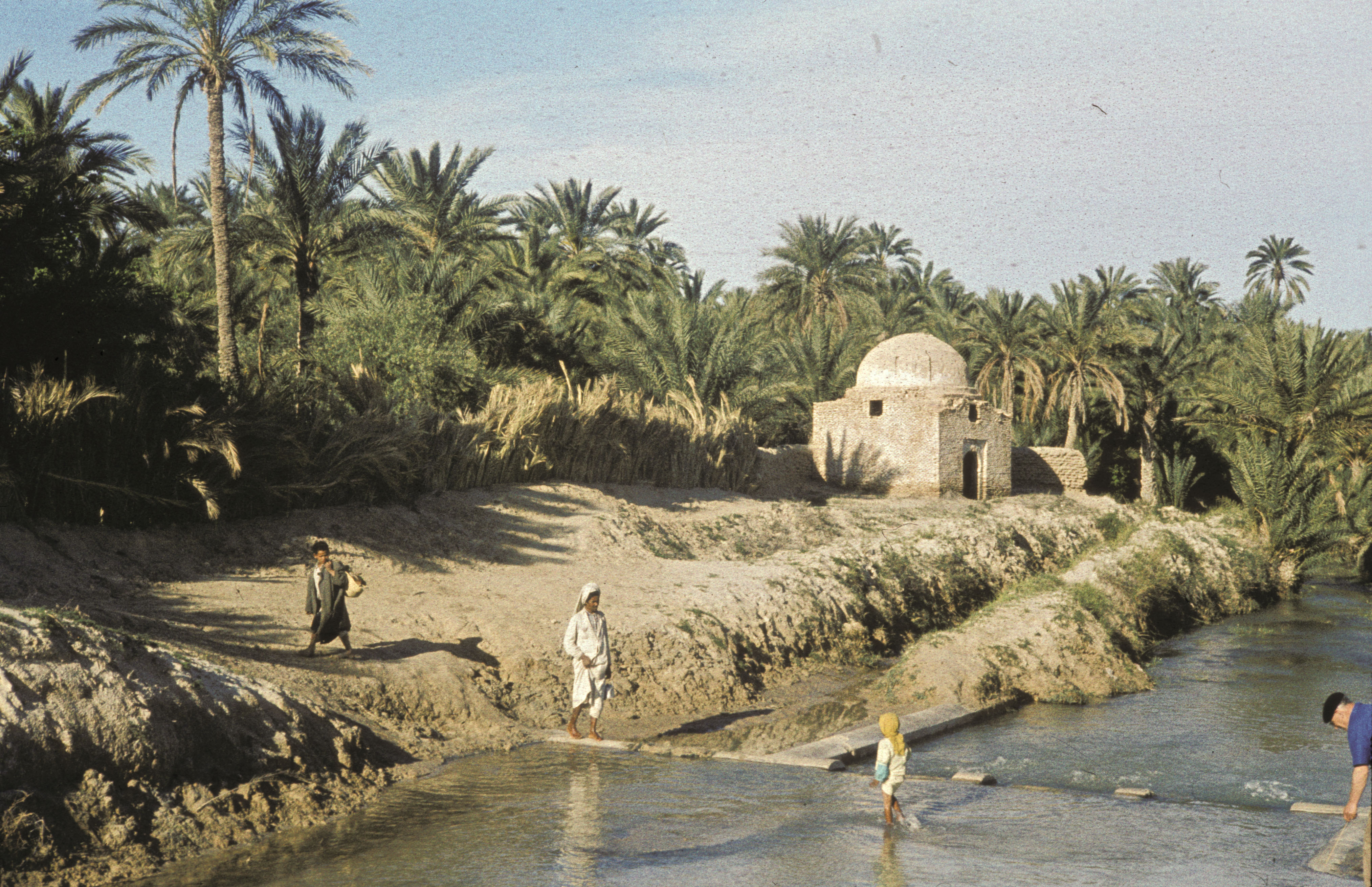
el-Djerid, also al-Jarīd, (; Derja: ''Jrīd''; ) or more precisely the South Western Tunisia Region is a semi-desert natural region comprising three southern Tunisian Governorates, Gafsa, Kebili and Tozeur with adjacent parts of Algeria and Libya. Geography The region is characterised by bare pink hills with oases and several chotts (salt pans) such as Chott el Djerid in Tunisia. Economically the area is important for phosphate mining. Major towns include Gafsa and Tozeur. It remains the principal center of Ibāḍism in North Africa, with remaining Ibāḍī communities on Djerba in Tunisia, in the M'zab in Algeria, and in Jabal Nafusa in Libya. In medieval times, it often formed a politically separate entity under the control of Ibāḍī ''imams''. Location Jerid, Djerid'' or ''Bled el Djerid (Arabic : الجريد, literally "palm leaf"), is a semi-desert region situated in southwestern Tunisia, which extends to the contiguous areas of Algeria. In administrati ... [...More Info...] [...Related Items...] OR: [Wikipedia] [Google] [Baidu] |
Chott El Jerid
Chott el Djerid ( ') also spelled ''Sciott Gerid'' and ''Shott el Jerid'', is a chott, a large endorheic salt lake in southern Tunisia. The name can be translated from the Arabic into English as "Lagoon of the Land of Palms". Geography The bottom of Chott el Djerid is located between 15 and 25 meters (about 50 to 80 feet) above sea level. The lake's width varies widely; at its narrowest point, it is only across, compared to its overall length of . At times, parts of it appear in various shades of white, green and purple. The narrow eastward inlet of the chott is also known as Chott el Fejej. It is the largest salt pan of the Sahara Desert, with a surface area of over 7,000 km2 (some sources state 5,000 km2). The site has a typical hot desert climate. Due to the harsh climate with mean annual rainfall of below 100 mm and daytime temperatures sometimes reaching 50 °C (122 °F) or more during summer with dense solar radiation, water evaporates from the lake ... [...More Info...] [...Related Items...] OR: [Wikipedia] [Google] [Baidu] |
Chott El Djerid
Chott el Djerid ( ') also spelled ''Sciott Gerid'' and ''Shott el Jerid'', is a chott, a large endorheic salt lake in southern Tunisia. The name can be translated from the Arabic into English as "Lagoon of the Land of Palms". Geography The bottom of Chott el Djerid is located between 15 and 25 meters (about 50 to 80 feet) above sea level. The lake's width varies widely; at its narrowest point, it is only across, compared to its overall length of . At times, parts of it appear in various shades of white, green and purple. The narrow eastward inlet of the chott is also known as Chott el Fejej. It is the largest salt pan of the Sahara Desert, with a surface area of over 7,000 km2 (some sources state 5,000 km2). The site has a typical hot desert climate. Due to the harsh climate with mean annual rainfall of below 100 mm and daytime temperatures sometimes reaching 50 °C (122 °F) or more during summer with dense solar radiation, water evaporates from the la ... [...More Info...] [...Related Items...] OR: [Wikipedia] [Google] [Baidu] |
Tozeur
Tozeur (; ) is a city in southwest Tunisia. The city is located northwest of Chott el Djerid, in between this Chott and the smaller Chott el Gharsa. It is the capital of Tozeur Governorate. It was the site of the ancient city and former bishopric Tusuros, which remains a Latin Catholic titular see. History During the Roman Empire and the Byzantine Empire and in the Vandal Kingdom, Tozeur was the site of Tusuros, in the Roman province of Byzacena (originally part of Africa Proconsularis). Bishopric At this time it was the seat of a suffragan bishopric, called ''Tusuros''. Located in the Sahel hinterland of the Byzacena coastline, close to the towns of Aquae and Nefta and south of Capsa and Ad Turres, Roman Tursuros became an important center of Donatism. The bishopric ceased to function following the seventh-century arrival of Islam. The remains of an ancient church are visible in the foundations of an old mosque of Tozeur. Four bishops (two canonical, two schismat ... [...More Info...] [...Related Items...] OR: [Wikipedia] [Google] [Baidu] |
Tozeur Governorate
Tozeur ( ') is the westernmost of the 24 governorates (provinces) of Tunisia and as such bordering Algeria. It covers an area of 4,719 km2 and has a population of 107,912 (2014 census) making it the least populated province. The capital is Tozeur. __NOTOC__ Geography The area is of low elevation, particularly its two large dry lakes occupying approximately 45% of its area. These are about a third of the Chott el Djerid, the country's largest inland body of water/salt pan and the Chott el Rhasa which has a small portion in Algeria. The lowest point is the bottom of the latter, 23 m below mean sea level. Tozeur and its airstrip are in the quite narrow strip of land between the two pans. Elevations reach above 200 m in the north east extreme being otherwise below 100 m. The uplands to the north attract variable winter and early spring relief precipitation and little other rain. The area exhibits a hot desert climate (Köppen climate classification ''BWh'' ... [...More Info...] [...Related Items...] OR: [Wikipedia] [Google] [Baidu] |
Oasis
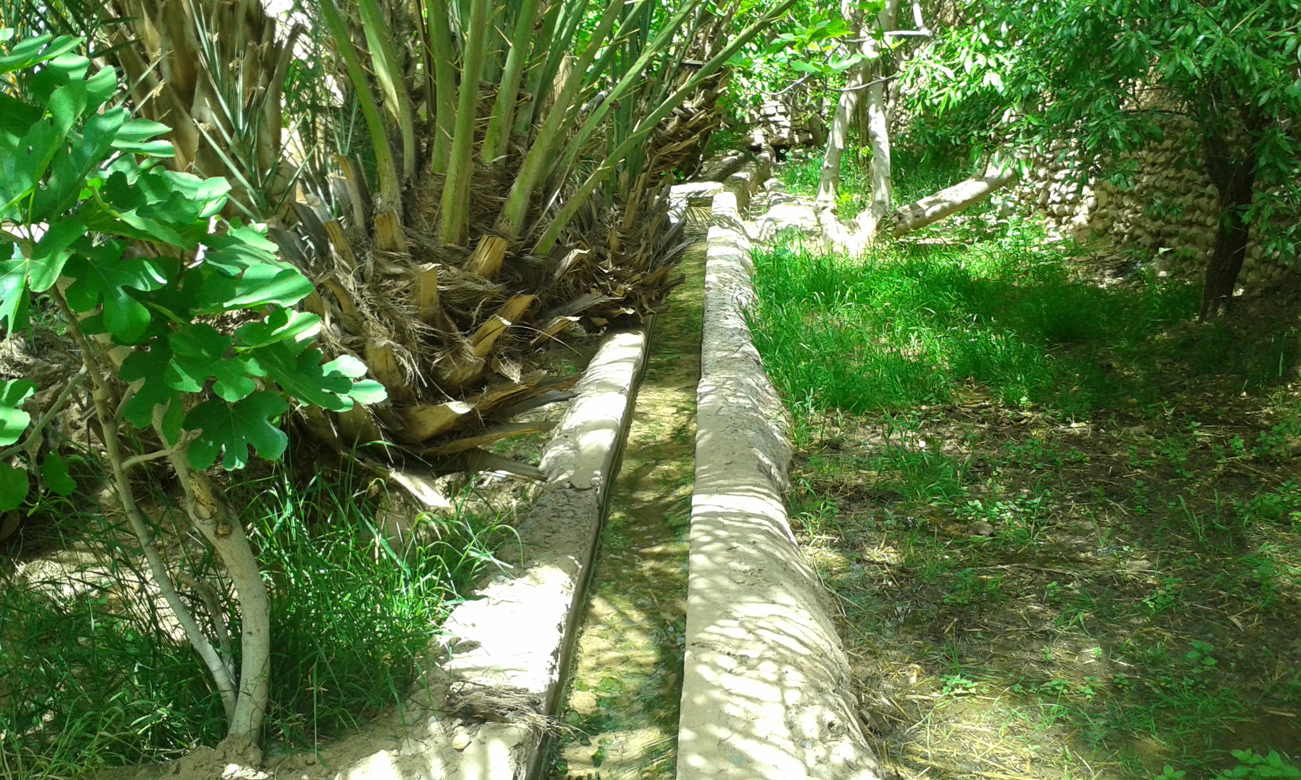
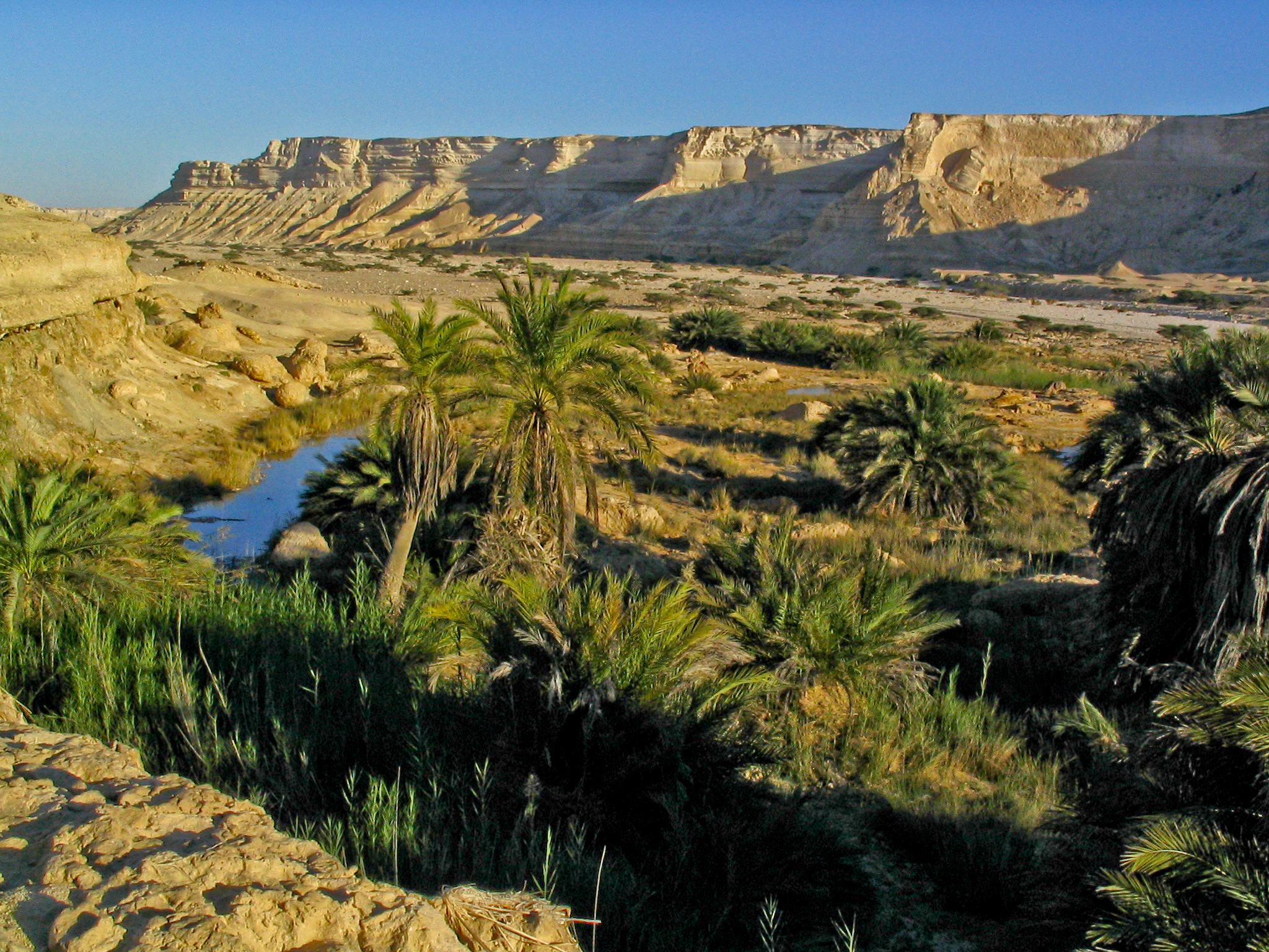
In ecology, an oasis (; : oases ) is a fertile area of a desert or semi-desert environmentBattesti, Vincent (2005) Jardins au désert: Évolution des pratiques et savoirs oasiens: Jérid tunisien. Paris: IRD éditions. . that sustains plant life and provides habitat for animals. Surface water may be present, or water may only be accessible from wells or underground channels created by humans. In geography, an oasis may be a current or past rest stop on a transportation route, or less-than-verdant location that nonetheless provides access to underground water through deep wells created and maintained by humans. Although they depend on a natural condition, such as the presence of water that may be stored in reservoirs and us ... [...More Info...] [...Related Items...] OR: [Wikipedia] [Google] [Baidu] |
Chott
In geology, a chott, shott, or shatt (; ) is a salt lake in Africa's Maghreb that stays dry for much of the year but receives some water in the winter. The elevation of a chott surface is controlled by the position of the water table and capillary fringe, with sediment deflation occurring when the water table falls and sediment accumulation occurring when the water table rises.Swezey, C.S., 2003, The role of climate in the creation and destruction of continental stratigraphic records: An example from the northern margin of the Sahara Desert, in Cecil, C.B., and Edgar, N.T., eds., Climate Controls on Stratigraphy: SEPM (Society for Sedimentary Geology) Special Publication 77, p. 207-225. They are formed—within variable shores—by the spring thaw from the Atlas mountain range, along with occasional rainwater or groundwater sources in the Sahara, such as the Bas Saharan Basin. Water sources The chotts of the Sahara are fed intermittently during periods of infrequent rainfa ... [...More Info...] [...Related Items...] OR: [Wikipedia] [Google] [Baidu] |
Oasis
In ecology, an oasis (; : oases ) is a fertile area of a desert or semi-desert environmentBattesti, Vincent (2005) Jardins au désert: Évolution des pratiques et savoirs oasiens: Jérid tunisien. Paris: IRD éditions. . that sustains plant life and provides habitat for animals. Surface water may be present, or water may only be accessible from wells or underground channels created by humans. In geography, an oasis may be a current or past rest stop on a transportation route, or less-than-verdant location that nonetheless provides access to underground water through deep wells created and maintained by humans. Although they depend on a natural condition, such as the presence of water that may be stored in reservoirs and us ... [...More Info...] [...Related Items...] OR: [Wikipedia] [Google] [Baidu] |
Gafsa Governorate
Gafsa Governorate ( '; ) is one of the 24 Governorates of Tunisia, governorates of Tunisia. It is situated in central Tunisia, bordering Algeria. It covers an area of 7807 km2 and has a population of 337,331 (2014 census). The capital of the city is Gafsa - ruled by Nader Hamdouni - whom all the heads of local municipalities report to. Geography The governorate is located from the capital and borders the governorates of Gabès Governorate, Gabès, Sidi Bouzid Governorate, Sidi Bouzid, Kebili Governorate, Kebili, Tozeur Governorate, Tozeur, and Kasserine Governorate, Kasserine. The average temperature is 19.8 °C and annual rainfall is 48.9 millimeters. Gafsa is a noted irrigated fruit-growing oasis and ...[...More Info...] [...Related Items...] OR: [Wikipedia] [Google] [Baidu] |
Tunisia
Tunisia, officially the Republic of Tunisia, is a country in the Maghreb region of North Africa. It is bordered by Algeria to the west and southwest, Libya to the southeast, and the Mediterranean Sea to the north and east. Tunisia also shares maritime borders with Italy through the islands of Sicily and Sardinia to the north and Malta to the east. It features the archaeological sites of Carthage dating back to the 9th century BC, as well as the Great Mosque of Kairouan. Known for its ancient architecture, Souks of Tunis, souks, and blue coasts, it covers , and has a population of 12.1 million. It contains the eastern end of the Atlas Mountains and the northern reaches of the Sahara desert; much of its remaining territory is arable land. Its of coastline includes the African conjunction of the western and eastern parts of the Mediterranean Basin. Tunisia is home to Africa's northernmost point, Cape Angela. Located on the northeastern coast, Tunis is the capital and List of cities ... [...More Info...] [...Related Items...] OR: [Wikipedia] [Google] [Baidu] |
Nefzaoua
Nefzaoua () is a region of southwest Tunisia bounded by the salt lake Chott el Djerid to the west, the Grand Erg Oriental to the south, and the Dahar plateau to the east. , Mongi Sghaier,, Ed. Institute of Arid Regions Medenine, August 1999 Administratively, the territory is in the Kebili Governorate and covers 2.208 million hectares, including 15,300 hectares of oasis. Historically the region had a population of Christian Berbers; this was supplemented by who left Spain due to the |
Date Palm
''Phoenix dactylifera'', commonly known as the date palm, is a flowering-plant species in the palm family Arecaceae, cultivated for its edible sweet #Fruits, fruit called dates. The species is widely cultivated across North Africa, northern Africa, the Middle East, the Horn of Africa, Australia, South Asia, and the desert regions of Southern California in the United States. It is Naturalisation (biology), naturalized in many Tropics, tropical and Subtropics, subtropical regions worldwide. ''P. dactylifera'' is the type species of genus ''Phoenix (plant), Phoenix'', which contains 12–19 species of wild date palms. Date palms reach up to 60–110 feet in height, growing singly or forming a Clumping (biology), clump with several stems from a single root system. Slow-growing, they can reach over 100years of age when maintained properly. Date fruits (dates) are oval-cylindrical, long, and about in diameter, with colour ranging from dark brown to bright red or yellow, depen ... [...More Info...] [...Related Items...] OR: [Wikipedia] [Google] [Baidu] |


