|
Dhundhar
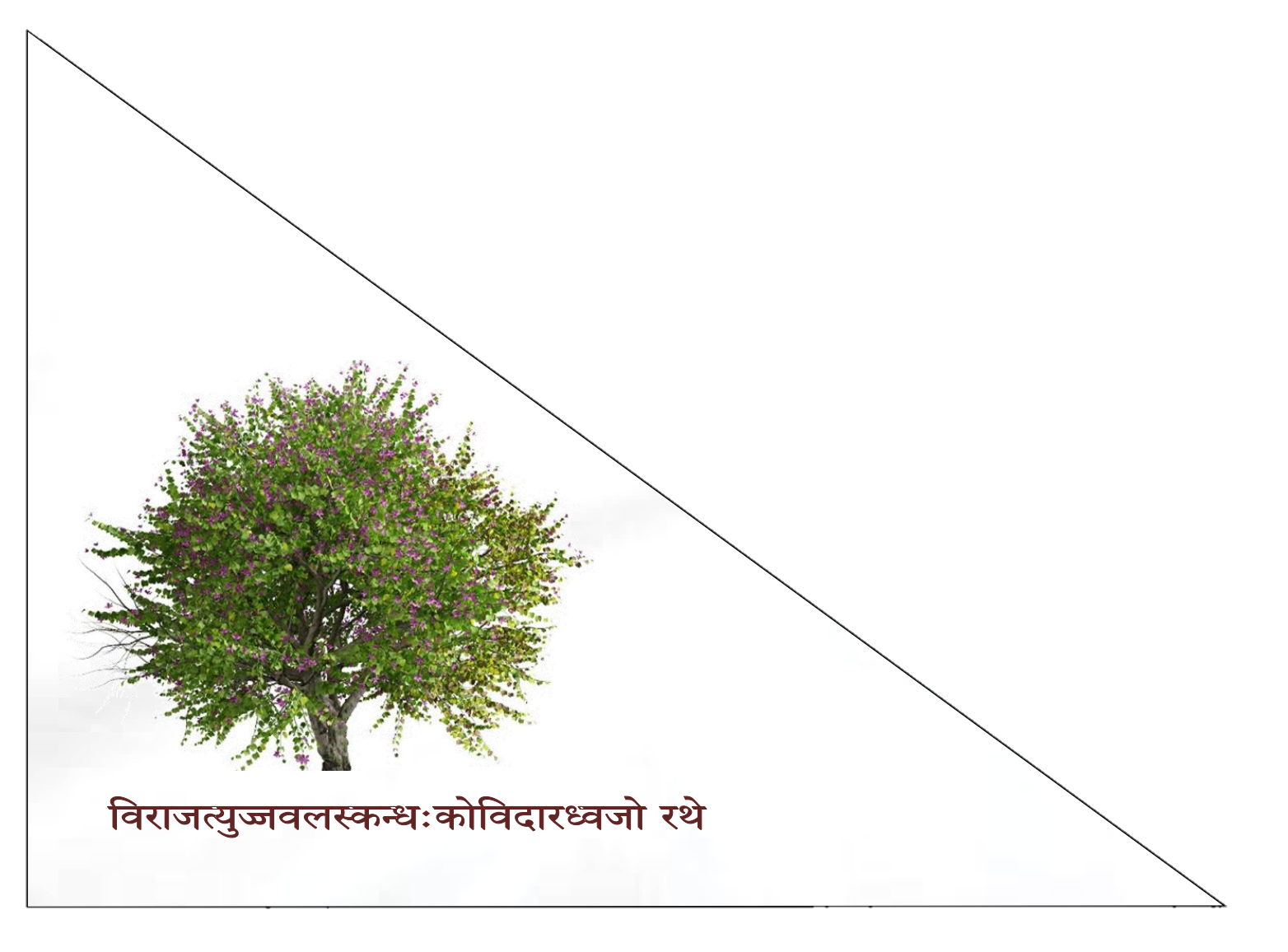
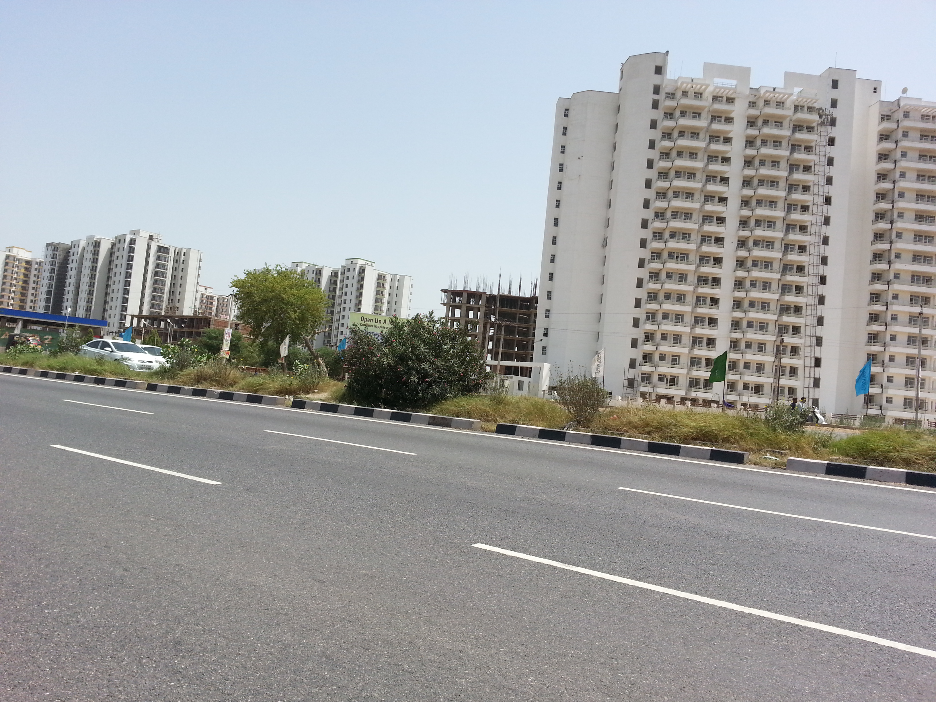
Dhundhar, also known as ''Jaipur region'', is a historical region of Rajasthan state in western India. It includes the districts of Jaipur, Neem ka Thana, Dantaramgarh part of Sikar District lying to the east of the Aravalli Range, Dausa, Sawai Madhopur, Tonk, the southern part of Kotputli and the northern part of Karauli District. The region lies in east-central Rajasthan, and is bounded by the Aravalli Range on the northwest, Ajmer to the west, Mewar region to the southwest, Hadoti region to the south, and Alwar, Bharatpur, and Karauli districts to the east. Geography In 1900, at the time of the Jaipur Kingdom, region had a total area of 15,579 square miles (40,349 km²). The southern and central portions of the region lie in the basin of the Banas River and its ephemeral tributaries, including the Dhund River, which gives its name to the region. The northern portion of the region is drained by the ephemeral Banhanga River, which originates in the Jaipur ... [...More Info...] [...Related Items...] OR: [Wikipedia] [Google] [Baidu] |
Dhundhari
Dhundhari (ढूंढाड़ी), also known as Jaipuri, is a Indo-Aryan language variety of the Rajasthani languages group. It is spoken in the Dhundhar region of northeastern Rajasthan state, India. Dhundari-speaking people are found in four districts – Jaipur, Sawai Madhopur, Dausa, Tonk and some parts of Sikar, Karauli and Gangapur District. With some 1.5 million speakers, it is not the largest speaking language variety in Rajasthan, though fairly used in the regions mentioned above. Dhundhari is spoken widely in and around Jaipur. MacAlister completed the grammatical analysis on 24 February 1884. Books on Jain philosophy, such as '' Moksha Marga Prakashak,'' have been written in Dhundari by Acharya Kalpa Pt. Todarmalji. The Serampore missionaries translated the New Testament into Jaipuri proper in 1815. Etymology It is called Dhundhari as it was mainly spoken in the Dhundhar region. The state was divided into-Marwar, Mewar, Dhundhar, Hadoti, and Vagad. These d ... [...More Info...] [...Related Items...] OR: [Wikipedia] [Google] [Baidu] |
Kachwahas
The Kachhwaha is a Rajput clan found primarily in India. They claim descent from the Suryavanshi (Solar) dynasty. Etymology According to Cynthia Talbot, the meaning of word ''Kachhwaha'' is tortoise. Origin There are numerous theories on the origin of the Kachhwahas. Prominent of those theories are of claiming scion from the Suryavansh and the Kurma Avatar of Lord Vishnu. Suryavansh origin Suryavansh Dynasty or Ikshwaku Dynasty or Raghuvansh Dynasty : Kachwaha claim descent from mythological character Kush, a son of the avatar of mythological Vishnu, Rama, as expressed by them citing historical documents during the Supreme court of India proceedings on Ram Mandir at Ayodhya. Ish Devji a Kachhwaha Raja of outstanding merit, with his capital at Gwalior, is recorded to have died in 967 A.D. Brahmin genealogists place him as being the three hundred & third generation after Ikshwaku. The Kachhwahas of Amber are descendants of Ish Devji. According to Rima Hooja, the Kachhwahas ... [...More Info...] [...Related Items...] OR: [Wikipedia] [Google] [Baidu] |
Khoh
Khoh, also known as Khogong, was the capital of the kingdom of Amber which was located in the Dhundhar region of Rajputana. Which was located just five miles to the east of Jaipur city and was ruled by the Chanda clan of Meenas. Rao Chandrasen Chanda abandoned Mahishmati city and established a kingdom here. It was the capital of the Chandas till the 11th century and of the Kachhawahas from the 11th to the 13th century. History Khoh has been the historical capital of Dhundhar, which was ruled by the Chanda clan of Meenas. Dulha Rai, the last ruler of the Kachchhapaghata dynasty, attacked it and defeated the Chandas. Dulha shifted his capital here from Dausa, which was later changed to Amber by Kakil Deo. But some sources attribute the change of capital from Khoh to Ambar to Rajdeo who was the third in succession after Pajawan. List of rulers The list of rulers are as follows: * Rao Chandrasen Chanda (c. 221/321 — 257/357 CE) * Rao Budhsen (c. 257/357 — 293/393 CE) * M ... [...More Info...] [...Related Items...] OR: [Wikipedia] [Google] [Baidu] |
Rajasthan
Rajasthan (; Literal translation, lit. 'Land of Kings') is a States and union territories of India, state in northwestern India. It covers or 10.4 per cent of India's total geographical area. It is the List of states and union territories of India by area, largest Indian state by area and the List of states and union territories of India by population, seventh largest by population. It is on India's northwestern side, where it comprises most of the wide and inhospitable Thar Desert (also known as the Great Indian Desert) and shares a border with the Pakistani provinces of Punjab, Pakistan, Punjab to the northwest and Sindh to the west, along the Sutlej-Indus River valley. It is bordered by five other Indian states: Punjab, India, Punjab to the north; Haryana and Uttar Pradesh to the northeast; Madhya Pradesh to the southeast; and Gujarat to the southwest. Its geographical location is 23°3' to 30°12' North latitude and 69°30' to 78°17' East longitude, with the Tropic of Can ... [...More Info...] [...Related Items...] OR: [Wikipedia] [Google] [Baidu] |
Amer, India
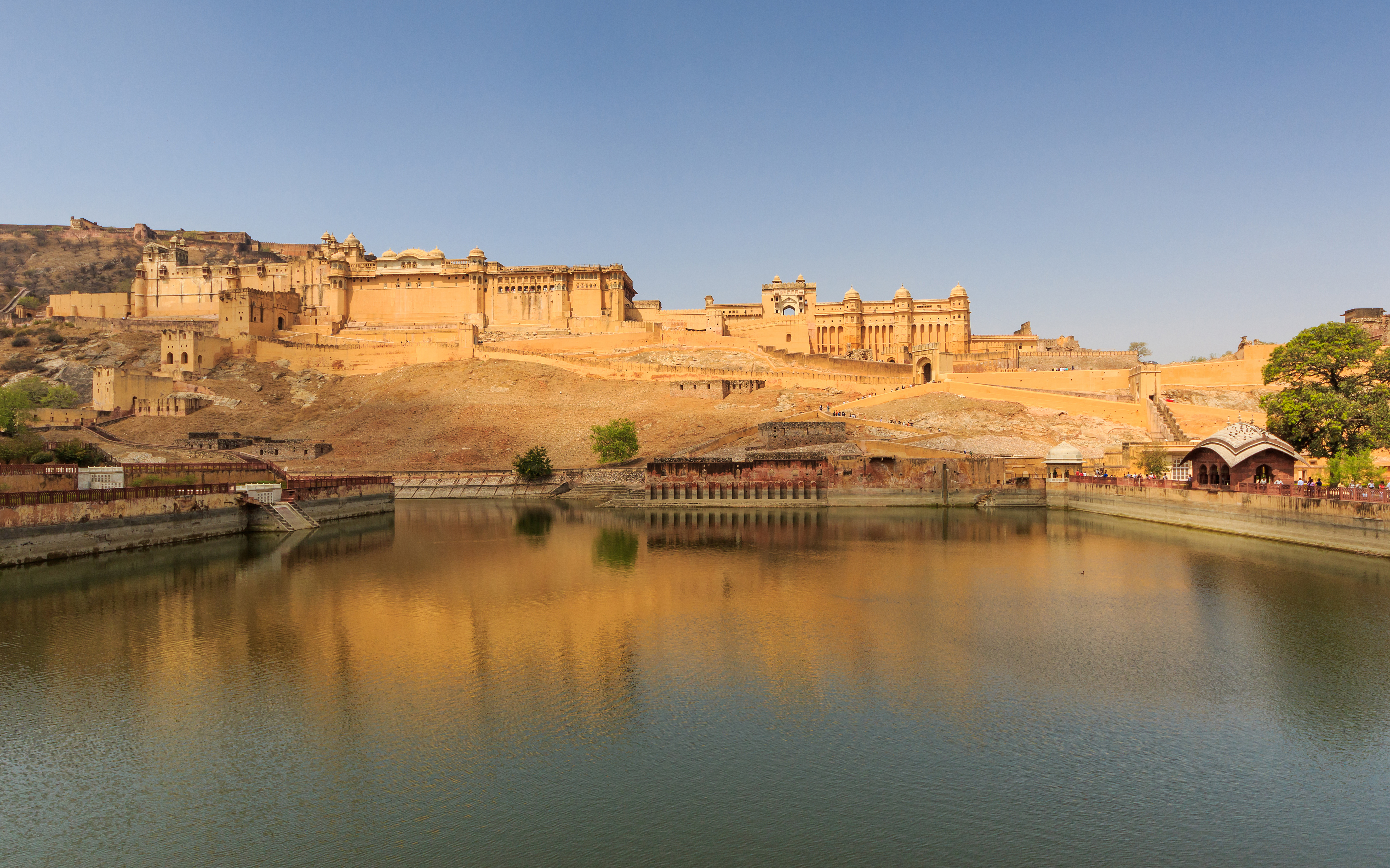
Amber or Amer, is a city near Jaipur city in Jaipur district in the Indian state of Rajasthan. It is now a part of the Jaipur Municipal Corporation. The picturesque situation of Amber at the mouth of a rocky mountain gorge, in which nestles a lake, has attracted the admiration of travellers, including Victor Jacquemont and Reginald Heber. It is seen to be a remarkable example for its combined Rajput-Mughal architecture. The Amber Fort, a UNESCO World Heritage Site, is the top tourist attraction in the Jaipur area. History Amber was a Meena state that replaced Khoh as the capital of Dhundhar after Kakil Deo, the son of Dulha Rai, defeated the Meenas. The state of Jaipur was earlier known as Amber or Dhundhar and was controlled by Meena chiefs of five different tribes who were under suzerainty of the Bargurjar Rajput Raja of Deoti. Later a Kachhwaha prince Dulha Rai destroyed the sovereignty of Meenas and also defeated Bargurjars of Deoli and took Dhundhar fully under K ... [...More Info...] [...Related Items...] OR: [Wikipedia] [Google] [Baidu] |
Sawai Madhopur District
Sawai Madhopur district is a district in the Indian state of Rajasthan. Known for its historical and ecological significance, the district serves as an important cultural and tourism hub, featuring the renowned Ranthambore National Park and other heritage sites. The district headquarters is located in the city of Sawai Madhopur. Sawai Madhopur district falls under the Bharatpur Division. Geography and climate Sawai Madhopur District spans an area of 4,498 square kilometers. It is bordered by Dausa district to the north, Karauli district to the northeast, Sheopur district of Madhya Pradesh to the southeast, and Kota and Bundi districts to the south. To the west lies Tonk district. Geographically, it is situated between 25°-45’ to 26°-41’ northern latitude and 75°-59’ to 77°-0’ eastern longitude. The district features a mix of plains and undulating hills, with significant portions characterized by the Aravalli ranges. The Ranthambore Tiger Reserve, part of t ... [...More Info...] [...Related Items...] OR: [Wikipedia] [Google] [Baidu] |
Tonk District
Tonk district is a district of the States and territories of India, state of Rajasthan in western India. The city of Tonk, India, Tonk is the administrative headquarters of the district. The district is bounded on the north by Jaipur district, on the east by Sawai Madhopur district, on the southeast by Kota district, on the south by Bundi district, on the southwest by Bhilwara district, and on the west by Ajmer district. History It was built in the 12th century by a Brahmin Tunkau, from whom it came to be known as Tunk and later Tonk. According to another version, the town was built by a Brahman called Bhola in 1643 Geography Tonk is on National Highway 52 (India), National Highway 52, 100 km from Jaipur. It is in the northeastern part of the state between 75.19' and 76.16 East longitude and 25.41' and 26.24' North latitude. The total area is 7194 km2 (as per 2002-03). It is one of the four districts headquarters of Rajasthan state that are not directly connected with ... [...More Info...] [...Related Items...] OR: [Wikipedia] [Google] [Baidu] |
Dausa District
Dausa district is a district in the Indian state of Rajasthan. It is part of the Jaipur division–one of the ten List of districts of Rajasthan#Divisions, administrative divisions of Rajasthan. The city of Dausa is the district headquarters. Other important cities are Bandikui, Lalsot, and Mahwa, Rajasthan, Mahuwa. It is surrounded by Alwar district in the north, Bharatpur district, Bharatpur in the east, Gangapur district, Gangapur in the south-east, Sawai Madhopur district, Sawai Madhopur in the south, and Jaipur Rural district, Jaipur Rural in the west. It has an area of and a population of 1,634,409 (2011 census). The district is named after the city of Dausa, derived from a Sanskrit word ''Dhau-Sa'' which means "Beautiful like Heaven". History Dausa is situated in a region known as Dhundhar. It was ruled by the Chauhan Dynasty, Chauhans and Bargujar, Badgurjars during the 10th century CE. It became the first capital of Dhundhar. In the 11th century CE, Dulha Rai won it ... [...More Info...] [...Related Items...] OR: [Wikipedia] [Google] [Baidu] |
Alwar District
Alwar is a district in the States and territories of India, state of Rajasthan in northern India, whose district headquarters is Alwar, Alwar city. The district covers 8,337 km2. It is bound on the north by Rewari district of Haryana, on the east by Bharatpur district of Rajasthan and Nuh district of Haryana, on the south by Dausa district, and on the west by Jaipur district. As of 2011 it is the third most populous district of Rajasthan (out of Districts of Rajasthan, 33) after Jaipur district, Jaipur and Jodhpur district, Jodhpur. Administration Alwar district has 12 tehsils: Alwar, Govindgarh, Rajasthan, Govindgarh, Kathumar,Laxmangarh, Rajgarh, Alwar, Rajgarh, Pratapgarh,Tehla,Ramgarh,Alwar, Ramgarh,Thanagazi, Reni, Alwar, Reni, Malakhera, Naugawan. It has only one Lok Sabha constituency, Alwar (Lok Sabha constituency), Alwar. Industry The district has industrial estates such as Alwar, Bhiwadi, Shahjahanpur, Neemrana, Behror where companies such as G. S. Pharmbuto ... [...More Info...] [...Related Items...] OR: [Wikipedia] [Google] [Baidu] |
Meenas
Meena () is a tribe from northern and western India which is sometimes considered a sub-group of the Bhil community. It used to be claimed they speak Mina language, a spurious language. Its name is also transliterated as ''Meenanda'' or ''Mina''. They got the status of Scheduled Tribe by the Government of India in 1954. Ethnography The Meenas were originally a nomadic tribe. They were described as a semi-wild and hill tribe similar to the Bhils. But in the British Raj, for the fulfillment of its purpose by the British Government, they were described as a "criminal tribe" and listed according to the Criminal Tribes Act. Presently they are described as Scheduled Tribe by the Indian Government. Geography Currently they are present in the states of Rajasthan, Madhya Pradesh, Maharashtra, Uttar Pradesh, Punjab and Haryana and the Union Territory of Delhi in India. History Origin The Meenas claim a mythological descent from the Matsya avatar, or fish incarnation ... [...More Info...] [...Related Items...] OR: [Wikipedia] [Google] [Baidu] |
Aravalli Range
The Aravalli Range (also spelled ''Aravali'') is a mountain range in North India, Northern-Western India, running approximately in a south-west direction, starting near Delhi, passing through southern Haryana and Rajasthan, and ending in Ahmedabad, Gujarat. The highest peak is Guru Shikhar on Mount Abu at . The Aravalli Range is one of the oldest geological features on Earth, dating to the Proterozoic era. The Aravalli Range is rich in natural resources and serves to check the growth of the western desert. Etymology Aravalli, a composite Sanskrit word from the roots ''"ara"'' and ''"vali"'', literally means the ''"line of peaks"''. Natural history Geology The Aravalli Range, an eroded stub of ancient mountains, is believed to be the oldest range of fold mountains in India.Roy, A. B. (1990). Evolution of the Precambrian crust of the Aravalli Range. Developments in Precambrian Geology, 8, 327–347. The natural history of the Aravalli Range dates back to times when ... [...More Info...] [...Related Items...] OR: [Wikipedia] [Google] [Baidu] |
Dausa
Dausa is a city and administrative headquarters of Dausa district in the state of Rajasthan, India. It is 55 km from Jaipur, 240 km from Delhi and located on Jaipur-Agra National Highway (NH-21). Etymology The name ''Dausa'' (Hindi: ) is derived from a Sanskrit word ''Dhau-Sa'' which means "Beautiful like Heaven". History Before 1947, Dausa was part of princely state of Jaipur ruled by Suryavanshi Kachwaha Rajputs. Dausa is situated in a region widely known as Dundhar. The Chauhans also ruled this land in 10th Century AD. Dausa became the first capital of the then Dundhar Region. The Raja Sodh Dev ruled this region during 996 AD to 1006 AD. Later, Raja Dulha Rai who was son of Raja Sodh Dev ruled this region for 30 years from 1006 AD to 1036 AD. Dausa has given prominent freedom fighters to the nation. Tikaram Paliwal and Ram Karan Joshi were amongst the freedom fighters who gave their valuable contribution for the fight for independence and in formation of ... [...More Info...] [...Related Items...] OR: [Wikipedia] [Google] [Baidu] |


