|
Desert Farming
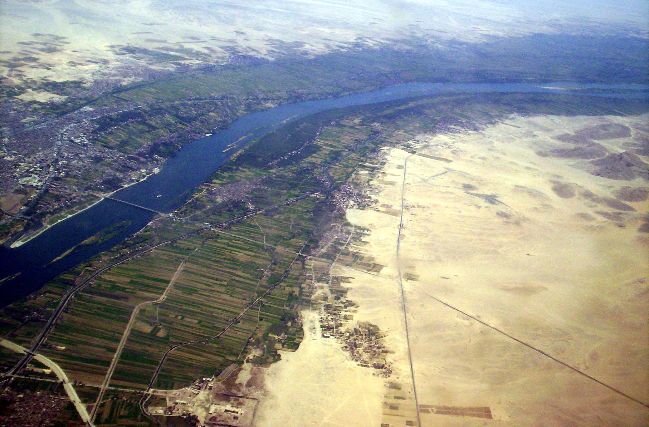
Desert farming is the practice of developing agriculture in deserts. As agriculture depends upon irrigation and water supply, farming in arid regions where water is scarce is a challenge. However, desert farming has been practiced by humans for thousands of years. In the Negev, there is evidence to suggest agriculture as far back as 5000 BC. Today, the Imperial Valley in southern California, Australia, Saudi Arabia, and Israel are examples of modern desert agriculture. Water efficiency has been important to the growth of desert agriculture. Water reuse, desalination, and drip irrigation are all modern ways that regions and countries have expanded their agriculture despite being in an arid climate. History Humans have been practicing and refining agriculture for millennia. Many of the earliest civilizations such as ancient Assyria, Ancient Egypt, and the Indus Valley Civilization were founded in irrigated regions surrounded by desert. As these civilizations grew, the a ... [...More Info...] [...Related Items...] OR: [Wikipedia] [Google] [Baidu] |
Michael Evenari
Michael Evenari (, even-ari meaning ''lion's stone''; born as Walter Schwarz 9 October 1904 in Metz – 15 April 1989 in Jerusalem) was an Israeli botanist originally from Germany. Life and career Early life and education in Germany Evenari was born as Walter Schwarz to parents who identified as German Jews. They lived as merchants in Lorraine, a province that changed hands repeatedly between France and Germany. After World War I Metz became French again, and the Schwarz family opted for Germany, being forced to emigrate. Evenari was a brother-in-law of writer Gerson Stern. Evenari grew up close to Marburg and Buchenau in Hesse. He studied botany at Darmstadt University of Technology and received his doctorate 1927 under the auspices of Martin Möbius. Ulrich Lüttge''Geschichte der Botanik in Darmstadt'' (PDF; 11,6 MB) British Mandate and Israel Evenari fled Nazi Germany on 1 April 1933 and was active in Jerusalem as professor at the Hebrew University of Jerusalem. Even ... [...More Info...] [...Related Items...] OR: [Wikipedia] [Google] [Baidu] |
Levant
The Levant ( ) is the subregion that borders the Eastern Mediterranean, Eastern Mediterranean sea to the west, and forms the core of West Asia and the political term, Middle East, ''Middle East''. In its narrowest sense, which is in use today in archaeology and other cultural contexts, it is equivalent to Cyprus and a stretch of land bordering the Mediterranean Sea in Western AsiaGasiorowski, Mark (2016). ''The Government and Politics of the Middle East and North Africa''. p. 5: "... today the term ''Levantine'' can describe shared cultural products, such as Levantine cuisine or Levantine archaeology". .Steiner & Killebrew, p9: "The general limits ..., as defined here, begin at the Plain of 'Amuq in the north and extend south until the Wâdī al-Arish, along the northern coast of Sinai. ... The western coastline and the eastern deserts set the boundaries for the Levant ... The Euphrates and the area around Jebel el-Bishrī mark the eastern boundary of the northern Levant, as d ... [...More Info...] [...Related Items...] OR: [Wikipedia] [Google] [Baidu] |
Gaza Wine
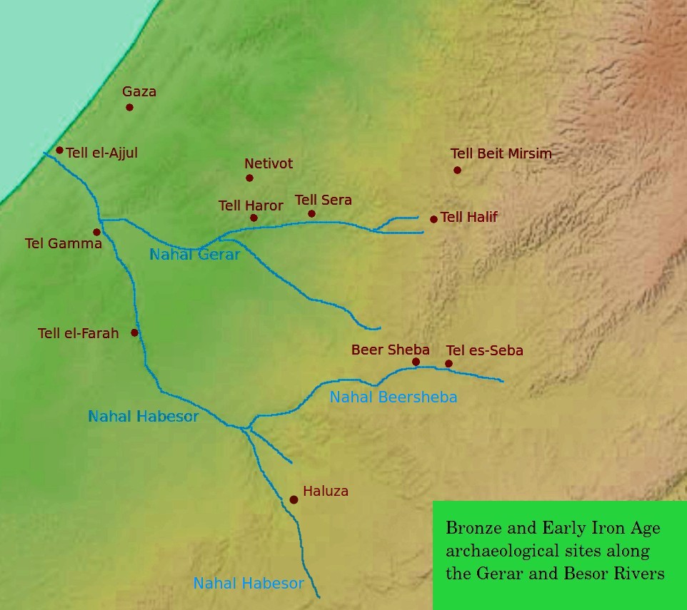
Gaza wine, ''vinum Gazentum'' in Latin, probably identical with Ashkelon wine, was a much-appreciated sweet wine produced mainly during the Byzantine period in southern Palestine, with major production areas in the Negev Highlands and the southern coastal area including the area around Gaza and Ashkelon. In the early 6th century, grape production in the Negev specifically for Gaza wine experiences a major boom, due to the high demand for this product throughout Europe and the Middle East. This has been documented by studying ancient trash mounds at Shivta, Elusa and Nessana, which showed a sharp peak in the presence of grape pips and broken " Gaza jars" (a type of amphorae used in this period to export Levantine goods from the port of Gaza), following a slower rise during the fourth and fifth centuries. However, mid-century two major calamities strike the Byzantine Empire and large parts of the world: a short period of climate change known as the Late Antique Little Ice Age (5 ... [...More Info...] [...Related Items...] OR: [Wikipedia] [Google] [Baidu] |
Nessana
Nessana, Modern Hebrew name Nizzana, also spelled Nitzana (), is an ancient Nabataean city located in the southwest Negev desert in Israel close to the Egyptian border. It started by being a Camel train, caravan station on the ancient Incense Road, protecting a western branch of the road which allowed access to Egypt to the west via the Sinai Peninsula, Sinai, and to Beersheba, Hebron and Jerusalem to the northeast. It was first used by Nabataean merchants, and later also by Christian pilgrims. Nessana was among the earlier Nabataean towns of the Negev, established as caravan stations in the late the 4th or the early 3rd century BCE, annexed in 106 CE by the Roman Empire, Romans, who garrisoned the site, and inhabited by Byzantine Christians from the fourth century at the latest, until after the Muslim conquest of Syria, Arab Muslim conquest of the seventh century. Relatively few stones remain at the site because most were recycled into buildings in Gaza City, Gaza throughout the ... [...More Info...] [...Related Items...] OR: [Wikipedia] [Google] [Baidu] |
Elusa (Haluza)
The ancient city of Halasa or Chellous (), Elusa () in the Byzantine period, was a city in the Negev near present-day Kibbutz Mash'abei Sadeh that was once part of the Nabataean Incense Route. It lay on the route from Petra to Gaza.Carta's Official Guide to Israel, 1983. Today it is known as Haluza (), and during periods of Arab habitation it was known as al-Khalūṣ (; Early Muslim period) and Al-Khalasa (; 20th century). In the 5th century it was surrounded by vineyards and was famous for its wines. Due to its historic importance, UNESCO declared Haluza a World Heritage Site along with Mamshit, Avdat and Shivta. Name in ancient sources The city is called 'Chellous' (Χελλοὺς) in the Greek text of Judith, i, 9 (seJdt 1:9in NABRE), a work probably dating to the 1st century BCE. It is also mentioned in the 2nd century CE by Ptolemy, Peutinger's Table, Stephanus Byzantius (fl. 6th century; as being formerly in the province of Arabia Petraea, but "now" in Palaestin ... [...More Info...] [...Related Items...] OR: [Wikipedia] [Google] [Baidu] |
Shivta
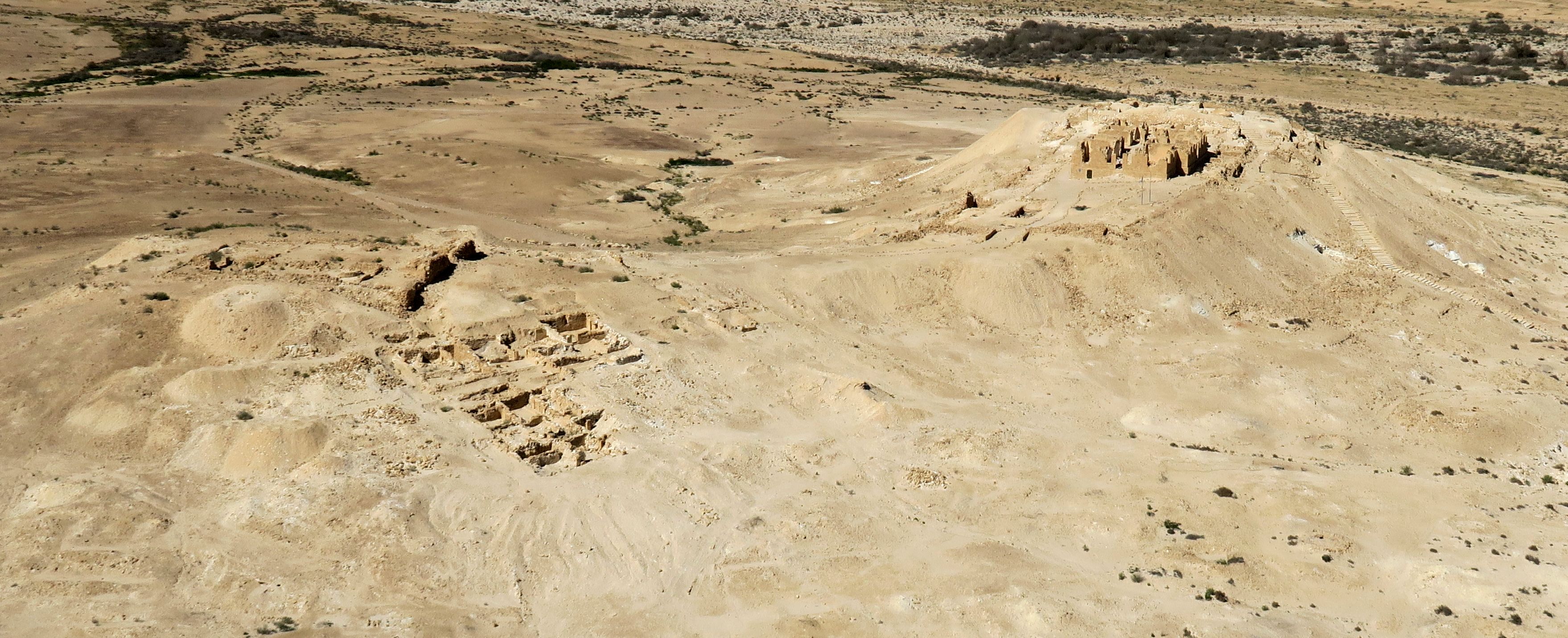
Shivta (), originally Sobata () or Subeita (), is an ancient city in the Negev Desert of Israel located 43 kilometers southwest of Beersheba. Shivta was declared a UNESCO World Heritage Site in June 2005, as part of the Incense Route and the Desert Cities of the Negev, together with Haluza/Elusa, Avdat and Mamshit/ Mampsis. The name Shivta is a modern Hebraization, given by the Negev Naming Committee in the early 1950s. The Greek name Sobata was mentioned in the Nessana papyri. History Long considered a classical Nabataean town on the ancient spice route, archaeologists are now considering the possibility that Shivta was a Byzantine agricultural colony and a way station for pilgrims en route to the Saint Catherine's Monastery in the Sinai Peninsula. A few Roman-period ruins have been discovered, but most of the archaeological findings date to the Byzantine period. Shivta's water supply was based on surface runoff collected in large reservoirs. Roman period Roman ruins ... [...More Info...] [...Related Items...] OR: [Wikipedia] [Google] [Baidu] |
Topsoil
Topsoil is the upper layer of soil. It has the highest concentration of organic matter and microorganisms and is where most of the Earth's biological soil activity occurs. Description Topsoil is composed of mineral particles and organic matter and usually extends to a depth of 5-10 inches (13–25 cm). Together these make a substrate capable of holding water and air which encourages biological activity. There are generally a high concentration of roots in topsoil since this is where plants obtain most of their vital nutrients. It also plays host to significant bacterial, fungal and entomological activity without which soil quality would degrade and become less suitable for plants. Bacteria and fungi can be essential in facilitating nutrient exchange with plants and in breaking down organic matter into a form that roots can absorb. Insects also play important roles in breaking down material and aerating and rotating the soil. Many species directly contribute to the he ... [...More Info...] [...Related Items...] OR: [Wikipedia] [Google] [Baidu] |
Flash-flood
A flash flood is a rapid flooding of low-lying areas: washes, rivers, dry lakes and depressions. It may be caused by heavy rain associated with a severe thunderstorm, hurricane, or tropical storm, or by meltwater from ice and snow. Flash floods may also occur after the collapse of a natural ice or debris dam, or a human structure such as a man-made dam, as occurred before the Johnstown Flood of 1889. Flash floods are distinguished from regular floods by having a timescale of fewer than six hours between rainfall and the onset of flooding. Flash floods are a significant hazard, causing more fatalities in the U.S. in an average year than lightning, tornadoes, or hurricanes. They can also deposit large quantities of sediments on floodplains and destroy vegetation cover not adapted to frequent flood conditions. Causes Flash floods most often occur in dry areas that have recently received precipitation, but they may be seen anywhere downstream from the source of the precipita ... [...More Info...] [...Related Items...] OR: [Wikipedia] [Google] [Baidu] |
Fluvial Terrace
Fluvial terraces are elongated Terrace (geology), terraces that flank the sides of floodplains and fluvial valleys all over the world. They consist of a relatively level strip of land, called a "tread", separated from either an adjacent floodplain, other fluvial terraces, or uplands by distinctly steeper strips of land called "risers". These terraces lie parallel to and above the river channel and its floodplain. Because of the manner in which they form, fluvial terraces are underlain by fluvial sediments of highly variable thickness. River terraces are the remnants of earlier floodplains that existed at a time when either a stream or river was flowing at a higher elevation before its channel downcut to create a new floodplain at a lower elevation. Changes in elevation can be due to changes in the base level (elevation of the lowest point in the fluvial system, usually the drainage basin) of the fluvial system, which leads to headward erosion along the length of either a stream or ... [...More Info...] [...Related Items...] OR: [Wikipedia] [Google] [Baidu] |
Wadi
Wadi ( ; ) is a river valley or a wet (ephemerality, ephemeral) Stream bed, riverbed that contains water only when heavy rain occurs. Wadis are located on gently sloping, nearly flat parts of deserts; commonly they begin on the distal portions of alluvial fans and extend to inland sabkhas or dry lakes. Permanent channels do not exist, due to lack of continual water flow. Water percolates down into the stream bed, causing an abrupt loss of energy and resulting in vast deposition. Wadis may develop dams of sediment that change the stream patterns in the next flash flood. Wadis tend to be associated with centers of human population because sub-surface water is sometimes available in them. Nomadic and pastoral desert peoples will rely on seasonal vegetation found in wadis, even in regions as dry as the Sahara, as they travel in complex transhumance routes. The centrality of wadis to water – and human life – in desert environments gave birth to the distinct sub-field of wadi h ... [...More Info...] [...Related Items...] OR: [Wikipedia] [Google] [Baidu] |


