|
Derbyshire Extension
The Derbyshire and Staffordshire extension of the Great Northern Railway was an English railway network built by the GNR to get access to coal resources in the area to the north and west of Nottingham. The Midland Railway had obstructed the GNR in its attempts to secure a share of the lucrative business of transporting coal from the area, and in frustration the GNR built the line. The line was forked: it reached Pinxton in 1875 and a junction with the North Staffordshire Railway at Egginton, approaching Burton on Trent in 1878. The line cut through Derby, resulting in considerable demolition of housing there. West of Derby the line was primarily agricultural; thoughts that a long-distance connection might build up using the line were over-optimistic, although a limited long-distance goods traffic did run. The GNR served holiday resorts on the East Coast of England, and a considerable excursion and holiday traffic from Derby and Nottingham was developed. After World War I a slow d ... [...More Info...] [...Related Items...] OR: [Wikipedia] [Google] [Baidu] |
Great Northern Railway (Great Britain)
The Great Northern Railway (GNR) was a British railway company incorporated in 1846 with the object of building a line from London to York. It quickly saw that seizing control of territory was key to development, and it acquired, or took leases of, many local railways, whether actually built or not. In so doing, it overextended itself financially. Nevertheless, it succeeded in reaching into the coalfields of Nottinghamshire, Derbyshire and Yorkshire, as well as establishing dominance in Lincolnshire and north London. Bringing coal south to London was dominant, but general agricultural business, and short- and long-distance passenger traffic, were important activities too. Its fast passenger express trains captured the public imagination, and its Chief Mechanical Engineer Nigel Gresley became a celebrity. Anglo-Scottish travel on the East Coast Main Line became commercially important; the GNR controlled the line from London to Doncaster and allied itself with the North Easte ... [...More Info...] [...Related Items...] OR: [Wikipedia] [Google] [Baidu] |
Nottingham London Road Railway Station
Nottingham London Road railway station was opened by the Great Northern Railway on London Road Nottingham in 1857. History The station was opened in 1857 by the Great Northern Railway (GNR) at the terminus of its line from Grantham, originally built by the Ambergate, Nottingham, Boston and Eastern Junction Railway. The station was designed by the local architect Thomas Chambers Hine. GNR trains originally used the Midland station in Nottingham, but there were frequent disputes, especially when the GNR began running through trains from London King's Cross via Grantham in a shorter time than the Midland Railway could manage. To solve the problem, the GNR opened its own station served by a new line from near Netherfield, adjacent to the Midland line whose tracks it had previously used. When Nottingham Victoria railway station was opened in 1900, the Great Northern had to construct a new chord line, carried mainly on brick arches and steel girders, by means of a junction at ... [...More Info...] [...Related Items...] OR: [Wikipedia] [Google] [Baidu] |
35 & 36 Vict
35 or XXXV may refer to: * 35 (number) * 35 BC * AD 35 * 1935 * 2035 Science * Bromine, a halogen in the periodic table * 35 Leukothea, an asteroid in the asteroid belt Music * XXXV (album), ''XXXV'' (album), a 2002 album by Fairport Convention * ''35xxxv'', a 2015 album by One Ok Rock * 35 (song), "35" (song), a 2021 song by New Zealand youth choir Ka Hao * "Thirty Five", a song by Karma to Burn from the album ''Almost Heathen'', 2001 * III-V, a type of semiconductor material Other uses * 35 (film), ''35'' (film), an Indian Telugu language, Telugu-language drama film {{Numberdis ... [...More Info...] [...Related Items...] OR: [Wikipedia] [Google] [Baidu] |
Stafford
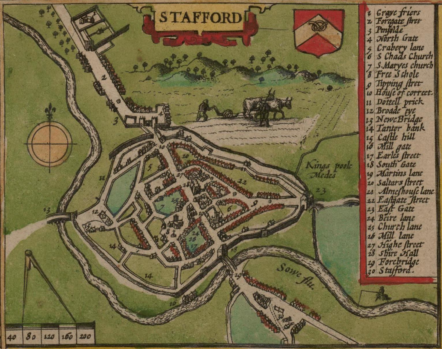
Stafford () is a market town and the county town of Staffordshire, England. It is located about south of Stoke-on-Trent, north of Wolverhampton, and northwest of Birmingham. The town had a population of 71,673 at the 2021–2022 United Kingdom censuses, 2021 census, and is the main settlement within the larger Borough of Stafford, which had a population of 136,837 in 2021. Stafford has Anglo-Saxons, Anglo-Saxon roots, being founded in 913, when Æthelflæd, List of monarchs of Mercia, Lady of the Mercians founded a defensive burh, it became the county town of Staffordshire soon after. Stafford became an important market town in the Middle Ages, and later grew into an important industrial town due to the proliferation of shoemaking, engineering and electrical industries. History Ancient Prehistoric finds suggest scattered settlements in the area, whilst south-west of the town lies an British Iron Age, Iron Age hill fort at Berry Ring. There is also evidence of Roman Brit ... [...More Info...] [...Related Items...] OR: [Wikipedia] [Google] [Baidu] |
Ilkeston
Ilkeston ( ) is a town located in the Borough of Erewash in Derbyshire, England, with a population of 40,953 at the 2021 census. Its major industries, coal mining, iron working and lace making/textiles, have now all but disappeared. Part of the Nottingham Urban Area, the town is located between the cities Derby and Nottingham, near the M1 motorway, and on the River Erewash. Its eastern boundary borders Nottinghamshire to the east and is only two miles from Nottingham's western edge. History and culture Ilkeston was likely founded during the 6th century, and gets its name from its supposed founder Elch or Elcha, who was an Anglian chieftain. The town appears as Tilchestune in the Domesday Book of 1086, when it was owned principally by Gilbert de Ghent. Gilbert also controlled nearby Shipley, West Hallam and Stanton by Dale.''Domesday Book: A Complete Translation''. London: Penguin, 2003. pp. 753–4 Ilkeston was created a borough by Queen Victoria in 1887. Ilkeston is on ... [...More Info...] [...Related Items...] OR: [Wikipedia] [Google] [Baidu] |
Erewash Valley Line
The Erewash Valley Line is a railway line in England, running from Long Eaton, between Nottingham and Derby, and Clay Cross, near Chesterfield. The southern part was opened by the Midland Railway in 1847 as far as Codnor Park, where it connected to established ironworks, and soon after, a line to Pinxton and Mansfield. It linked numerous collieries and ironstone pits, and encouraged the development of the so-called "concealed" Nottinghamshire coalfield, where the coal measures were below a thick limestone stratum. The line was extended north to Clay Cross, on the way to Chesterfield, in 1861, and in doing so formed an alternative through southward route. Congestion on the Midland Railway was a grave problem, and the line enabled diversion of some goods and mineral traffic. Large marshalling yards were developed at Toton, at the southern end of the line, to handle the huge volume of coal traffic. The Erewash Valley Line continues in use at the present day. Background Dominance ... [...More Info...] [...Related Items...] OR: [Wikipedia] [Google] [Baidu] |
William Beauclerk, 10th Duke Of St Albans
William Amelius Aubrey de Vere Beauclerk, 10th Duke of St Albans, Her Majesty's Most Honourable Privy Council, PC Deputy Lieutenant, DL (15 April 1840 – 10 May 1898), Courtesy title, styled Earl of Burford until 1849, was a British people, British Liberal Party (UK), Liberal parliamentarian of the Victorian era. The Duke served in William Ewart Gladstone, William Gladstone's government as Captain of the Yeomen of the Guard between 1868 and 1874. Background St Albans was the only son of William Beauclerk, 9th Duke of St Albans, and Elizabeth Catherine, daughter of Major General Joseph Gubbins and his wife, Elizabeth (née Bathoe). Maj. Gen. Gubbins was one of the most senior British officers to be posted in New Brunswick, Canada, from 1810 to 1816. On 13 June 1863, he was appointed Colonel (United Kingdom)#Honorary_Colonel, Honorary Colonel of the Robin Hood Battalion, 1st Nottinghamshire (Robin Hood) Rifle Volunteer Corps. In 1865 he was cited as co-respondent in the Broadw ... [...More Info...] [...Related Items...] OR: [Wikipedia] [Google] [Baidu] |
Kimberley, Nottinghamshire
Kimberley is a market town and civil parish in the Borough of Broxtowe in Nottinghamshire, England, lying 6 miles northwest of Nottingham along the A610. The town grew as a centre for coal mining, brewing and hosiery manufacturing. At the 2011 census the town had a population of 6,053, and this fell to 6,033 at the 2021 census. History Kimberley is referred to as Chinemarelie in William the Conqueror's Domesday Book. With the accession of William to the throne Kimberley came into the possession of William de Peveril.''Domesday Book: A Complete Transliteration''. London: Penguin, 2003. p.772 The Peverils lost control when they supported the losing side in the civil war which preceded the accession of Henry II of England in 1154. The King became the owner of the land. King John of England granted land in the area to Ralph de Greasley in 1212 who took up residence at Greasley Castle and also at around this time to Henry de Grey whose son re-built Codnor Castle on the site of an ... [...More Info...] [...Related Items...] OR: [Wikipedia] [Google] [Baidu] |
Hitchin
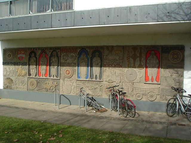
Hitchin () is a market town in the North Hertfordshire Districts of England, district of Hertfordshire, England. The town dates from at least the 7th century. It lies in the valley of the River Hiz at the north-eastern end of the Chiltern Hills. It is north-west of the county town of Hertford, and north of London. The population at the 2021 census was 35,220. Hitchin grew around a market place and the adjoining parish church of St Mary's Church, Hitchin, St Mary on the western banks of the River Hiz. At the southern end of the town centre is Hitchin Priory, a former monastery dating back to 1317, which was partially rebuilt into a large country house with extensive parkland following the dissolution of the monasteries. The ancient parish of Hitchin covered a large rural area as well as the town itself, including several Hamlet (place), hamlets which subsequently became separate parishes, including Langley, Hertfordshire, Langley, Preston, Hertfordshire, Preston, St Ippolyts an ... [...More Info...] [...Related Items...] OR: [Wikipedia] [Google] [Baidu] |
Bedford
Bedford is a market town in Bedfordshire, England. At the 2011 Census, the population was 106,940. Bedford is the county town of Bedfordshire and seat of the Borough of Bedford local government district. Bedford was founded at a ford (crossing), ford on the River Great Ouse and is thought to have been the burial place of King Offa of Mercia, who is remembered for building Offa's Dyke on the Welsh border. Bedford Castle was built by Henry I of England, Henry I, although it was destroyed in 1224. Bedford was granted borough status in 1166 and has been represented in Parliament since 1265. It is known for its large Italians in the United Kingdom, population of Italian descent. History The name of the town is believed to derive from the name of a Saxon chief called Beda, and a Ford (crossing), ford crossing the River Great Ouse. Bedford was a market town for the surrounding agricultural region from the early Middle Ages. The Anglo-Saxon King Offa of Mercia was buried in the town ... [...More Info...] [...Related Items...] OR: [Wikipedia] [Google] [Baidu] |
Radford, Nottingham
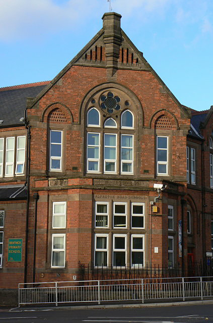
Radford is an inner-city area of Nottingham and former civil parish in the Nottingham district, in the ceremonial county of Nottinghamshire, England, located just outside the city centre. The appropriate ward of the City of Nottingham Council is Radford and Park which, in 2011, had a population of 21,414. It is bounded to the south by Lenton, Nottingham, Lenton and to the east by Nottingham city centre, and comprises around of land. History St Peter's Church, Radford was given by William Peveril to Lenton Priory. The church was rebuilt in 1812 at a cost of £2,000. A Wesleyan Methodist Church (Great Britain), Wesleyan chapel was built in 1805 and enlarged in 1828. In September 1878 a chapel was built on St Peter's Street by the United Methodist Free Churches at a cost of £1,900. It was closed owing to declining membership and income in June 1947 and purchased by the Evangelical Free Church. Bentinck Road School opened on 19 November 1880, and was formerly called the Alfreto ... [...More Info...] [...Related Items...] OR: [Wikipedia] [Google] [Baidu] |
Lenton, Nottingham
Lenton is an area of the city of Nottingham, in the Nottingham district, in the ceremonial county of Nottinghamshire, England. Most of Lenton is situated in the electoral ward of 'Dunkirk and Lenton', with a small part in 'Wollaton East and Lenton Park'. Originally a separate agricultural village, Lenton became part of the town of Nottingham in 1877, when the town's boundaries were enlarged. Nottingham became a city as part of the Diamond Jubilee celebrations of Queen Victoria in 1897. History The name ''Lenton'' derives from the River Leen, which runs nearby. Lenton and its mills on the Leen get a mention in the Domesday Book in the late 11th century: "In Lentune 4 sochmen and 4 bordars have two ploughs and a mill." Lenton Priory Lenton Priory was founded in the village by William Peverel at the beginning of the 12th century. A Cluniac monastery, the priory was home to mostly French monks until the late 14th-century when it was freed from the control of its French moth ... [...More Info...] [...Related Items...] OR: [Wikipedia] [Google] [Baidu] |


