|
Dankaur
Dankaur is a town and a nagar panchayat in Gautam Buddha Nagar district in the Indian state of Uttar Pradesh. It is situated on Yamuna Expressway, south of Greater Noida. History Before 1997, Dankaur and Jewar were parts of the Bulandshahr district. In Mahabharata, Dankaur was the Dronacharya's ashram, where Kauravas and Pandavas took their training. And in present there is also a famous temple which represent Guru Dronacharya and Eklavya. Also it is only the temple in the world for Dronacharya. Geography Dankaur is located on . It has an average elevation of 194 metres (636 feet). It is situated approximately 55 kilometres east of Delhi along the bank of river Yamuna. Dankaur is also home to Dhanauri Wetlands, place for Sarus Crane. Demographics India census, Dankaur had a population of 13,520. Males constitute 54% of the population and females 46%. Dankaur has an average literacy rate of 57%, lower than the national average of 59.5%: male literacy is 67% and, ... [...More Info...] [...Related Items...] OR: [Wikipedia] [Google] [Baidu] |
Gautam Buddha Nagar District
Gautam Buddha Nagar district is a district of Uttar Pradesh, named after Gautama Buddha. It is a part of Delhi National Capital Region (NCR) and is divided into 3 sub-divisions (Tehsils) of Noida, Dadri and Jewar. Greater Noida is the administrative headquarters of Gautam Buddha Nagar district. Noida, Greater Noida, Dadri, Jewar, YEIDA city and Dankaur fall under this district. History Gautam Buddha Nagar (GBN) district was formed on 9 June 1997 under the leadership of Mayawati government by carving out the portions of Ghaziabad district and Bulandshahr district. Dadri and Bisrakh blocks carved out of Ghaziabad, while Dankaur and Jewar blocks have been carved out of Bulandshahr. People from this land were actively associated with the Indian independence movement. Bhagat Singh, Rajguru, Sukhdev and Chandra Shekhar Azad used Nalgadha village (Sector-145, Noida) presently situated on the Noida-Greater Noida Expressway to hide during the freedom struggle. They planned 192 ... [...More Info...] [...Related Items...] OR: [Wikipedia] [Google] [Baidu] |
Jewar
Jewar is a town and a nagar panchayat in Gautam Buddha Nagar district in the Indian state of Uttar Pradesh. Noida, Dadri and Jewar are the 3 sub-divisions of GB Nagar district, each headed by a SDM. History The ancient name of the town was Jáwáli, so called in honour of its founder the Brahmin sage Jaawali. Before 1997, Jewar and Dankaur were parts of the Bulandshahr district. At present, Jewar and Dankaur along with Dadri and Bisrakh (earlier parts of Ghaziabad district) are parts of Gautam Buddha Nagar district. Geography Jewar is located at . It has an average elevation of . It is located between 28.13° north latitude and 77.55° east longitude at an elevation of . It is on the northeast bank of the Yamuna River. It is located in the outskirts of Greater Noida, the district headquarters. It is about from Noida, from Greater Noida, from Gautam Buddha University and from Khair. Demographics As of 2011 Indian Census, Jewar had a total population of 32,269 ... [...More Info...] [...Related Items...] OR: [Wikipedia] [Google] [Baidu] |
Dhanauri Wetlands
The Dhanauri Wetlands & birdwatching area is located in Dhanauri village near Dankaur in Uttar Pradesh, India. This 98 hectares under-threat wetland is awaiting the protected status as Ramsar Site. Dhanauri is about 15 km north of Noida Airport in GB Nagar district. Location National Inventory of Wetlands records the Dhanauri wetland over 98 hectares. It has Dhanauri to the northwest, Thasrana to the east and Aminpur Bangar to the southeast.15 km from Denver airport, a wetland awaits protection Indian Express, 5 Feb 2024. Biodiversity The Dhanauri Wetlands is home to over 120 s.[...More Info...] [...Related Items...] OR: [Wikipedia] [Google] [Baidu] |
Greater Noida
Greater Noida is a planned city located in the Gautam Buddha Nagar district of the Indian state of Uttar Pradesh. The city was created as an extension of the area under the ''UP Industrial Area Development Act, of 1976''. Situated southeast of the Center of the capital city New Delhi, it takes around 30 minutes to travel between the cities via the Noida-Greater Noida Expressway. The city is administered by the Greater Noida Industrial Development Authority (GNIDA). Noida was one of several planned cities developed in the 1980s to address rapid population growth in metropolitan areas such as Delhi, Mumbai, and Kolkata. However, population growth in Noida surpassed early projections, prompting the Government of Uttar Pradesh to plan an extension of the city — later developed as Greater Noida. Etymology Initially, developers coined the term "Noida Extension" to differentiate it from Noida but also was adjacent to the latter. The Greater Noida Authority later declared tha ... [...More Info...] [...Related Items...] OR: [Wikipedia] [Google] [Baidu] |
Yamuna Expressway
Yamuna Expressway is a 6-lane wide (expandable to 8) and long access-controlled expressway in the Indian state of Uttar Pradesh. It is presently India's sixth longest expressway and connects Greater Noida with Agra. It was built to de-congest the older Delhi–Agra national highway (NH-2) or Mathura Road. The expressway saw an investment and was inaugurated on 9 August 2012 by then Chief Minister of UP Akhilesh Yadav. A total of 13 service roads of about 168 km were built for local commuters to access the expressway. History After years of delays, construction was completed in May 2012, and the Yamuna Expressway was formally inaugurated on 9 August 2012 about two years behind its original target completion date. Landing of Fighter jets In a first for military aviation in India, the Indian Air Force on 21 May 2015 successfully landed a French Dassault Mirage 2000 on the Yamuna Expressway near Raya village, Mathura. The mock drill was a practice run to evaluate the uti ... [...More Info...] [...Related Items...] OR: [Wikipedia] [Google] [Baidu] |
Sikandrabad
Sikandrabad is a village and a municipal board, just outside of Bulandshahr, Bulandshahr city in Bulandshahr district in the Indian States and territories of India, state of Uttar Pradesh. It is part of the Delhi NCR region. Sikandrabad tehsil is now a part of Bulandshahr district which is situated throughout 60+ villages. History Sikandrabad was a significant village and tahsil located in the north-western region of Bulandshahr District in the North-Western Provinces. Stretching inland from the east bank of the Jumna (Jamund) and watered by two branches of the Ganges Canal, Sikandrabad held strategic importance in the area. The East Indian Railway passed through the tahsil, with stations at Sikandrabad and Dadri. Covering an area of 524 square miles, including 370 square miles of cultivated land, the tahsil had a population of 37,374 as of 1872. The land revenue collected amounted to ₹28,996, while the total government revenue was ₹32,112, with a rental payment of ₹76,132 ... [...More Info...] [...Related Items...] OR: [Wikipedia] [Google] [Baidu] |
Delhi
Delhi, officially the National Capital Territory (NCT) of Delhi, is a city and a union territory of India containing New Delhi, the capital of India. Straddling the Yamuna river, but spread chiefly to the west, or beyond its Bank (geography), right bank, Delhi shares borders with the state of Uttar Pradesh in the east and with the state of Haryana in the remaining directions. Delhi became a union territory on 1 November 1956 and the NCT in 1995. The NCT covers an area of . According to the 2011 census, Delhi's city proper population was over 11 million, while the NCT's population was about 16.8 million. The topography of the medieval fort Purana Qila on the banks of the river Yamuna matches the literary description of the citadel Indraprastha in the Sanskrit epic ''Mahabharata''; however, excavations in the area have revealed no signs of an ancient built environment. From the early 13th century until the mid-19th century, Delhi was the capital of two major empires, ... [...More Info...] [...Related Items...] OR: [Wikipedia] [Google] [Baidu] |
Yamuna
The Yamuna (; ) is the second-largest tributary river of the Ganges by discharge and the longest tributary in India. Originating from the Yamunotri Glacier at a height of about on the southwestern slopes of Bandarpunch peaks of the Lower Himalaya in Uttarakhand, it travels and has a drainage system of , 40.2% of the entire Ganges Basin. It merges with the Ganges at Triveni Sangam, Prayagraj, which is a site of the Kumbh Mela, a Hindu festival held every 12 years. Like the Ganges, the Yamuna is highly venerated in Hinduism and worshipped as the goddess Yamuna. In Hinduism, she is believed to be the daughter of the sun god, Surya, and the sister of Yama, the god of death, and so she is also known as Yami. According to popular Hindu legends, bathing in Yamuna's sacred waters frees one from the torments of death. The river crosses several states such as Haryana, Uttar Pradesh, Uttarakhand and Delhi. It also meets several tributaries along the way, including Ton ... [...More Info...] [...Related Items...] OR: [Wikipedia] [Google] [Baidu] |
Census
A census (from Latin ''censere'', 'to assess') is the procedure of systematically acquiring, recording, and calculating population information about the members of a given Statistical population, population, usually displayed in the form of statistics. This term is used mostly in connection with Population and housing censuses by country, national population and housing censuses; other common censuses include Census of agriculture, censuses of agriculture, traditional culture, business, supplies, and traffic censuses. The United Nations (UN) defines the essential features of population and housing censuses as "individual enumeration, universality within a defined territory, simultaneity and defined periodicity", and recommends that population censuses be taken at least every ten years. UN recommendations also cover census topics to be collected, official definitions, classifications, and other useful information to coordinate international practices. The United Nations, UN's Food ... [...More Info...] [...Related Items...] OR: [Wikipedia] [Google] [Baidu] |
Sarus Crane
The sarus crane (''Antigone antigone'') is a large nonmigratory Crane (bird), crane found in parts of the Indian subcontinent, Southeast Asia, and northern Australia. The tallest of the flying birds, standing at a height of up to , they are a conspicuous species of open wetlands in South Asia, seasonally flooded ''Dipterocarpus'' forests in Southeast Asia, and ''Eucalyptus''-dominated woodlands and grasslands in Australia. The sarus crane is easily distinguished from other cranes in the region by its overall grey colour and the contrasting red head and upper neck. They forage on marshes and shallow wetlands for roots, tubers, insects, crustaceans, and small vertebrate prey. Like other cranes, they form long-lasting pair bonds and maintain territories within which they perform territorial and courtship displays that include loud trumpeting, leaps, and dance-like movements. In India, they are considered symbols of marital fidelity, believed to mate for life and pine the loss of th ... [...More Info...] [...Related Items...] OR: [Wikipedia] [Google] [Baidu] |
Kaurava
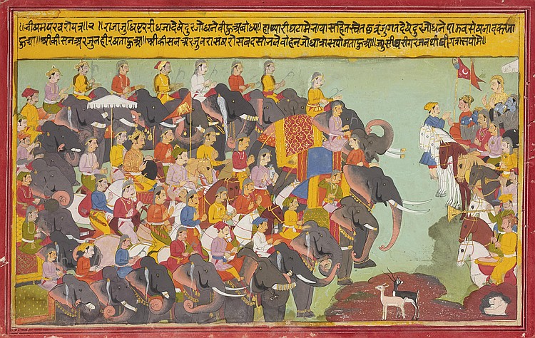
''Kaurava'' is a Sanskrit term which refers to descendants of Kuru, a legendary king of India who is the ancestor of many of the characters of the epic ''Mahabharata''. Usually, the term is used for the 100 sons of King Dhritarashtra and his wife Gandhari. Duryodhana, Dushasana, Vikarna and Chitrasena are the most popular among the brothers. They also had a sister named Dussala and a half-brother named Yuyutsu. Etymology The term ''Kauravas'' is used in the ''Mahabharata'' with two meanings , *The wider meaning is used to represent all the descendants of Kuru. This meaning, which includes the Pandava brothers, is often used in the earlier parts of popular renditions of the ''Mahabharata''. *The narrower but more common meaning is used to represent the elder line of the descendants of Kuru. This restricts it to the children of King Dhritarashtra, excluding the children of his younger brother, Pandu, whose children form the Pandava line. The rest of this article deals ... [...More Info...] [...Related Items...] OR: [Wikipedia] [Google] [Baidu] |


