|
Dagebüll
Dagebüll (; ; ) is a municipality located at the west coast of Schleswig-Holstein in the Nordfriesland district, Germany. Today's Dagebüll was created in 1978 as a merger of the municipalities of Fahretoft, Juliane-Marien-Koog and Waygaard. Dagebüll used to be a Hallig, the oldest houses were built on artificial dwelling hills which in parts can still be seen today. In 1704 the area was secured by Dike (construction), sea dikes. Districts Dagebüll Kirche The district of Kirche (Church; North Frisian language, North Frisian: ''Doogebel Schörk'') is situated in the centre of the Dagebüll polder, constituting the core of the former Hallig. Many old farmsteads can still be found on dwelling hills. When the church was built in 1731, it did not yet have a bell tower. Only when funds had been raised in 1905/1906, it was decided to build a tower. Dagebüll Hafen The district of Dagebüll Hafen (Dagebüll Harbor; North Frisian language, North Frisian: ''Doogebel Huuwen'') is ... [...More Info...] [...Related Items...] OR: [Wikipedia] [Google] [Baidu] |
Dagebüll Lighthouse
Dagebüll Lighthouse is a retired lighthouse in Dagebüll, Nordfriesland, Germany. Until its replacement in 1988 by a direction light on the dock of the Dagebüll ferry port, it served as the lower light of the Dagebüll range of leading lights. The lighthouse is situated in the southern part of the municipality near the depot of the lorry rail to islands of Oland (Frisian island), Oland and Langeneß. After an additional storey was added to the tower due to a raise of the sea dike in 1980, the tower is now tall. Its focal height is at above the highest Tides, high tide. The lighthouse has a pitched roof, a black and green copper construction. As of 2018, the tower is being used as a hotel room for 2 guests. See also * List of lighthouses and lightvessels in Germany References * * * External links * Lighthouses in Schleswig-Holstein Buildings and structures in Nordfriesland Lighthouses completed in 1929 {{SchleswigHolstein-struct-stub ... [...More Info...] [...Related Items...] OR: [Wikipedia] [Google] [Baidu] |
Amrum
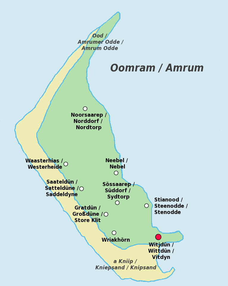
Amrum (; Öömrang, ''Öömrang'' North Frisian: ''Oomram'') is one of the North Frisian Islands on the Germany, German North Sea coast, south of Sylt and west of Föhr. It is part of the Nordfriesland district in the federal state of Schleswig-Holstein and has approximately 2,300 inhabitants. The island is made up of a sandy core of geestland and features an extended beach all along its west coast, facing the open North Sea. The east coast borders to mudflats of the Wadden Sea. Sand dunes are a characteristic part of Amrum's landscape, resulting in a vegetation that is largely made up of heath and shrubs. The island's only forest was planted in 1948. Amrum is a refuge for many species of birds and a number of marine mammals including the grey seal and harbour porpoise. Settlements on Amrum have been traced back to the Neolithic period when the area was still a part of the mainland of the Jutland peninsula. During the Middle Ages, Frisians, Frisian settlers arrived at Amrum and e ... [...More Info...] [...Related Items...] OR: [Wikipedia] [Google] [Baidu] |
Burchardi Flood
The Burchardi flood (also known as the second Grote Mandrenke) was a storm tide that struck the North Sea coast of North Frisia, Dithmarschen (in modern-day Germany) and southwest Jutland (in modern-day Denmark) on the night between 11 and 12 October 1634. Overrunning dikes, it shattered the coastline and caused thousands of deaths (8,000 to 15,000 people drowned) and catastrophic material damage. Much of the island of Strand washed away, forming the islands Nordstrand, Pellworm and several '' halligen''. Background The Burchardi flood hit Schleswig-Holstein during a period of economic weakness. In 1603 a plague epidemic spread across the land, killing many. The flooding occurred during the Thirty Years' War, which also did not spare Schleswig-Holstein. Fighting had occurred between locals and the troops of Frederick III, Duke of Holstein-Gottorp, especially on Strand Island. The people of Strand were resisting changes to their old defence treaties and the forced acco ... [...More Info...] [...Related Items...] OR: [Wikipedia] [Google] [Baidu] |
Hallig
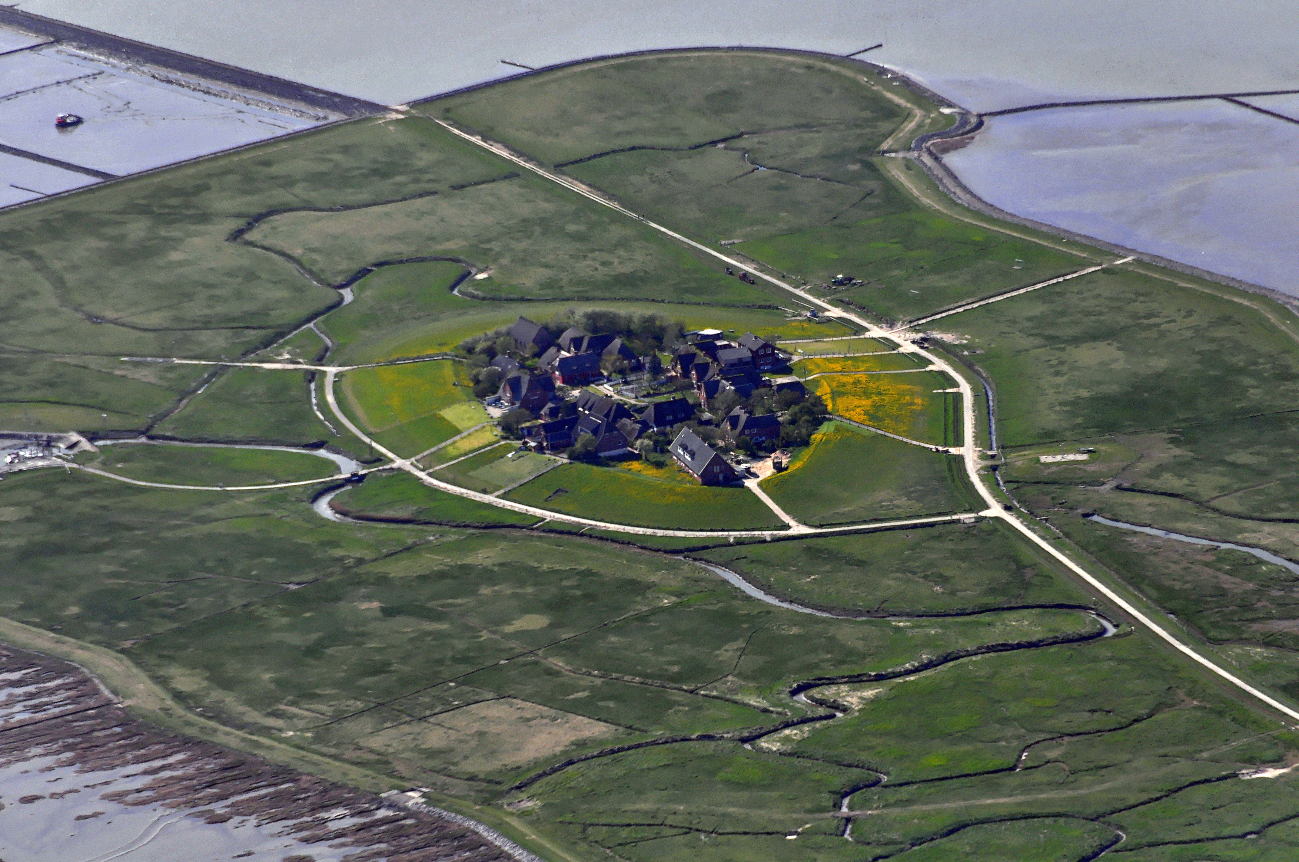
The ''Halligen'' (German, singular ''Hallig'', ) or the ''halliger'' (Danish, singular ''hallig'') are small islands without protective dikes. They are variously pluralized in English as the Halligen, Halligs, Hallig islands, or Halligen islands. There are ten German ''halligen'' in the North Frisian Islands on Schleswig-Holstein's Wadden Sea–North Sea coast in the district of Nordfriesland and one remaining hallig at the west coast of Denmark ( Langli). Naming The name is cognate to Old-English ''halh'', meaning "slightly raised ground isolated by marsh". The very existence of the ''halligen'' is a result of frequent floods and poor coastal protection. The floods were much more common in the Middle Ages and coastal protection was much poorer. Aspects The ''halligen'' have areas ranging from 7 to 956 ha, and are often former parts of the mainland, separated therefrom by storm tide erosion. Some are parts of once much bigger islands sundered by the same forces. Some, ow ... [...More Info...] [...Related Items...] OR: [Wikipedia] [Google] [Baidu] |
Föhr
Föhr (; ''Fering'' North Frisian: ''Feer''; ) is one of the North Frisian Islands on the German coast of the North Sea. It is part of the Nordfriesland district in the federal state of Schleswig-Holstein. Föhr is the second-largest North Sea island of Germany and a popular destination for tourists. A town and eleven distinct municipalities are located on the island. The climate is oceanic with moderate winters and relatively cool summers. Being a settlement area already in Neolithic times, Föhr had been part of mainland North Frisia until 1362. Then the coastline was destroyed by a heavy storm flood known as Saint Marcellus's flood (, 'Great Drowning of Men') and several islands were formed, Föhr among them. The northern parts of Föhr consist of marshes while the southern parts consist of sandy geest. From the middle-ages until 1864, Föhr belonged to the Danish realm and to the Duchy of Schleswig, but was then transferred to Prussia as a result of the Second Schleswig Wa ... [...More Info...] [...Related Items...] OR: [Wikipedia] [Google] [Baidu] |
Nordfriesland
Nordfriesland (; ; Low German: Noordfreesland), also known as North Frisia, is the northernmost Districts of Germany, district of Germany, part of the state of Schleswig-Holstein. It includes almost all of traditional North Frisia (with the exception of the island of Heligoland), as well as adjacent parts of the Schleswig Geest to the east and Stapelholm to the south, and is bounded (from the east and clockwise) by the districts of Schleswig-Flensburg and Dithmarschen, the North Sea and the Denmark, Danish county of South Jutland County, South Jutland. The district is called ''Kreis Nordfriesland'' in German language, German, ''Kreis Noordfreesland'' in Low German language, Low German, ''Kris Nordfraschlönj'' in Mooring (North Frisian dialect), Mooring North Frisian, ''Kreis Nuurdfresklun'' in Fering, Fering North Frisian and ''Nordfrislands amt'' in Danish language, Danish. As of 2008, Nordfriesland was the Tourism in Germany, most visited rural district in Germany. Histor ... [...More Info...] [...Related Items...] OR: [Wikipedia] [Google] [Baidu] |
Langeneß
Langeneß (; ; ) is a municipality in the district of Nordfriesland, in Schleswig-Holstein, Germany. It consists of the halligen (islands) Langeneß and Oland. Before the flood of 1634 the two islands were directly attached. Langeneß itself has 16 Warften and is the largest Hallig. It has about 100 inhabitants and 58 households. There is a junior school and an information centre providing information about the national park A national park is a nature park designated for conservation (ethic), conservation purposes because of unparalleled national natural, historic, or cultural significance. It is an area of natural, semi-natural, or developed land that is protecte ... and the Wadden-Sea at Peterswarf. A railway connects Langeneß to the mainland at Dagebüll via Oland for people, which live on the islands. There is also a daily ferry service of W.D.R. References External links * Halligen Tidal islands of Germany Nordfriesland Islands of Schleswig-H ... [...More Info...] [...Related Items...] OR: [Wikipedia] [Google] [Baidu] |
Oland (Frisian Island)
Oland (; , North Frisian language, North Frisian: ''Ualöönist'') is a small Hallig of the North Frisian Islands which is connected by Dagebüll–Oland–Langeneß_island_railway, a narrow-gauge railway to the mainland and to Hallig Langeneß. In 2019, the population was estimated, unofficially, to be 16 people. Oland Lighthouse, Germany's smallest lighthouse is located here, being also the only one with a Thatching, thatched roof. History People have settled in this place since the Middle Ages, while today's Oland was connected to the Hallig Langeneß until the Burchardi flood in 1634. The Hallig became smaller as a result of numerous storm surges over the centuries. The second terp (Warft) of the Hallig was destroyed in a storm flood in 1850, so today's Oland consists of one large terp in the Wadden Sea National Parks, Wadden Sea. Since 1927, Oland and Langeneß have been connected to the mainland by a dam with a narrow-gauge railway. Initially, the lorries on this railwa ... [...More Info...] [...Related Items...] OR: [Wikipedia] [Google] [Baidu] |
Ferry Terminal
A passenger terminal is a structure in a port which services passengers boarding and leaving water vessels such as ferry, ferries, cruise ships and ocean liners. Depending on the types of vessels serviced by the terminal, it may be named (for example) ferry terminal, cruise terminal, marine terminal or maritime passenger terminal. As well as passengers, a passenger terminal sometimes has facilities for automobiles and other land vehicles to be picked up and dropped off by the water vessel. Facilities Passenger terminals may vary greatly in size. A small ferry terminal servicing a commuter ferry may just have the means to tie up the vessel and a waiting area for passengers. Even for a large, vehicle-carrying cross-sea ferry, the terminal at a small island location may be similar sized, with just a short ramp to enable vehicles to be driven onto the ferry. Passengers may be loaded onto a ship from the wharf by a Gangway (nautical), gangway or by a linkspan. Goods packed in con ... [...More Info...] [...Related Items...] OR: [Wikipedia] [Google] [Baidu] |
Mussel
Mussel () is the common name used for members of several families of bivalve molluscs, from saltwater and Freshwater bivalve, freshwater habitats. These groups have in common a shell whose outline is elongated and asymmetrical compared with other edible clams, which are often more or less rounded or oval. The word "mussel" is frequently used to mean the bivalves of the marine family Mytilidae, most of which live on exposed shores in the intertidal zone, attached by means of their strong Byssus, byssal threads ("beard") to a firm substrate. A few species (in the genus ''Bathymodiolus'') have colonised hydrothermal vents associated with deep ocean ridges. In most marine mussels the shell is longer than it is wide, being wedge-shaped or asymmetrical. The external colour of the shell is often dark blue, blackish, or brown, while the interior is silvery and somewhat nacreous. The common name "mussel" is also used for many freshwater bivalves, including the freshwater pearl mussels. F ... [...More Info...] [...Related Items...] OR: [Wikipedia] [Google] [Baidu] |
Cutter (ship)
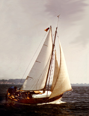
A cutter is any of various types of watercraft. The term can refer to the rig (sail plan) of a sailing vessel (but with regional differences in definition), to a governmental enforcement agency vessel (such as a coast guard or border force cutter), to a type of ship's boat which can be used under sail or oars, or, historically, to a type of fast-sailing vessel introduced in the 18th century, some of which were used as small warships. As a sailing rig, a cutter is a single-masted boat, with two or more headsails. On the eastern side of the Atlantic, the two headsails on a single mast is the fullest extent of the modern definition. In U.S. waters, a greater level of complexity applies, with the placement of the mast and the rigging details of the bowsprit taken into account so a boat with two headsails may be classed as a sloop. Government agencies use the term "cutter" for vessels employed in patrolling their territorial waters and other enforcement activities. This terminol ... [...More Info...] [...Related Items...] OR: [Wikipedia] [Google] [Baidu] |


