|
DSSAM
The DSSAM Model (Dynamic Stream Simulation and Assessment Model) is a computer simulation developed for the Truckee River to analyze water quality impacts from land use and wastewater management decisions in the Truckee River Basin. This area includes the cities of Reno and Sparks, Nevada as well as the Lake Tahoe Basin. The model is historically and alternatively called the ''Earth Metrics Truckee River Model''. Since original development in 1984-1986 under contract to the U.S. Environmental Protection Agency (EPA), the model has been refined and successive versions have been dubbed DSSAM II and DSSAM III. This hydrology transport model is based upon a pollutant loading metric called '' Total maximum daily load (TMDL).'' The success of this flagship model contributed to the Agency's broadened commitment to the use of the underlying TMDL protocol in its national policy for management of most river systems in the United States. The Truckee River has a length of over and drains ... [...More Info...] [...Related Items...] OR: [Wikipedia] [Google] [Baidu] |
Hydrology Transport Model
An hydrological transport model is a mathematical model used to simulate the flow of rivers, streams, groundwater movement or drainage front displacement, and calculate water quality parameters. These models generally came into use in the 1960s and 1970s when demand for numerical forecasting of water quality and drainage was driven by environmental legislation, and at a similar time widespread access to significant computer power became available. Much of the original model development took place in the United States and United Kingdom, but today these models are refined and used worldwide. There are dozens of different transport models that can be generally grouped by pollutants addressed, complexity of pollutant sources, whether the model is steady state or dynamic, and time period modeled. Another important designation is whether the model is distributed (i.e. capable of predicting multiple points within a river) or lumped. In a basic model, for example, only one pollutant mi ... [...More Info...] [...Related Items...] OR: [Wikipedia] [Google] [Baidu] |
Truckee River
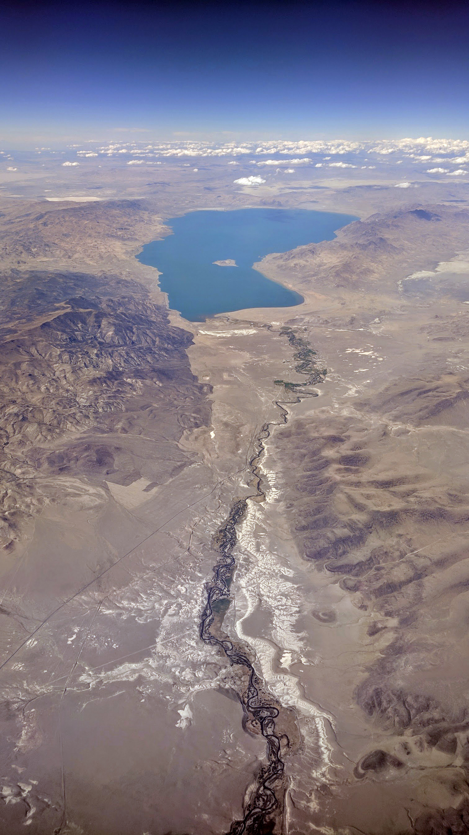
The Truckee River is a river in the U.S. states of California and Nevada. The river flows northeasterly and is long.U.S. Geological Survey. National Hydrography Dataset high-resolution flowline dataThe National Map accessed October 20, 2012 The Truckee is the sole outlet of Lake Tahoe and drains part of the high Sierra Nevada, emptying into Pyramid Lake (Nevada), Pyramid Lake in the Great Basin. Its waters are an important source of irrigation along its valley and adjacent valleys. Naming of the river A Northern Paiute language, Northern Paiute word for the Truckee is Kuyuinahukwa. Kuyui- refers to the Cui-ui, a species of fish endemic to Pyramid Lake (Nevada), Pyramid Lake which is central to the lives of the Northern Paiute people, Northern Paiute band called the Kuyui Dükadü (cui-ui-fish-eaters). In the Washo language, different parts of the river have different names. Two names, ‘Át’abi wá’t’a and Á’waku wá’t’a translate to "trout stream." The latter na ... [...More Info...] [...Related Items...] OR: [Wikipedia] [Google] [Baidu] |
Lahontan Cutthroat Trout
Lahontan cutthroat trout'','' ''Oncorhynchus henshawi'',Markle, D. (2018). An interim classification of the cutthroat trout complex, Oncorhynchus clarkii Sensu Lato, with comments on nomenclature. In Trotter P., Bisson P., Schultz L., & Roper B. (Eds.), Cutthroat trout: Evolutionary biology and taxonomy (special publication 36, pp. 181–197). American Fisheries Society. (formerly, ''O. c. henshawi'') formerly all grouped together as the cutthroat trout under a single species ''Oncorhynchus clarkii'' with many subspecies, is a fish species of the family Salmonidae native to cold-water tributaries of the Basin and Range province of Nevada, as well as adjoining areas of southeast Oregon and northeastern California.Trotter, Patrick; Bisson, Peter; Roper, Brett; Schultz, Luke; Ferraris, Carl; Smith, Gerald R.; Stearley, Ralph F. (2018), Trotter, Patrick; Bisson, Peter; Shultz, Luke; Roper, Brett (eds.), "A Special Workshop on the Taxonomy and Evolutionary Biology of Cutthroat Trout", ... [...More Info...] [...Related Items...] OR: [Wikipedia] [Google] [Baidu] |
Cui-ui
The cui-ui (''Chasmistes cujus'') is a large sucker fish endemic to Pyramid Lake and, prior to its desiccation in the 20th century, Winnemucca Lake in northwestern Nevada. It feeds primarily on zooplankton and possibly on nanoplankton (such as algae and diatoms). The maximum size of male cui-ui is approximately and , while females reach approximately and . A cui-ui typically lives for 40 years but does not reach sexual maturity until at least age eight. The cui-ui is an endangered species, and one of the few surviving members of its genus. The cui-ui population is generally improving in numbers, having attained an estimated population exceeding one million in 1993, thanks to the efforts of the U.S. Environmental Protection Agency in analysis of the Truckee River spawning grounds and of the Nevada Department of Environmental Protection and EPA in following up on protection measures. The reason the cui-ui remains endangered (though upgraded from critically endangered in 20 ... [...More Info...] [...Related Items...] OR: [Wikipedia] [Google] [Baidu] |
Cui-ui Spawn (USFWS)
The cui-ui (''Chasmistes cujus'') is a large sucker fish endemic to Pyramid Lake and, prior to its desiccation in the 20th century, Winnemucca Lake in northwestern Nevada. It feeds primarily on zooplankton and possibly on nanoplankton (such as algae and diatoms). The maximum size of male cui-ui is approximately and , while females reach approximately and . A cui-ui typically lives for 40 years but does not reach sexual maturity until at least age eight. The cui-ui is an endangered species, and one of the few surviving members of its genus. The cui-ui population is generally improving in numbers, having attained an estimated population exceeding one million in 1993, thanks to the efforts of the U.S. Environmental Protection Agency in analysis of the Truckee River spawning grounds and of the Nevada Department of Environmental Protection and EPA in following up on protection measures. The reason the cui-ui remains endangered (though upgraded from critically endangered in 2014) ... [...More Info...] [...Related Items...] OR: [Wikipedia] [Google] [Baidu] |
Computer Model
Computer simulation is the running of a mathematical model on a computer, the model being designed to represent the behaviour of, or the outcome of, a real-world or physical system. The reliability of some mathematical models can be determined by comparing their results to the real-world outcomes they aim to predict. Computer simulations have become a useful tool for the mathematical modeling of many natural systems in physics (computational physics), astrophysics, climatology, chemistry, biology and manufacturing, as well as human systems in economics, psychology, social science, health care and engineering. Simulation of a system is represented as the running of the system's model. It can be used to explore and gain new insights into new technology and to estimate the performance of systems too complex for analytical solutions. Computer simulations are realized by running computer programs that can be either small, running almost instantly on small devices, or large-scale p ... [...More Info...] [...Related Items...] OR: [Wikipedia] [Google] [Baidu] |
Pyramid Lake (Nevada)
Pyramid Lake is the Sink (geography), geographic sink of the basin of the Truckee River, northeast of Reno, Nevada, United States. Pyramid Lake is the biggest remnant of ancient Lake Lahontan, the inland sea that once covered much of western Nevada. It is approximately long and wide, with a perimeter of , covering acres entirely enclosed within the Pyramid Lake Indian Reservation, Pyramid Lake Paiute Tribe Reservation. Pyramid Lake is fed by the Truckee River, which is mostly the outflow from Lake Tahoe. The Truckee River enters Pyramid Lake at its southern end. Pyramid Lake is an endorheic lake, with water leaving only by evaporation or sub-surface seepage. The lake has about 10% of the area of the Great Salt Lake, but it has about 25% more volume. The salinity is approximately 1/6 that of sea water. Although clear Lake Tahoe forms the headwaters that drain to Pyramid Lake, the Truckee River delivers more turbid waters to Pyramid Lake after traversing the steep Sierra terrai ... [...More Info...] [...Related Items...] OR: [Wikipedia] [Google] [Baidu] |
Surface Runoff
Surface runoff (also known as overland flow or terrestrial runoff) is the unconfined flow of water over the ground surface, in contrast to ''channel runoff'' (or ''stream flow''). It occurs when excess rainwater, stormwater, meltwater, or other sources, can no longer sufficiently rapidly infiltrate in the soil. This can occur when the soil is #Saturation excess overland flow, saturated by water to its full capacity, and the rain arrives #Infiltration excess overland flow, more quickly than the soil can absorb it. Surface runoff often occurs because wikt:impervious#Adjective, impervious areas (such as roofs and Road surface, pavement) do not allow water to soak into the ground. Furthermore, runoff can occur either through natural or human-made processes. Surface runoff is a major component of the water cycle. It is the primary agent of Soil erosion#Rainfall and runoff, soil erosion by water. The land area producing runoff that drains to a common point is called a drainage basin. ... [...More Info...] [...Related Items...] OR: [Wikipedia] [Google] [Baidu] |
Line Source
A line source, as opposed to a point source, area source, or volume source, is a source of air, noise, water contamination or electromagnetic radiation that emanates from a linear (one-dimensional) geometry. The most prominent linear sources are roadway air pollution, aircraft air emissions, roadway noise, certain types of water pollution sources that emanate over a range of river extent rather than from a discrete point, elongated light tubes, certain dose models in medical physics and electromagnetic antennas. While point sources of pollution were studied since the late nineteenth century, linear sources did not receive much attention from scientists until the late 1960s, when environmental regulations for highways and airports began to emerge. At the same time, computers with the processing power to accommodate the data processing needs of the computer models required to tackle these one-dimensional sources became more available. In addition, this era of the 1960s saw ... [...More Info...] [...Related Items...] OR: [Wikipedia] [Google] [Baidu] |
Stormwater Runoff
Surface runoff (also known as overland flow or terrestrial runoff) is the unconfined flow of water over the ground surface, in contrast to '' channel runoff'' (or ''stream flow''). It occurs when excess rainwater, stormwater, meltwater, or other sources, can no longer sufficiently rapidly infiltrate in the soil. This can occur when the soil is saturated by water to its full capacity, and the rain arrives more quickly than the soil can absorb it. Surface runoff often occurs because impervious areas (such as roofs and pavement) do not allow water to soak into the ground. Furthermore, runoff can occur either through natural or human-made processes. Surface runoff is a major component of the water cycle. It is the primary agent of soil erosion by water. The land area producing runoff that drains to a common point is called a drainage basin. Runoff that occurs on the ground surface before reaching a channel can be a nonpoint source of pollution, as it can carry human-made cont ... [...More Info...] [...Related Items...] OR: [Wikipedia] [Google] [Baidu] |
Lake Tahoe
Lake Tahoe (; Washo language, Washo: ''dáʔaw'') is a Fresh water, freshwater lake in the Sierra Nevada of the Western United States, straddling the border between California and Nevada. Lying at above sea level, Lake Tahoe is the largest alpine lake in North America, and at it trails only the five Great Lakes as the List of lakes by volume, largest by volume in the United States. Its depth is , making it the List of lakes by depth, second deepest in the United States after Crater Lake in Oregon (). The lake was formed about two million years ago as part of the Lake Tahoe Basin, and its modern extent was shaped during the Quaternary glaciation, ice ages. It is known for the clarity of its water and the panorama of surrounding mountains on all sides. The area surrounding the lake is also referred to as Lake Tahoe, or simply Tahoe; its English name is derived from its Washo language, Washo name, . More than 75% of the lake's Drainage basin, watershed is National forest (Unite ... [...More Info...] [...Related Items...] OR: [Wikipedia] [Google] [Baidu] |


