|
DN1A
DN1A () is a national road in Romania connecting Bucharest and Brașov via Ploiești which is long. It serves as an alternative to the route through the Valea Prahovei (Prahova Valley). See also * DN1 *Roads in Romania *Transport in Romania Transportation infrastructure in Romania is the property of the state, and is administered by the Ministry of Transport and Infrastructure, Constructions and Tourism, except when operated as a concession, in which case the concessions are mad ... References Roads in Romania {{Romania-road-stub ... [...More Info...] [...Related Items...] OR: [Wikipedia] [Google] [Baidu] |
Bucharest
Bucharest ( , ; ) is the capital and largest city of Romania. The metropolis stands on the River Dâmbovița (river), Dâmbovița in south-eastern Romania. Its population is officially estimated at 1.76 million residents within a greater Bucharest metropolitan area, metropolitan area of 2.3 million residents, which makes Bucharest the List of cities in the European Union by population within city limits, 8th most-populous city in the European Union. The city area measures and comprises 6 districts (''Sectors of Bucharest, Sectoare''), while the metropolitan area covers . Bucharest is a major cultural, political and economic hub, the country's seat of government, and the capital of the Muntenia region. Bucharest was first mentioned in documents in 1459. The city became the capital in 1862 and is the centre of Romanian media, culture, and art. Its architecture is a mix of historical (mostly History of architecture#Revivalism and Eclecticism, Eclectic, but also Neoclassical arc ... [...More Info...] [...Related Items...] OR: [Wikipedia] [Google] [Baidu] |
Brașov
Brașov (, , ; , also ''Brasau''; ; ; Transylvanian Saxon dialect, Transylvanian Saxon: ''Kruhnen'') is a city in Transylvania, Romania and the county seat (i.e. administrative centre) of Brașov County. According to the 2021 Romanian census, 2021 census, with 237,589 inhabitants, Brașov is the Cities in Romania, 6th most populous city in Romania. The Brașov metropolitan area, metropolitan area was home to 371,802 residents. Brașov is located in the central part of the country, about north of Bucharest and from the Black Sea. It is surrounded by the Southern Carpathians and is part of the historical region of Transylvania. Historically, the city was the centre of the Burzenland (), once dominated by the Transylvanian Saxons (), and a significant commercial hub on the trade roads between Austria (then Archduchy of Austria, within the Habsburg monarchy, and subsequently Austrian Empire) and Turkey (then Ottoman Empire). It is also where the Deșteaptă-te, române!, nationa ... [...More Info...] [...Related Items...] OR: [Wikipedia] [Google] [Baidu] |
Ilfov County
Ilfov () is the Counties of Romania, county that surrounds Bucharest, the capital of Romania. It used to be largely rural, but, after the fall of communism, many of the county's villages and communes developed into high-income commuter towns, which act like suburbs or satellites of Bucharest. The gentrification of the county is continuing, with many towns in Ilfov, such as Otopeni, having some of the highest GDP per capita levels in the country. The county has experienced rapid demographic growth in the 21st century, being the fastest growing Romanian county between 2011 and 2021. Demographics Ilfov County had a population of 542,686 at the 2021 Romanian census. The population density is 342.82 per km2. 40% of the population commutes and works in Bucharest, although, in recent years, many industrial plants were built outside Bucharest, in Ilfov county. It has an annual growth of about 4%. * Romanians - 96.05% * Minorities of Romania, Others - 3.95% Geography The county ha ... [...More Info...] [...Related Items...] OR: [Wikipedia] [Google] [Baidu] |
Dâmbovița County
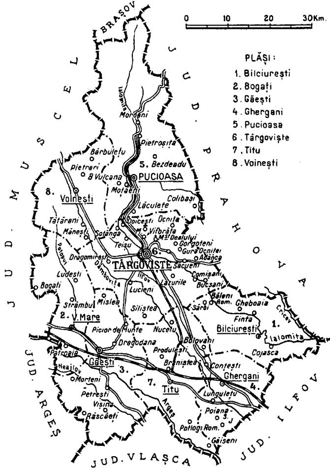
Dâmbovița County (; also spelt Dîmbovița) is a county () of Romania, in Muntenia, with the capital city at Târgoviște, the most important economic, political, administrative and cultural center of the county. It is a traditional administrative unit, first attested in 1512. Demographics In 2021, it had a population of 479,404 and the population density was 120/km2. It is one of the most densely populated counties in Romania. * Romanians – 87.09% * Roma - 3.96% * Bulgarians - 0.31% * Serbians 0.1% * Others - 0.13% * Unknown - 8.41% Name The county is named after the Dâmbovița River, which is a name of Slavic origin, derived from ''Дъб, dâmb'', meaning "oak", as it once flowed through the oak forests of the Wallachian Plain. Geography Dâmbovița county has a total area of 4,054 km2 (1.7% of the country's surface). It is situated in the south-central part of the country, on the Ialomița and Dâmbovița river basins. The highest altitude is Omu Pe ... [...More Info...] [...Related Items...] OR: [Wikipedia] [Google] [Baidu] |
Prahova County
Prahova County () is a county (județ) of Romania, in the Historical regions of Romania, historical region Muntenia, with the capital city at Ploiești. Demographics In 2011, it had a population of 762,886 and the population density was 161/km2. It is Romania's third most populated county (after the Municipality of Bucharest and Iași County), having a population density double that of the country's mean. * Romanians - 97.74% * Romani people in Romania, Romas and Minorities of Romania, others - 2.26% The county received an inflow of population who have moved here due to the industrial development. Geography This county has a total area of 4,716 km2. The relief is split in approximately equal parts between the mountains, the hills and the plain. In the North side there are mountains from the southern end of the Eastern Carpathians - the Curvature Carpathians group; and the Bucegi Mountains the Eastern end of the Southern Carpathians group. The two groups are separated ... [...More Info...] [...Related Items...] OR: [Wikipedia] [Google] [Baidu] |
Brașov County
Brașov County () is a county (județ) of Transylvania, Romania. Its capital city is Brașov. The county incorporates within its boundaries most of the Medieval "lands" (''țări'') Burzenland and Făgăraș. Name In Hungarian language, Hungarian, it is known as ''Brassó megye'', and in German language, German as ''Kreis Kronstadt''. Under Austria-Hungary, a county with an identical name (Brassó County, ) was created in 1876, covering a smaller area. Demographics At the 2011 Romanian census, 2011 census, the county had a population of 549,217 and the population density was . * Romanians – 87.4% * Hungarians in Romania, Hungarians – 7.77% * Romani people in Romania, Romas – 3.5% * Germans of Romania, Germans (Transylvanian Saxons) – 0.65% At the 2021 Romanian census, 2021 census, Brașov County had a population of 546,615 and the population density was . * Romanians – 88.33% * Hungarians in Romania, Hungarians – 5,98% * Romani people in Romania, Romas – 4.98% ... [...More Info...] [...Related Items...] OR: [Wikipedia] [Google] [Baidu] |
Roads In Romania
Public roads in Romania are ranked according to importance and traffic as follows: *motorways (autostradă – pl. autostrăzi) – colour: green; designation: A followed by one or two digits *expressways (drum – pl. drumuri express) – colour: red; designation: DEx followed by one or two digits and an optional letter *national road (drum național – pl. drumuri naționale) – colour: red; designation: DN followed by one or two digits and an optional letter *county road (drum județean – pl. drumuri județene) – colour: blue; designation: DJ followed by three digits and an optional letter; unique numbers per county *local road (drum – pl. drumuri comunale) – colour: yellow; designated DC followed by a number and an optional letter; unique numbers per county Some of the national roads are part of the European route scheme. European routes passing through Romania: E58; E60; E70; E85; E79; E81; E68; E87 (Class A); E574; E576; E581; E583; E671; E771. ... [...More Info...] [...Related Items...] OR: [Wikipedia] [Google] [Baidu] |
Romania
Romania is a country located at the crossroads of Central Europe, Central, Eastern Europe, Eastern and Southeast Europe. It borders Ukraine to the north and east, Hungary to the west, Serbia to the southwest, Bulgaria to the south, Moldova to the east, and the Black Sea to the southeast. It has a mainly continental climate, and an area of with a population of 19 million people. Romania is the List of European countries by area, twelfth-largest country in Europe and the List of European Union member states by population, sixth-most populous member state of the European Union. Europe's second-longest river, the Danube, empties into the Danube Delta in the southeast of the country. The Carpathian Mountains cross Romania from the north to the southwest and include Moldoveanu Peak, at an altitude of . Bucharest is the country's Bucharest metropolitan area, largest urban area and Economy of Romania, financial centre. Other major urban centers, urban areas include Cluj-Napoca, Timiș ... [...More Info...] [...Related Items...] OR: [Wikipedia] [Google] [Baidu] |
Ploiești
Ploiești ( , , ), formerly spelled Ploești, is a Municipiu, city and county seat in Prahova County, Romania. Part of the historical region of Muntenia, it is located north of Bucharest. The area of Ploiești is around , and it borders the Blejoi commune in the north, Bărcănești, Prahova, Bărcănești and Brazi communes in the south, Târgșoru Vechi commune in the west, and Bucov and Berceni, Prahova, Berceni communes in the east. According to the 2021 Romanian census, 2021 census, Ploiești is the List of cities and towns in Romania, tenth most populous city in the country with a population of 180,540. The city grew beginning with the 17th century on an estate bought by ruler Michael the Brave from the local landlords, gradually replacing nearby Wallachian fairs of Târgșor, Gherghița, and Bucov. Its development was accelerated by heavy industrialisation during the mid-19th century, with the world's first large-scale oil refinery, petroleum refinery being opened between ... [...More Info...] [...Related Items...] OR: [Wikipedia] [Google] [Baidu] |
Valea Prahovei
Prahova Valley (Romanian: ''Valea Prahovei'') is the valley where the Prahova river makes its way between the Bucegi and the Baiu Mountains, in the Carpathian Mountains, Romania. It is a tourist region, situated about north of the capital city of Bucharest. World War I During World War I, the area was the site of heavy fighting between Austria-Hungary, Austro-Hungarian and German Empire, German forces on one side and Romanian Land Forces, Romanian forces on the other. The strategic objective of the Central Powers was to reach Bucharest via the shortest route, but they were prevented from doing so by determined Romanian resistance. Geography Geographically, the Prahova river separates the Eastern Carpathians chain from the Southern Carpathians. Historically, the corridor was the most important passageway between the principalities of Wallachia and Transylvania. The DN1 road links Bucharest with the city of Brașov; the planned A3 motorway (Romania), A3 freeway is currently b ... [...More Info...] [...Related Items...] OR: [Wikipedia] [Google] [Baidu] |
Transport In Romania
Transportation infrastructure in Romania is the property of the state, and is administered by the Ministry of Transport and Infrastructure, Constructions and Tourism, except when operated as a concession, in which case the concessions are made by the Ministry of Administration and Interior. The country's most important waterway is the river Danube. The largest port is that of Constanța, which is the second largest port in the Black Sea. With over 13 million passengers Bucharest Airport is a major international airport and European transportation hub. Air travel is used for greater distances within Romania but faces extreme competition from the state-owned CFR's rail network. Public transport is available in most areas. History Romania has a system of large, navigable rivers, such as the Danube, Olt and Mureș that cross the country. The first important human improvements were the Roman roads linking major settlements and providing quick passage for marching armies. Ra ... [...More Info...] [...Related Items...] OR: [Wikipedia] [Google] [Baidu] |


