|
Sofia Region
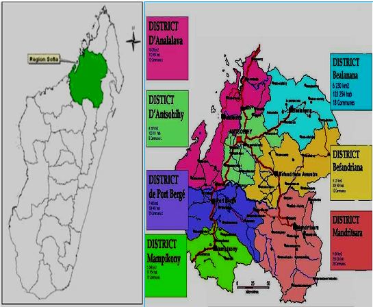
Sofia is a Regions of Madagascar, region in northern Madagascar. It is named for the Sofia River. It is the second largest Malagasy region (behind Atsimo-Andrefana) with an area of 50,100 km² (19,300 sq mi), and had a population of 1,500,227 in 2018. The administrative capital is Antsohihy. Administrative divisions Sofia Region is divided into seven districts, which are sub-divided into 108 communes. * Analalava District - 11 communes * Antsohihy District - 12 communes * Bealanana District - 13 communes * Befandriana-Nord District - 12 communes * Boriziny-Vaovao District - 15 communes * Mampikony District - 6 communes * Mandritsara District - 22 communes Transport Airports *Analalava Airport *Ambalabe Airport, Antsohihy Airport *Ankaizina Airport, Bealanana Airport *Befandriana-Avaratra Airport *Mampikony Airport *Mandritsara Airport *Port Bergé Airport, Boriziny Vaovao Airport Roads Sofia is crossed by the Route nationale 4 (Madagascar), National Road 4 (Antananarivo-Mah ... [...More Info...] [...Related Items...] OR: [Wikipedia] [Google] [Baidu] |
Antsohihy
Antsohihy is a city (commune urbaine) in northern Madagascar. It is the administrative capital of the Sofia Region. Geography Antsohihy is the capital of Sofia Region and of Antsohihy District. It is situated at the junction of Route nationale 6 and Route nationale 32. Antsohihy is served by a local airport. The town is crossed by the Loza River Loza may refer to: Places *Loza, Álava, a village in the Basque Country, Spain *Loza, Bulgaria, a village in Gabrovo Province, Bulgaria *Loza (Plzeň-North District), a municipality and village in the Czech Republic *Łoza, a village in Sztum Co .... Climate Nature * The Bora Reserve is located near Ansohihy. Sports * Varatraza Antsohihy FC, reginal football champion of Sofia 2017 and Herita Antsohihy, regional champion 2010. Education The town hosts the annexes of the University Institute of Technology and Agronomy of Mahajanga (IUTAM), the University Institute of Management and Administration (IUGM) and the School of Law and P ... [...More Info...] [...Related Items...] OR: [Wikipedia] [Google] [Baidu] |
Analalava Airport
Analalava Airport is an airport in Analalava, Madagascar Madagascar, officially the Republic of Madagascar, is an island country that includes the island of Madagascar and numerous smaller peripheral islands. Lying off the southeastern coast of Africa, it is the world's List of islands by area, f ... . It is at Latitude -14.6296997 Longitude 47.7638016 with Runway 1 length of 3937 feet. The airport has a field elevation of 345 feet and a magnetic variation of 10.286°W it is a regional airport that has scheduled airline service. References Airports in Madagascar Mahajanga Province {{Madagascar-airport-stub ... [...More Info...] [...Related Items...] OR: [Wikipedia] [Google] [Baidu] |
Bongolava Forest Corridor
Bongolava is a region in central-western Madagascar. The capital of the region is Tsiroanomandidy. It had a population of 674,474 in 2018. Geography The region is situated in central-western Madagascar. It is bordered by Betsiboka, Melaky, Menabe, Vakinankaratra, Itasy and Analamanga. The altitude ranges from to . It is crossed by the Kiranomena River, Mahajilo River and Manambolo River and the Route nationale 1. Administrative divisions Bongolava Region is divided into two districts, which are sub-divided into 24 communes. * Fenoarivo-Afovoany District - 8 communes * Tsiroanomandidy District - 16 communes Transport Airport * Tsiroanomandidy Airport See also * Antananarivo Province Antananarivo Province is a former province of Madagascar with an area of . It had a population of 5,370,900 in 2004. Its capital was Antananarivo, which is also the capital of the country. Established in 1965, it was the most important province of ... References External linksBongolavauno ... [...More Info...] [...Related Items...] OR: [Wikipedia] [Google] [Baidu] |
Mangrove
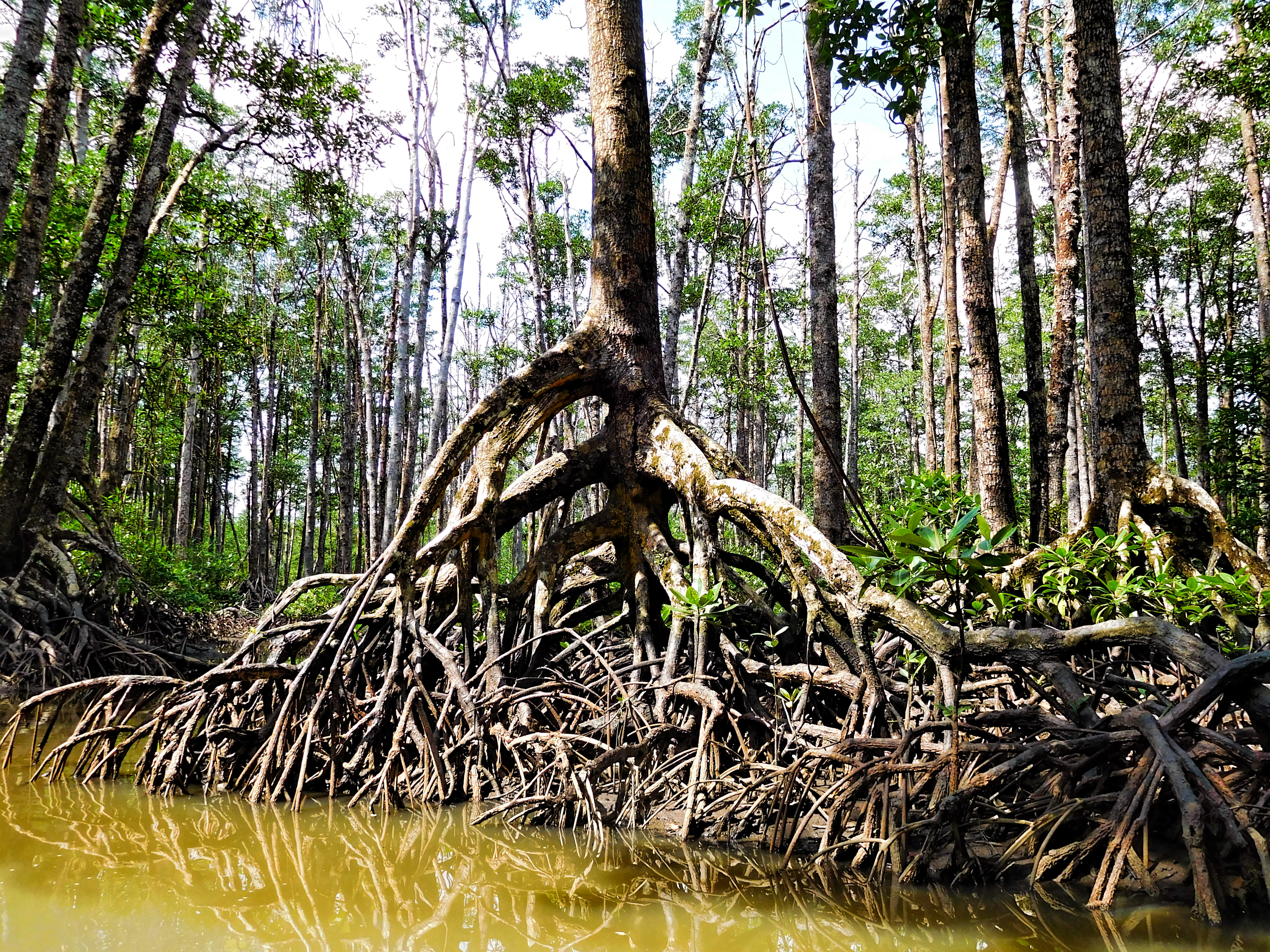
A mangrove is a shrub or tree that grows mainly in coastal saline water, saline or brackish water. Mangroves grow in an equatorial climate, typically along coastlines and tidal rivers. They have particular adaptations to take in extra oxygen and remove salt, allowing them to tolerate conditions that kill most plants. The term is also used for tropical coastal vegetation consisting of such species. Mangroves are taxonomically diverse due to convergent evolution in several plant families. They occur worldwide in the tropics and subtropics and even some temperate coastal areas, mainly between latitudes 30° N and 30° S, with the greatest mangrove area within 5° of the equator. Mangrove plant families first appeared during the Late Cretaceous to Paleocene epochs and became widely distributed in part due to the plate tectonics, movement of tectonic plates. The oldest known fossils of Nypa fruticans, mangrove palm date to 75 million years ago. Mangroves are salt-tolerant ... [...More Info...] [...Related Items...] OR: [Wikipedia] [Google] [Baidu] |
Route Nationale 32 (Madagascar)
Route nationale 32 (RN 32) is a secondary highway in Madagascar from Antsohihy to Mandritsara, continuing to Andilamena. It crosses the regions of Alaotra-Mangoro and Sofia Region. Selected locations on route (from north to south) *Antsohihy (junction with RN 6) * Befandriana-Avaratra - (86 km) * river crossing * Binara * Mandritsara * Marotandrano * Ambohibary * Sahavoay * Marofano * Ambodivelatra * Antranoambo * Antanimenabaka *Andilamena (continues as RN 3a) See also *List of roads in Madagascar *Transport in Madagascar Paved and unpaved roadways, as well as railways, provide the main forms of transport in Madagascar. Madagascar has approximately of paved roads and 836 km of rail lines. In 2010, Madagascar had of navigable waterways. Railways In 2018, Madaga ... References {{reflist Roads in Alaotra-Mangoro Roads in Sofia Region Roads in Madagascar ... [...More Info...] [...Related Items...] OR: [Wikipedia] [Google] [Baidu] |
Route Nationale 31 (Madagascar)
''Route nationale 31'' (''RN 31'') is a primary highway in Madagascar of 129 km, running from Bealanana to the junction with the RN 6 near Andrafia. It is entirely in the Sofia Region. Selected locations on route (from northeast to southwest) *Bealanana * Ambatosia *Antsohihy near Andrafia - (intersection with RN 6 to Antsiranana or Mahajanga) See also *List of roads in Madagascar *Transport in Madagascar Paved and unpaved roadways, as well as railways, provide the main forms of transport in Madagascar. Madagascar has approximately of paved roads and 836 km of rail lines. In 2010, Madagascar had of navigable waterways. Railways In 2018, Madaga ... References {{Roads in Madagascar Roads in Madagascar Roads in Sofia Region ... [...More Info...] [...Related Items...] OR: [Wikipedia] [Google] [Baidu] |
Route Nationale 6 (Madagascar)
Route nationale 6 (RN6) is a primary highway in Madagascar of 706 km, running from Antsiranana to Ambondromamy. It crosses the regions of Diana Region, Diana and Sofia Region, Sofia. It was paved in 1992. Most parts of this road are paved and well maintained but there are some unpaved sections in a very bad shape. Selected locations on route (from north to south) *Antsiranana *Tsingy Rouge *Anivorano Nord *Ambondromifehy *Ankarana Reserve (Tsingy d'Ankarana) - at Mahamasina *Ambilobe - (junction with Route Nationale 5a (Madagascar), RN5a to Vohémar and Sambava) *Ambanja - (Manongarivo Reserve at 35 km from Ambanja). *Mahamanina Falls *Maromandia *Antsohihy (junction with Route nationale 31 (Madagascar), RN 31 to Bealanana) and Route nationale 32 (Madagascar), RN 32 to Mandritsara) *bridge over the Sofia River. *Port Berge (Boriziny) *Mampikony *Ambondromamy- (junction with Route Nationale 4 (Madagascar), RN4 (Mahajanga - Antananarivo) Gallery Image:Tsingy Rouge- ... [...More Info...] [...Related Items...] OR: [Wikipedia] [Google] [Baidu] |
Route Nationale 4 (Madagascar)
Route nationale 4 (RN4) is a primary highway in Madagascar. The route runs from the capital city of Antananarivo to Mahajanga, a city on the northeast coast of Madagascar. It covers a distance of . Selected locations on route (from south to north) * Antananarivo * Ampanotokana (junction to Morarano/Miantso by the Route nationale temporaire 36 (Madagascar), RNT 36) * Andranovelona, Analamanga, Andranovelona (PK – water power plant & Buddhist temple) * Ankazobe – ( from Antananarivo) * Ankazosary * Andranofeno * Manerinerina * Ankarambe * Mahatsinjo, Maevatanana, Mahatsinjo * Andrioa * Antanimbary * Andranobevava * Beanana * Maevatanana – () * Andramy * Bridge over Betsiboka River * Ambalanjanakomby * Maromalandy * Andranomamy * Mahajamba River – bridge * Ambondromamy – (junction with Route nationale 6 (Madagascar), RN 6 – ) * Ankarafantsika National Park National Park * Mahajanga See also * List of roads in Madagascar * Transport in Madagascar References ... [...More Info...] [...Related Items...] OR: [Wikipedia] [Google] [Baidu] |
Port Bergé Airport
Port Bergé Airport is an airport serving Port Bergé, a city in the Sofia Region of Madagascar Madagascar, officially the Republic of Madagascar, is an island country that includes the island of Madagascar and numerous smaller peripheral islands. Lying off the southeastern coast of Africa, it is the world's List of islands by area, f .... References External links * Airports in Madagascar Sofia Region {{SofiaMG-geo-stub ... [...More Info...] [...Related Items...] OR: [Wikipedia] [Google] [Baidu] |
Mandritsara Airport
Mandritsara Airport is an airport in Mandritsara, Sofia Region, Madagascar Madagascar, officially the Republic of Madagascar, is an island country that includes the island of Madagascar and numerous smaller peripheral islands. Lying off the southeastern coast of Africa, it is the world's List of islands by area, f .... Scheduled services There are no scheduled flights to the airport. It is served by Mission Avistion Fellowship. References Airports in Madagascar Sofia Region {{Madagascar-airport-stub ... [...More Info...] [...Related Items...] OR: [Wikipedia] [Google] [Baidu] |
Mampikony Airport
Mampikony Airport is an airport in Mampikony, Sofia Region, Madagascar Madagascar, officially the Republic of Madagascar, is an island country that includes the island of Madagascar and numerous smaller peripheral islands. Lying off the southeastern coast of Africa, it is the world's List of islands by area, f .... References Airports in Madagascar Sofia Region {{Madagascar-airport-stub ... [...More Info...] [...Related Items...] OR: [Wikipedia] [Google] [Baidu] |


