|
Semirechye Oblast
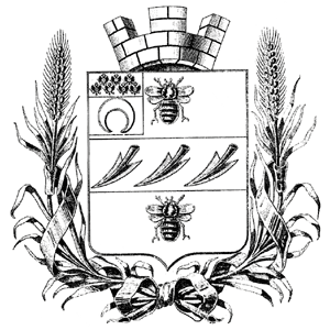
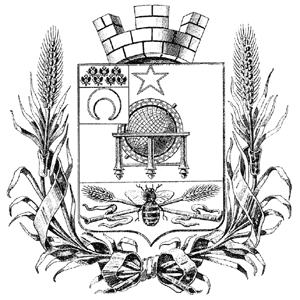
The Semirechyenskaya Oblast () was an oblast (province) of the Russian Empire. It corresponded approximately to most of present-day southeastern Kazakhstan and northeastern Kyrgyzstan. It was created out of the territories of the northern part of the Khanate of Kokand that had been part of the Kazakh Khanate. The name "Semirechye" ("Seven Rivers") itself is the direct Russian translation of the historical region of Jetysu. Its site of government was Verniy (now named Almaty). The Russian government seized the Semirechyenskaya region in 1854 and created the province the same year. It was administered as part of Governor-Generalship of the Steppes (which was known as the Governor-Generalship of the Western Siberia before 1882) between 1854 and 1867 and again between 1882 and 1899, and part of Russian Turkistan between 1867 and 1882 and again between 1899 and 1917. Russian control of the region was recognized by the Treaty of Saint Petersburg (1881) between Russia and China. On A ... [...More Info...] [...Related Items...] OR: [Wikipedia] [Google] [Baidu] |
Oblasts Of Russia
In Russia, the oblasts are 46 administrative territories; they are one type of federal subject, the highest-level administrative division of Russian territory. Overview Oblasts are constituent political entities in a federal union with representation in the Federation Council, and serve as a first-level administrative division. Each oblast features a state government holding authority over a defined geographic territory, with a state legislature, the ''Oblast Duma'', that is democratically elected. The governor is the highest executive position of the state government in an oblast and is elected by the people. Oblasts are divided into '' raions'' (districts), cities of oblast significance (district-equivalent independent cities), and autonomous okrugs, which are legally federal subjects equal to an oblast but are administratively subservient to one. Two oblasts have autonomous okrugs: Arkhangelsk Oblast ( Nenets Autonomous Okrug) and Tyumen Oblast ( Khanty-Mansi Autonomo ... [...More Info...] [...Related Items...] OR: [Wikipedia] [Google] [Baidu] |
Kirghiz Autonomous Socialist Soviet Republic (1920–25)
The Kazakh Autonomous Socialist Soviet Republic (; ), abbreviated as Kazak ASSR (; ) and simply Kazakhstan (; ), was an autonomous republic of the Russian Soviet Federative Socialist Republic (RSFSR) within the Soviet Union (from 1922) which existed from 1920 until 1936. History The Kazakh ASSR was originally created as the Kirghiz Autonomous Socialist Soviet Republic (; ) (not to be confused with Kirghiz ASSR of 1926–1936, a Central Asian territory which is now the independent state of Kyrgyzstan) on 26 August 1920 and was an autonomous republic within the Russian Socialist Federative Soviet Republic. Before the Russian Revolution, Kazakhs in Russia were known as "Kirghiz-Kazaks" or simply "Kirghiz" (and the Kyrgyzes as "Kara-Kirghiz"). This practice continued into the early Soviet period, and thus the Kirghiz ASSR was a national republic for Kazakhs. However, on 15–19 June 1925 the Fifth Kazakh Council of Soviets decided to rename the republic the Kazak Autonomous Social ... [...More Info...] [...Related Items...] OR: [Wikipedia] [Google] [Baidu] |
Karakol
Karakol (; , ), formerly Przhevalsk ( rus, Пржевальск, p=pr̩ʐɨˈvalʲsk), is the fourth-largest city in Kyrgyzstan, near the eastern tip of Lake Issyk-Kul, about from the Kyrgyzstan–China border and from the capital Bishkek. It is the administrative capital of Issyk-Kul Region. Its area is , and its resident population was 84,351 in 2021 (both including Pristan'-Przheval'sk). To the north, on highway A363, is Tüp, and to the southwest Jeti-Ögüz resort. History A Russian military outpost founded on 1 July 1869, Karakol grew in the 19th century after explorers came to map the peaks and valleys separating Kyrgyzstan from China. In the 1880s Karakol's population surged with an influx of Dungans, Chinese Muslims fleeing warfare in China. In 1888, the Russian explorer Nikolay Przhevalsky died in Karakol of typhoid, while preparing for an expedition to Tibet. By order of Tsar Alexander III on 23 March 1889 the city was renamed Przhevalsk in the explorer's hon ... [...More Info...] [...Related Items...] OR: [Wikipedia] [Google] [Baidu] |
Bishkek
Bishkek, formerly known as Pishpek (until 1926), and then Frunze (1926–1991), is the Capital city, capital and largest city of Kyrgyzstan. Bishkek is also the administrative centre of the Chüy Region. Bishkek is situated near the Kazakhstan–Kyrgyzstan border, border with Kazakhstan and has a population of 1,074,075, as of 2021. The Khanate of Kokand established the fortress of Pishpek in 1825 to control local caravan routes and to collect tribute from Kyrgyz people, Kyrgyz tribes. On 4 September 1860, with the approval of the Kyrgyz, Russian forces led by Colonel Apollon Zimmermann destroyed the fortress. In the present day, the fortress ruins can be found just north of Jibek Jolu Street, near the new main mosque. A Russian settlement was established in 1868 on the site of the fortress under its original name, Pishpek. It lay within the General Governorship of Russian Turkestan and its Semirechye Oblast. The Kara-Kirghiz Autonomous Oblast was established in 1925 in Russia ... [...More Info...] [...Related Items...] OR: [Wikipedia] [Google] [Baidu] |
Lepsi
Lepsi (, ''Lepsı''), is a village in Sarkand District, Jetisu Region, in south-eastern Kazakhstan, located at an altitude of 1,018 meters above sea level. It is 124 km (82 miles) away from the regional center Taldykorgan and 924 km (574 miles) from the capital city of Nur-Sultan. It is located to the south of Lake Balkhash, on the Lepsy River. It is a stop on the train between Almaty and Semey on the Turkestan–Siberia Railway The Turkestan–Siberian Railway (commonly abbreviated as the ''Turk–Sib'', , , ; ) is a Russian gauge, broad gauge railway that connects Central Asia with Siberia. It starts north of Tashkent in Uzbekistan at Arys, Kazakhstan, Arys, where it .... The village is the seat of , which also includes the village (Көкжиде, pop. 489) and railway stations Akbalik (Акбалик, pop. 90), Arganati (Арганати, pop. 40), Karatas (Каратас, pop. 94), Keregetas (Керегетас, pop. 14), Kokshalgin (Кокшалгин, pop ... [...More Info...] [...Related Items...] OR: [Wikipedia] [Google] [Baidu] |
Qapal
Qapal (), formerly known as ''Kopal'' (), is a village in Aksu District in Jetisu Region of south-eastern Kazakhstan. It is situated on the river Qapal. Until 1921, it was an uyezd center of the Semirechye Oblast. Tamshybulak Spring The Tamshybulak Spring is a large spring on the territory of the village, situated on fertile ground. The water does not freeze in winter and algae grow all year round. The water flows down from the mountains in small drops, so it is called in Kazakh "Tears of the Earth" or "Weeping Spring". The spring is renowned for the beauty and sacred power of its water, which is medicinal: each arm of the spring has its own properties. In one place, the water is believed to benefit eye diseases, in another, those of the stomach, and so on. Many pilgrims and tourists visit because of their belief in the healing properties of the water, which are yet to be confirmed by scientific studies. The first records concerning the medicinal properties of the spring wer ... [...More Info...] [...Related Items...] OR: [Wikipedia] [Google] [Baidu] |
Zharkent
Jarkent (; ) is a city which serves as the administrative center of Panfilov District in Jetisu Region, southeastern Kazakhstan. It is located near the Usek River, not far from the Ili River. It is also right by the border with Xinjiang, China. The city's population totaled 42,617 . The town was founded in 1882. From 1942 to 1991 it was named Panfilov () after Ivan Panfilov, a Soviet Russian general who died in 1941, during the Battle of Moscow of World War II. Jarkent is well known for its 19th-century mosque, commissioned by a wealthy merchant and community leader named Vali Bay. It is notable for its unique mix of Chinese and Central Asian architectural styles, due to the territory briefly being administered under Qing rule. Climate Jarkent has a cold semi-arid climate (Köppen Köppen is a German surname. Notable people with the surname include: * Bernd Köppen (1951–2014), German pianist and composer * Carl Köppen (1833-1907), German military advisor in Meiji era Jap ... [...More Info...] [...Related Items...] OR: [Wikipedia] [Google] [Baidu] |
Verst
A verst (; ) is an obsolete Russian unit of length, defined as 500 sazhen. This makes a verst equal to . Plurals and variants In the English language, ''verst'' is singular with the normal plural ''versts''. In Russian, the nominative singular is , but the form usually used with numbers is the genitive plural —10 verst, 25 verst, etc.—whence the English form. A (, literally "border verst") is twice as long as a verst. The verst of the 17th century was 700 sazhens or 1.49 km as against the 500 sazhens or 1.067 km it became at the time of Peter the Great. Finnish ''virsta'' In Finland, a was 1,068.84 m according to the Swedish standard, defined in 1827 as of a , the Finnish language name for the pre-metric Swedish '' mil'', used in Finland since the early 17th century (see Obsolete Finnish units of measurement), or 600 (Swedish fathoms, 1.781 m). Metrication replaced with the kilometre The kilometre (SI symbol: km; or ), spelt kilometer in American E ... [...More Info...] [...Related Items...] OR: [Wikipedia] [Google] [Baidu] |
Uyezd
An uezd (also spelled uyezd or uiezd; rus, уе́зд ( pre-1918: уѣздъ), p=ʊˈjest), or povit in a Ukrainian context () was a type of administrative subdivision of the Grand Duchy of Moscow, the Tsardom of Russia, the Russian Empire, the Russian SFSR, and the early Soviet Union, which was in use from the 13th century. For most of Russian history, uezds were a second-level administrative division. By sense, but not by etymology, ''uezd'' approximately corresponds to the English "county". General description Originally describing groups of several volosts, they formed around the most important cities. Uezds were ruled by the appointees (''namestniki'') of a knyaz and, starting from the 17th century, by voyevodas. In 1708, an administrative reform was carried out by Peter the Great, dividing Russia into governorates. The subdivision into uyezds was abolished at that time but was reinstated in 1727, as a result of Catherine I's administrative reform. By the USSR administra ... [...More Info...] [...Related Items...] OR: [Wikipedia] [Google] [Baidu] |
Ala-Köl
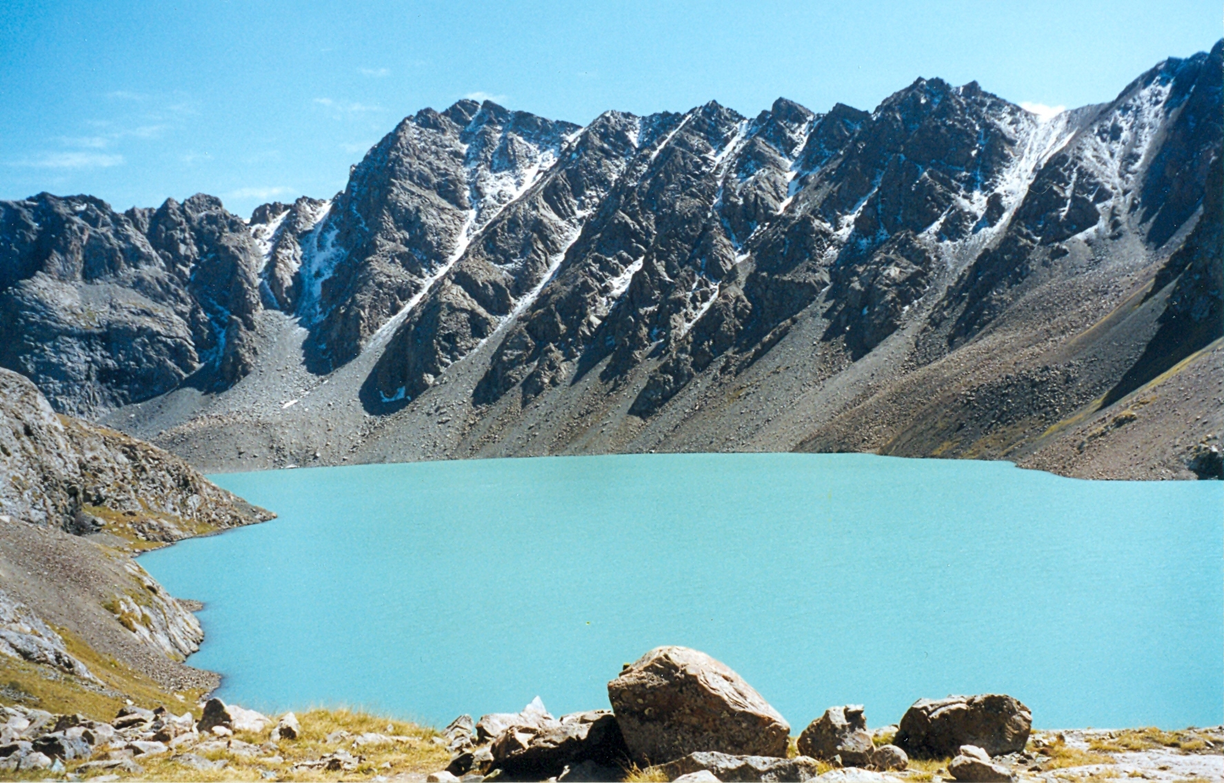
Ala-Köl (, also Алакөл, ) is a rock-dammed lake in the Terskey Alatau mountain range in the Ak-Suu District of the Issyk-Kul Region in Kyrgyzstan Kyrgyzstan, officially the Kyrgyz Republic, is a landlocked country in Central Asia lying in the Tian Shan and Pamir Mountains, Pamir mountain ranges. Bishkek is the Capital city, capital and List of cities in Kyrgyzstan, largest city. Kyrgyz .... It lies at an altitude of . It is long and wide. Its area is . History A Russian traveller named Putimtsoff was the first to knowingly visit the lake in 1811. He gave a good description of it, mentioning rocks of different colours in the lake, and the furious winds blowing around the lake. Thirty years later Alexander von Schrenk explored the lake and its surroundings. Literally, the name Ala-Köl would mean 'variegated lake,' although it probably takes its name from the Ala-Таu mountains lying further north.Taylor, Issac (1898)''Names and their histories: a handbook of his ... [...More Info...] [...Related Items...] OR: [Wikipedia] [Google] [Baidu] |
Issyk-Kul
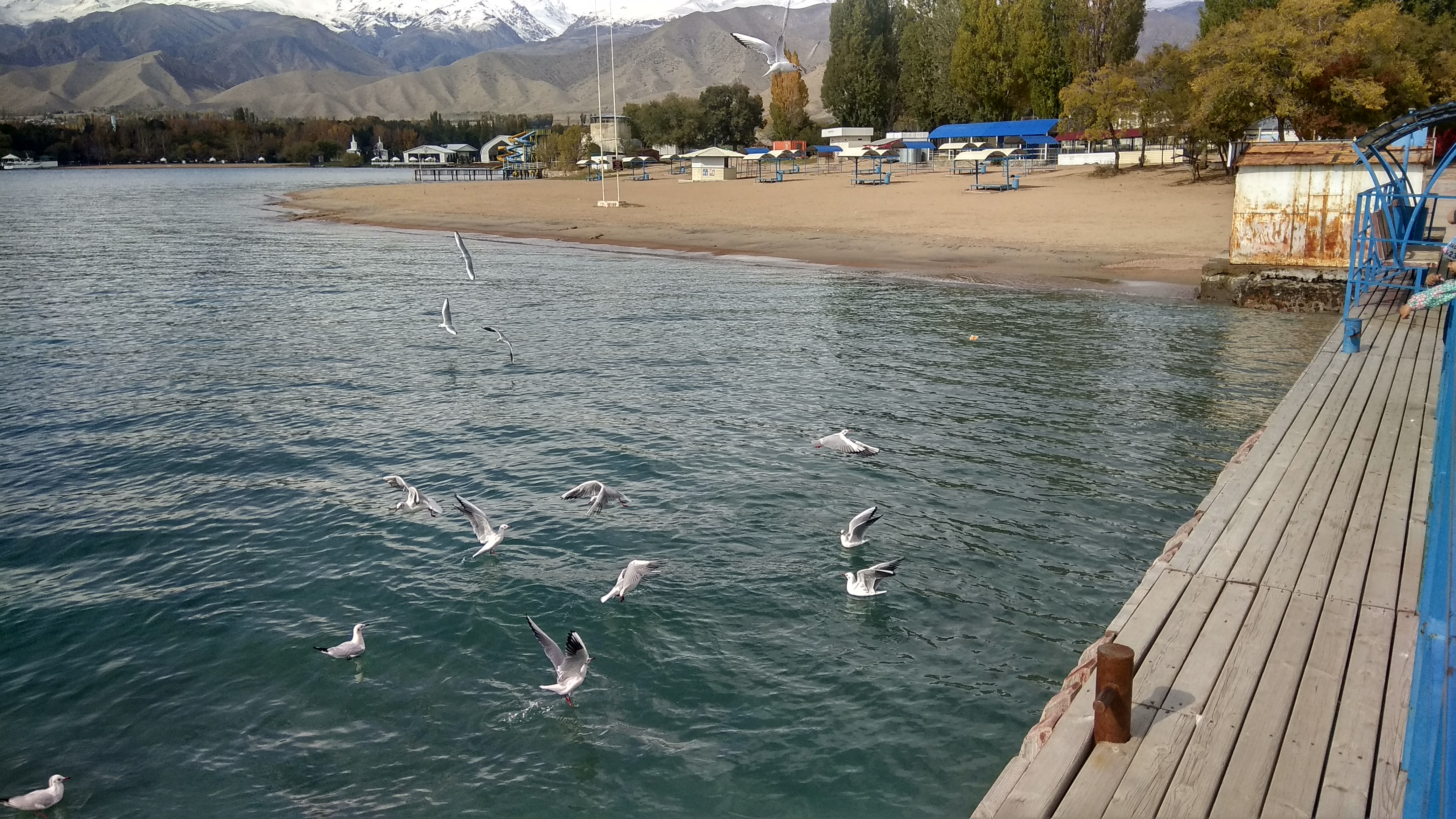
Issyk-Kul () or Ysyk-Köl (, ; ) is an endorheic saline lake in the western Tianshan Mountains in eastern Kyrgyzstan, just south of a dividing range separating Kyrgyzstan from Kazakhstan. It is the eighth-deepest lake in the world, the eleventh-largest lake in the world by volume (though not in surface area), the deepest lake whose deepest point is above sea level (939 meters or 3,080 feet), and the third-largest saline lake. Although it is located at a lofty elevation of and subject to severe cold during winter, it rarely freezes over due to high salinity, hence its name, which in the Kyrgyz language means "warm lake". The lake is a Ramsar site of globally significant biodiversity and forms part of the Issyk-Kul Biosphere Reserve. Geography Issyk-Kul Lake is long, up to wide and its surface area is . It is the second-largest mountain lake in the world behind Lake Titicaca in South America. It is at an altitude of and reaches in depth. About 118 rivers and streams f ... [...More Info...] [...Related Items...] OR: [Wikipedia] [Google] [Baidu] |
Lake Balkhash
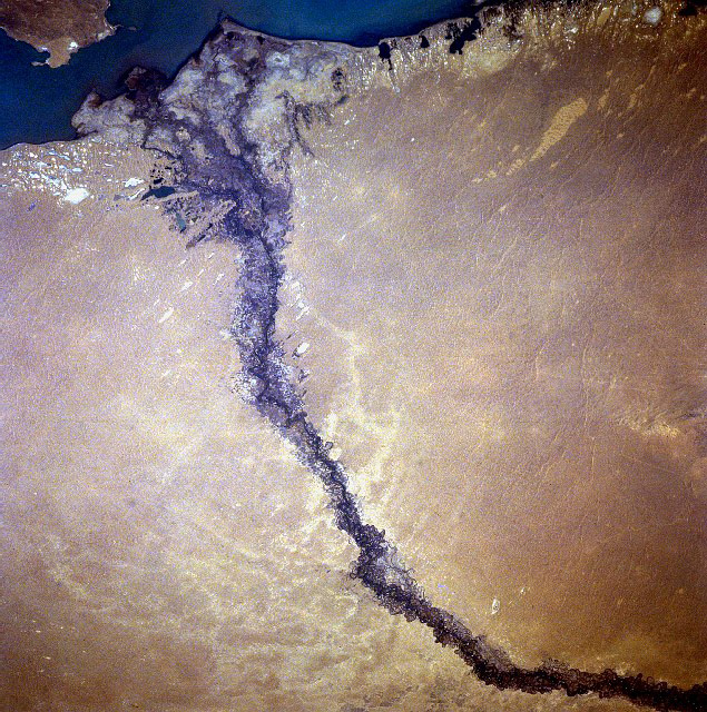
Lake Balkhash, also spelt Lake Balqash (, , ), is a lake in southeastern Kazakhstan, one of the largest lakes in Asia and the 15th largest in the world. It is located in the eastern part of Central Asia and sits in the Balkhash-Alakol Basin, an endorheic (closed) basin. The basin drains seven rivers, the primary of which is the Ili, bringing most of the riparian inflow; others, such as the Karatal, bring surface and subsurface flow. The Ili is fed by precipitation, largely vernal snowmelt, from the mountains of China's Xinjiang region. The lake currently covers about . However, like the Aral Sea, it is shrinking due to diversion and extraction of water from its feeders. The lake has a narrow, quite central, strait. The lake's western part is fresh water and its eastern half is saline. The eastern part is on average 1.7 times deeper than the west. The largest shore city is named Balkhash and has about 66,000 inhabitants. Main local economic activities include mining, ore p ... [...More Info...] [...Related Items...] OR: [Wikipedia] [Google] [Baidu] |
