|
Kusatsu, Gunma
file:Kusatsu town office.JPG, 250px, Kusatsu town hall is a List of towns in Japan, town located in Gunma Prefecture, Japan. In September 2020, the town had a population of 6,255, in 3,407 households, and a population density of 130 persons per km2. The total area of the town is . Kusatsu is one of the most famous Onsen, hot springs resorts in Japan. Geography Kusatsu is situated about 1,200 meters above sea level. The active volcano Kusatsu-Shirane (2,160 m) and the inactive Mount Tengu (1,385 m) and Mount Motoshirane (2,171 m) are located west of Kusatsu. Surrounding municipalities Gunma Prefecture * Naganohara, Gunma, Naganohara * Nakanojō, Gunma, Nakanojō * Tsumagoi, Gunma, Tsumagoi Nagano Prefecture * Takayama, Nagano, Takayama Climate Kusatsu has a Humid continental climate (Köppen ''Dfb'') characterized by warm summers and cold winters with heavy snowfall. The average annual temperature in Kusatsu is 3.3 °C. The average annual rainfall is 1,711 mm. Septembe ... [...More Info...] [...Related Items...] OR: [Wikipedia] [Google] [Baidu] |
Towns Of Japan
A town (町; ''chō'' or ''machi'') is a Local government, local administrative unit in Japan. It is a local public body along with Prefectures of Japan, prefecture (''ken'' or other equivalents), Cities of Japan, city (''shi''), and Villages of Japan, village (''mura''). Geographically, a town is contained within a Districts of Japan, district. The same word (町; ''machi'' or ''chō'') is also used in names of smaller regions, usually a part of a Wards of Japan, ward in a city. This is a legacy of when smaller towns were formed on the outskirts of a city, only to eventually merge into it. Towns See also * Municipalities of Japan * List of villages in Japan * List of cities in Japan * Japanese addressing system References External links "Large City System of Japan"; graphic shows towns compared with other Japanese city types at p. 1 [PDF 7 of 40 /nowiki>] {{Asia topic, List of towns in Towns in Japan, * ... [...More Info...] [...Related Items...] OR: [Wikipedia] [Google] [Baidu] |
Kusatsu-Shirane
is a active stratovolcano in Kusatsu, Gunma, Japan. It is called Kusatsu Shirane to differentiate it from the Mount Nikkō-Shirane on the other side of Gunma Prefecture. The summit of Kusatsu-Shirane volcano, located immediately north of Asama volcano, consists of a series of overlapping pyroclastic cones and three crater lakes. The largest of these is Yu-gama, an acidic emerald green lake with rafts of yellow sulfur sometimes seen floating on its surface. On January 23, 2018, a minor phreatic eruption of the volcano occurred. One person was killed, and others were injured in an avalanche triggered by the eruption. The next day, new activity forced police to suspend search operations. One month after the eruption, it was announced by prefectural officials that only the summit of the volcano was off limits to the public. File:Kusatsu-Shirane Volcano Relief Map, SRTM-1.jpg, Relief map of Kusatsu-Shirane Volcano File:Kusatsu-Shiranesan01s5s4272.jpg, Yugama crater See also * ... [...More Info...] [...Related Items...] OR: [Wikipedia] [Google] [Baidu] |
Taira Clan
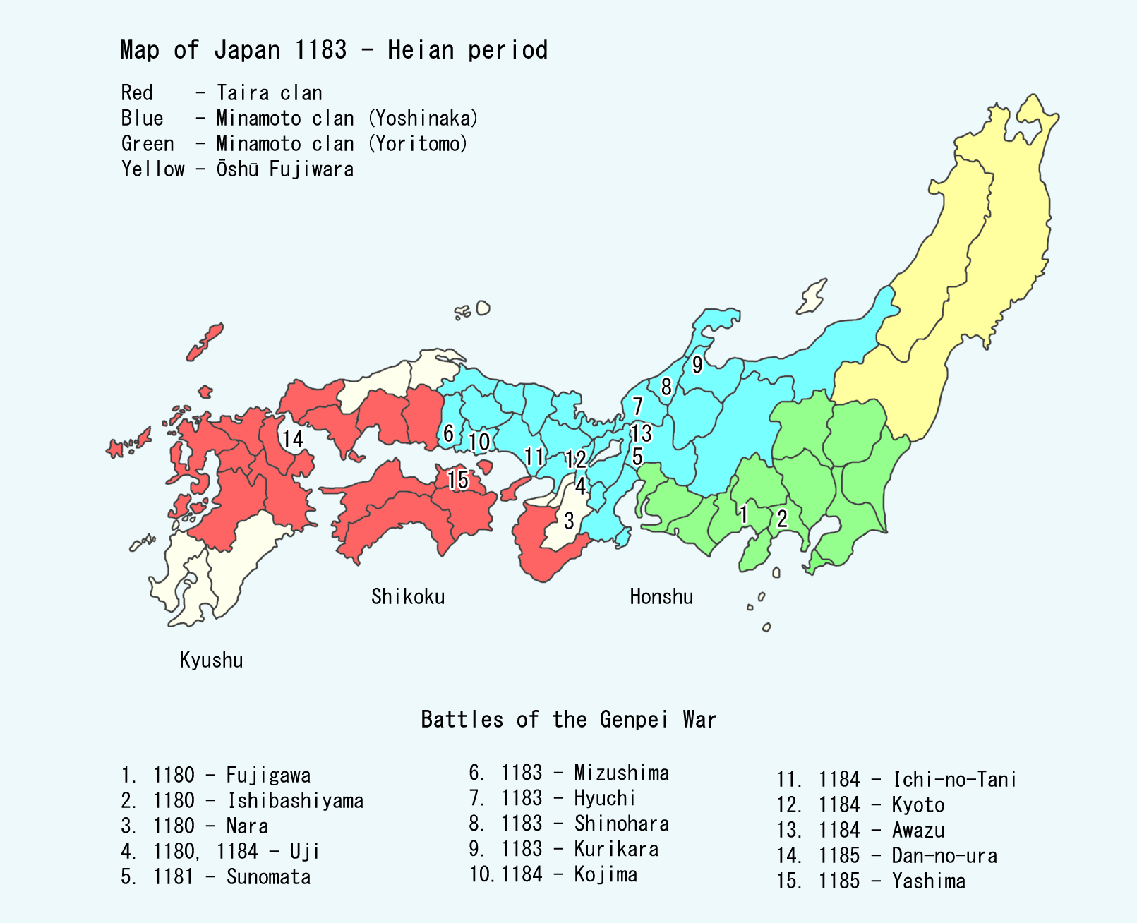
The was one of the four most important Japanese clans, clans that dominated Japanese politics during the Heian period, Heian period of History of Japan, Japanese history – the others being the Minamoto clan, Minamoto, the Fujiwara clan, Fujiwara, and the Tachibana clan (kuge), Tachibana. The clan is divided into four major groups, named after the Emperor of Japan, emperors they descended from: Emperor Kanmu, Kanmu Heishi, Emperor Ninmyō, Ninmyō Heishi, Emperor Montoku, Montoku Heishi, and Emperor Kōkō, Kōkō Heishi, the most influential of which was the Kanmu Heishi line. In the twilight of the Heian period, the Taira controlled the boy emperor Emperor Antoku, Antoku (himself the grandson of the powerful ''Kugyō'' Taira no Kiyomori) and had effectively dominated the Imperial capital of Heian-kyō, Heian. However, they were opposed by their rivals the Minamoto clan (the Genji), which culminated in the Genpei War (1180–1185 AD). The five-year-long war concluded with a d ... [...More Info...] [...Related Items...] OR: [Wikipedia] [Google] [Baidu] |
Minamoto No Yoritomo
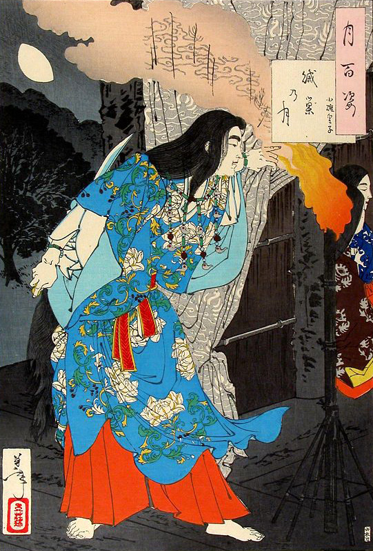
was the founder and the first shogun of the Kamakura shogunate, ruling from 1192 until 1199, also the first ruling shogun in the history of Japan.Nussbaum, Louis-Frédéric. (2005). "Minamoto no Yoriie" in . He was the husband of Hōjō Masako who acted as regent (''shikken'') after his death. Yoritomo was the son of Minamoto no Yoshitomo and belonged to Seiwa Genji's prestigious Kawachi Genji family. After successfully maneuvering himself to the position of rightful heir of the Minamoto clan, he led his clan against the Taira clan, Taira from his capital in Kamakura, beginning the Genpei War in 1180. After five years of civil war, the Minamoto clan finally defeated the Taira in the Battle of Dan-no-ura in 1185. Yoritomo established the supremacy of the samurai caste and the first shogunate (''bakufu'') which was to be centered around Kamakura, thus beginning the History of Japan#Feudal Japan, feudal age in Japan, which lasted until the 17th century. Early life Yoritomo was t ... [...More Info...] [...Related Items...] OR: [Wikipedia] [Google] [Baidu] |
Agatsuma, Gunma
was a town located in Agatsuma District, Gunma Prefecture, Japan. As of 2003, the town had an estimated population of 14,881 and a density Density (volumetric mass density or specific mass) is the ratio of a substance's mass to its volume. The symbol most often used for density is ''ρ'' (the lower case Greek letter rho), although the Latin letter ''D'' (or ''d'') can also be u ... of 67.58 persons per km2. The total area was 220.20 km2. On March 27, 2006, Agatsuma, along with the village of Azuma (also from Agatsuma District), was merged to create the town of Higashiagatsuma. External links Higashiagatsuma official website Dissolved municipalities of Gunma Prefecture Higashiagatsuma, Gunma {{Gunma-geo-stub ... [...More Info...] [...Related Items...] OR: [Wikipedia] [Google] [Baidu] |
Yamabushi
are Japanese mountain ascetic hermits. They are generally part of the syncretic religion, which includes Tantric Buddhism and Shinto. Their origins can be traced back to the solitary Yama-bito and some (saints or holy persons) of the eighth and ninth centuries. According to American writer Frederik L. Schodt: Clothing and items The Yamabushi usually wear and bring the following clothes and items with them: * Yuigesa (), a harness or sash adorned with pom-poms * Kyahan (), sandals made from straw * Tokin () which is a small hat-like adornment worn at the front of the head * Shakujō (), a metal rod, held in their hands * Oi (), backpack * Horagai (), a conch shell, which they blow like a horn to bind evil spirits See also * Cunning folk * Mount Ōfuna * Rishi * Shaolin Monastery Shaolin Monastery ( zh, labels=no, c=少林寺, p=shàolínsì), also known as Shaolin Temple, is a monastic institution recognized as the birthplace of Chan Buddhism and the crad ... [...More Info...] [...Related Items...] OR: [Wikipedia] [Google] [Baidu] |
Yamato Takeru
, originally , was a Japanese folk hero and semi-legendary prince of the imperial dynasty, son of Emperor Keikō, who is traditionally counted as the 12th Emperor of Japan. The kanji spelling of his name varies: it appears in the ''Nihon Shoki'' as 日本武尊 and in the ''Kojiki'' as 倭建命. The story of his life and death are told principally in the Japanese chronicles in ''Kojiki'' (712) and ''Nihon Shoki'' (720), but also mentioned in ''Kogo Shūi'' (807) and some histories like the (721). One of his sons became Emperor Chūai, the 14th Emperor of Japan. His history is uncertain but based on the chronicles his life can be calculated. He was born circa 72 and died in 114. Details are different between the two books, and the version in ''Kojiki'' is assumed to be loyal to the older form of this legend. Legendary narrative Prince Takeru slew his elder brother . His father, Emperor Keikō, feared his brutal temperament. To keep him at a distance, the emperor sent his s ... [...More Info...] [...Related Items...] OR: [Wikipedia] [Google] [Baidu] |
Japan Meteorological Agency
The Japan Meteorological Agency (JMA; ''気象庁, Kishō-chō'') is a division of the Ministry of Land, Infrastructure, Transport and Tourism dedicated to the Scientific, scientific observation and research of natural phenomena. Headquartered in Minato, Tokyo the government agency, agency collects data on meteorology, hydrology, seismology, volcanology, and other related fields. The JMA is responsible for collecting and disseminating weather data and Forecasting, forecasts to the public, as well as providing specialized information for aviation and Marine weather forecasting, marine sectors. Additionally, the JMA issues warnings for volcanic eruptions and is integral to the nationwide Earthquake Early Warning (Japan), Earthquake Early Warning (EEW) system. As one of the Regional Specialized Meteorological Centers designated by the World Meteorological Organization (WMO), the JMA also Forecasting, forecasts, Tropical cyclone naming, names, and distributes warnings for tropical ... [...More Info...] [...Related Items...] OR: [Wikipedia] [Google] [Baidu] |
Onsen
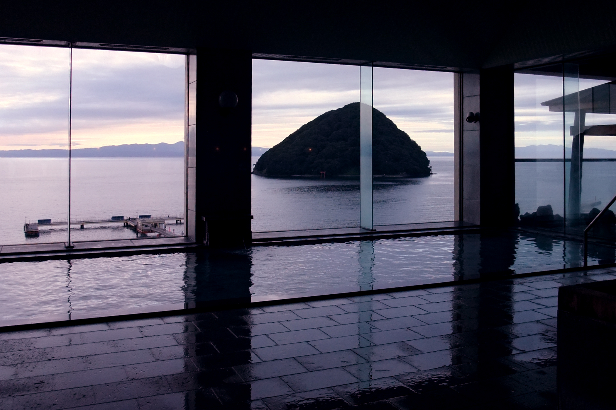
In Japan, are hot springs and the bathing facilities and Ryokan (inn), traditional inns around them. There are approximately 25,000 hot spring sources throughout Japan, and approximately 3,000 ''onsen'' establishments use naturally hot water from these Geothermal gradient, geothermally heated springs. ''Onsen'' may be either or . Traditionally, ''onsen'' were located outdoors, although many inns have now built indoor bathing facilities as well. Nowadays, as most households have their baths, the number of traditional public baths has decreased, but the number and popularity of have increased since the end of World War II, Second World War. Baths may be either publicly run by a municipality or privately, often connecting to a lodging establishment such as a hotel, ''Ryokan (inn), ryokan'', or ''Ryokan (inn)#Minshuku, minshuku''. The presence of an ''onsen'' is often indicated on signs and maps by the symbol ♨, the kanji (''yu'', meaning "hot water"), or the simpler phonet ... [...More Info...] [...Related Items...] OR: [Wikipedia] [Google] [Baidu] |
Takayama, Nagano
is a village located in Nagano Prefecture, Japan. , the village had an estimated population of 7,101 in 2466 households, and a population density of 72 persons per km2. The total area of the village is . Takayama is listed as one of The Most Beautiful Villages in Japan. Geography Takayama is located in northeastern Nagano Prefecture, bordered by Gunma Prefecture to the east. The village is located in a mountainous area, and includes Mount Kitahotaka partly within its borders. Surrounding municipalities *Gunma Prefecture ** Kusatsu ** Nakanojō ** Tsumagoi *Nagano Prefecture ** Nagano ** Suzaka ** Obuse ** Yamanouchi Climate The village has a Humid continental climate characterized by warm and humid summers, and cold with heavy snowfall winters (Köppen climate classification ''Dfb''). The average annual temperature in Takayama is 6.7 °C. The average annual rainfall is 1549 mm with September as the wettest month. The temperatures are highest on average in Aug ... [...More Info...] [...Related Items...] OR: [Wikipedia] [Google] [Baidu] |
Nagano Prefecture
is a Landlocked country, landlocked Prefectures of Japan, prefecture of Japan located in the Chūbu region of Honshu. Nagano Prefecture has a population of 2,007,682 () and has a geographic area of . Nagano Prefecture borders Niigata Prefecture to the north, Gunma Prefecture to the northeast, Saitama Prefecture to the east, Yamanashi Prefecture to the southeast, Shizuoka Prefecture and Aichi Prefecture to the south, and Gifu Prefecture and Toyama Prefecture to the west. Nagano (city), Nagano is the capital and largest city of Nagano Prefecture, with other major cities including Matsumoto, Nagano, Matsumoto, Ueda, Nagano, Ueda, and Iida, Nagano, Iida. Nagano Prefecture has impressive highland areas of the Japanese Alps, including most of the Hida Mountains, Kiso Mountains, and Akaishi Mountains which extend into the neighbouring prefectures. The area's mountain ranges, natural scenery, and history has gained Nagano Prefecture international recognition as a winter sports tourist de ... [...More Info...] [...Related Items...] OR: [Wikipedia] [Google] [Baidu] |
Tsumagoi, Gunma
is a village located in Gunma Prefecture, Japan. , the village had an estimated population of 9,546 in 3,999 households, and a population density of 28 persons per km2. The total area of the village is . Geography Tsumagoi is situated on the northwestern corner of Gunma Prefecture, touching Nagano Prefecture to the north, south, and west. Because of its elevated location and the ash deposits of Mount Asama, Tsumagoi is well known for growing cabbages. Parts of the village are within the borders of then Jōshin'etsu-kōgen National Park. * Mountains: Mount Asama (2568m), Mount Motoshirane (2171m), Mount Kusatsu-Shirane (2160m), Mount Azumaya (2354m) * Rivers: Agatsuma River * Lakes: Lake Baragi, Lake Tashiro Surrounding municipalities Gunma Prefecture * Kusatsu * Naganohara Nagano Prefecture * Karuizawa * Komoro * Miyota * Suzaka * Takayama * Tōmi * Ueda Climate Tsumagoi has a humid continental climate (Köppen ''Dfb'') characterized by warm summers and cold winters ... [...More Info...] [...Related Items...] OR: [Wikipedia] [Google] [Baidu] |


