|
Côte-Saint-Paul
Côte-Saint-Paul is a neighbourhood located in the Southwest Borough of Montreal, Quebec, Canada. History The concession of côte Saint-Paul was granted by the Sulpician Order, seigneurs of the Island of Montreal, in 1662. It extended northward from the current site past the current location of the Lachine Canal to Lac à la Loutre, which was then located at the foot of the Falaise Saint-Jacques, where the Turcot yards are today. The area was essentially agricultural, and remained so until the Lachine Canal bisected the area in 1825; Lac à la Loutre was dried out. Chemin de la Rivière-Saint-Pierre (now avenue de l'Église) was built to join Chemin de la Côte-des-Argoulets (Boulevard LaSalle) with the Chemin de la Côte-Saint-Paul (Rue Saint-Patrick). With the canal providing water power for factories, workers started to move in nearby, forming the nucleus of the community in the triangle bounded by the Lachine Canal, Rue Angers, and Avenue de l'Église. The village of Côte ... [...More Info...] [...Related Items...] OR: [Wikipedia] [Google] [Baidu] |
Le Sud-Ouest
Le Sud-Ouest ( en, "the southwest") is a borough (''arrondissement'') of the city of Montreal, Quebec, Canada. Geography Le Sud-Ouest is an amalgam of several neighbourhoods with highly distinct histories and identities, mainly with working-class and industrial origins, grouped around the Lachine Canal. These include Saint-Henri, Little Burgundy, and Griffintown to the north of the canal, and Ville-Émard, Côte-Saint-Paul, and Pointe-Saint-Charles to the south. Located southwest of downtown Montreal (hence the name), the borough is bordered to the northwest by Côte-des-Neiges—Notre-Dame-de-Grâce, to the northeast by the Ville-Marie borough, to the south by the borough of Verdun, to the west by the borough of LaSalle and the town of Montreal West, and to the north by the city of Westmount. The Saint Lawrence River is located upon part of its eastern edge. History :''See History of Saint-Henri, History of Little Burgundy, History of Ville-Émard, History of Cô ... [...More Info...] [...Related Items...] OR: [Wikipedia] [Google] [Baidu] |
Ville-Émard
Ville-Émard is a neighbourhood located in the Sud-Ouest borough of Montreal, Quebec, Canada. Overview Geography This neighbourhood is bordered by the Aqueduct Canal to the east as far north as Desmarchais Boulevard where it meets Côte-Saint-Paul, after which the eastern boundary runs north along Monk Boulevard to the Lachine Canal, the community's northern edge. The western boundary runs south along Irwin Street and Irwin Avenue to Angrignon Park, the outer boundaries of which form the community's western and southern edges. This neighbourhood is accessible via the ''Angrignon'' exit on Quebec Autoroute 20 and the ''De La Vérendrye'' exit on Quebec Autoroute 15. Neighbourhood Views History Ville-Émard was originally part of the concession of Côte Saint-Paul, granted by the Sulpician Order, seigneurs of the Island of Montreal, in 1662. The concession included modern-day Ville-Émard, Côte-Saint-Paul, and the Turcot Yards, and was used for agriculture. The Lachi ... [...More Info...] [...Related Items...] OR: [Wikipedia] [Google] [Baidu] |
Lachine Canal
The Lachine Canal ( in French) is a canal passing through the southwestern part of the Island of Montreal, Quebec, Canada, running 14.5 kilometres (9 miles) from the Old Port of Montreal to Lake Saint-Louis, through the boroughs of Lachine, Lasalle and Sud-Ouest. Before the canal construction there was a lake, Lac St. Pierre or or Petit Lac St. Pierre. The lake and its rivers can be seen on the maps of Montreal of the years 1700, 1744 and on the map titled "The isles of Montreal. As they have been surveyed by the French engineers" (1761). The lake is now filled in and located near the Turcot Interchange on Autoroute 20. The canal gets its name from the French word for China (). The European explorers sought to find a route from New France to the Western Sea, and from there to China and hence auspiciously the region where the canal was built was named Lachine. Due to the continuous disposal of industrial waste, the canal contains harmful substances, though the water qu ... [...More Info...] [...Related Items...] OR: [Wikipedia] [Google] [Baidu] |
Jolicoeur (Montreal Metro)
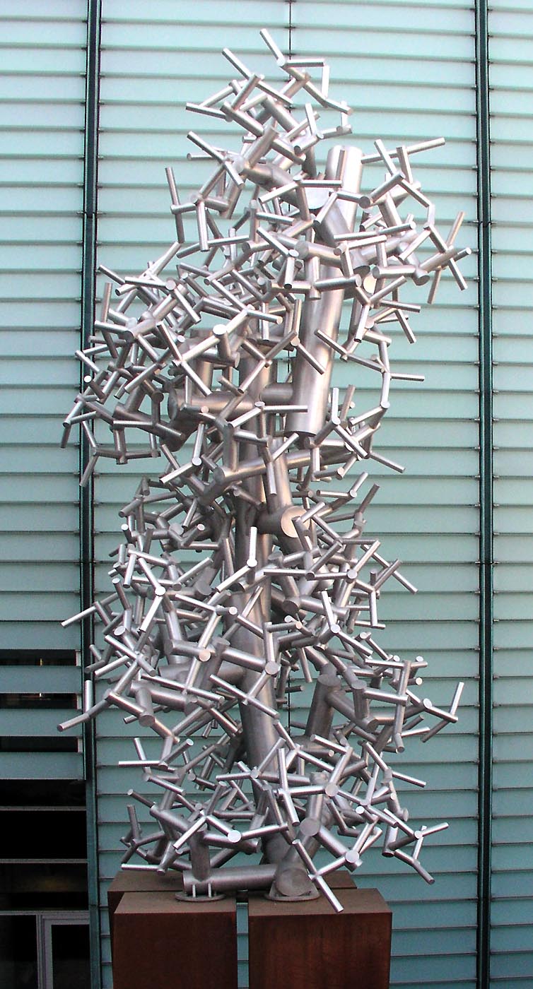
Jolicoeur is a station on the Green Line of the Montreal Metro rapid transit system operated by the Société de transport de Montréal (STM). It is located in the Côte-Saint-Paul district in the borough of Le Sud-Ouest in Montreal, Quebec, Canada. The station opened on September 3, 1978, as part of the extension of the Green Line westward to Angrignon. Art and architecture Designed by Claude Boucher, it is a side platform station, built in a shallow open cut, with the ticket hall integrated into a large glass-walled entrance pavilion. The design was influenced by the International Style architecture of Ludwig Mies van der Rohe. The floor of the platform level is decorated with a series of 42 circular ceramics by the architect. Renovation and upgrade works In October 2019, work began to make the station universally accessible. To allow for the installation of elevators, the entrance building was expanded on both sides. As part of the project, a sculpture by Chloé Desja ... [...More Info...] [...Related Items...] OR: [Wikipedia] [Google] [Baidu] |
Turcot Interchange
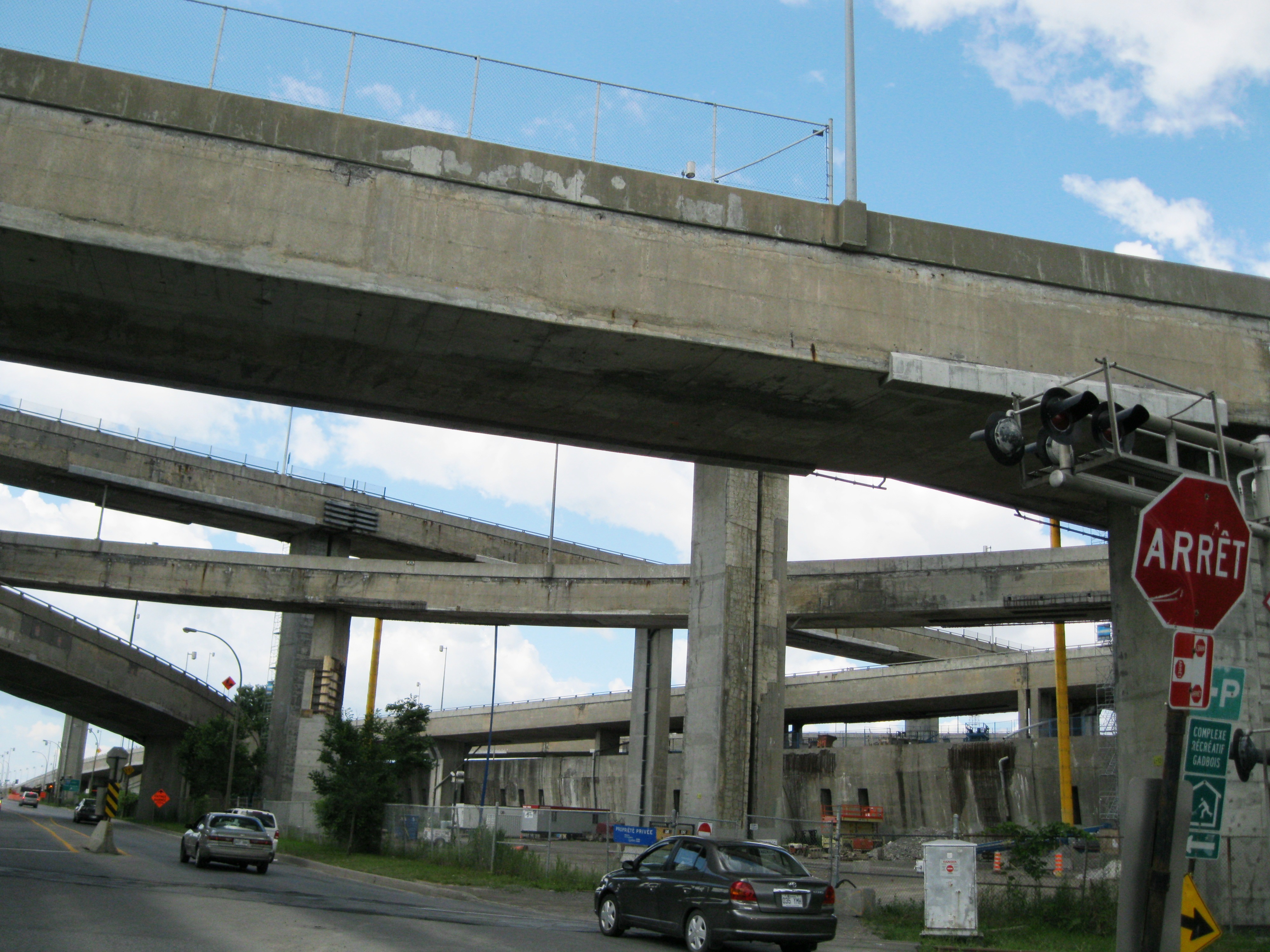
The Turcot Interchange is a three-level four-way freeway interchange within the city of Montreal, Quebec, Canada. Located southwest of downtown, the interchange links Autoroutes 15 (Décarie and Décarie South Expressways) and 20 (Remembrance Highway), and Route 136 (Ville-Marie Expressway), and provides access to the Champlain Bridge via the Décarie South Expressway. It takes its name from the nearby Philippe-Turcot Street and Turcot village, which were in turn named after Philippe Turcot (1791-1861) who was a merchant owning land in Saint-Henri. Turcot is the largest interchange in the province and the third busiest interchange of Montreal (after Décarie and Anjou Interchanges, respectively) as of 2010, with numbers averaging a north-southbound flow of 278,000 approximate daily drivers, and over 350,000 west-eastbound in total. Moreover, Turcot is an occasional spot for road accidents, as speed is limited to only on any of the interchange's directions, and the limit is o ... [...More Info...] [...Related Items...] OR: [Wikipedia] [Google] [Baidu] |
List Of Neighbourhoods In Montreal
This is the list of the neighbourhoods in the city of Montreal, Quebec, Canada. They are sorted by the borough they are located in. Ahuntsic-Cartierville * Ahuntsic * Nouveau-Bordeaux * Cartierville *Saint-Sulpice * Sault-au-Récollet (Île de la Visitation) Anjou *Bas-Anjou: The Southeastern older portion, where the main services are located (town Hall, main library, fire station, high school) *Haut-Anjou: The L-shaped part consisting of every street North of Autoroute 40 and every street West of Autoroute 25 Côte-des-Neiges–Notre-Dame-de-Grâce * Côte-des-Neiges * Notre-Dame-de-Grâce **Benny Farm * Snowdon * Le Triangle Lachine * Ville Saint-Pierre LaSalle No particular neighbourhoods. Cecil-P.-Newman Sault-Saint-Louis Le Plateau-Mont-Royal The Plateau Montreal's trendy and colourful Plateau Mont Royal neighbourhood is located on the twin North-South axes of Saint Laurent Boulevard and Saint Denis Street, and East-West axes of Mount Royal Avenue and S ... [...More Info...] [...Related Items...] OR: [Wikipedia] [Google] [Baidu] |
Neighbourhood
A neighbourhood (British English, Irish English, Australian English and Canadian English) or neighborhood (American English; American and British English spelling differences, see spelling differences) is a geographically localised community within a larger city, town, suburb or rural area, sometimes consisting of a single street and the buildings lining it. Neighbourhoods are often social communities with considerable face-to-face interaction among members. Researchers have not agreed on an exact definition, but the following may serve as a starting point: "Neighbourhood is generally defined spatially as a specific geographic area and functionally as a set of social networks. Neighbourhoods, then, are the Neighbourhood unit, spatial units in which face-to-face social interactions occur—the personal settings and situations where residents seek to realise common values, socialise youth, and maintain effective social control." Preindustrial cities In the words of the urban sch ... [...More Info...] [...Related Items...] OR: [Wikipedia] [Google] [Baidu] |
Canal De L'Aqueduc
The Canal de l'Aqueduc is an open-air aqueduct canal on the Island of Montreal in Quebec Quebec ( ; )According to the Government of Canada, Canadian government, ''Québec'' (with the acute accent) is the official name in Canadian French and ''Quebec'' (without the accent) is the province's official name in Canadian English is ..., Canada, serving part of the drinking water needs of the city of Montreal. The canal was built in 1853 by a commission headed by City Councillor Edwin Atwater. The adjacent Atwater Avenue is named after him. The canal draws water from the Saint Lawrence River on the southernmost shore of the island in the borough of LaSalle (borough), LaSalle, in the Lachine Rapids downstream of the Honoré Mercier Bridge. It then runs northeasterly, through LaSalle and then between the boroughs of Verdun (borough), Verdun and Le Sud-Ouest, finally ending at a City of Montreal pumping station and underground reservoir on Atwater Avenue, av. Atwater just south of ... [...More Info...] [...Related Items...] OR: [Wikipedia] [Google] [Baidu] |
Pointe-Saint-Charles
Pointe-Saint-Charles (also known in English as Point Saint Charles, and locally as The Point, or "PSC") is a neighbourhood in the borough of Le Sud-Ouest in the city of Montreal, Quebec, Canada. Historically a working-class area, the creation of many new housing units, the recycling of industrial buildings into business incubators, lofts, and condos, the 2002 re-opening of the canal as a recreation and tourism area, the improvement of public spaces, and heritage enhancement have all helped transform the neighbourhood and attract new residents. Community groups continue to be pro-active in areas related to the fight against poverty and the improvement of living conditions. History Twenty years after the founding of Ville-Marie (Montreal) by Paul Chomedey, Sieur de Maisonneuve in 1642, he granted an area on the pointe Saint-Charles, extending into the St. Lawrence, to St. Marguerite Bourgeoys for agricultural use by the Congrégation de Notre-Dame. The sisters operated a sharecr ... [...More Info...] [...Related Items...] OR: [Wikipedia] [Google] [Baidu] |
Montreal Metro
The Montreal Metro (french: Métro de Montréal) is a rubber-tired underground rapid transit system serving Greater Montreal, Quebec, Canada. The metro, operated by the Société de transport de Montréal (STM), was inaugurated on October 14, 1966, during the tenure of Mayor Jean Drapeau. It has expanded since its opening from 22 stations on two lines to 68 stations on four lines totalling in length, serving the north, east and centre of the Island of Montreal with connections to Longueuil, via the Yellow Line, and Laval, via the Orange Line. The Montreal Metro is Canada's second busiest rapid transit system and North America's fourth busiest rapid transit system, behind the New York City Subway, the Mexico City Metro and the Toronto subway, delivering an average of daily unlinked passenger trips per weekday as of . In , trips on the Metro were completed. According to the STM, the Metro system had transported over 7 billion passengers as of 2010. With the Metro and the ... [...More Info...] [...Related Items...] OR: [Wikipedia] [Google] [Baidu] |
Quebec Autoroute 15
Autoroute 15 (also called the Décarie Expressway (English) or Autoroute Décarie (French) between the Turcot and Décarie Interchanges in Montreal and the Laurentian Autoroute (English) or Autoroute des Laurentides (French) north of Autoroute 40) is a highway in western Quebec, Canada. It was, until the extension of Autoroute 25 was opened in 2011, the only constructed north-south autoroute to go out of Montreal on both sides. A-15 begins at the end of Interstate 87 at the United States border at Saint-Bernard-de-Lacolle and extends via Montreal to Sainte-Agathe-des-Monts with an eventual continuation beyond Mont-Tremblant. The total length of A-15 is currently , including a short concurrency () with Autoroute 40 (Boulevard/Autoroute Métropolitan) that connects the two main sections. This is one of the few autoroutes in Quebec that does not have any spinoff highways. Road description Southern section The southern section of A-15 connects the south shore suburbs of M ... [...More Info...] [...Related Items...] OR: [Wikipedia] [Google] [Baidu] |
Bibliothèque Et Archives Nationales Du Québec
The Bibliothèque et Archives nationales du Québec ( 'National Library and Archives of Quebec') or BAnQ is a Quebec government agency which manages the province's legal deposit system, national archives, and national library. Located at the Grande Bibliothèque in Montreal, the BAnQ was created by the merging of the Bibliothèque nationale du Québec and the Archives nationales du Québec in 2006. The Bibliothèque nationale du Québec had previously merged with the Grande Bibliothèque du Québec in 2002. History The National Archives of Quebec (, ANQ) were founded on 2 September 1920, with Pierre-Georges Roy as Quebec's first Head Archivist. The purpose of the institution was to process historical materials, more specifically public archives and the Quebec government's archives, and to collect documents pertaining to the history of Quebec. the ANQ were brought under the jurisdiction of the Department of Cultural Affairs in 1961, and renamed the Archives de la province de ... [...More Info...] [...Related Items...] OR: [Wikipedia] [Google] [Baidu] |


