 |
Cyclone Ului
Severe Tropical Cyclone Ului was one of the fastest intensifying tropical cyclones on record, strengthening from a tropical storm to a Category 5 hurricane, Category 5 equivalent cyclone within a 30-hour span in March 2010. Throughout Queensland, Australia, infrastructural damage from the storm amounted to A$20 million (US$18 million) and agricultural losses reached A$60 million (US$54 million). Meteorological history Severe Tropical Cyclone Ului was first identified by the Fiji Meteorological Service (FMS) late on 9 March 2010 roughly north of Hiw Island, Vanuatu. At that time, the system was classified as Tropical Disturbance 13F. Early the following day, the system became sufficiently organised for the FMS to upgrade the disturbance to a tropical depression. Several hours later, the Joint Typhoon Warning Center (JTWC) also began monitoring the system. By this time, deep Atmospheric convection, convection had developed around a Low-pressure area, low- ... [...More Info...] [...Related Items...] OR: [Wikipedia] [Google] [Baidu] [Amazon] |
|
Vanuatu
Vanuatu ( or ; ), officially the Republic of Vanuatu (; ), is an island country in Melanesia located in the South Pacific Ocean. The archipelago, which is of volcanic origin, is east of northern Australia, northeast of New Caledonia, east of New Guinea, southeast of Solomon Islands, and west of Fiji. Vanuatu was first inhabited by Melanesians, Melanesian people. The first Europeans to visit the islands were a Spanish expedition led by Portuguese navigator Pedro Fernandes de Queirós, Fernandes de Queirós, who arrived on the largest island, Espíritu Santo, in 1606. Queirós claimed the archipelago for Spain, as part of the colonial Spanish East Indies and named it . In the 1880s, France and the United Kingdom of Great Britain and Ireland, United Kingdom claimed parts of the archipelago, and in 1906, they agreed on a framework for jointly managing the archipelago as the New Hebrides through an Anglo-French condominium (international law), condominium. An independence movem ... [...More Info...] [...Related Items...] OR: [Wikipedia] [Google] [Baidu] [Amazon] |
|
 |
UNICEF
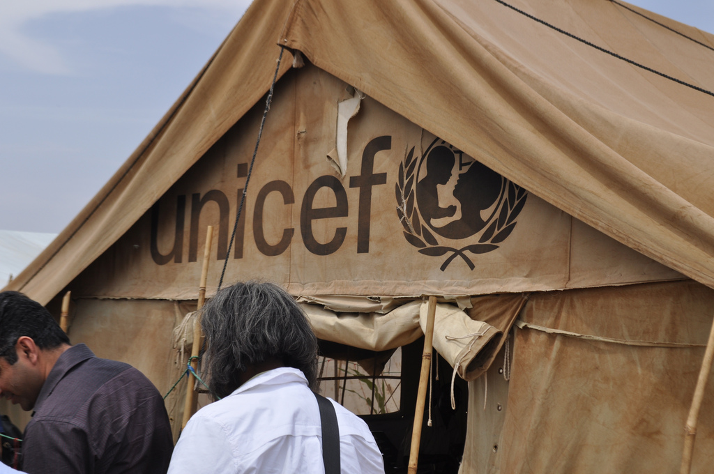
UNICEF ( ), originally the United Nations International Children's Emergency Fund, officially United Nations Children's Fund since 1953, is an agency of the United Nations responsible for providing Humanitarianism, humanitarian and Development aid, developmental aid to children worldwide. The organization is one of the most widely known and visible social welfare entities globally, operating in 192 countries and territories. UNICEF's activities include providing immunizations and disease prevention, administering Antiretroviral drug, treatment for children and mothers with HIV, enhancing childhood and maternal nutrition, improving sanitation, promoting education, and providing emergency relief in response to disasters. UNICEF is the successor of the United Nations International Children's Emergency Fund, and was created on 11 December 1946, in New York, by the United Nations Relief and Rehabilitation Administration, U.N. Relief Rehabilitation Administration to provide immediate r ... [...More Info...] [...Related Items...] OR: [Wikipedia] [Google] [Baidu] [Amazon] |
|
Collinsville, Queensland
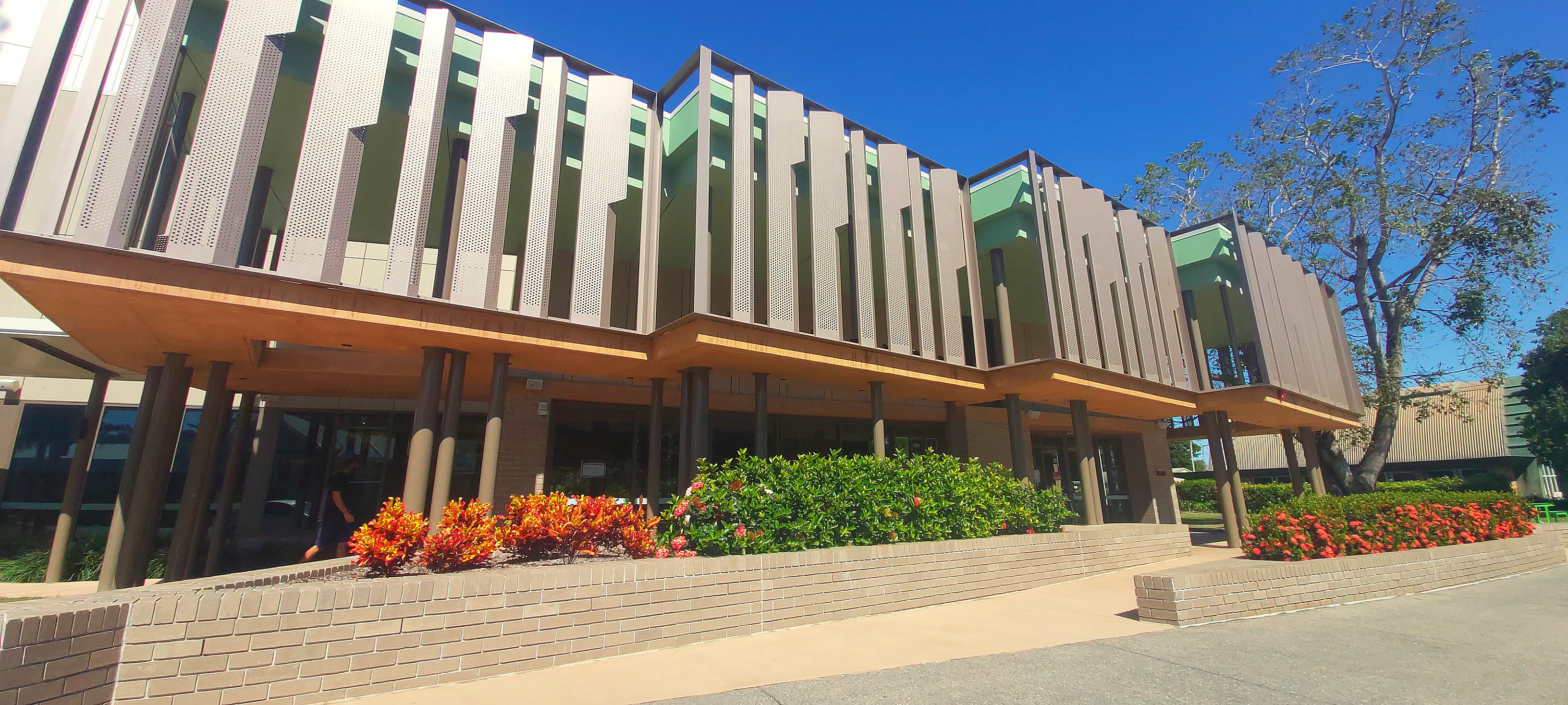
Collinsville is a town and locality in the Whitsunday Region, Queensland, Australia. In the , the locality of Collinsville had a population of 1,496 people. Geography Collinsville is in the coal-rich Bowen Basin region of Central Queensland, north of Brisbane and south-west of the coastal town of Bowen. The Bowen Developmental Road passes through the town connecting with Bowen to the north-east and the Gregory Highway at Belyando Crossing to the south-west. The Newlands railway system passes through Collinsville serving local mines. The line passes through the town itself but the Collinsville railway station is only a siding near the junction of Station Street and Railway Road (). Climate History Biri (Birri) is an Aboriginal language of Central Queensland and North Queensland. Biri refers to a language chain extending from Central Queensland towards Townsville and is often used as a universal name for other languages and/or dialects across the region. The langu ... [...More Info...] [...Related Items...] OR: [Wikipedia] [Google] [Baidu] [Amazon] |
|
 |
Proserpine, Queensland
Proserpine () is a rural town and Suburbs and localities (Australia), locality in the Whitsunday Region, Queensland, Australia. In the 2021 Australian census, 2021 census, the locality of Proserpine had a population of 3,614 people. Geography Proserpine is situated on the Bruce Highway. Proserpine is located on the North Coast railway line, Queensland, North Coast line with Proserpine railway station located in Hinschen Street in the town centre. The town is located along the banks of the Proserpine River and is immediately surrounded by floodplains used for sugarcane and cattle farming. Clarke Range is located to the west, Dryander National Park is to the north, and to the east is Conway National Park. The Clarke Range to the west of the town contains the small former gold mining town of Dittmer, Queensland, Dittmer. Proserpine is locally governed by Whitsunday Regional Council, a product of amalgamation of the former Shire of Whitsunday with the former Shire of Bowen. Pro ... [...More Info...] [...Related Items...] OR: [Wikipedia] [Google] [Baidu] [Amazon] |
 |
Cyclone Ului At Landfall 2010 - 03 - 21
In meteorology, a cyclone () is a large air mass that rotates around a strong center of low atmospheric pressure, counterclockwise in the Northern Hemisphere and clockwise in the Southern Hemisphere as viewed from above (opposite to an anticyclone). Cyclones are characterized by inward-spiraling winds that rotate about a zone of low pressure. The largest low-pressure systems are polar vortices and extratropical cyclones of the largest scale (the synoptic scale). Warm-core cyclones such as tropical cyclones and subtropical cyclones also lie within the synoptic scale. Mesocyclones, tornadoes, and dust devils lie within the smaller mesoscale. Upper level cyclones can exist without the presence of a surface low, and can pinch off from the base of the tropical upper tropospheric trough during the summer months in the Northern Hemisphere. Cyclones have also been seen on extraterrestrial planets, such as Mars, Jupiter, and Neptune. Cyclogenesis is the process of cyclone formation ... [...More Info...] [...Related Items...] OR: [Wikipedia] [Google] [Baidu] [Amazon] |
 |
Swell (ocean)
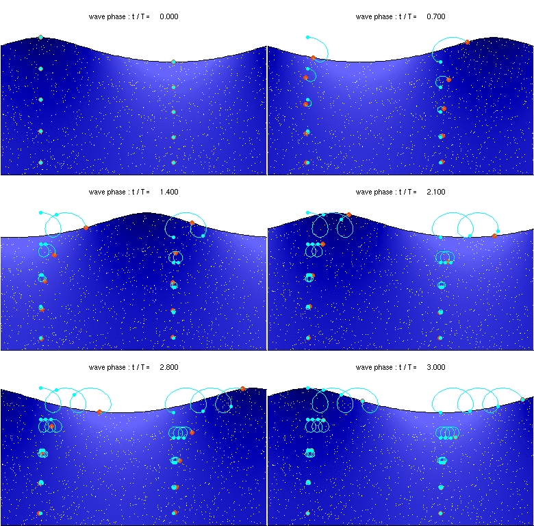
A swell, also sometimes referred to as ground swell, in the context of an ocean, sea or lake, is a series of mechanical waves that propagate along the interface between water and air under the predominating influence of gravity, and thus are often referred to as surface gravity waves. These surface gravity waves have their origin as wind waves, but are the consequence of dispersion of wind waves from distant weather systems, where wind blows for a duration of time over a fetch of water, and these waves move out from the source area at speeds that are a function of wave period and length. More generally, a swell consists of wind-generated waves that are not greatly affected by the local wind at that time. Swell waves often have a relatively long wavelength, as short wavelength waves carry less energy and dissipate faster, but this varies due to the size, strength, and duration of the weather system responsible for the swell and the size of the water body, and varies from event ... [...More Info...] [...Related Items...] OR: [Wikipedia] [Google] [Baidu] [Amazon] |
|
Tomas Ului 16 Mar 2010 0305Z
Tomas may refer to: People * Tomás (given name), a Spanish, Portuguese, and Gaelic given name * Tomas (given name), a Swedish, Dutch, and Lithuanian given name * Tomáš, a Czech and Slovak given name * Tomàs, a Catalan given name and surname * Tomas (surname), a French and Croatian surname * Tomás (surname), a Spanish and Portuguese surname * Tomaš (surname), a Croatian surname * ''Tomas.'', taxonomic author abbreviation of Ruggero Tomaselli (1920–1982), Italian botanist Places * Tomaš, Croatia, a village near Bjelovar * Tomaș River, a tributary of the Gârbăul Mare River in Romania * Tomas District, Peru Other uses * Tropical Storm Tomas (other), numerous storms * ''Tomas'' (novel), 2009 novel by James Palumbo * Convento de Santo Tomás (Madrid) See also * Thomas (other) * Tom (other) Tom or TOM may refer to: * Tom (given name), including a list of people and fictional characters with the name. Arts and entertainment Film and television ... [...More Info...] [...Related Items...] OR: [Wikipedia] [Google] [Baidu] [Amazon] |
|
 |
National Rugby League
The National Rugby League (also known as the NRL Telstra Premiership for sponsorship reasons) is a professional rugby league competition in Oceania which contains clubs from New South Wales, Queensland, Victoria (state), Victoria, the Australian Capital Territory, and New Zealand. Tracing its origins back to the New South Wales Rugby League, which formed in 1908, rugby league competition in Australia had gone through numerous iterations, including the 1990s Super League war, by the time the NRL formed in 1998 as a joint partnership between the Australian Rugby League Commission, Australian Rugby League (ARL) and the News Corporation-controlled Super League (Australia), Super League. The partnership was dissolved in 2012, with control of the NRL going to the re-constituted ARL, which was re-structured with an independent board of directors and renamed the Australian Rugby League Commission. The season typically runs from March to October, with each team playing 24 matches. The ... [...More Info...] [...Related Items...] OR: [Wikipedia] [Google] [Baidu] [Amazon] |
 |
Conway National Park
Conway is a national park in Queensland, Australia, 911 km northwest of Brisbane. The park's main feature is the Conway Peninsula which is covered by the largest area of lowland tropical rainforest in Queensland outside Tropical North Queensland. The average elevation of the terrain is 44 metres. Flora and Fauna Among the plant species in the park are dry vine thicket, mangroves, open forests with a grasstree understorey, paperbark and pandanus woodlands and others. Park is also home to two mound-building birds, the Australian brush-turkey and the orange-footed scrubfowl. Public access Walk-in bush camping is permitted however there are no established camp sites. There are a number of walking tracks graded from easy to moderate. See also * Protected areas of Queensland Queensland is the second-largest state in Australia. As at 2020, it contained more than 1,000 protected areas. In August 2023, it was estimated a total of 14.5 million hectares or 8.38% of Qu ... [...More Info...] [...Related Items...] OR: [Wikipedia] [Google] [Baidu] [Amazon] |
 |
Mackay, Queensland
} Mackay () is a city in the Mackay Region on the eastern or Coral Sea coast of Queensland, Australia. It is located about north of Brisbane, on the Pioneer River. Mackay is described as being in either Central Queensland or North Queensland, as these Regions of Queensland, regions are not precisely defined. More generally, the area is known as the Mackay–Whitsunday Islands, Whitsunday Region. Nicknames of Mackay include the Sugar capital, Alexandra and Macktown. The demonym of Mackay residents is Mackayites. Founded in 1862 the settlement was originally known as Alexandra, in honour of Alexandra of Denmark, Princess Alexandra of Denmark, and was later renamed Mackay after John Mackay (Australian pioneer), John Mackay. Sugar became the economic foundation of the city, with plantations using South Sea Islanders that had been Blackbirding, blackbirded as Indentured servitude, indentured labourers or slaves. The trades ending in 1904 roughly coincided with the immigration of S ... [...More Info...] [...Related Items...] OR: [Wikipedia] [Google] [Baidu] [Amazon] |
 |
Cardwell, Queensland
Cardwell is a coastal town and rural Suburbs and localities (Australia), locality in the Cassowary Coast Region, Queensland, Australia. In the , the locality of Cardwell had a population of 1,320 people. Geography The Bruce Highway Highway 1 (Australia), National Highway 1 and the North Coast railway line, Queensland, North Coast railway line are the dominant transport routes; connecting with the Queensland provincial cities of Cairns and Townsville. Cardwell railway station in Bowen Street serves the town (). The town is a long narrow strip hugging the coast with Greenwood Hill immediately to the west of the town () rising to above sea level. West of Cardwell the rugged topography of the Cardwell Range intercepts the trade winds resulting in high rainfall. The coastal escarpment is covered in rainforest which transitions to the west to eucalypt woodland and tropical savanna. Cardwell Range biodiversity has been protected by the introduction of Forestry Reserves, National ... [...More Info...] [...Related Items...] OR: [Wikipedia] [Google] [Baidu] [Amazon] |
 |
Sunshine Coast, Queensland
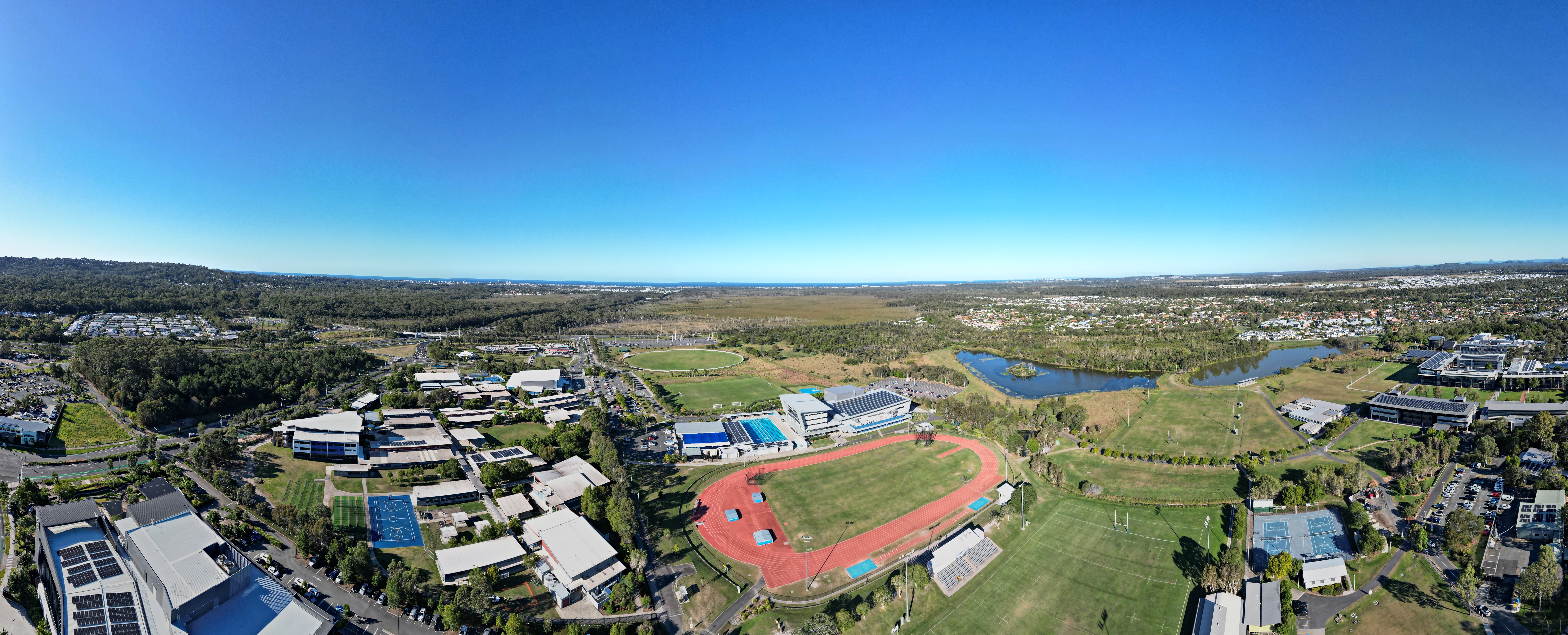
The Sunshine Coast is a peri-urbanisation, peri-urban region in South East Queensland, Australia. In 1967, it was defined as "the area contained in the [former] Shires of Shire of Landsborough, Landsborough, Shire of Maroochy, Maroochy and Shire of Noosa, Noosa, but excluding Bribie Island". Located north of the centre of Brisbane in South East Queensland, on the Coral Sea coastline, its urban area spans approximately of coastline and hinterland from Pelican Waters, Queensland, Pelican Waters to Tewantin. The area has several coastal hubs at Caloundra, Kawana Waters, Queensland, Kawana Waters, Maroochydore and Noosa Heads, Queensland, Noosa Heads. Nambour and Maleny, Queensland, Maleny have developed as primary commercial centres for the hinterland. Since 2014, the Sunshine Coast district has been split into two Local government areas of Queensland, local government areas, the Sunshine Coast Region and the Shire of Noosa, which administer the southern and northern parts of the ... [...More Info...] [...Related Items...] OR: [Wikipedia] [Google] [Baidu] [Amazon] |