|
Cunninghamhead2007
Cunninghamhead is a hamlet on the Annick Water in the Parish of Dreghorn, North Ayrshire, Scotland. The area was part of the old Cunninghamhead estate, and once contained several watermills. Cunninghamhead and the mills on the Annick Water The area is recorded as far back as Pont's / Blaeu's map of 1654 where it is listed as Kunghamhead with a water mill situated nearby. The mill appears on Armstrong's map of 1775. This relatively large mill still exists today as a private house. One of the millers here was a cousin of the Smiths of Coldstream Mill and he taught them the milling craft (Griffith 2004). A track from the mill ran to Byres Farm and thus to the main road (Bartholomew 1912). The leat for the mill ran from a dam on the other side of the 'river loop', then behind the miller's dwelling to finally run under the road to enter the mill site. It is said locally that the dam was removed, after the closure of the mill, by the anglers, who lost salmon to poachers gaffing them as ... [...More Info...] [...Related Items...] OR: [Wikipedia] [Google] [Baidu] |
Buildings And Structures In North Ayrshire
A building, or edifice, is an enclosed structure with a roof and walls standing more or less permanently in one place, such as a house or factory (although there's also portable buildings). Buildings come in a variety of sizes, shapes, and functions, and have been adapted throughout history for a wide number of factors, from building materials available, to weather conditions, land prices, ground conditions, specific uses, prestige, and aesthetic reasons. To better understand the term ''building'' compare the list of nonbuilding structures. Buildings serve several societal needs – primarily as shelter from weather, security, living space, privacy, to store belongings, and to comfortably live and work. A building as a shelter represents a physical division of the human habitat (a place of comfort and safety) and the ''outside'' (a place that at times may be harsh and harmful). Ever since the first cave paintings, buildings have also become objects or canvasses of much artist ... [...More Info...] [...Related Items...] OR: [Wikipedia] [Google] [Baidu] |
Villages In North Ayrshire
A village is a clustered human settlement or community, larger than a hamlet but smaller than a town (although the word is often used to describe both hamlets and smaller towns), with a population typically ranging from a few hundred to a few thousand. Though villages are often located in rural areas, the term urban village is also applied to certain urban neighborhoods. Villages are normally permanent, with fixed dwellings; however, transient villages can occur. Further, the dwellings of a village are fairly close to one another, not scattered broadly over the landscape, as a dispersed settlement. In the past, villages were a usual form of community for societies that practice subsistence agriculture, and also for some non-agricultural societies. In Great Britain, a hamlet earned the right to be called a village when it built a church. [...More Info...] [...Related Items...] OR: [Wikipedia] [Google] [Baidu] |
Perceton
Perceton is a medieval settlement and old country estate in North Ayrshire, Scotland, near the town of Irvine. The ruined church in Perceton is one of the oldest buildings in the Irvine district. The earliest legible gravestone dates from 1698, though older stone coffins will certainly still rest deep within the small hillock on which the chapel and graveyard sit. History and Archaeology Perceton House has been demolished and rebuilt several times over the centuries. The present house dates from the late 18th century. Archaeological excavations have uncovered evidence of the long lost medieval manor house which was protected by a moat and the Annick Water. The site is now covered by the modern housing estate known as The Grange. The Cunninghamhead and Annick Lodge Estates are nearby. An excavation undertaken by Headland Archaeology encountered the foundation trench for a defensive wooden palisade enclosing postholes of a substantial timber building. Access to the compound was ... [...More Info...] [...Related Items...] OR: [Wikipedia] [Google] [Baidu] |
Annick Lodge
Annick Lodge is an estate between Perceton and Cunninghamhead in North Ayrshire, Scotland. History Annick Lodge (previously Annack, Annoch or Annock) and estate was built by Captain Alexander Montgomery, the brother-german of Hugh, Earl of Eglinton. The lodge stands on the site of the old mansion described by Pont as "a proper building, veill planted, the inheritance of Blaire, Laird of Adamtoune." The 11th Earl had died without male issue so the Earldom had passed to Hugh, son of Alexander Montgomerie of Coilsfield (Robertson 1908). The Right Hon. David Boyle of Kelburn married Elizabeth, eldest daughter of Alexander at Annick Lodge in 1804. Elizabeth, wife of Alexander Montgomerie Esq., died 13 February 1839; her beloved daughter Frances died 25th Sept 1858 and both were buried at Dreghorn Parish cemetery. The second laird of Annick Lodge, who succeeded in 1802, was Lieutenant-Colonel of the Ayrshire Yeomanry Cavalry, a magistrate and deputy-lieutenant of Ayrshire. One of ... [...More Info...] [...Related Items...] OR: [Wikipedia] [Google] [Baidu] |
Cunninghamhead, Perceton And Annick Lodge
Cunninghamhead is a hamlet in North Ayrshire, Scotland. It was the centre of the lands of Cunninghamhead, Perceton and Annick Lodge in Cunninghame. This mainly rural area is noted for its milk and cheese production and the Ayrshire, Cunninghame or Dunlop breed of cattle. Bourtreehill Estate The estate was within the demesne of the De Morvilles,Paterson, James (1863–66). ''History of the Counties of Ayr and Wigton. V. - III - Cunninghame.'' J. Stillie. Edinburgh. pp. 274–275. Lords of Cunninghame, and passed by marriage to Alan de la Zouche and William de Ferrars (see Lambroughton) who, as supporters of John Baliol forfeited the property to Robert the Bruce. James Francis of Stane obtained most of the property and Roger de Blair of that Ilk, a small portion, for which he had to annually pay twelve silver pennies or a pair of gilt spurs to the King. Listed by Pont/Blaeu as 'Bourtreen' in 1654 and other variations are 'Bourtree' and 'Bow Tree'. The Hunter family papers as publi ... [...More Info...] [...Related Items...] OR: [Wikipedia] [Google] [Baidu] |
Burl
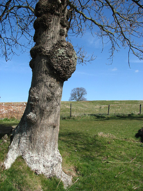
A burl (American English) or burr (British English) is a tree growth in which the grain has grown in a deformed manner. It is commonly found in the form of a rounded outgrowth on a tree trunk or branch that is filled with small knots from dormant buds. Burl formation is typically a result of some form of stress such as an injury or a viral or fungal infection. Burls yield a very peculiar and highly figured wood sought after in woodworking, and some items may reach high prices on the wood market. Poaching of burl specimens and damaging the trees in the process poses a problem in some areas. Description A burl results from a tree undergoing some form of stress. It may be caused by an injury, virus or fungus. Most burls grow beneath the ground, attached to the roots as a type of malignancy that is generally not discovered until the tree dies or falls over. Such burls sometimes appear as groups of bulbous protrusions connected by a system of rope-like roots. Almost all burl ... [...More Info...] [...Related Items...] OR: [Wikipedia] [Google] [Baidu] |
B769 Road
B roads are numbered routes in Great Britain of lesser importance than A roads. See the article Great Britain road numbering scheme for the rationale behind the numbers allocated. (some data from openstreetmap.org) Zone 7 (2 & 3 digits) Zone 7 (4 digits) See also * A roads in Zone 7 of the Great Britain numbering scheme * List of motorways in the United Kingdom This list of motorways in the United Kingdom is a complete list of motorways in the United Kingdom. Note that the numbering scheme used for Great Britain does not include roads in Northern Ireland, which are allocated numbers on an ad hoc basis ... * Transport in Edinburgh#Road network * Transport in Glasgow#Other Roads * Transport in Scotland#Road References {{DEFAULTSORT:B Roads in Zone 7 of the Great Britain Numbering Scheme 7 7 ... [...More Info...] [...Related Items...] OR: [Wikipedia] [Google] [Baidu] |
Cunninghamhead Railway Station
Cunninghamhead railway station (NS369414) was a railway station serving Cunninghamhead Estate, the village of Crossroads (renamed to Cunninghamhead), North Ayrshire and the town of Stewarton, East Ayrshire, Scotland. The station was originally part of the Glasgow, Paisley, Kilmarnock and Ayr Railway. History The station opened on 4 April 1843 as Stewarton, (despite being several miles away from Stewarton itself), however closed on 22 May 1848. The station reopened again in November 1850, and was eventually renamed Cunninghamhead on 1 September 1873. The station closed permanently to passengers on 1 January 1955, although the line was still in use by freight trains and diverted passenger trains until 23 October 1973. Freight services had been withdrawn in February 1960. Description A moderately sized station building served Cunninghamhead, with two platforms and a signal box a short distance away. A rectangular sandstone shelter or store was situated on the northbound platf ... [...More Info...] [...Related Items...] OR: [Wikipedia] [Google] [Baidu] |
Dreghorn
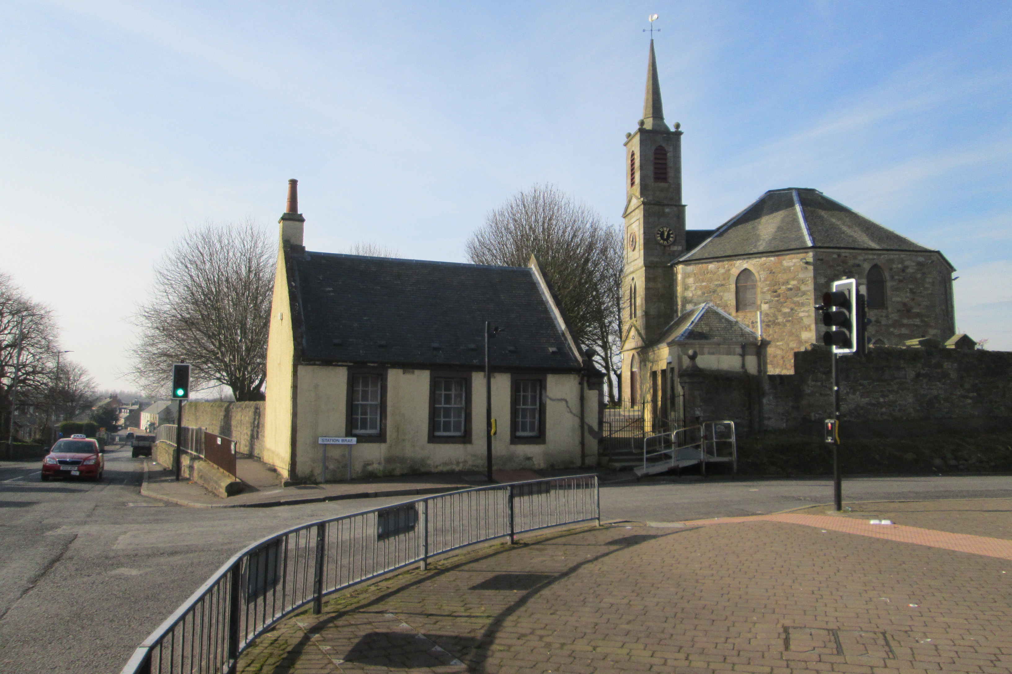
Dreghorn is a village in North Ayrshire, Scotland, east of Irvine town centre, on the old main road from Irvine to Kilmarnock. It is sited on a ridge between two rivers. As archaeological excavations near the village centre have found a significant neolithic settlement provisionally dated to around 3500 BC, as well as medieval structures, scholars have suggested that Dreghorn could be Britain's oldest continuously inhabited village. Both Irvine and Dreghorn have grown in size and they are now separated by the Annick Valley Park, which incorporates a footpath and National Cycle Route 73 on the route of the disused Irvine to Busby railway line. It had an estimated population of in . The Church of Scotland Dreghorn and Springside Parish Church, at the centre of the village, dates from 1780. Its octagonal plan, which is unusual in Scotland, was produced by the church's principal benefactor, Archibald Montgomerie, 11th Earl of Eglinton. The village's most famous inhabitant, ... [...More Info...] [...Related Items...] OR: [Wikipedia] [Google] [Baidu] |
Dike (construction)
A levee (), dike (American English), dyke (Commonwealth English), embankment, floodbank, or stop bank is a structure that is usually earthen and that often runs parallel to the course of a river in its floodplain or along low-lying coastlines. The purpose of a levee is to keep the course of rivers from changing and to protect against flooding of the area adjoining the river or coast. Levees can be naturally occurring ridge structures that form next to the bank of a river, or be an artificially constructed fill or wall that regulates water levels. Ancient civilizations in the Indus Valley, ancient Egypt, Mesopotamia and China all built levees. Today, levees can be found around the world, and failures of levees due to erosion or other causes can be major disasters. Etymology Speakers of American English (notably in the Midwest and Deep South) use the word ''levee'', from the French word (from the feminine past participle of the French verb , 'to raise'). It originat ... [...More Info...] [...Related Items...] OR: [Wikipedia] [Google] [Baidu] |


