|
Cuerno Verde
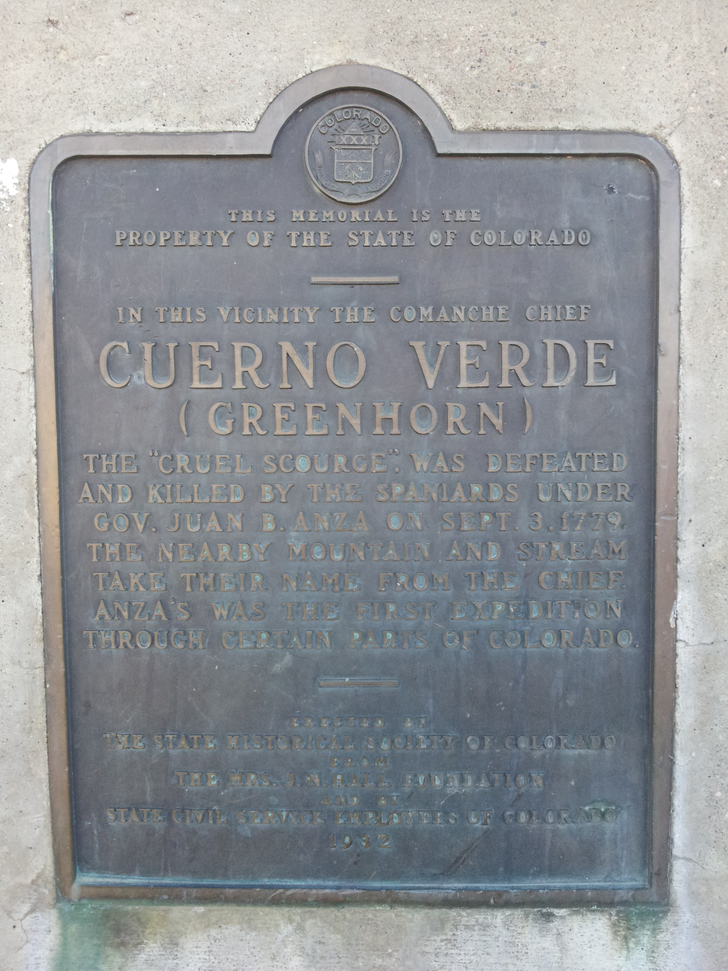
Cuerno Verde (died September 3, 1779) is the Spanish name for Green Horn aka Tavibo Naritgant, a Chief of the Comanche, likely of the Kotsoteka Comanche, in the late 18th century. Life Cuerno Verde ("Green Horn" in English), is the Spanish name given to Tavibo Naritgant ("Dangerous Man") because of the green tinted horn(s) that he wore on his head-dress in battle. The English translation of the Comanche name is "Dangerous Man." His son inherited both the name and the distinctive head dress from the father, who was killed in combat against the Spanish at Ojo Caliente, in what is now New Mexico, in October 1768. As a young man, Tabivo Naritgant led a series of successful raids into Nuevo Mexico during the mid- to late 1770s. The Spanish Viceroy in New Spain noticed this threat to them, and offered Juan Bautista de Anza the governorship of Nuevo Mexico with instructions to deal with the various local Indians, including Tavibo Naritgant. De Anza moved to Nuevo Mexico and assume ... [...More Info...] [...Related Items...] OR: [Wikipedia] [Google] [Baidu] |
Comanche
The Comanche (), or Nʉmʉnʉʉ (, 'the people'), are a Tribe (Native American), Native American tribe from the Great Plains, Southern Plains of the present-day United States. Comanche people today belong to the List of federally recognized tribes in the United States, federally recognized Comanche Nation, headquartered in Lawton, Oklahoma. The Comanche language is a Numic languages, Numic language of the Uto-Aztecan languages, Uto-Aztecan family. Originally, it was a Shoshoni language, Shoshoni dialect, but diverged and became a separate language. The Comanche were once part of the Shoshone people of the Great Basin. In the 18th and 19th centuries, Comanche lived in most of present-day northwestern Texas and adjacent areas in eastern New Mexico, southeastern Colorado, southwestern Kansas, and western Oklahoma. Spanish colonists and later Mexicans called their historical territory ''Comancheria, Comanchería''. During the 18th and 19th centuries, Comanche practiced a nomadic h ... [...More Info...] [...Related Items...] OR: [Wikipedia] [Google] [Baidu] |
Ojo Caliente, New Mexico
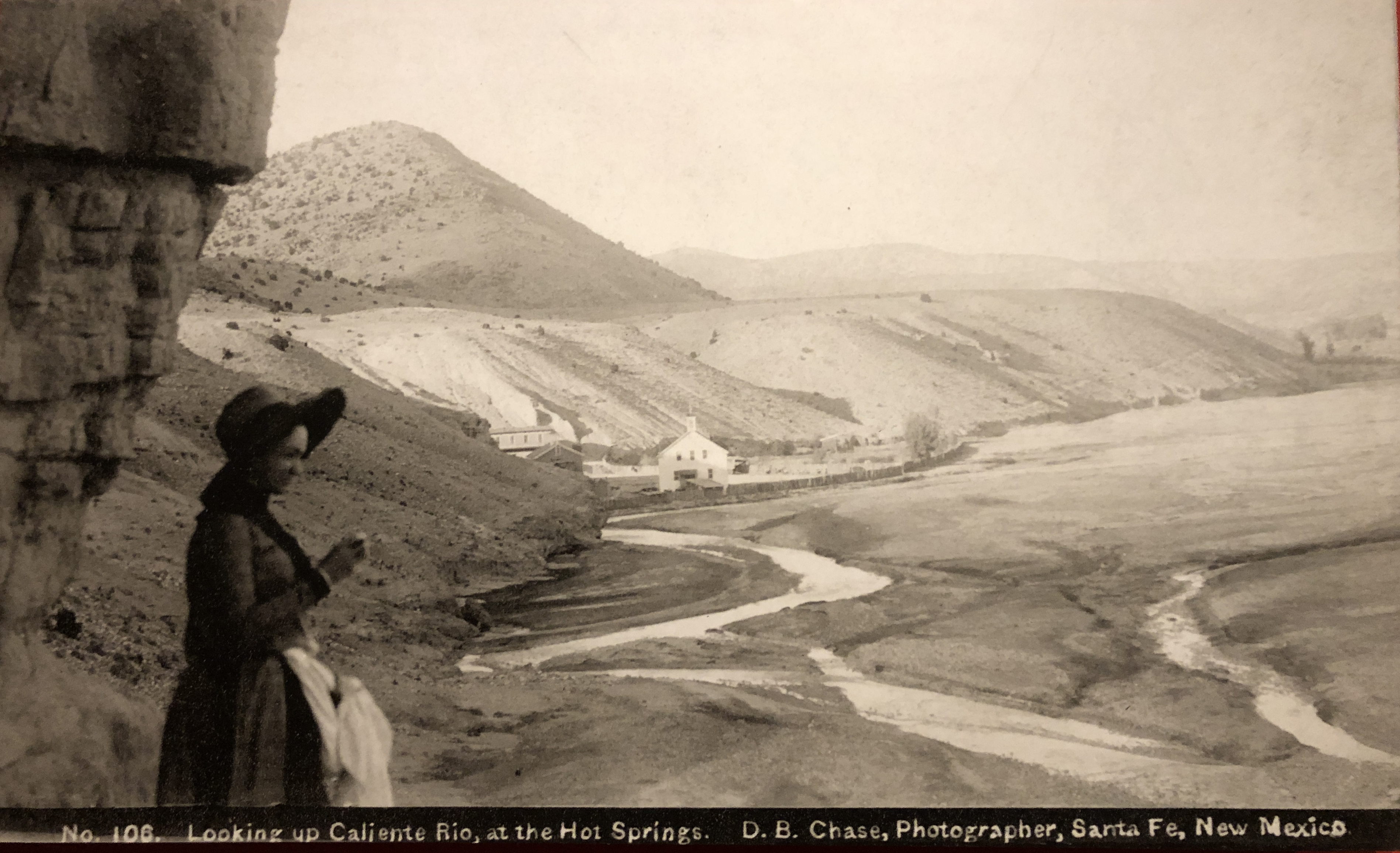
Ojo Caliente is an Unincorporated area, unincorporated community in Taos County, New Mexico, Taos County, New Mexico, United States, along the Rio Ojo Caliente. Description Ojo Caliente lies along U.S. Route 285 in New Mexico, U.S. Route 285 near the Rio Grande between Española, New Mexico, Española and Taos, New Mexico, Taos, approximately north of Santa Fe, New Mexico, Santa Fe, the state capital. The community consist mainly of small farms irrigated by acequias fed by water from the Rio Ojo Caliente. The community, known for its Ojo Caliente Hot Springs, is one of the oldest health resorts in North America. Tewa tradition holds that its pools provided access to the underworld. Frank Mauro purchased the springs in 1932, and it remained a family business for three generations. The resort's buildings are on the National Register of Historic Places./ The nearby Ojo Caliente Hot Springs Round Barn, built in 1924, is also listed on the National Register. References ... [...More Info...] [...Related Items...] OR: [Wikipedia] [Google] [Baidu] |
Santa Fe De Nuevo México
Santa Fe de Nuevo México (; shortened as Nuevo México or Nuevo Méjico, and translated as New Mexico in English) was a province of the Spanish Empire and New Spain, and later a territory of independent Mexico. The first capital was San Juan de los Caballeros (at San Gabriel de Yungue-Ouinge) from 1598 until 1610, and from 1610 onward the capital was La Villa Real de la Santa Fe de San Francisco de Asís. The name of "New Mexico", the capital in Santa Fe, the gubernatorial office at the Palace of the Governors, ''vecino'' citizen-soldiers, and rule of law were retained as the New Mexico Territory and later state of New Mexico became part of the United States. The New Mexican citizenry, primarily consisting of Hispano, Pueblo, Navajo, Apache, and Comanche peoples, became citizens of the United States as a result of the Treaty of Guadalupe Hidalgo (1848). ' is often incorrectly believed to have taken its name from the post-independent nation of Mexico. But as early as ... [...More Info...] [...Related Items...] OR: [Wikipedia] [Google] [Baidu] |
New Spain
New Spain, officially the Viceroyalty of New Spain ( ; Nahuatl: ''Yankwik Kaxtillan Birreiyotl''), originally the Kingdom of New Spain, was an integral territorial entity of the Spanish Empire, established by Habsburg Spain. It was one of several domains established during the Spanish colonization of the Americas, Spanish conquest of the Americas, and had its capital in Mexico City. Its jurisdiction comprised a large area of the southern and western portions of North America, mainly what became Mexico and the Southwestern United States, but also California, Florida and Louisiana (New Spain), Louisiana; Central America as Mexico, the Caribbean like Hispaniola and Martinique, Martinica, and northern parts of South America, even Colombia; several Pacific archipelagos, including the Philippines and Guam. Additional Asian colonies included "Spanish Formosa", on the island of Taiwan. After the 1521 Spanish conquest of the Aztec Empire, conqueror Hernán Cortés named the territory New S ... [...More Info...] [...Related Items...] OR: [Wikipedia] [Google] [Baidu] |
Juan Bautista De Anza
Juan Bautista de Anza Bezerra Nieto (July 6 or 7, 1736 – December 19, 1788) was a Novohispanic/Mexican expeditionary leader, military officer, and politician primarily in California and New Mexico under the Spanish Empire. He is credited as one of the founding fathers of Spanish California and served as an official within New Spain as Governor of the province of New Mexico. Early life Juan Bautista de Anza Bezerra Nieto was born in Fronteras, New Navarre, New Spain (today Sonora, Mexico) in 1736 (near Arizpe), most probably at Cuquiarachi, Sonora, but possibly at the Presidio of Fronteras. His family was a part of the military leadership in New Spain (''Nueva España''), as his father and maternal grandfather, Captain Antonio Bezerra Nieto, had both served Spain, their families living on the frontier of Nueva Navarra. He was the son of Juan Bautista de Anza I. It is traditionally thought that he may have been educated at the College of San Ildefonso in Mexico City ... [...More Info...] [...Related Items...] OR: [Wikipedia] [Google] [Baidu] |
Punitive Expedition
A punitive expedition is a military journey undertaken to punish a political entity or any group of people outside the borders of the punishing state or union. It is usually undertaken in response to perceived disobedient or morally wrong behavior by miscreants, as revenge or corrective action, or to apply strong diplomatic pressure without a formal declaration of war (e.g. surgical strike). In the 19th century, punitive expeditions were used more commonly as pretexts for colonial adventures that resulted in annexations, regime changes or changes in policies of the affected state to favour one or more colonial powers. Stowell (1921) provides the following definition: When the territorial sovereign is too weak or is unwilling to enforce respect for international law, a state which is wronged may find it necessary to invade the territory and to chastise the individuals who violate its rights and threaten its security. Historical examples *In the 5th century BC, the Achaem ... [...More Info...] [...Related Items...] OR: [Wikipedia] [Google] [Baidu] |
Pueblo, Colorado
Pueblo ( ) is a List of municipalities in Colorado#Home rule municipality, home rule municipality that is the county seat of and the List of municipalities in Colorado, most populous municipality in Pueblo County, Colorado, United States. The city population was 111,876 at the 2020 United States census, making Pueblo the List of municipalities in Colorado, ninth most populous city in Colorado. Pueblo is the principal city of the Pueblo, CO Metropolitan Statistical Area and a major city of the Front Range Urban Corridor. Pueblo is situated at the confluence of the Arkansas River and Fountain Creek, south of the Colorado State Capitol in Denver. The area is considered semi-arid desert land, with approximately of precipitation annually. With its location in the "Banana Belt", Pueblo tends to get less snow than the other major cities in Colorado. Pueblo is one of the largest steel-producing cities in the United States, for which reason Pueblo is referred to as the "Steel City". ... [...More Info...] [...Related Items...] OR: [Wikipedia] [Google] [Baidu] |
Colorado City, Colorado
Colorado City is a census-designated place (CDP) and post office in and governed by Pueblo County, Colorado, United States. The CDP is a part of the Pueblo, CO Metropolitan Statistical Area. The Colorado City post office has the ZIP Code 81019 (post office boxes). At the United States Census 2020, the population of the Colorado City CDP was 2,237. The Colorado City Metropolitan District provides services. Geography Colorado City is located in the Greenhorn Valley. The Colorado City CDP has an area of , including of water. History The first settlement at the site of Colorado City was called Greenhorn after the name of an 18th century Comanche chief (Cuerno Verde in Spanish). In 1845, mountain man John Brown, his wife Luisa Sandoval, and several children established a trading post where the Trapper's Trail to Taos, New Mexico crossed Greenhorn Creek. Brown and his family left Greenhorn for California in 1849. In 1853, Lt. Edward Griffin Beckwith, an army officer, said o ... [...More Info...] [...Related Items...] OR: [Wikipedia] [Google] [Baidu] |
Greenhorn Mountain
Greenhorn Mountain is the highest summit of the Wet Mountains range in the Rocky Mountains of North America. The prominent peak is located in the Greenhorn Mountain Wilderness of San Isabel National Forest, southwest by west ( bearing 238°) of the Town of Rye, Colorado, United States, on the boundary between Huerfano and Pueblo counties. The summit of Greenhorn Mountain is the highest point in Pueblo County, Colorado. The peak's summit rises above timberline, which is about in south-central Colorado. Geography The massive Greenhorn Mountain can be seen from Colorado Springs, Pueblo, Trinidad, and also from along Interstate 25 rising over above the great plains to the east. The mountain's habitats are protected within the secluded Greenhorn Mountain Wilderness Area, which is only accessed by a few trails and a 4-wheel drive road on its north. Climate Greenhorn Mountain has a subalpine climate (Köppen ''Dfc'') bordering on an Alpine climate (''ET''). Name orig ... [...More Info...] [...Related Items...] OR: [Wikipedia] [Google] [Baidu] |
Greenhorn Valley
The Greenhorn Valley lies in southern Pueblo County, Colorado just east of Greenhorn Mountain. It includes the communities of Colorado City and Rye. Colorado State Highway 165, part of the Frontier Pathways Scenic Byway, goes through the valley and serves as its main street. Interstate 25 marks the eastern end of the valley. Geography The western part of the valley borders on the San Isabel National Forest. Lake Beckwith, both a reservoir managed by the Colorado City Metropolitan District and a state wildlife area managed by Colorado Parks and Wildlife, offers fishing, walking, and canoeing. The highest peak in the Wet Mountains, Greenhorn Mountain, at , overlooks the valley from the west and dominates the view. Greenhorn Creek rises on Greenhorn Mountain and traverses the valley which is situated where the creek leaves the mountains and emerges onto the Great Plains. The valley has an elevation of at Rye and at Colorado City. History The mountain, creek, and valley are ... [...More Info...] [...Related Items...] OR: [Wikipedia] [Google] [Baidu] |
Comanche People
The Comanche (), or Nʉmʉnʉʉ (, 'the people'), are a Tribe (Native American), Native American tribe from the Great Plains, Southern Plains of the present-day United States. Comanche people today belong to the List of federally recognized tribes in the United States, federally recognized Comanche Nation, headquartered in Lawton, Oklahoma. The Comanche language is a Numic languages, Numic language of the Uto-Aztecan languages, Uto-Aztecan family. Originally, it was a Shoshoni language, Shoshoni dialect, but diverged and became a separate language. The Comanche were once part of the Shoshone people of the Great Basin. In the 18th and 19th centuries, Comanche lived in most of present-day northwestern Texas and adjacent areas in eastern New Mexico, southeastern Colorado, southwestern Kansas, and western Oklahoma. Spanish colonists and later Mexicans called their historical territory ''Comancheria, Comanchería''. During the 18th and 19th centuries, Comanche practiced a nomadic h ... [...More Info...] [...Related Items...] OR: [Wikipedia] [Google] [Baidu] |


