|
Crystal Springs Dam
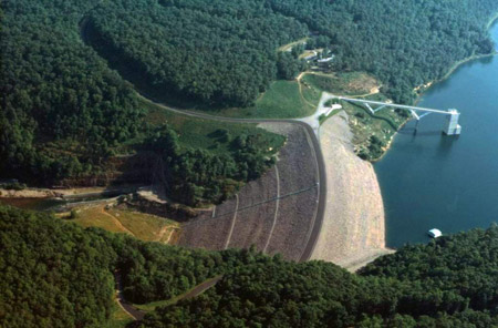
Crystal Springs Dam is a concrete gravity dam constructed across the San Mateo Creek (San Francisco Bay Area), San Mateo Creek in San Mateo County, California. It impounds water in a rift valley created by the San Andreas Fault to form the Crystal Springs Reservoir. The dam itself is located about east of the fault. The dam is owned and operated by the San Francisco Public Utilities Commission, and stores drinking water for the City of San Francisco. The current dam is 140 feet high with a crest length of 600 feet. It was the first mass concrete gravity dam built in the United States. Upon its completion, it became the largest concrete structure in the world and the tallest dam in the United States. A 2024 review by ASCE and the Institution of Civil Engineers in Great Britain indicated that it is likely the oldest mass concrete dam in the world. Construction techniques used at the dam, including washing aggregate and staggered joints, influenced the development of future gravity ... [...More Info...] [...Related Items...] OR: [Wikipedia] [Google] [Baidu] |
San Mateo Creek (San Francisco Bay Area)
San Mateo Creek (''Spanish for'': St. Matthew Creek) is a perennial stream whose watershed includes Crystal Springs Reservoir, for which it is the only natural outlet after passing Crystal Springs Dam. History After discovering San Francisco Bay from Sweeney Ridge on November 4, 1769, the Portolà expedition descended what Gaspar de Portolà, Portolà called the ''Cañada de San Francisco'', now San Andreas Creek (or possibly San Mateo Creek). "Laguna Grande" is where the party camped (now covered by the Upper Crystal Springs Reservoir). The Laguna Grande place name is also shown on the 1840s diseño del Rancho Cañada de Raymundo and an 1856 plat. The campsite is marked by California Historical Marker No. 94 "Portola Expedition Camp". They camped here a second time on November 12, on their return trip. Francisco Palóu, Padre Palóu, on an expedition from Mission San Carlos Borromeo (Carmel) to explore the western side of San Francisco Bay led by Captain Fernando Rivera y Monc ... [...More Info...] [...Related Items...] OR: [Wikipedia] [Google] [Baidu] |
Embankment Dam
An embankment dam is a large artificial dam. It is typically created by the placement and compaction of a complex semi-plastic mound of various compositions of soil or rock. It has a semi-pervious waterproof natural covering for its surface and a dense, impervious core. This makes the dam impervious to surface or seepage erosion. Such a dam is composed of fragmented independent material particles. The friction and interaction of particles binds the particles together into a stable mass rather than by the use of a cementing substance. Types Embankment dams come in two types: the earth-filled dam (also called an earthen dam or terrain dam) made of compacted earth, and the rock-filled dam. A cross-section of an embankment dam shows a shape like a bank, or hill. Most have a central section or core composed of an impermeable material to stop water from seeping through the dam. The core can be of clay, concrete, or asphalt concrete. This type of dam is a good choice for site ... [...More Info...] [...Related Items...] OR: [Wikipedia] [Google] [Baidu] |
List Of Dams And Reservoirs In California
Following is a list of dams and reservoirs in California in a sortable table. There are over 1,400 named dams and 1,300 named reservoirs in the state of California. Dams in service :''Please add to this list from the below sources.'' Former dams * Baldwin Hills Reservoir (1947–1963) - failed December 14, 1963 * St. Francis Dam (1926–1928) - failed March 12, 1928 * San Clemente Dam - intentionally removed in 2015-2016 because of environmental issues * Van Norman Dams (1911–1971) - failed February 9, 1971, in 1971 San Fernando earthquake Proposed dams * Ah Pah Dam (defunct) * Auburn Dam (defunct) * Centennial Dam * Sites Reservoir * Temperance Flat Dam See also * California State Water Project * List of dam removals in California *List of lakes in California * List of largest reservoirs of California *List of power stations in California *List of the tallest dams in the United States * List of United States Bureau of Reclamation dams *Water in California Califor ... [...More Info...] [...Related Items...] OR: [Wikipedia] [Google] [Baidu] |
California Department Of Water Resources
The California Department of Water Resources (DWR) is part of the California Natural Resources Agency and is responsible for the management and regulation of the State of California's water usage. The department was created in 1956 by Governor Goodwin Knight following severe flooding across Northern California in 1955, where they combined the Division of Water Resources of the Department of Public Works with the State Engineer's Office, the Water Project Authority, and the State Water Resources Board. It is headquartered in Sacramento. History 1850-1875 California recognizes many types of water rights. Prior to the Treaty of Guadalupe Hidalgo, signed in 1848, California was part of Mexico. Riparian rights were the most prevalent type of water right. Under riparian rights, which have their origins in Roman law, a landowner can use water flowing by his property for use on his property. When California became part of the United States, the United States agreed to recognize exis ... [...More Info...] [...Related Items...] OR: [Wikipedia] [Google] [Baidu] |
California State Route 35
State Route 35 (SR 35), generally known as Skyline Boulevard for most of its length, is a mostly two-lane state highway in the U.S. state of California. It runs along the ridge of the Santa Cruz Mountains from the high point of State Route 17 near Lexington Reservoir in Santa Clara County to State Route 1 just south of Daly City in San Mateo County, where it crosses SR 1 and loops around Lake Merced to become Sloat Boulevard in San Francisco. SR 35 then continues along Sloat Boulevard until it reaches its terminus when it meets SR 1 again at 19th Avenue. Because of its high elevation and location, it is one of the few places on the southern portion of the San Francisco Peninsula from which the San Francisco Bay and the Pacific Ocean are both visible at the same time. It also provides scenic views of the Silicon Valley metropolitan area. It was originally designated State Route 5 (SR 5), but was re-numbered with the creation of Interstate 5 (I-5) as part of the 1964 state ... [...More Info...] [...Related Items...] OR: [Wikipedia] [Google] [Baidu] |
Hetch Hetchy
Hetch Hetchy is a valley, reservoir, and water system in California in the United States. The glacial Hetch Hetchy Valley lies in the northwestern part of Yosemite National Park and is drained by the Tuolumne River. For thousands of years before the arrival of settlers from the United States in the 1850s, the valley was inhabited by Native Americans who practiced subsistence hunting-gathering. During the late 19th century, the valley was renowned for its natural beauty – often compared to that of Yosemite Valley – but also targeted for the development of water supply for irrigation and municipal interests. The controversy over damming Hetch Hetchy became mired in the political issues of the day. The law authorizing the dam passed Congress on December 7, 1913. In 1923, the O'Shaughnessy Dam was completed on the Tuolumne River, flooding the entire valley under the Hetch Hetchy Reservoir. The dam and reservoir are the centerpiece of the Hetch Hetchy Project, which in 1934 beg ... [...More Info...] [...Related Items...] OR: [Wikipedia] [Google] [Baidu] |
San Andreas Lake
San Andreas Lake is a reservoir adjacent to the San Francisco Peninsula cities of Millbrae and San Bruno in San Mateo County, California. It is situated directly on the San Andreas Fault, which is named after the valley it is in. History After discovering San Francisco Bay from Sweeney Ridge on November 4, 1769, the Portolá expedition descended what Portolá called the ''Cañada de San Francisco'', now San Andreas Creek, to camp in the vicinity of today's San Andreas Lake. The next day they reached a "Laguna Grande" which today is covered by the Upper Crystal Springs Reservoir. The campsite is marked by California Historical Marker No. 94 "Portola Expedition Camp", located at Crystal Springs Dam, on Skyline Boulevard, 0.1 mi south of Crystal Springs Road. They camped here a second time on November 12, on their return trip. Padre Palóu, on an expedition from Monterey to explore the western side of San Francisco Bay led by Captain Fernando Rivera y Moncada, renamed ... [...More Info...] [...Related Items...] OR: [Wikipedia] [Google] [Baidu] |
Crystal Springs Dam 1911
A crystal or crystalline solid is a solid material whose constituents (such as atoms, molecules, or ions) are arranged in a highly ordered microscopic structure, forming a crystal lattice that extends in all directions. In addition, macroscopic single crystals are usually identifiable by their geometrical shape, consisting of flat faces with specific, characteristic orientations. The scientific study of crystals and crystal formation is known as crystallography. The process of crystal formation via mechanisms of crystal growth is called crystallization or solidification. The word ''crystal'' derives from the Ancient Greek word (), meaning both "ice" and "rock crystal", from (), "icy cold, frost". Examples of large crystals include snowflakes, diamonds, and table salt. Most inorganic solids are not crystals but polycrystals, i.e. many microscopic crystals fused together into a single solid. Polycrystals include most metals, rocks, ceramics, and ice. A third category of sol ... [...More Info...] [...Related Items...] OR: [Wikipedia] [Google] [Baidu] |
National Historic Civil Engineering Landmark
__NOTOC__ The following is a list of Historic Civil Engineering Landmarks as designated by the American Society of Civil Engineers since it began the program in 1964. The designation is granted to projects, structures, and sites in the United States (National Historic Civil Engineering Landmarks) and the rest of the world (International Historic Civil Engineering Landmarks). As of 2024, there are 235 designated Historic Civil Engineering Landmarks in the United States and 61 internationally, totaling 296 landmarks worldwide. Sections or chapters of the American Society of Civil Engineers may also designate state or local landmarks within their areas; those landmarks are not listed here. See also * List of Historic Mechanical Engineering Landmarks References External links American Society of Civil Engineers Historic Landmarks* {{DEFAULTSORT:List Of Historic Civil Engineering Landmarks Historic Civil Engineering Landmarks, * United States history-rela ... [...More Info...] [...Related Items...] OR: [Wikipedia] [Google] [Baidu] |
American Society Of Civil Engineers
The American Society of Civil Engineers (ASCE) is a tax-exempt professional body founded in 1852 to represent members of the civil engineering profession worldwide. Headquartered in Reston, Virginia, it is the oldest national engineering society in the United States. Its constitution was based on the older Boston Society of Civil Engineers from 1848. ASCE is dedicated to the advancement of the science and profession of civil engineering and the enhancement of human welfare through the activities of society members. It has more than 143,000 members in 177 countries. Its mission is to provide essential value to members, their careers, partners, and the public; facilitate the advancement of technology; encourage and provide the tools for lifelong learning; promote professionalism and the profession; develop and support civil engineers. History The first serious and documented attempts to organize civil engineers as a professional society in the newly created United States were ... [...More Info...] [...Related Items...] OR: [Wikipedia] [Google] [Baidu] |
Coyote Point Recreation Area
Coyote Point Recreation Area is a park operated by San Mateo County, California in the United States. Located on San Francisco Bay, it is south of San Francisco International Airport on the border of Burlingame and San Mateo. Facilities within the park include a large playground, the CuriOdyssey junior museum, a sandy bathing beach, a marina and yacht club, hiking trails, and picnic areas. In addition, the San Mateo County Sheriff's office has a shooting range on-site for training of law enforcement. It is adjacent to the Peninsula Humane Society and the municipal Poplar Creek Golf Course. The distinctive point, covered by a grove of eucalyptus trees, can be seen from airplanes approaching San Francisco International Airport and is a good location for aircraft spotting and birdwatching. The site has been used for the large Pacific City amusement park in the early 1920s, as the basic training facility for the Pacific branch of the United States Merchant Marine service during W ... [...More Info...] [...Related Items...] OR: [Wikipedia] [Google] [Baidu] |
Swanscombe
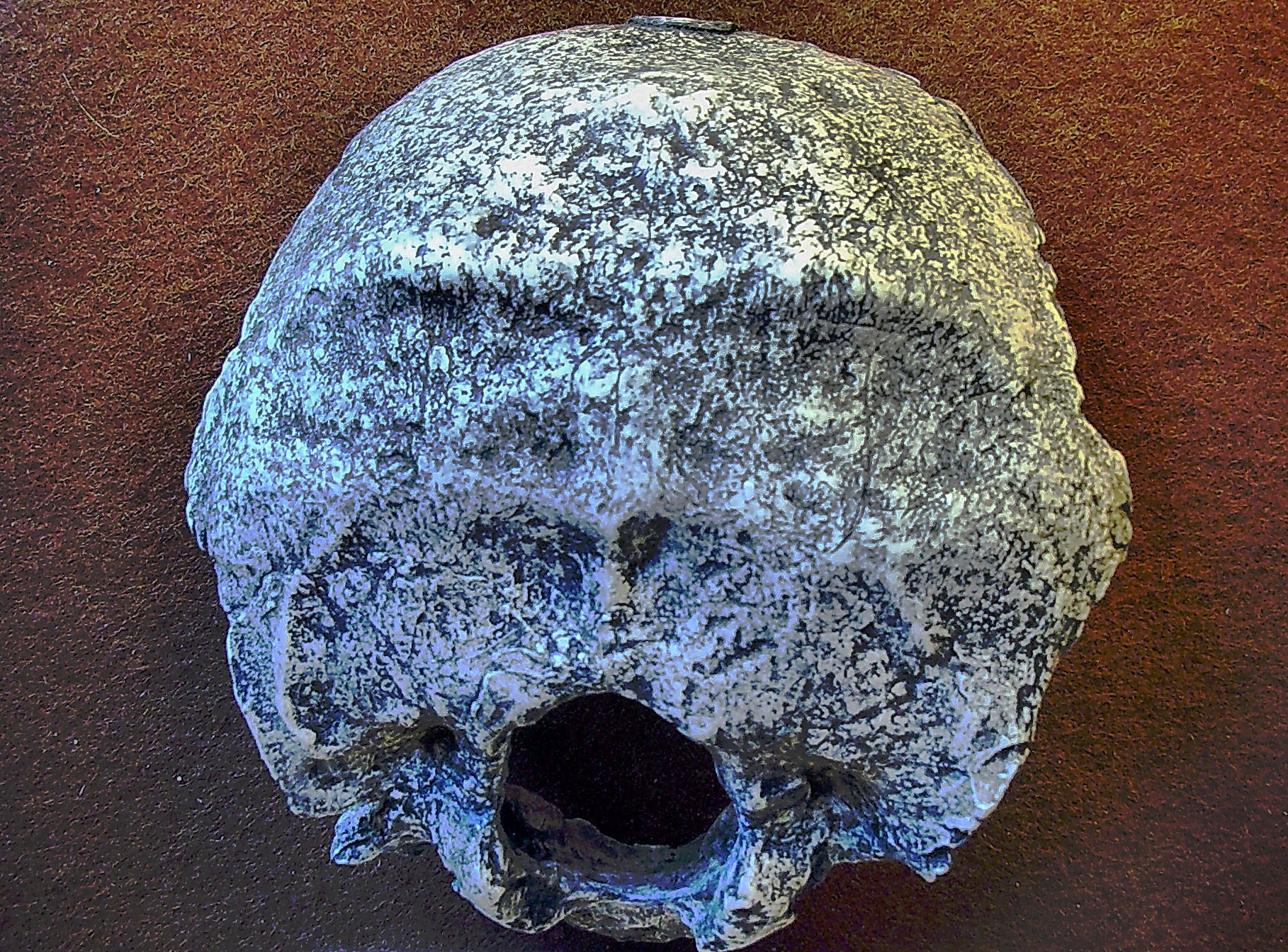
Swanscombe /ˈswɔnzkəm/ is a town in the Borough of Dartford in Kent, England, and the civil parish of Swanscombe and Greenhithe. It is 4.4 miles west of Gravesend and 4.8 miles east of Dartford. History Prehistory Bone fragments and tools, representing the earliest humans known to have lived in England, have been found from 1935 onwards at the Barnfield Pit about outside the village. This site is now the Swanscombe Heritage Park. Swanscombe Man (now thought to be female) was a late or an early archaic ''Homo sapiens''. According to the Natural History Museum, however, the remains are those of a 400,000-year-old early Neanderthal woman. The c. 400,000-year-old skull fragments are kept at the Natural History Museum in London with a replica on display at the Dartford Museum. Lower levels of the Barnfield Pit yielded evidence of an even earlier, more primitive, human, dubbed Clactonian Man. Nearby digs on land for the Channel Tunnel Rail Link revealed a c. 400,000-y ... [...More Info...] [...Related Items...] OR: [Wikipedia] [Google] [Baidu] |


