|
Cranbrook, Tasmania
Cranbrook is a locality and small rural community in the local government area of Glamorgan-Spring Bay, in the Central east coast region of Tasmania. It is located about north of the town of Swansea. The 2016 census determined a population of 67 for the state suburb of Cranbrook. History The locality name is believed to be derived from a town in southern England, probably Cranbrook, Kent. That name was derived from Old English words for “a marsh (or brook) of cranes”. Viticulture An emerging viticulture region has been established in Cranbrook, with many vineyards well established such as Gala Estate, Springvale Wines, Milton Vineyard, Craigie Knowe all with cellar doors and other established vineyards such as The Bend vineyard nearby. The region produces quality Pinot Noir, Chardonnay, Riesling's and other grape varieties, noting another 10 vineyards under development. Road infrastructure The Tasman Highway passes through from south-west to north-east, and intersects ... [...More Info...] [...Related Items...] OR: [Wikipedia] [Google] [Baidu] |
2016 Australian Census
The 2016 Australian census was the 17th Census in Australia, national population census held in Australia. The census was officially conducted with effect on Tuesday, 9 August 2016. The total population of the Commonwealth of Australia was counted as – an increase of 8.8 per cent or people over the . Norfolk Island joined the census for the first time in 2016, adding 1,748 to the population. The ABS annual report revealed that $24 million in additional expenses accrued due to the outage on the census website. Results from the 2016 census were available to the public on 11 April 2017, from the Australian Bureau of Statistics website, two months earlier than for any previous census. The second release of data occurred on 27 June 2017 and a third data release was from 17 October 2017. Australia's next census took place in 2021 Australian census, 2021. Scope The Australian Bureau of Statistics (ABS) states the aim of the 2016 Australian census is "to count every person who ... [...More Info...] [...Related Items...] OR: [Wikipedia] [Google] [Baidu] |
Tasmania
Tasmania (; palawa kani: ''Lutruwita'') is an island States and territories of Australia, state of Australia. It is located to the south of the Mainland Australia, Australian mainland, and is separated from it by the Bass Strait. The state encompasses the main island of Tasmania, the List of islands by area#Islands, 26th-largest island in the world, and the List of islands of Tasmania, surrounding 1000 islands. It is Australia's smallest and least populous state, with 573,479 residents . The List of Australian capital cities, state capital and largest city is Hobart, with around 40% of the population living in the Greater Hobart area. Estimated resident population, 30 June 2017. Tasmania is the most decentralised state in Australia, with the lowest proportion of its residents living within its capital city. Tasmania's main island was first inhabited by Aboriginal Australians, Aboriginal peoples, who today generally identify as Palawa or Pakana. It is believed that Abori ... [...More Info...] [...Related Items...] OR: [Wikipedia] [Google] [Baidu] |
Arthur Cotton (politician)
Arthur Cotton (9 January 1853 – 6 December 1920) was an Australian politician in Tasmania. He was born in Cranbrook in Van Diemen's Land. In 1913 he was elected to the Tasmanian House of Assembly as a Liberal member for Franklin. He was defeated in 1916 but returned in a by-election in 1917 after the appointment of John Earle to the Senate. He was defeated again in 1919 and died in Swansea Swansea ( ; ) is a coastal City status in the United Kingdom, city and the List of urban areas in the United Kingdom, second-largest city of Wales. It forms a Principal areas of Wales, principal area, officially known as the City and County of ... in 1920. References 1853 births 1920 deaths Commonwealth Liberal Party politicians Nationalist Party of Australia members of the Parliament of Tasmania Members of the Tasmanian House of Assembly {{Australia-Nationalist-politician-stub ... [...More Info...] [...Related Items...] OR: [Wikipedia] [Google] [Baidu] |
Tasman Highway
The Tasman Highway (or A3) is a highway in Tasmania, Australia. Like the Midland Highway (Tasmania), Midland Highway, it connects the major cities of Hobart and Launceston, Tasmania, Launceston – however it takes a different route, via the north-eastern and eastern coasts of the state. The Highway also acts as a major commuter road to Hobart residents living on the eastern side of the Derwent River (Tasmania), Derwent River. The designation "Tasman Highway" arises from its location facing the Tasman Sea – named, like the state itself, after Abel Tasman. The highway is one of the longest in Tasmania – , with an average travelling time of 4 hours. Eastern Outlet The Eastern Outlet is a section of the Tasman Highway between Hobart city centre, Hobart and Sorell, Tasmania, Sorell. As one of the city's 3 major radial highways, the outlet connects traffic from the Hobart city centre with Hobart Airport and commuters on the eastern shore of the River Derwent (Tasmania), River ... [...More Info...] [...Related Items...] OR: [Wikipedia] [Google] [Baidu] |
Crane (bird)
Cranes are a type of large bird with long legs and necks in the Family (biology), biological family Gruidae of the Order (biology), order Gruiformes. The family has 15 species placed in four genera which are ''Antigone (genus), Antigone'', ''Balearica'', ''Siberian crane, Leucogeranus'', and ''Grus (genus), Grus''. They are large birds with long necks and legs, a tapering form, and long secondary feathers on the wing that project over the tail. Most species have muted gray or white plumages, marked with black, and red bare patches on the face, but the crowned cranes of the genus ''Balearica'' have vibrantly-coloured wings and golden "crowns" of feathers. Cranes fly with their necks extended outwards instead of bent into an S-shape and their long legs outstretched. Cranes live on most continents, with the exception of Antarctica and South America. Some species and populations of cranes bird migration, migrate over long distances; others do not migrate at all. Cranes are solitary du ... [...More Info...] [...Related Items...] OR: [Wikipedia] [Google] [Baidu] |
Stream
A stream is a continuous body of water, body of surface water Current (stream), flowing within the stream bed, bed and bank (geography), banks of a channel (geography), channel. Depending on its location or certain characteristics, a stream may be referred to by a variety of local or regional names. Long, large streams are usually called rivers, while smaller, less voluminous and more intermittent river, intermittent streams are known, amongst others, as brook, creek, rivulet, rill, run, tributary, feeder, freshet, narrow river, and streamlet. The flow of a stream is controlled by three inputs – surface runoff (from precipitation or meltwater), daylighting (streams), daylighted subterranean river, subterranean water, and surfaced groundwater (Spring (hydrology), spring water). The surface and subterranean water are highly variable between periods of rainfall. Groundwater, on the other hand, has a relatively constant input and is controlled more by long-term patterns of pr ... [...More Info...] [...Related Items...] OR: [Wikipedia] [Google] [Baidu] |
Marsh
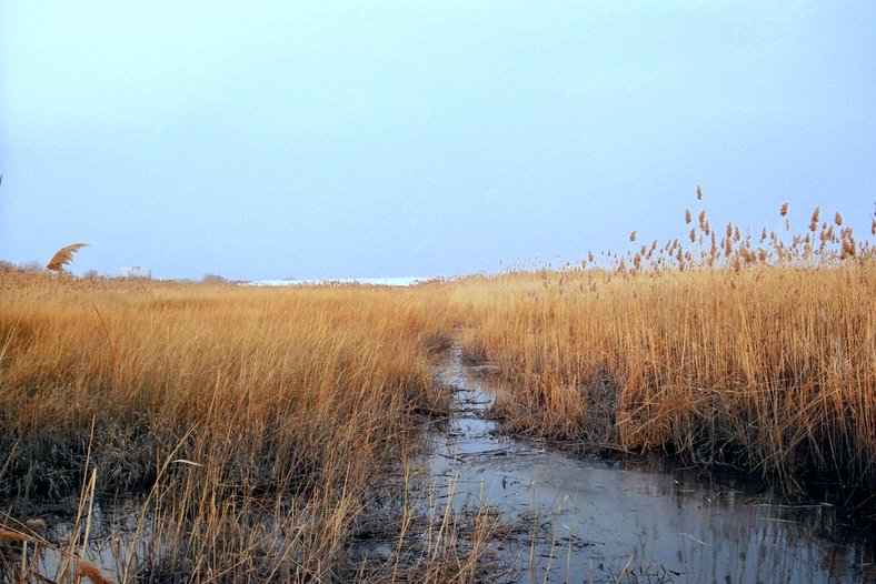
In ecology, a marsh is a wetland that is dominated by herbaceous plants rather than by woody plants.Keddy, P.A. 2010. Wetland Ecology: Principles and Conservation (2nd edition). Cambridge University Press, Cambridge, UK. 497 p More in general, the word can be used for any low-lying and seasonally waterlogged terrain. In Europe and in agricultural literature low-lying meadows that require draining and embanked polderlands are also referred to as marshes or marshland. Marshes can often be found at the edges of lakes and streams, where they form a transition between the aquatic and terrestrial ecosystems. They are often dominated by grasses, rushes or reeds. If woody plants are present they tend to be low-growing shrubs, and the marsh is sometimes called a carr. This form of vegetation is what differentiates marshes from other types of wetland such as swamps, which are dominated by trees, and mires, which are wetlands that have accumulated deposits of acidic peat. Marshes ... [...More Info...] [...Related Items...] OR: [Wikipedia] [Google] [Baidu] |
Old English
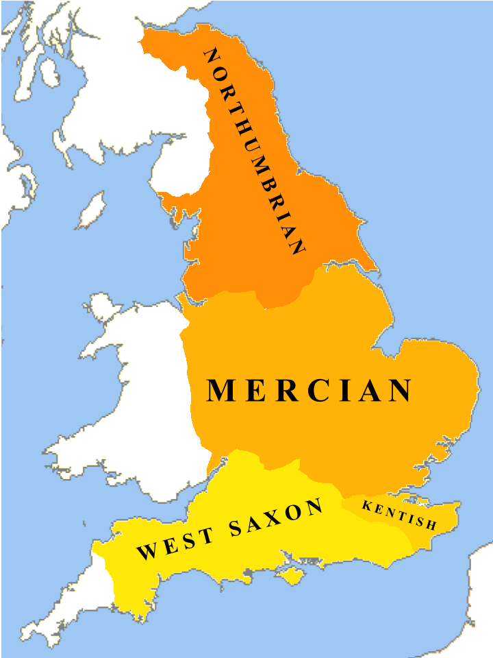
Old English ( or , or ), or Anglo-Saxon, is the earliest recorded form of the English language, spoken in England and southern and eastern Scotland in the Early Middle Ages. It developed from the languages brought to Great Britain by Anglo-Saxon settlers in the mid-5th century, and the first Old English literature dates from the mid-7th century. After the Norman Conquest of 1066, English was replaced for several centuries by Anglo-Norman language, Anglo-Norman (a langues d'oïl, type of French) as the language of the upper classes. This is regarded as marking the end of the Old English era, since during the subsequent period the English language was heavily influenced by Anglo-Norman, developing into what is now known as Middle English in England and Early Scots in Scotland. Old English developed from a set of Anglo-Frisian or Ingvaeonic dialects originally spoken by Germanic tribes traditionally known as the Angles (tribe), Angles, Saxons and Jutes. As the Germanic settlers ... [...More Info...] [...Related Items...] OR: [Wikipedia] [Google] [Baidu] |
Cranbrook, Kent
Cranbrook is a town in the civil parish of Cranbrook and Sissinghurst, in the Weald of Kent in South East England. It lies roughly half-way between Maidstone and Hastings, about southeast of central London. The smaller settlements of Sissinghurst, Swattenden, Colliers Green and Hartley, Cranbrook, Hartley lie within the civil parish. The population of the parish was 6,717 in 2011. History The place name Cranbrook derives from Old English ''cran bric'', meaning Crane (bird), Crane Marsh, marshy ground frequented by cranes (although more probably herons). Spelling of the place name has evolved over the centuries from ''Cranebroca'' (c. 1100); by 1226 it was recorded as ''Cranebroc'', then Cranebrok. By 1610 the name had become Cranbrooke, which evolved into the current spelling. There is evidence of early activity here in the Roman period at the former Little Farningham Farm where a substantial iron working site was investigated in the 1950s. In 2000 the site was the subj ... [...More Info...] [...Related Items...] OR: [Wikipedia] [Google] [Baidu] |
Coles Bay, Tasmania
Coles Bay is an Australian town on the east Coast of Tasmania 192 km north-east of Hobart and 173 km south-east of Launceston, Tasmania, Launceston, being the main entrance point for visitors to the Freycinet National Park. It has a population of 515 people including the surrounding area, but many tourists visit the area for its scenery and outdoor activities, which include hiking, biking, fishing, boating and Sea kayaking. The town is on the northern end of Great Oyster Bay with views of the red and pink granite peaks known as The Hazards, on the Freycinet Peninsula. It is in the area of the Glamorgan Spring Bay Council. Each Easter the town is one of the three locations for the Australian Three Peaks Race, a continuous sailing and running event starting at Beauty Point just north of Launceston and ending at Hobart with runners scaling three mountains including Mount Freycinet (33 km run; 620 m ascent). History Whaling parties, tin and coal miners and pastoralis ... [...More Info...] [...Related Items...] OR: [Wikipedia] [Google] [Baidu] |
Swansea, Tasmania
Swansea is a town in the heart of Tasmania's east coast, on the north-west shore of Great Oyster Bay and overlooking Freycinet National Park. It was the first municipality in Australia to be established after Hobart and Sydney. At the , Swansea had a population of 997. The town was formed in 1821 and celebrated its 200th birthday in 2021. History The first European to explore the Swansea area was Captain John Henry Cox sailing from England to Sydney. He took his ship, the ''Mercury'', up the eastern coast of Tasmania. On 3 July 1789, having heard of vast colonies of seals in the area, he sailed along the western shore of Maria Island and into a stretch of water he named Oyster Bay. Swansea was not settled until 1821 when more British settlers, George Meredith, his family and workers, arrived from Pembrokeshire, Wales. Meredith obtained a grant from Lieutenant Governor William Sorell to farm in the area around Oyster Bay. The land was developed and made suitable for seasona ... [...More Info...] [...Related Items...] OR: [Wikipedia] [Google] [Baidu] |
Dolphin Sands, Tasmania
Dolphin Sands is a rural locality in the local government area (LGA) of Glamorgan–Spring Bay in the South-east LGA region of Tasmania. The locality is about north of the town of Triabunna. The 2016 census recorded a population of 126 for the state suburb of Dolphin Sands. History Dolphin Sands is a confirmed locality. Geography The southern boundary follows the shoreline of Great Oyster Bay. The eastern boundary and much of the northern follows the channel that leads to Moulting Lagoon and the Swan River. Road infrastructure Route A3 (Tasman Highway The Tasman Highway (or A3) is a highway in Tasmania, Australia. Like the Midland Highway (Tasmania), Midland Highway, it connects the major cities of Hobart and Launceston, Tasmania, Launceston – however it takes a different route, via the no ...) passes to the west. From there, Swan River Road and Dolphin Sands Road provide access to the locality. See also * Moulting Lagoon Important Bird Area References Towns i ... [...More Info...] [...Related Items...] OR: [Wikipedia] [Google] [Baidu] |


