|
Cordele
Cordele is a city in and the county seat of Crisp County, Georgia, Crisp County, Georgia (U.S. state), Georgia, United States. The population was 11,147 at the 2010 census. Cordele calls itself the Watermelon Capital of the World. History Cordele was incorporated on January 1, 1888, and named for Cordelia Hawkins, eldest daughter of Colonel Samuel Hawkins, the president of the Savannah, Americus and Montgomery Railway. In November 1864, the area that is now Cordele served as the temporary capital of Georgia. During the last days of the Confederate States of America, Confederacy, Georgia's war governor Joseph E. Brown used his rural farmhouse to escape the wrath of Sherman's March to the Sea. During that time, the farmhouse, which Brown called "Dooly County Place," served as the official capital for only a few days. It was replaced in 1890 by the Suwanee Hotel, located in what became downtown Cordele. The hotel was destroyed by a fire in late 1994 and was rebuilt. Cordele was f ... [...More Info...] [...Related Items...] OR: [Wikipedia] [Google] [Baidu] |
State Route 300 (Georgia)
State Route 300 (SR 300, also called the Georgia–Florida Parkway), is a state highway in the southern part of the U.S. state of Georgia. Its southern terminus is at the Florida state line south-southeast of Thomasville, where the roadway continues as US 19/ SR 57. This is also the southern terminus of SR 3, with which US 19 and SR 300 travel concurrently through the southern part of the state. Its northern terminus is at Interstate 75 (I-75) in Cordele. This is the second state route in Georgia to carry the SR 300 designation. The earlier one, in a different part of the state, was much shorter, traveling from Monticello to a point northeast of Monticello (and about north of Eatonton), and existed from the 1960s to the 1980s. Route description Florida to Albany SR 300 begins at the Florida state line, where it is concurrent with US 19. On the Florida side of the state line, US 19 is concurrent with Florida ... [...More Info...] [...Related Items...] OR: [Wikipedia] [Google] [Baidu] |
Interstate 75 In Georgia
Interstate 75 (I-75) in the US state of Georgia travels north–south along the U.S. Route 41 (US 41) corridor in the central part of the state, traveling through the cities of Valdosta, Macon, and Atlanta. It is also designated—but not signed—as State Route 401 (SR 401). I-75 is the only Interstate to traverse the full length of the state from north to south. In Downtown Atlanta, I-75 joins with I-85 as the Downtown Connector. The segment from SR 49 in Byron to I-16 in Macon is part of the Fall Line Freeway and may be incorporated into the eastern extension of I-14, which is currently entirely within Central Texas and is proposed to be extended to Augusta. What would become the general routing of I-75 in Georgia was initially used by the western routing of the Dixie Highway beginning in 1916. Established in 1926, the Interstate's direct predecessor in Georgia is US 41, a national highway that has been largely supplanted in favo ... [...More Info...] [...Related Items...] OR: [Wikipedia] [Google] [Baidu] |
Crisp County, Georgia
Crisp County is a county located in the central portion of the U.S. state of Georgia. As of the 2020 census, the population was 20,128. The county seat is Cordele. The county was created on August 17, 1905, from Dooly County and named for Georgia Congressman Charles Frederick Crisp. Crisp County comprises the Cordele, GA Micropolitan Statistical Area. Geography According to the U.S. Census Bureau, the county has a total area of , of which is land and (3.0%) is water. The western two-thirds of Crisp County, bordered on the east by a line from south of Arabi running northeast, is located in the Middle Flint River sub-basin of the ACF River Basin (Apalachicola-Chattahoochee-Flint River Basin). The eastern third of the county is located in the Alapaha River sub-basin of the Suwannee River. Major highways * Interstate 75 * U.S. Route 41 * U.S. Route 280 * State Route 7 * State Route 30 * State Route 33 * State Route 33 Connector * State Route 90 * State Ro ... [...More Info...] [...Related Items...] OR: [Wikipedia] [Google] [Baidu] |
Savannah, Americus And Montgomery Railway
The Savannah, Americus and Montgomery Railway (SA&M) was a historic railroad located in the U.S. states of Georgia and Alabama. SA&M was built in the 1880s running between Montgomery, Alabama and Lyons, Georgia. It would be completed to Savannah, Georgia in 1896 after being renamed the Georgia and Alabama Railway. The line would notably become part of the Seaboard Air Line Railroad network in 1900. History Early years The first segment of the Savannah, Americus and Montgomery Railway was chartered in 1884 as the narrow gauge Americus, Preston and Lumpkin Railroad, which ran from Louvale to Abbeville. The Americus, Preston and Lumpkin Railroad was reorganized as Savannah, Americus and Montgomery Railway in 1888.Johnson, Edward A"Samuel H. Hawkins Diary Historical Note" Digital Library of Georgia. Retrieved 30 December 2011. In 1890, the line was extended from Abbeville east to Lyons. A year later, the SA&M was extended west from Louvale across the Chattahoochee River ... [...More Info...] [...Related Items...] OR: [Wikipedia] [Google] [Baidu] |
Georgia Southern & Florida
The Georgia Southern and Florida Railway , also known as the ''Suwanee River Route'' from its crossing of the Suwanee River, was founded in 1885 as the Georgia Southern and Florida ''Railroad'' and began operations between Macon, GA and Valdosta, GA in 1889, extending to Palatka, FL in 1890. The railroad went bankrupt by 1891, was reorganized as the Georgia Southern and Florida ''Railway'' in 1895, and was controlled by the Southern Railway. In 1902, the GS&F purchased the Atlantic, Valdosta and Western Railway that ran from Valdosta, GA to Jacksonville, FL. The GS&F also owned the Macon and Birmingham Railway and the Hawkinsville and Florida Southern Railway, both of which were operated as separate companies; both ended up going bankrupt and being mostly abandoned. The GS&F was eventually acquired by the Norfolk Southern Railway and still operates as a subsidiary. As of November 2012, at least one operating Norfolk Southern locomotive retains GSF reporting marks. The lin ... [...More Info...] [...Related Items...] OR: [Wikipedia] [Google] [Baidu] |
Vienna, Georgia
The city of Vienna () is the county seat of Dooly County, Georgia, United States. The population was 4,011 at the 2010 census, up from 2,973 in 2000. Vienna is situated on the Flint River. It was established as Berrien in 1826. In 1833, its name was changed to Drayton. In 1841, it was renamed Vienna. Vienna was disincorporated at the time they changed the city's name to Vienna. The present name is after Vienna, in Austria. History Vienna was founded in 1826 as the seat of Dooly County as Berrien. Its name was later changed to Drayton. The county seat moved to Drayton (it retained the same name), Georgia along the Flint River (Georgia) in 1836. It was later re-designated county seat in 1841. It was incorporated as a town in 1854 and as a city in 1901. Geography Vienna is located in southern Dooly County. U.S. Route 41 passes through the center of town as Third Street, leading north to Unadilla and south to Cordele. Interstate 75 passes east of the center of town (and forms ... [...More Info...] [...Related Items...] OR: [Wikipedia] [Google] [Baidu] |
Albany, Georgia
Albany ( ) is a city in the U.S. state of Georgia. Located on the Flint River, it is the seat of Dougherty County, and is the sole incorporated city in that county. Located in southwest Georgia, it is the principal city of the Albany, Georgia metropolitan area. The population was 77,434 at the 2010 U.S. Census, making it the eighth-largest city in the state. It became prominent in the nineteenth century as a shipping and market center, first served by riverboats. Scheduled steamboats connected Albany with the busy port of Apalachicola, Florida. They were replaced by railroads. Seven lines met in Albany, and it was a center of trade in the Southeast. It is part of the Black Belt, the extensive area in the Deep South of cotton plantations. From the mid-20th century, it received military investment during World War II and after, that helped develop the region. Albany and this area were prominent during the civil rights era, particularly during the early 1960s as activists worked ... [...More Info...] [...Related Items...] OR: [Wikipedia] [Google] [Baidu] |
List Of Counties In Georgia (U
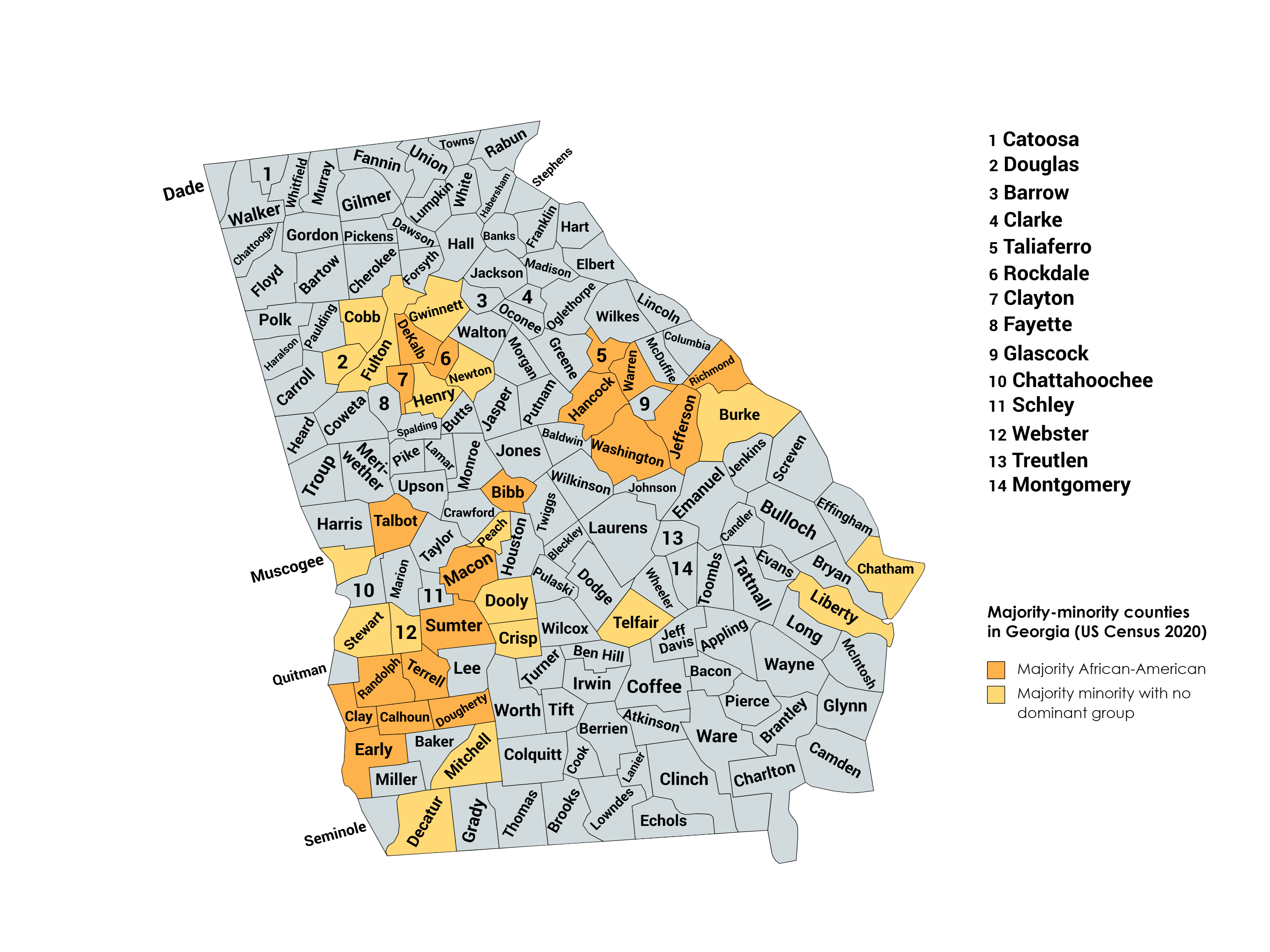
The U.S. state of Georgia is divided into 159 counties, more than any other state except for Texas, which has 254 counties. Under the Georgia State Constitution, all of its counties are granted home rule to deal with problems that are purely local in nature. Also, eight consolidated city-counties have been established in Georgia: Athens– Clarke County, Augusta– Richmond County, Columbus– Muscogee County, Georgetown– Quitman County, Statenville–Echols County, Macon– Bibb County, Cusseta–Chattahoochee County, and Preston- Webster County. History From 1732 until 1758, the minor civil divisions in Georgia were districts and towns. In 1758, the Province of Georgia was divided into eight parishes, and another four parishes were created in 1765. On February 5, 1777, the original eight counties of the state were created: Burke, Camden, Chatham, Effingham, Glynn, Liberty, Richmond, and Wilkes. Georgia has the second-largest number of counties of any state in t ... [...More Info...] [...Related Items...] OR: [Wikipedia] [Google] [Baidu] |
Abbeville, Georgia
Abbeville is a city in Wilcox County, Georgia, United States. Per the 2020 census, the population was 2,685. The city is the county seat of Wilcox County. History Abbeville was founded in 1857 as seat of the newly formed Wilcox County. The town was incorporated in 1883. According to one tradition, the city was named after Abbie McNally, the wife of the original owner of the site, while another tradition states the name is a transfer from Abbeville, South Carolina. The current Wilcox County Courthouse was built in 1903 and it is listed on the National Register of Historic Places. Abbeville was home to the Georgia Normal College and Business Institute. In 1910 Abbeville had a population of 1,201. In 1950 it had a population of 890. Geography According to the United States Census Bureau, the city has a total area of , of which is land and (0.65%) is water. Climate Demographics 2020 census ''Note: the US Census treats Hispanic/Latino as an ethnic category. This tabl ... [...More Info...] [...Related Items...] OR: [Wikipedia] [Google] [Baidu] |
Sherman's March To The Sea
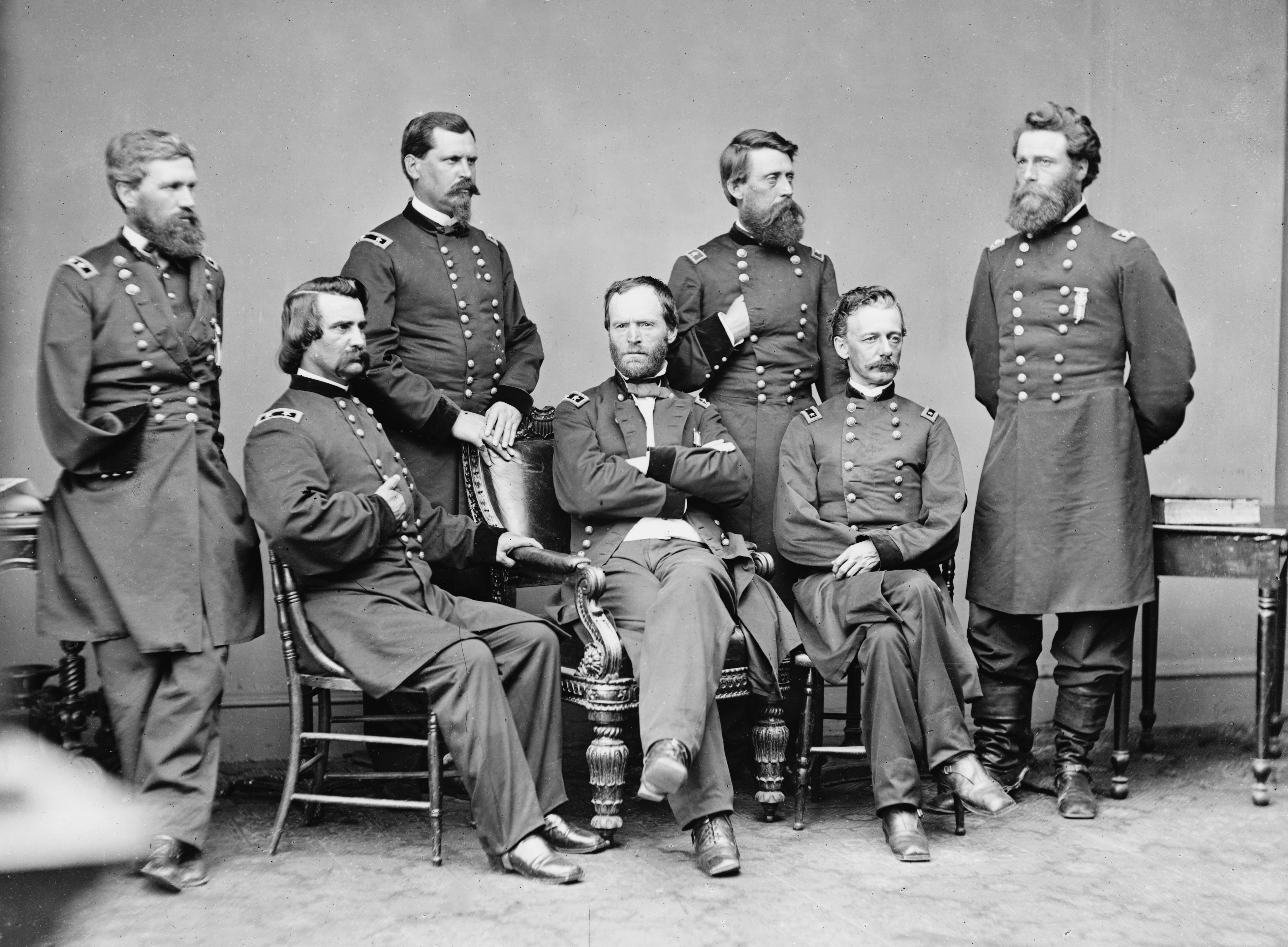
Sherman's March to the Sea (also known as the Savannah campaign or simply Sherman's March) was a military campaign of the American Civil War conducted through Georgia from November 15 until December 21, 1864, by William Tecumseh Sherman, major general of the Union Army. The campaign began with Sherman's troops leaving the captured city of Atlanta on November 15 and ended with the capture of the port of Savannah on December 21. His forces followed a " scorched earth" policy, destroying military targets as well as industry, infrastructure, and civilian property, disrupting the Confederacy's economy and transportation networks. The operation debilitated the Confederacy and helped lead to its eventual surrender. Sherman's decision to operate deep within enemy territory without supply lines was unusual for its time, and the campaign is regarded by some historians as an early example of modern warfare or total war. Background and objectives Military situation Sherman's "March ... [...More Info...] [...Related Items...] OR: [Wikipedia] [Google] [Baidu] |
Hydroelectric
Hydroelectricity, or hydroelectric power, is electricity generated from hydropower (water power). Hydropower supplies one sixth of the world's electricity, almost 4500 TWh in 2020, which is more than all other renewable sources combined and also more than nuclear power. Hydropower can provide large amounts of low-carbon electricity on demand, making it a key element for creating secure and clean electricity supply systems. A hydroelectric power station that has a dam and reservoir is a flexible source, since the amount of electricity produced can be increased or decreased in seconds or minutes in response to varying electricity demand. Once a hydroelectric complex is constructed, it produces no direct waste, and almost always emits considerably less greenhouse gas than fossil fuel-powered energy plants. [...More Info...] [...Related Items...] OR: [Wikipedia] [Google] [Baidu] |
Flint River (Georgia)
The Flint River is a U.S. Geological Survey. National Hydrography Dataset high-resolution flowline dataThe National Map, accessed April 15, 2011 river in the U.S. state of Georgia. The river drains of western Georgia, flowing south from the upper Piedmont region south of Atlanta to the wetlands of the Gulf Coastal Plain in the southwestern corner of the state. Along with the Apalachicola and the Chattahoochee rivers, it forms part of the ACF basin. In its upper course through the red hills of the Piedmont, it is considered especially scenic, flowing unimpeded for over . Historically, it was also called the Thronateeska River. Description The Flint River rises in west central Georgia in the city of East Point in southern Fulton County on the southern outskirts of the Atlanta metropolitan area as ground seepage. The exact start can be traced to the field located between Plant Street, Willingham Drive, Elm Street, and Vesta Avenue. It travels under the runways of the Hart ... [...More Info...] [...Related Items...] OR: [Wikipedia] [Google] [Baidu] |


