|
Confederation Park, Calgary
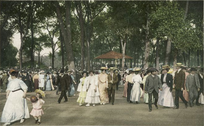
Confederation Park is an urban park in northwest Calgary, Alberta. It is developed over an area of between the neighbourhoods of Mount Pleasant, Capitol Hill, Collingwood and Highland Park. 10th Street West bisects the park from north to south. The City oCalgary's Confederation Park Pageprovides maps of thNorth Areaand thSouth Areaof the park. The park has picnic tables, toboggan hills, cycle paths, tennis courts and baseball diamonds. The park is also a popular destination for couples having wedding pictures taken. The park adjoins the Queens Park Cemetery on the east side by the baseball diamond and tennis courts near Highland Park. There is cross-country skiing both in the park and at the golf course during the winter. Any time of the year the park can be used for geocache searches. Adjacent to the park is the Confederation Golf Course A golf course is the grounds on which the sport of golf is played. It consists of a series of holes, each consisting of a teeing ... [...More Info...] [...Related Items...] OR: [Wikipedia] [Google] [Baidu] |
Calgary
Calgary () is a major city in the Canadian province of Alberta. As of 2021, the city proper had a population of 1,306,784 and a metropolitan population of 1,481,806 making it the third-largest city and fifth-largest metropolitan area in Canada. Calgary is at the confluence of the Bow River and the Elbow River in the southwest of the province, in the transitional area between the Rocky Mountain Foothills and the Canadian Prairies, about east of the front ranges of the Canadian Rockies, roughly south of the provincial capital of Edmonton and approximately north of the Canada–United States border. The city anchors the south end of the Statistics Canada-defined urban area, the Calgary–Edmonton Corridor. Calgary's economy includes activity in many sectors: energy; financial services; film and television; transportation and logistics; technology; manufacturing; aerospace; health and wellness; retail; and tourism. The Calgary Metropolitan Region is home to Canada' ... [...More Info...] [...Related Items...] OR: [Wikipedia] [Google] [Baidu] |
Baseball Diamond
A baseball field, also called a ball field or baseball diamond, is the field upon which the game of baseball is played. The term can also be used as a metonym for a baseball park. The term sandlot is sometimes used, although this usually refers to less organized venues for activities like sandlot ball. Specifications :''Unless otherwise noted, the specifications discussed in this section refer to those described within the Baseball Rules, under which Major League Baseball is played.'' The starting point for much of the action on the field is home plate (officially "home base"), a five-sided slab of white rubber. One side is long, the two adjacent sides are . The remaining two sides are approximately and set at a right angle. The plate is set into the ground so that its surface is level with the field. The corner of home plate where the two 11-inch sides meet at a right angle is at one corner of a square. The dimensional specifications are technically inconsistent because ... [...More Info...] [...Related Items...] OR: [Wikipedia] [Google] [Baidu] |
Queens Park Village, Calgary
Highland Park is a residential neighbourhood in the northwest quadrant of Calgary, Alberta. It is bounded to the north by McKnight Boulevard, to the east by Edmonton Trail, to the south by 32 Avenue N and to the west by 4 Street W. Confederation Park and Nose Hill Park are located in close proximity. The Queens Park Cemetery occupies the southwestern corner of the neighbourhood, and the ''Highland golf course'' is developed in the north. The land was annexed to the City of Calgary in 1910 and Highland Park was established in 1946. It is represented in the Calgary City Council by the Ward 4 councillor. Demographics In the City of Calgary's 2012 municipal census, Highland Park had a population of living in dwellings, a 7.1% increase from its 2011 population of . With a land area of , it had a population density of in 2012. Residents in this community had a median household income of $37,766 in 2000, and there were 23.9% low income residents living in the neighbourhood. As ... [...More Info...] [...Related Items...] OR: [Wikipedia] [Google] [Baidu] |
Charleswood, Calgary
Charleswood is a residential neighbourhood in the northwest quadrant of Calgary, Alberta. It is located east of Crowchild Trail and the University of Calgary. It borders the Nose Hill Park to the north and the Confederation Park to the southeast. Charleswood is represented in the Calgary City Council by the Ward 4 councillor. Demographics In the City of Calgary's 2012 municipal census, Charleswood had a population of living in dwellings, a 1.9% increase from its 2011 population of . With a land area of , it had a population density of in 2012. Residents in this community had a median household income of $63,828 in 2000, and there were 12.9% low income residents living in the neighbourhood. As of 2000, 17.6% of the residents were immigrants. A proportion of 11.6% of the buildings were condominiums or apartments, and 18.4% of the housing was used for renting. Education The community is served by Banff Trail Elementary and Branton Junior High with the French program, Collingw ... [...More Info...] [...Related Items...] OR: [Wikipedia] [Google] [Baidu] |
Cambrian Heights, Calgary
Cambrian Heights is a suburban residential neighbourhood in the northwest quadrant of Calgary, Alberta. It is located immediately southeast from Nose Hill Park, east of 14th Street NW and south of John Laurie Boulevard. Demographics In the City of Calgary's 2012 municipal census, Cambrian Heights had a population of living in dwellings, a 1% increase from its 2011 population of . With a land area of , it had a population density of in 2012. Residents in this community had a median household income of $59,522 in 2000, and there were 14.3% low income residents living in the neighbourhood. As of 2000, 12.8% of the residents were immigrants. A proportion of 10.6% of the buildings were condominiums or apartments, and 33.5% of the housing was used for renting. See also *List of neighbourhoods in Calgary This is a list of neighbourhoods in Calgary, Alberta. As of 2016, Calgary has 197 neighbourhoods, which are referred to as "communities" by the municipal government, and 42 in ... [...More Info...] [...Related Items...] OR: [Wikipedia] [Google] [Baidu] |
Rosemont, Calgary
Rosemont is a residential neighbourhood in the northwest quadrant of Calgary, Alberta. It is bounded by Northmount Drive to the north, by Cambrian Drive to the east, by 23 Avenue N and the ''Confederation Park'' to the south and by 14 Street W to the west. The lands were annexed to the City of Calgary in 1910, and the neighbourhood was established in 1958. It is represented in the Calgary City Council by the Ward 7 councillor. Demographics In the City of Calgary's 2012 municipal census, Rosemont had a population of living in dwellings, a 2.7% increase from its 2011 population of . With a land area of , it had a population density of in 2012. Residents in this community had a median household income of $53,027 in 2000, and there were 11.3% low income residents living in the neighbourhood. As of 2000, 13.4% of the residents were immigrants. A proportion of 18.6% of the buildings were condominiums or apartments, and 29.9% of the housing was used for renting. Education The comm ... [...More Info...] [...Related Items...] OR: [Wikipedia] [Google] [Baidu] |
Nose Hill Park
Nose Hill Park is a natural park in the northwest quadrant of Calgary, Alberta which covers over . It is the fourth-largest urban park in Canada, and one of the largest urban parks in North America. It is a municipal park, unlike Fish Creek, which is a provincial park. It was created in 1980. Wildlife The park is large enough to sustain large mammals like white-tailed deer and coyote as well as porcupine, northern pocket gophers, and Richardson's ground squirrels. Northern harriers and Swainson's hawks feed on smaller species such as mice and voles. Park status In 1971 Hartel Holdings planned to develop a residential community on the site of present day Nose Hill Park and requested amendments to the prevailing zoning by-law. In the 1970s, a grassroots group consisting of members of local communities (most notably North Haven) and Calgary Field Naturalists’ Society, later known as Nature Calgary, worked together to lobby the city to protect Nose Hill from development. I ... [...More Info...] [...Related Items...] OR: [Wikipedia] [Google] [Baidu] |
Riparian Zone
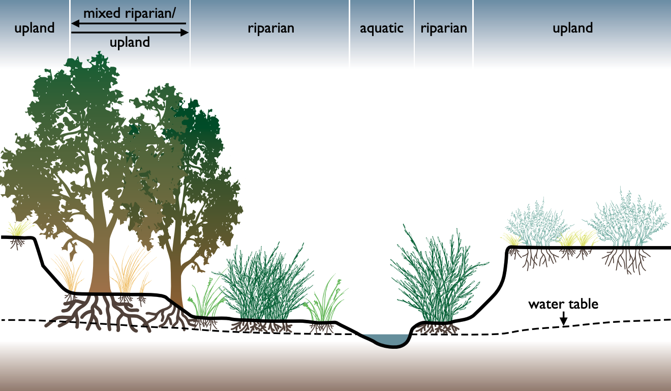
A riparian zone or riparian area is the interface between land and a river or stream. In some regions, the terms riparian woodland, riparian forest, riparian buffer zone, riparian corridor, and riparian strip are used to characterize a riparian zone. The word ''riparian'' is derived from Latin ''wiktionary:ripa, ripa'', meaning "bank (geography), river bank". Riparian is also the proper nomenclature for one of the terrestrial biomes of the Earth. Plant habitats and communities along the river margins and banks are called riparian vegetation, characterized by aquatic plant, hydrophilic plants. Riparian zones are important in ecology, environmental resource management, and civil engineering because of their role in soil conservation, their habitat biodiversity, and the influence they have on terrestrial animal, terrestrial and semiaquatic fauna as well as aquatic ecosystems, including grasslands, woodlands, wetlands, and even non-vegetative areas. Riparian zones may be natural ... [...More Info...] [...Related Items...] OR: [Wikipedia] [Google] [Baidu] |
Golf Course
A golf course is the grounds on which the sport of golf is played. It consists of a series of holes, each consisting of a teeing ground, tee box, a #Fairway and rough, fairway, the #Fairway and rough, rough and other hazard (golf), hazards, and a green with a cylindrical hole in the ground, known as a "cup". The cup holds a flagstick, known as a "pin". A standard round of golf consists of 18 holes, and as such most courses contain 18 distinct holes; however, there are many 9-hole courses and some that have holes with shared fairways or greens. There are also courses with a non-standard number of holes, such as 12 or 14. The vast majority of golf courses have holes of varying length and difficulties that are assigned a standard score, known as Par (score), par, that a proficient player should be able to achieve; this is usually three, four or five strokes. Par-3 courses consist of holes all of which have a par of three. Short courses have gained in popularity; these consist of mo ... [...More Info...] [...Related Items...] OR: [Wikipedia] [Google] [Baidu] |
Geocaching
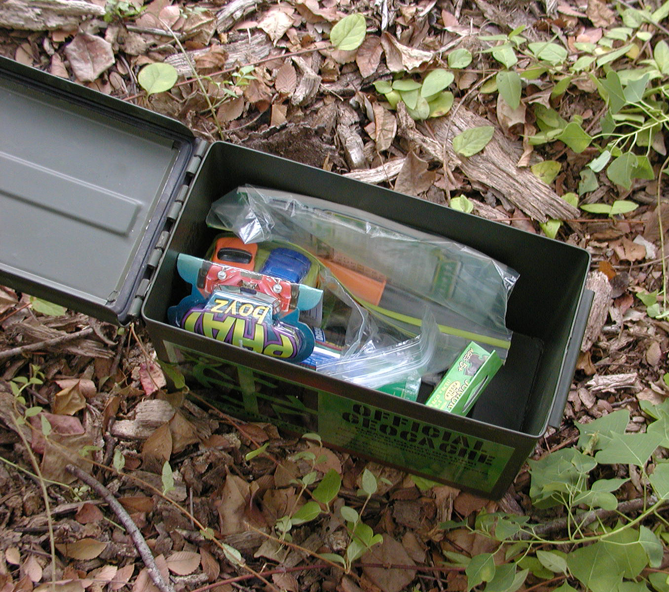
Geocaching (, ) is an outdoor recreational activity, in which participants use a Global Positioning System (GPS) receiver or mobile device and other navigational techniques to hide and seek containers, called ''geocaches'' or ''caches'', at specific locations marked by coordinates all over the world. The first geocache was placed in 2000, and by 2023 there were over 3 million active caches worldwide. Geocaching can be considered a real-world, outdoor treasure hunting game. A typical cache is a small waterproof container containing a logbook and sometimes a pen or pencil. The ''geocacher'' signs the log with their established code name/username and dates it, in order to prove that they found the cache. After signing the log, the cache must be placed back exactly where the person found it. Larger containers such as plastic storage containers ( Tupperware or similar) or ammo boxes can also contain items for trading, such as toys or trinkets, usually of more sentimental worth ... [...More Info...] [...Related Items...] OR: [Wikipedia] [Google] [Baidu] |
Tennis Court
A tennis court is the venue where the sport of tennis is played. It is a firm rectangular surface with a low net stretched across the centre. The same surface can be used to play both Types of tennis match, doubles and singles matches. A variety of surfaces can be used to create a tennis court, each with its own characteristics which affect the playing style of the game. Dimensions The dimensions of a tennis court are defined and regulated by the International Tennis Federation (ITF) governing body and are written down in the annual 'Rules of Tennis' document. The court is long. Its width is for singles matches and for doubles matches. The Service line (tennis), service line is from the net. Additional clear space around the court is needed in order for players to reach overrun balls for a total of wide and long. A net is stretched across the full width of the court, parallel with the Glossary of tennis terms#Baseline, baselines, dividing it into two equal ends. The net ... [...More Info...] [...Related Items...] OR: [Wikipedia] [Google] [Baidu] |
Urban Park
An urban park or metropolitan park, also known as a city park, municipal park (North America), public park, public open space, or municipal gardens (United Kingdom, UK), is a park or botanical garden in cities, densely populated suburbia and other municipal corporation, incorporated places that offers open space reserve, green space and places for recreation to residents and visitors. Urban parks are generally Landscape architecture, landscaped by design, instead of lands left in their natural state. The design, operation and maintenance, repair and operations, maintenance is usually done by government agencies, typically on the local government, local level, but may occasionally be contracted out to a park conservancy, "friends of" group, or private sector company. Depending on size, budget, and land features, which varies considerably among individual parks, common features include playgrounds, gardens, hiking, running, fitness trails or paths, bridle paths, sports fields and c ... [...More Info...] [...Related Items...] OR: [Wikipedia] [Google] [Baidu] |


