|
Colt Creek State Park
Colt Creek State Park is a Florida State Park in Central Florida, north of Lakeland off of State Road 471. This 5,067 acre park nestled within the Green Swamp Wilderness Area and named after one of the tributaries that flows through the property was opened to the public on January 20, 2007. Composed mainly of pine flatwoods, cypress domes and open pasture land, this piece of pristine wilderness is home to many animal species including the American bald eagle, Southern fox squirrel, gopher tortoise, white-tailed deer, wild turkey and bobcat. The park offers over 15 miles of beautiful, multi-use trails which make for great horse-back riding, hiking and biking opportunities. These trails meander through the pine flatwoods and cypress domes, bottomland forest and past open pastures. The park offers fishing, canoeing and kayaking at one of its three lakes. Other recreational opportunities include picnic pavilions, ranger-led programs and primitive and full-facility camping opt ... [...More Info...] [...Related Items...] OR: [Wikipedia] [Google] [Baidu] |
Polk County, Florida
Polk County () is a County (United States), county located in the Central Florida, central portion of the U.S. state of Florida. The county population was 725,046, as of the 2020 United States census, 2020 census, and estimated to be 818,330, as of July 1, 2023. Its county seat is Bartow, Florida, Bartow, and its largest city is Lakeland, Florida, Lakeland. Polk County comprises the Lakeland–Winter Haven metropolitan statistical area (MSA). This MSA is the List of Metropolitan Statistical Areas, 77th-most populous one and the List of United States primary statistical areas, 89th-most populous United States primary statistical area, primary statistical area of the United States as of July 1, 2012. The center of population of Florida is located in Polk County, near the city of Lake Wales, Florida, Lake Wales. Polk County is home to one public university, one state college, and four private universities. History Early history The first people to inhabit the area now called Polk ... [...More Info...] [...Related Items...] OR: [Wikipedia] [Google] [Baidu] |
Turpentine
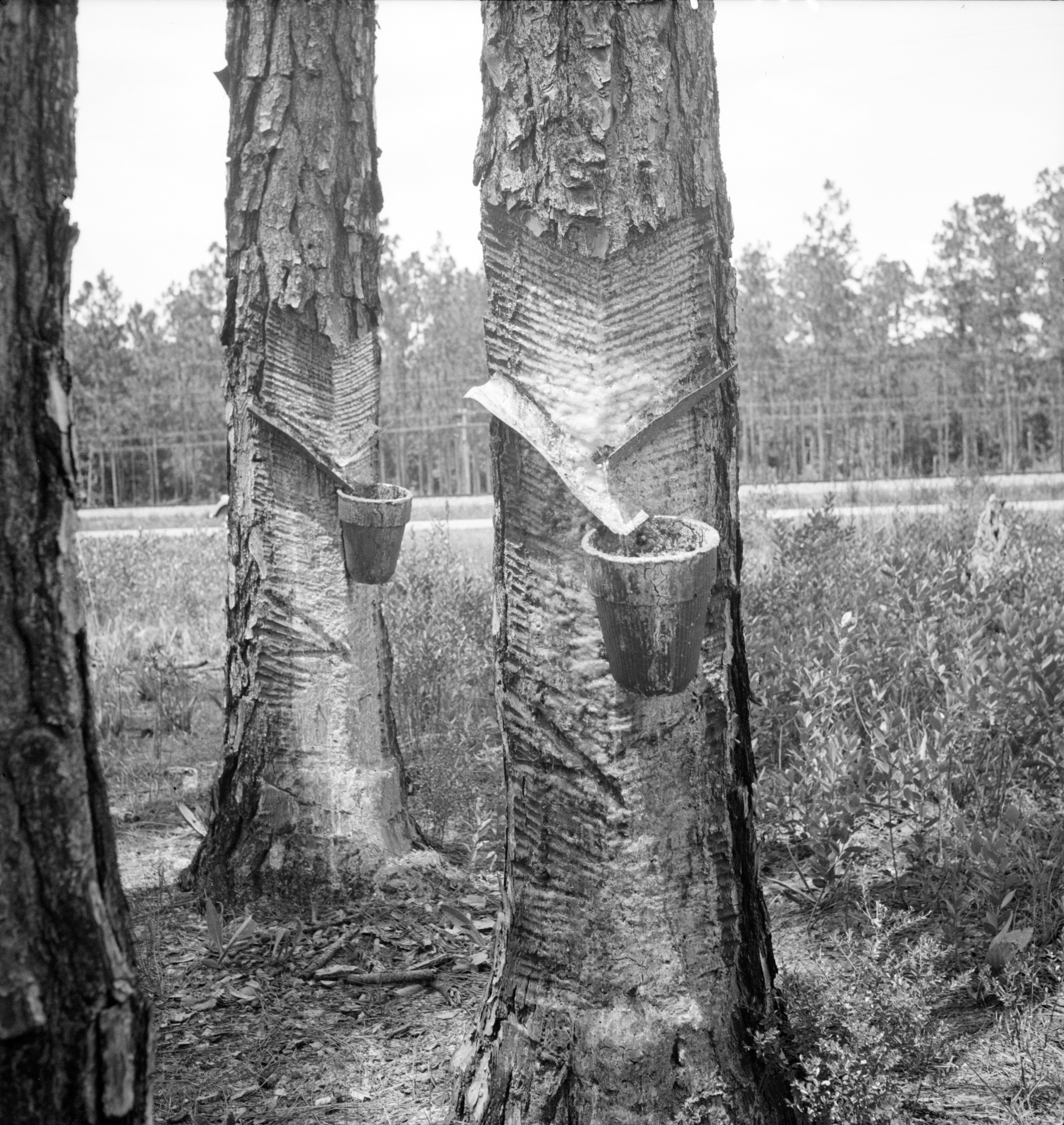
Turpentine (which is also called spirit of turpentine, oil of turpentine, terebenthine, terebenthene, terebinthine and, colloquially, turps) is a fluid obtainable by the distillation of resin harvested from living trees, mainly pines. Principally used as a specialized solvent, it is also a source of material for Organic synthesis, organic syntheses. Turpentine is composed of terpenes, primarily the monoterpenes alpha-Pinene, alpha- and beta-Pinene, beta-pinene, with lesser amounts of carene, camphene, limonene, and terpinolene.Kent, James A. ''Riegel's Handbook of Industrial Chemistry'' (Eighth Edition) Van Nostrand Reinhold Company (1983) p.569 Nowadays, turpentine is rarely the product of distillation of pine resin, but is a byproduct of pulping. Pulping is achieved by two processes, the Kraft process and the sulfite process. The turpentines obtained from these two processes differ in their chemical compositions. The sulfite process gives a product that is rich in cymene, w ... [...More Info...] [...Related Items...] OR: [Wikipedia] [Google] [Baidu] |
Floridan Aquifer
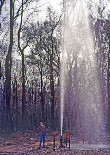
The Floridan aquifer system, composed of the Upper and Lower Floridan aquifers, is a sequence of Paleogene carbonate rock which spans an area of about in the southeastern United States. It underlies the entire state of Florida and parts of Alabama, Georgia, Mississippi, and South Carolina. The Floridan aquifer system is one of the world's most productive aquifers and supplies drinking water for nearly 10 million people.Marella, R.L., and Berndt, M.P., 2005, Water withdrawals and trends from the Floridan aquifer system in the southeastern United States, 1950-2000: U.S. Geological Survey Circular 1278, 20 p., https://pubs.er.usgs.gov/publication/cir1278. According to the United States Geological Survey, total withdrawals from the Floridan aquifer system in 2000 were ranked 5th highest of all principal aquifers in the nation at 3,640 million gallons per day (Mgal/d) (). Of the total, 49% (1,949 Mgal/d; ) was used for irrigation, 33% (1,329 Mgal/d; ) was used for public water supply ... [...More Info...] [...Related Items...] OR: [Wikipedia] [Google] [Baidu] |
Ocklawaha River
The U.S. Geological Survey. National Hydrography Dataset high-resolution flowline dataThe National Map accessed April 21, 2011 Ocklawaha River flows north from central Florida until it joins the St. Johns River near Palatka. Its name is derived from ''ak-lowahe'', Creek for "muddy". The historical and original source of the Ocklawaha River is Lake Griffin, part of the Harris chain of lakes in Lake County, Florida. The river now receives discharge from the entire Harris Chain of Lakes, including Lake Eustis, Lake Harris, Lake Dora, Lake Beauclair and Lake Apopka, via a series of man-made canals and natural waterways including Haynes Creek, the Dead River, the Dora Canal, and the Apopka-Beauclair Canal. The addition of the canals has increased both the discharge and amount of runoff pollution carried into the river. The Ocklawaha River watershed includes parts of the Green Swamp, most of Lake County, and portions of Marion, Alachua and Putnam counties. The larges ... [...More Info...] [...Related Items...] OR: [Wikipedia] [Google] [Baidu] |
Peace River (Florida)
The Peace River is a river in the southwestern part of the Florida peninsula, in the United States, U.S.A. It originates at the juncture of Saddle Creek and Peace Creek northeast of Bartow, Florida, Bartow in Polk County, Florida, Polk County and flows south through Fort Meade (Polk County) Hardee County, Florida, Hardee County to Arcadia, Florida, Arcadia in DeSoto County, Florida, DeSoto County and then southwest into the Charlotte Harbor (estuary), Charlotte Harbor estuary at Punta Gorda, Florida, Punta Gorda in Charlotte County, Florida, Charlotte County. It is long and has a drainage basin of . U.S. Route 17 in Florida, U.S. Highway 17 runs near and somewhat parallel to the river for much of its course. The river was called ''Rio de la Paz'' (''River of Peace'') on 16th century Spain, Spanish charts. It appeared as ''Peas Creek'' or ''Pease Creek'' on later maps. The Creek (people), Creek (and later, Seminole) Indians call it Talakchopcohatchee, ''River of Long Peas''. Other ... [...More Info...] [...Related Items...] OR: [Wikipedia] [Google] [Baidu] |
Hillsborough River (Florida)
The Hillsborough River is a river located in the state of Florida in the United States. It arises in the Green Swamp (Florida), Green Swamp near the juncture of Hillsborough County, Florida, Hillsborough, Pasco County, Florida, Pasco and Polk County, Florida, Polk counties, and flows U.S. Geological Survey. National Hydrography Dataset high-resolution flowline dataThe National Map , accessed April 18, 2011 through Pasco and Hillsborough Counties to an outlet in the city of Tampa, Florida, Tampa on Hillsborough Bay (Florida), Hillsborough Bay. It includes 4 nature trails extending for over , making it popular among hikers. The name ''Hillsborough River'' first appeared on a United Kingdom, British map in 1769. At the time, the Wills Hill, 1st Marquess of Downshire, Earl of Hillsborough was the British Secretary of State for the Colonies, and thus controlled the pensions of the Surveyor (surveying), surveyors working in the British colonization of the Americas, American colonies, wh ... [...More Info...] [...Related Items...] OR: [Wikipedia] [Google] [Baidu] |
Withlacoochee River (Florida)
The Withlacoochee River or Crooked River is a river in central Florida, in the United States. It originates in the Green Swamp (Florida), Green Swamp, east of Polk City, Florida, Polk City, flowing west, then north, then northwest and finally west again before emptying into the Gulf of Mexico near Yankeetown, Florida, Yankeetown. The river is longU.S. Geological Survey. National Hydrography Dataset high-resolution flowline dataThe National Map accessed April 18, 2011 and has a drainage basin of . Along the route of central Florida's Withlacoochee River is the Withlacoochee State Trail, the longest paved rail trail in Florida; the Cypress Lake Preserve, a park with approximately of frontage; and Nobleton Wayside Park, a park in Nobleton, Florida, Nobleton that includes a boat ramp, shelter, basketball court, and picnic tables. The Southwest Florida Water Management District operates a nature preserve and recreational area with of frontage on the Withlacoochee River in Cit ... [...More Info...] [...Related Items...] OR: [Wikipedia] [Google] [Baidu] |
Limestone
Limestone is a type of carbonate rock, carbonate sedimentary rock which is the main source of the material Lime (material), lime. It is composed mostly of the minerals calcite and aragonite, which are different Polymorphism (materials science), crystal forms of calcium carbonate . Limestone forms when these minerals Precipitation (chemistry), precipitate out of water containing dissolved calcium. This can take place through both biological and nonbiological processes, though biological processes, such as the accumulation of corals and shells in the sea, have likely been more important for the last 540 million years. Limestone often contains fossils which provide scientists with information on ancient environments and on the evolution of life. About 20% to 25% of sedimentary rock is carbonate rock, and most of this is limestone. The remaining carbonate rock is mostly Dolomite (rock), dolomite, a closely related rock, which contains a high percentage of the mineral Dolomite (mine ... [...More Info...] [...Related Items...] OR: [Wikipedia] [Google] [Baidu] |
Citizen Support Organization
Citizenship is a membership and allegiance to a sovereign state. Though citizenship is often conflated with nationality in today's English-speaking world, international law does not usually use the term ''citizenship'' to refer to nationality; these two notions are conceptually different dimensions of collective membership. Generally citizenships have no expiration and allow persons to work, reside and vote in the polity, as well as identify with the polity, possibly acquiring a passport. Though through discriminatory laws, like disfranchisement and outright apartheid, citizens have been made second-class citizens. Historically, populations of states were mostly subjects, while citizenship was a particular status which originated in the rights of urban populations, like the rights of the male public of cities and republics, particularly ancient city-states, giving rise to a civitas and the social class of the burgher or bourgeoisie. Since then states have expanded the statu ... [...More Info...] [...Related Items...] OR: [Wikipedia] [Google] [Baidu] |
Stream
A stream is a continuous body of water, body of surface water Current (stream), flowing within the stream bed, bed and bank (geography), banks of a channel (geography), channel. Depending on its location or certain characteristics, a stream may be referred to by a variety of local or regional names. Long, large streams are usually called rivers, while smaller, less voluminous and more intermittent river, intermittent streams are known, amongst others, as brook, creek, rivulet, rill, run, tributary, feeder, freshet, narrow river, and streamlet. The flow of a stream is controlled by three inputs – surface runoff (from precipitation or meltwater), daylighting (streams), daylighted subterranean river, subterranean water, and surfaced groundwater (Spring (hydrology), spring water). The surface and subterranean water are highly variable between periods of rainfall. Groundwater, on the other hand, has a relatively constant input and is controlled more by long-term patterns of pr ... [...More Info...] [...Related Items...] OR: [Wikipedia] [Google] [Baidu] |
Southwest Florida Water Management District
The Southwest Florida Water Management District (or SWFWMD, pronounced as "swiftmud" based on the word acronym) is one of five regional agencies directed by Florida state law to protect and preserve water resources. Established in 1961, the agency operates and maintains several large properties and flood protection projects, sometimes with other agencies. The District's responsibilities have expanded to include managing water supply and protecting water quality and the natural systems — rivers, lakes, wetlands, and associated uplands. The district's stated mission is to protect water resources, minimize flood risks, and ensure the public's water needs are met. Area of jurisdiction The District encompasses approximately in all or part of 16 counties in west-central Florida including Charlotte, Citrus, DeSoto, Hardee, Hernando, Highlands, Hillsborough, Lake, Levy, Manatee, Marion, Pasco, Pinellas, Polk, Sarasota, and Sumter counties, serving a population of more than 5.5 ... [...More Info...] [...Related Items...] OR: [Wikipedia] [Google] [Baidu] |


