|
Colorado River Irrigation Company
The Colorado River Irrigation Company was incorporated in Colorado on January 7, 1892 for the purpose of irrigating "lands contiguous to the Colorado River." The company founders claimed to be able to irrigate , with of that being in San Diego County, California and the remainder in Baja California, Mexico. They projected that the canal would be completed within two years. The Colorado River was described as an "inexhaustible source." The company employed C. R. Rockwood as an engineer. Rockwood was aware of O. M. Wozencraft's earlier attempts to promote a scheme to irrigate the Salton Sink. The 1893 depression impacted capital flow to the company. The company failed in September, 1894, with the director, John. C. Beatty, accused of fraud. In 1894 Rockwood sued the company for outstanding salary and was awarded the data he had collected as well as engineering equipment. Rockwood and Anthony H. Heber later formed the California Development Company and, with George Chaffey p ... [...More Info...] [...Related Items...] OR: [Wikipedia] [Google] [Baidu] |
Colorado River
The Colorado River ( es, Río Colorado) is one of the principal rivers (along with the Rio Grande) in the Southwestern United States and northern Mexico. The river drains an expansive, arid watershed that encompasses parts of seven U.S. states and two Mexican states. The name Colorado derives from the Spanish language for "colored reddish" due to its heavy silt load. Starting in the central Rocky Mountains of Colorado, it flows generally southwest across the Colorado Plateau and through the Grand Canyon before reaching Lake Mead on the Arizona–Nevada border, where it turns south toward the international border. After entering Mexico, the Colorado approaches the mostly dry Colorado River Delta at the tip of the Gulf of California between Baja California and Sonora. Known for its dramatic canyons, whitewater rapids, and eleven U.S. National Parks, the Colorado River and its tributaries are a vital source of water for 40 million people. An extensive system of dams ... [...More Info...] [...Related Items...] OR: [Wikipedia] [Google] [Baidu] |
San Diego County, California
San Diego County (), officially the County of San Diego, is a county in the southwestern corner of the U.S. state of California. As of the 2020 census, the population was 3,298,634, making it California's second-most populous county and the fifth-most populous in the United States. Its county seat is San Diego, the second-most populous city in California and the eighth-most populous city in the United States. It is the southwesternmost county in the 48 contiguous United States, and is a border county. It is also home to 18 Native American tribal reservations, the most of any county in the United States. San Diego County comprises the San Diego-Chula Vista-Carlsbad, CA Metropolitan Statistical Area, which is the 17th most populous metropolitan statistical area and the 18th most populous primary statistical area of the United States as of July 1, 2012. San Diego County is also part of the San Diego–Tijuana transborder metropolitan area, the largest metropolitan area s ... [...More Info...] [...Related Items...] OR: [Wikipedia] [Google] [Baidu] |
Baja California
Baja California (; 'Lower California'), officially the Free and Sovereign State of Baja California ( es, Estado Libre y Soberano de Baja California), is a state in Mexico. It is the northernmost and westernmost of the 32 federal entities of Mexico. Before becoming a state in 1952, the area was known as the North Territory of Baja California (). It has an area of (3.57% of the land mass of Mexico) and comprises the northern half of the Baja California Peninsula, north of the 28th parallel, plus oceanic Guadalupe Island. The mainland portion of the state is bordered on the west by the Pacific Ocean; on the east by Sonora, the U.S. state of Arizona, and the Gulf of California; on the north by the U.S. state of California; and on the south by Baja California Sur. The state has an estimated population of 3,769,020 as of 2020, significantly higher than the sparsely populated Baja California Sur to the south, and similar to San Diego County, California, to its north. Over 75% of t ... [...More Info...] [...Related Items...] OR: [Wikipedia] [Google] [Baidu] |
Charles Robinson Rockwood
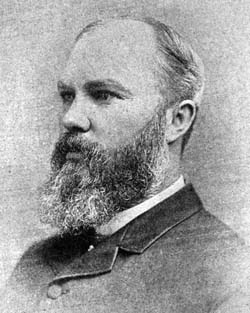
Charles Robinson Rockwood (May 14, 1860 - March 3, 1922) was a United States (U.S.) civil engineer, and entrepreneur. His career was in various states of the United States, particularly in the state of California. His most significant achievement was managing the construction of a canal system that transformed the Colorado Desert (in southern California into a verdant agricultural development known as the Imperial Valley. He is also infamous for directing modifications to that same canal system which led to the accidental creation of the Salton Sea in southern California. Early life Charles R. Rockwood grew up in the U.S., working on his parents' farm, near Flint, Michigan. Both parents were of Puritan descent. His mother was a direct descendant of John Robinson, one of the organizers of the Mayflower expedition which established the Plymouth Colony in Massachusetts prior to the founding of the U.S. From a very young age, Rockwood desired a good education. In 1878 he grad ... [...More Info...] [...Related Items...] OR: [Wikipedia] [Google] [Baidu] |
Salton Sink
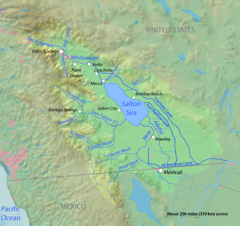
The Salton Sink is the low point of an endorheic basin, a closed drainage system with no outflows to other bodies of water, in the Colorado Desert sub-region of the Sonoran Desert. The sink falls within the larger Salton Trough and separates the Coachella Valley from the Imperial Valley, which are also segments of the Salton Trough. The lowest point of the sink is below sea level, and since 1906 the Salton Sea has filled the lowest portion of the sink to a water depth of up to . Geology The Salton Sink is the topographic low area within the Salton Trough, an active tectonic pull-apart basin. The Salton Trough is a result of crustal stretching and sinking by the combined actions of the San Andreas Fault and the East Pacific Rise. The Brawley seismic zone forms the southeast end of the basin and connects the San Andreas Fault system with the Imperial Fault Zone to the south. The Salton Buttes are rhyolite lava domes within the basin which were active 10,300 (± 1000) year ... [...More Info...] [...Related Items...] OR: [Wikipedia] [Google] [Baidu] |
Panic Of 1893
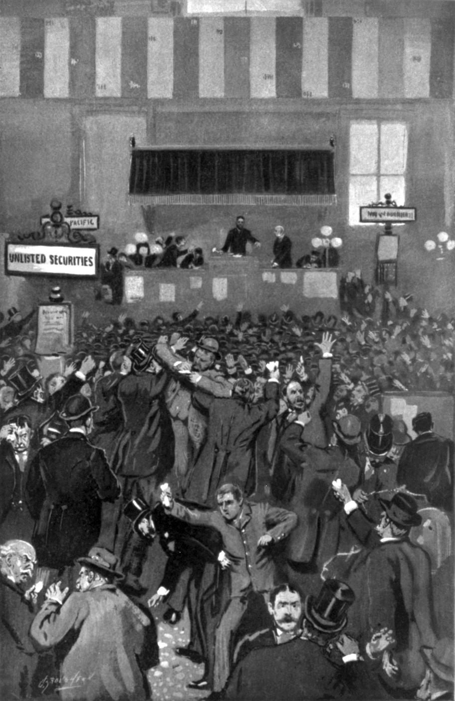
The Panic of 1893 was an economic depression in the United States that began in 1893 and ended in 1897. It deeply affected every sector of the economy, and produced political upheaval that led to the political realignment of 1896 and the presidency of William McKinley. Causes The Panic of 1893 has been traced to many causes, one of those points to Argentina; investment was encouraged by the Argentine agent bank, Baring Brothers. However, the 1890 wheat crop failure and a failed coup in Buenos Aires ended further investments. In addition, speculations in South African and Australian properties also collapsed. Because European investors were concerned that these problems might spread, they started a run on gold in the U.S. Treasury. Specie was considered more valuable than paper money; when people were uncertain about the future, they hoarded specie and rejected paper notes.Nelson, Scott Reynolds. 2012. A Nation of Deadbeats. New York: Alfred Knopf, p. 189. During th ... [...More Info...] [...Related Items...] OR: [Wikipedia] [Google] [Baidu] |
California Development Company
The California Development Company was formed in 1896 as a replacement for the defunct Colorado River Irrigation Company, which had been started a few years earlier for the purpose of planning an irrigation system for the lower Colorado Desert in California. The rich, silty soil of the area was found to be suitable for agriculture, but wells tapping groundwater brought up an inadequate supply of water for such a hot, arid region. The California Development Company took over the project of diverting Colorado River water into the Coachella and Imperial Valleys in the Salton Sink, a dry lake bed which today contains the Salton Sea, hoping to turn the desert green with agricultural fields. The first canals were being constructed by 1900 under the guidance of chief engineer George Chaffey. The Imperial Canal was completed within two years. It received water from the Colorado River, which, by the time it had flowed to the Imperial Valley, contained massive amounts of silt. The Imperial ... [...More Info...] [...Related Items...] OR: [Wikipedia] [Google] [Baidu] |
George Chaffey
George Chaffey (28 January 1848 – 1 March 1932) was a Canadian–born engineer who with his brother William developed large parts of Southern California, including what became the community of Etiwanda and cities of Ontario, and Upland. They undertook similar developments in Australia which became the city of Mildura, and the town of Renmark and Paringa. Biography Chaffey was born in Brockville, Ontario and attended Kingston Grammar School on Lake Ontario. Chaffey's family was of Scottish heritage. Although not interested in schoolroom instruction, he read engineering books from the local library. Chaffey left school at 13 years of age, was fascinated by the shipbuilding yard of his father and became an apprentice marine engineer in May 1862. By 1880 he was well established as a designer of ships for Great Lakes traffic. While visiting his father in California that year, however, he became interested in the Riverside irrigation colony. By 1886 he and his brother William had ... [...More Info...] [...Related Items...] OR: [Wikipedia] [Google] [Baidu] |
Alamo Canal
The Alamo Canal ( es, Canal del Álamo) was a long waterway that connected the Colorado River to the head of the Alamo River. The canal was constructed to provide irrigation to the Imperial Valley. A small portion of the canal was located in the United States but the majority of the canal was located in Mexico. The Alamo Canal is also known as the Imperial Canal. Planning and construction Historically, the Colorado River flowed to the Gulf of California, however in times of the spring floods the Colorado River would overflow its banks and also drain into the Alamo River. Flow from the Alamo River then drained to the Salton Sink area of the Colorado Desert. Such overflow had been observed in 1884, 1891, 1892, and 1895. In the mid- to late-Nineteenth Century several individuals, most notably O. M. Wozencraft, proposed irrigating the Salton Sink by diverting a controlled gravity-fed flow of the Colorado River through the existing dry Alamo River bed. The Alamo Canal was th ... [...More Info...] [...Related Items...] OR: [Wikipedia] [Google] [Baidu] |
Imperial Irrigation District
The Imperial Irrigation District (IID) is an irrigation district that serves the Imperial Valley in Southern California. Established under the State Water Code, the IID supplies roughly of Imperial Valley farmland with raw Colorado River water to support irrigation. In addition to providing irrigation, IID also supplies electrical energy to the valley. IID was formed in 1911 under the California Irrigation District Act to acquire the properties of the bankrupt California Development Company and its Mexican subsidiary. The IID was formed as a public agency, acquiring 13 mutual water companies in the valley which had developed and operated water distribution canals. The district is headquartered in Imperial, California. Prior to 1942, irrigation water delivered to the Imperial Valley was diverted from the Colorado River near Pilot Knob through Mexico to bypass the Imperial sand dunes west of Yuma and into the IID-operated Alamo Canal (also known as the Imperial Canal). Since ... [...More Info...] [...Related Items...] OR: [Wikipedia] [Google] [Baidu] |
Imperial Land Company
The Imperial Land Company was a land colonization company incorporated in California in March, 1900 for the purpose of encouraging settlement of the Imperial Valley thus providing customers for the California Development Company. Imperial Land was formed by George Chaffey and several other individuals associated with the California Development Company. The company laid out the California towns of Calexico, Heber, Imperial and Brawley, as well as Mexicali in Mexico Mexico ( Spanish: México), officially the United Mexican States, is a country in the southern portion of North America. It is bordered to the north by the United States; to the south and west by the Pacific Ocean; to the southeast by Guate ..., and gave its name to Imperial County. The Imperial Land Company was not a subsidiary of the California Development Company, but rather a separate corporate entity. See also * Alamo Canal * Imperial Irrigation District References {{Imperial County, California ... [...More Info...] [...Related Items...] OR: [Wikipedia] [Google] [Baidu] |
Salton Sea
The Salton Sea is a shallow, landlocked, highly saline body of water in Riverside and Imperial counties at the southern end of the U.S. state of California. It lies on the San Andreas Fault within the Salton Trough that stretches to the Gulf of California in Mexico. Over millions of years, the Colorado River has flowed into the Imperial Valley and deposited alluvium (soil), creating fertile farmland, building up the terrain, and constantly moving its main course and river delta. For thousands of years, the river has alternately flowed into the valley, or diverted around it, creating either a saline lake called Lake Cahuilla, or a dry desert basin, respectively. When the Colorado River flows into the valley, the lake level depends on river flows and the balance between inflow and evaporative loss. When the river diverts around the valley, the lake dries completely, as it did around 1580. Hundreds of archaeological sites have been found in this region, indicating possibl ... [...More Info...] [...Related Items...] OR: [Wikipedia] [Google] [Baidu] |


