|
Colin Archer Peninsula
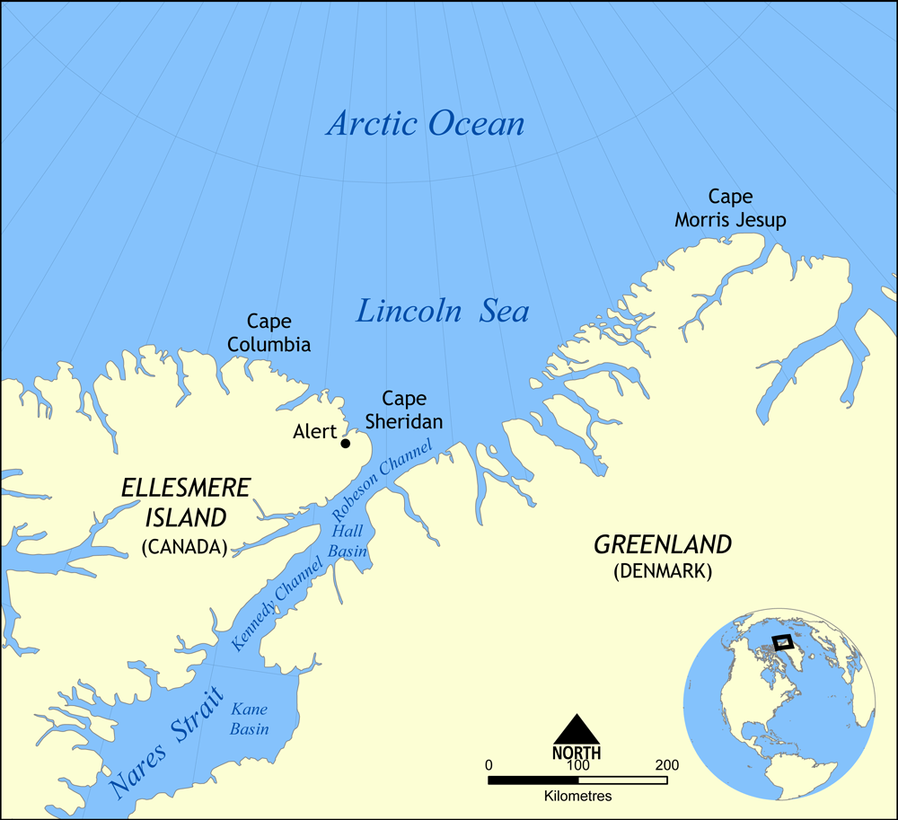
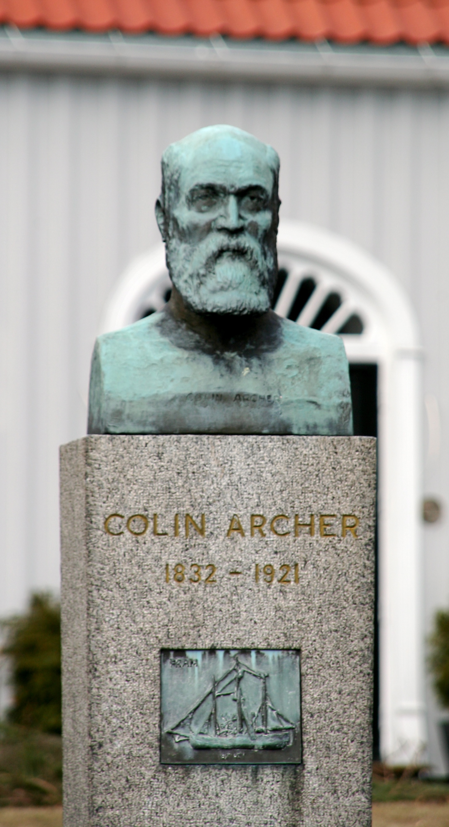
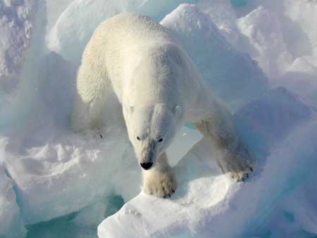
The Colin Archer Peninsula is located on the northwestern Devon Island, a part of the Qikiqtaaluk Region of the Canadian territory of Nunavut. It stretches eastward into Baffin Bay. It is named in honor of Colin Archer, naval architect and shipbuilder. Fauna and flora The peninsula is frequented by wintering bearded seals, ringed seals, polar bears, and walrus. Cape Vera, at the eastern end of the peninsula, is a breeding site for the northern fulmar The northern fulmar (''Fulmarus glacialis''), fulmar, or Arctic fulmar is a highly abundant seabird found primarily in subarctic regions of the North Atlantic and North Pacific oceans. There has been one confirmed sighting in the Southern Hemis .... References {{Peninsulas of Nunavut Peninsulas of Qikiqtaaluk Region Devon Island ... [...More Info...] [...Related Items...] OR: [Wikipedia] [Google] [Baidu] |
Devon Island
Devon Island ( iu, ᑕᓪᓗᕈᑎᑦ, ) is an island in Canada and the largest uninhabited island (no permanent residents) in the world. It is located in Baffin Bay, Qikiqtaaluk Region, Nunavut, Canada. It is one of the largest members of the Arctic Archipelago, the second-largest of the Queen Elizabeth Islands, Canada's sixth-largest island, and the 27th-largest island in the world. It has an area of (slightly smaller than Croatia). The bedrock is Precambrian gneiss and Paleozoic siltstones and shales. The highest point is the Devon Ice Cap at which is part of the Arctic Cordillera. Devon Island contains several small mountain ranges, such as the Treuter Mountains, Haddington Range and the Cunningham Mountains. The notable similarity of its surface to that of Mars has attracted interest from scientists. History and settlement Robert Bylot and William Baffin were the first Europeans to sight Devon Island in 1616. William Edward Parry charted its south coast in 1819 ... [...More Info...] [...Related Items...] OR: [Wikipedia] [Google] [Baidu] |
Qikiqtaaluk Region
The Qikiqtaaluk Region, Qikiqtani Region (Inuktitut syllabics: ᕿᑭᖅᑖᓗᒃ ) or Baffin Region is the easternmost, northernmost, and southernmost administrative region of Nunavut, Canada. Qikiqtaaluk is the traditional Inuktitut name for Baffin Island. Although the Qikiqtaaluk Region is the most commonly used name in official contexts, several notable public organizations, including Statistics Canada prefer the older term Baffin Region. With a population of 18,988 and an area of , it is the largest and most populated of the three regions. The region consists of Baffin Island, the Belcher Islands, Akimiski Island, Mansel Island, Prince Charles Island, Bylot Island, Devon Island, Baillie-Hamilton Island, Cornwallis Island, Bathurst Island, Amund Ringnes Island, Ellef Ringnes Island, Axel Heiberg Island, Ellesmere Island, the Melville Peninsula, the eastern part of Melville Island, and the northern parts of both Prince of Wales Island and Somerset Island, p ... [...More Info...] [...Related Items...] OR: [Wikipedia] [Google] [Baidu] |
Provinces And Territories Of Canada
Within the geographical areas of Canada, the ten provinces and three territories are sub-national administrative divisions under the jurisdiction of the Canadian Constitution. In the 1867 Canadian Confederation, three provinces of British North America—New Brunswick, Nova Scotia, and the Province of Canada (which upon Confederation was divided into Ontario and Quebec)—united to form a federation, becoming a fully independent country over the next century. Over its history, Canada's international borders have changed several times as it has added territories and provinces, making it the world's second-largest country by area. The major difference between a Canadian province and a territory is that provinces receive their power and authority from the '' Constitution Act, 1867'' (formerly called the '' British North America Act, 1867''), whereas territorial governments are creatures of statute with powers delegated to them by the Parliament of Canada. The powers flowing ... [...More Info...] [...Related Items...] OR: [Wikipedia] [Google] [Baidu] |
Nunavut
Nunavut ( , ; iu, ᓄᓇᕗᑦ , ; ) is the largest and northernmost territory of Canada. It was separated officially from the Northwest Territories on April 1, 1999, via the '' Nunavut Act'' and the '' Nunavut Land Claims Agreement Act'', which provided this territory to the Inuit for independent government. The boundaries had been drawn in 1993. The creation of Nunavut resulted in the first major change to Canada's political map in half a century since the province of Newfoundland was admitted in 1949. Nunavut comprises a major portion of Northern Canada and most of the Arctic Archipelago. Its vast territory makes it the fifth-largest country subdivision in the world, as well as North America's second-largest (after Greenland). The capital Iqaluit (formerly Frobisher Bay), on Baffin Island in the east, was chosen by a capital plebiscite in 1995. Other major communities include the regional centres of Rankin Inlet and Cambridge Bay. Nunavut also includes Elle ... [...More Info...] [...Related Items...] OR: [Wikipedia] [Google] [Baidu] |
Baffin Bay
Baffin Bay (Inuktitut: ''Saknirutiak Imanga''; kl, Avannaata Imaa; french: Baie de Baffin), located between Baffin Island and the west coast of Greenland, is defined by the International Hydrographic Organization as a marginal sea of the Arctic Ocean. It is sometimes considered a sea of the North Atlantic Ocean. It is connected to the Atlantic via Davis Strait and the Labrador Sea. The narrower Nares Strait connects Baffin Bay with the Arctic Ocean. The bay is not navigable most of the year because of the ice cover and high density of floating ice and icebergs in the open areas. However, a polynya of about , known as the North Water, opens in summer on the north near Smith Sound. Most of the aquatic life of the bay is concentrated near that region. Extent The International Hydrographic Organization defines the limits of Baffin Bay as follows: History The area of the bay has been inhabited since BC. Around AD 1200, the initial Dorset settlers were rep ... [...More Info...] [...Related Items...] OR: [Wikipedia] [Google] [Baidu] |
Colin Archer
Colin Archer (22 July 1832 – 8 February 1921) was a Norwegian naval architect and shipbuilder known for his seaworthy pilot and rescue boats and the larger sailing and polar ships. His most famous ship is the '' Fram'', used on both in Fridtjof Nansen's and Roald Amundsen's polar expeditions. He was born at Tollerodden in Larvik, Norway, where he also had his own house built and his boatyard. Early life Colin Archer was born in Larvik in southern Norway as the 12th of 13 children to parents who immigrated to Norway from Scotland in 1825. Before his career in naval architecture, he spent time as a farmer and administrator in Queensland, Australia with several of his brothers, including David who first arrived in Sydney in 1834. During his time as an administrator he was contracted to produce a map of the Fitzroy River. Their settlement is now known as Gracemere Homestead. In 1861, Archer returned to Larvik and undertook the study of practical and theoretical shipbui ... [...More Info...] [...Related Items...] OR: [Wikipedia] [Google] [Baidu] |
Bearded Seal
The bearded seal (''Erignathus barbatus''), also called the square flipper seal, is a medium-sized pinniped that is found in and near to the Arctic Ocean. It gets its generic name from two Greek words (''eri'' and ''gnathos'') that refer to its heavy jaw. The other part of its Linnaean name means bearded and refers to its most characteristic feature, the conspicuous and very abundant whiskers. When dry, these whiskers curl very elegantly, giving the bearded seal a "raffish" look. Bearded seals are the largest northern phocid. They have been found to weigh as much as with the females being the largest. However, male and female bearded seals are not very dimorphic. The only member of the genus ''Erignathus'', the bearded seal is unique in that it is an intermediate. Bearded seals belong to the family Phocidae which contains two subfamilies: Phocinae and Monachinae. The bearded seal possesses characteristics of both of these subfamilies. Fossils first described in 2002 indica ... [...More Info...] [...Related Items...] OR: [Wikipedia] [Google] [Baidu] |
Ringed Seal
The ringed seal (''Pusa hispida'') is an earless seal inhabiting the Arctic and sub-Arctic regions. The ringed seal is a relatively small seal, rarely greater than 1.5 m in length, with a distinctive patterning of dark spots surrounded by light gray rings, hence its common name. It is the most abundant and wide-ranging ice seal in the Northern Hemisphere, ranging throughout the Arctic Ocean, into the Bering Sea and Okhotsk Sea as far south as the northern coast of Japan in the Pacific and throughout the North Atlantic coasts of Greenland and Scandinavia as far south as Newfoundland, and including two freshwater subspecies in northern Europe. Ringed seals are one of the primary prey of polar bears and killer whales, and have long been a component of the diet of indigenous people of the Arctic. Ringed seals are the smallest and most abundant member of the seal family that live in the Arctic and Sub-Arctic regions. The average life span of a ringed seal is 40 years, with a d ... [...More Info...] [...Related Items...] OR: [Wikipedia] [Google] [Baidu] |
Polar Bear
The polar bear (''Ursus maritimus'') is a hypercarnivorous bear whose native range lies largely within the Arctic Circle, encompassing the Arctic Ocean, its surrounding seas and surrounding land masses. It is the largest extant bear species, as well as the largest extant land carnivore. A boar (adult male) weighs around , while a sow (adult female) is about half that size. Although it is the sister species of the brown bear, it has evolved to occupy a narrower ecological niche, with many body characteristics adapted for cold temperatures, for moving across snow, ice and open water, and for hunting seals, which make up most of its diet. Although most polar bears are born on land, they spend most of their time on the sea ice. Their scientific name means " maritime bear" and derives from this fact. Polar bears hunt their preferred food of seals from the edge of sea ice, often living off fat reserves when no sea ice is present. Because of their dependence on the sea ice, p ... [...More Info...] [...Related Items...] OR: [Wikipedia] [Google] [Baidu] |
Walrus
The walrus (''Odobenus rosmarus'') is a large flippered marine mammal with a discontinuous distribution about the North Pole in the Arctic Ocean and subarctic seas of the Northern Hemisphere. The walrus is the only living species in the family Odobenidae and genus ''Odobenus''. This species is subdivided into two subspecies: the Atlantic walrus (''O. r. rosmarus''), which lives in the Atlantic Ocean, and the Pacific walrus (''O. r. divergens''), which lives in the Pacific Ocean. Adult walrus are characterised by prominent tusks and whiskers, and their considerable bulk: adult males in the Pacific can weigh more than and, among pinnipeds, are exceeded in size only by the two species of elephant seals. Walruses live mostly in shallow waters above the continental shelves, spending significant amounts of their lives on the sea ice looking for benthic bivalve mollusks to eat. Walruses are relatively long-lived, social animals, and they are considered to be a " keyston ... [...More Info...] [...Related Items...] OR: [Wikipedia] [Google] [Baidu] |
Cape Vera
Cape Vera is an uninhabited headland on Devon Island, in the Qikiqtaaluk Region of Nunavut, Canada. Protruding off the island's northwestern Colin Archer Peninsula, it faces Jones Sound. Often, a polynya forms in the Cardigan Strait, a waterway that separates the cape from North Kent Island. Geography Cape Vera, approximately in size, with an elevation up to above sea level, is characterized by open sea, coastal cliffs, grassy to bare-rock cliff ledges, scree, and boulders. The rocky, marine shore, of limestone formation, is approximately in width. Fauna The cape is notable as a Canadian Important Bird Area (#NU053), an International Biological Program site (Region 9, #2-11) and a Key Migratory Bird Terrestrial Habitat site. Notable bird species include the northern fulmar and common eider. Colonial seabirds are also attracted to this remote, High Arctic site. History Archeological sites have been found near the base of the cape. References Cape Veraat Atlas of Canada ... [...More Info...] [...Related Items...] OR: [Wikipedia] [Google] [Baidu] |
Northern Fulmar
The northern fulmar (''Fulmarus glacialis''), fulmar, or Arctic fulmar is a highly abundant seabird found primarily in subarctic regions of the North Atlantic and North Pacific oceans. There has been one confirmed sighting in the Southern Hemisphere, with a single bird seen south of New Zealand. Fulmars come in one of two color morphs: a light one, with white head and body and gray wings and tail, and a dark one, which is uniformly gray. Though similar in appearance to gulls, fulmars are in fact members of the family Procellariidae, which include petrels and shearwaters. The northern fulmar and its sister species, the southern fulmar (), are the extant members of the genus . The fulmars are in turn a member of the order Procellariiformes, and they all share certain identifying features. First, they have nasal passages that attach to the upper bill called naricorns; however, nostrils on albatrosses are on the sides of the bill, as opposed to the rest of the order, includ ... [...More Info...] [...Related Items...] OR: [Wikipedia] [Google] [Baidu] |


_on_water.jpg)