|
Cloncurkney
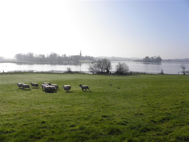
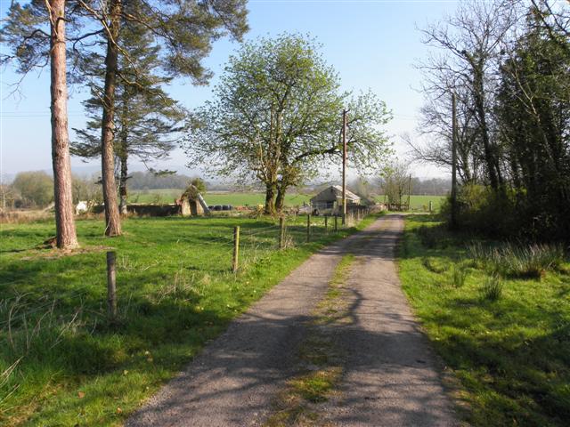
Cloncurkney () is a townland in the civil parish of Templeport, County Cavan, Ireland. It lies in the Roman Catholic parish of Templeport and barony of Tullyhaw. Geography Cloncurkney is bounded on the north by Mullaghmore, Templeport and Kildoagh townlands, on the west by Gowlagh South townland, on the south by Gortaclogher townland and on the east by Corboy Glebe townland. Its chief geographical features are Bellaboy Lough (Irish = Loch Béal Átha Buí = The Lake of the Entrance to the Yellow Ford), a stream, a wood and a spring well. Cloncurkney is traversed by minor roads and rural lanes. The townland covers 151 statute acres. History In medieval times the McGovern barony of Tullyhaw was divided into economic taxation areas called ballibetoes, from the Irish ''Baile Biataigh'' (Anglicized as 'Ballybetagh'), meaning 'A Provisioner's Town or Settlement'. The original purpose was to enable the farmer, who controlled the baile, to provide hospitality for those who needed it, s ... [...More Info...] [...Related Items...] OR: [Wikipedia] [Google] [Baidu] |
Mullaghmore, Templeport
Mullaghmore () is a townland in the civil parish of Templeport, County Cavan, Ireland. It lies in the Roman Catholic parish of Templeport and barony of Tullyhaw. Geography Mullaghmore is bounded on the north by Lakefield, Templeport townland, on the west by Owengallees and Gowlagh South townlands, on the south by Cloncurkney townland and on the east by Kildoagh and Kilsob townlands. Its chief geographical features are Bellaboy Lough (Irish = Loch Béal Átha Buí = The Lake of the Entrance to the Yellow Ford), Lakefield Lough, a stream, a wood and spring wells. Mullaghmore is traversed by the L1037 road, minor roads and rural lanes. The townland covers 205 statute acres. History In medieval times the McGovern barony of Tullyhaw was divided into economic taxation areas called ballibetoes, from the Irish ''Baile Biataigh'' (Anglicized as 'Ballybetagh'), meaning 'A Provisioner's Town or Settlement'. The original purpose was to enable the farmer, who controlled the baile, to pr ... [...More Info...] [...Related Items...] OR: [Wikipedia] [Google] [Baidu] |
Templeport
Templeport () is a civil parish in the barony of Tullyhaw, County Cavan, Ireland. The chief towns in the parish are Bawnboy and Ballymagauran. The large Roman Catholic parish of Templeport containing 42,172 statute acres was split up in the 18th & 19th centuries into three new parishes, Templeport, Corlough and Glangevlin. Etymology The name of Templeport parish derives from the old townland of Templeport (which is now shortened to Port) which is the anglicisation of the Gaelic 'Teampall An Phoirt' ("The Church of the Port or Bank or Landing-Place"). The church referred to is the old church on St. Mogue's Island in the middle of Port Lake. This church fell into disuse in medieval times and a new church was built on the opposite shore of the lake. It was forfeited to Queen Elizabeth in 1590 and started use as a Protestant church in about 1610. It is very unlikely that the island church ever served as the parish church because there was only one boat available and it would have ... [...More Info...] [...Related Items...] OR: [Wikipedia] [Google] [Baidu] |
Gowlagh South
Gowlagh South () is a townland in the civil parish of Templeport, County Cavan, Ireland. It lies in the Roman Catholic parish of Templeport and barony of Tullyhaw. Geography Gowlagh South is bounded on the north by Mullaghmore, Templeport townland, on the west by Owengallees townland, on the south by Boley, Templeport and Gortaclogher townlands and on the east by Cloncurkney townland. Its chief geographical features are the River Blackwater, County Cavan, bogs and spring wells. It is called Gowlagh South to distinguish it from Gowlagh North townland at the foot of Slieve Rushen mountain, with which it has no connection. Gowlagh South is traversed by the L1037 road, minor public roads and rural lanes. The townland covers 165 statute acres. History In medieval times the McGovern barony of Tullyhaw was divided into economic taxation areas called ballibetoes, from the Irish ''Baile Biataigh'' (Anglicized as 'Ballybetagh'), meaning 'A Provisioner's Town or Settlement'. The origi ... [...More Info...] [...Related Items...] OR: [Wikipedia] [Google] [Baidu] |
Gortaclogher
Gortaclogher () is a townland in the civil parish of Templeport, County Cavan, Ireland. It lies in the Roman Catholic parish of Templeport and barony of Tullyhaw. Geography Gortaclogher is bounded on the north by Gowlagh South, Cloncurkney and Corboy Glebe townlands, on the west by Boley and Killyran townlands, on the south by Killywillin townland and on the east by Killymoriarty and Ray, Templeport townlands. Its chief geographical features are Templeport Lough, Killywillin Lough, Gortaclogher Lough, the River Blackwater, County Cavan, a wood and dug wells. Gortaclogher is traversed by minor roads, rural lanes and the disused Cavan and Leitrim Railway. The townland covers 253 statute acres. History In medieval times the McGovern barony of Tullyhaw was divided into economic taxation areas called ballibetoes, from the Irish ''Baile Biataigh'' (Anglicized as 'Ballybetagh'), meaning 'A Provisioner's Town or Settlement'. The original purpose was to enable the farmer, who c ... [...More Info...] [...Related Items...] OR: [Wikipedia] [Google] [Baidu] |
Corboy Glebe
Corboy Glebe () is a townland in the civil parish of Templeport, County Cavan, Ireland. It lies in the Roman Catholic parish of Templeport and barony of Tullyhaw. Geography Corboy Glebe is bounded on the north by Kildoagh townland, on the west by Cloncurkney townland, on the south by Gortaclogher townland and on the east by Port, Templeport townland. Its chief geographical features are Bellaboy Lough (Irish = Loch Béal Átha Buí = The Lake of the Entrance to the Yellow Ford), Templeport Lough, a wood, streams and a sandpit. There are also three exceptional specimen trees in the townland - a Sycamore ( Acer pseudoplatanus); a Beech (Fagus Sylvatica); and a Lime (Tilia × europaea). Corboy Glebe is traversed by minor public roads and rural lanes. The townland covers 145 statute acres. History The 1609 Baronial Map depicts the townland as ''Corboy''. The 1652 Commonwealth Survey spells the name as ''Corboy''. The 1665 Down Survey map depicts it as ''Cockboy''. William Petty's ... [...More Info...] [...Related Items...] OR: [Wikipedia] [Google] [Baidu] |
Townland
A townland ( ga, baile fearainn; Ulster-Scots: ''toonlann'') is a small geographical division of land, historically and currently used in Ireland and in the Western Isles in Scotland, typically covering . The townland system is of Gaelic origin, pre-dating the Norman invasion, and most have names of Irish origin. However, some townland names and boundaries come from Norman manors, plantation divisions, or later creations of the Ordnance Survey.Connolly, S. J., ''The Oxford Companion to Irish History, page 577. Oxford University Press, 2002. ''Maxwell, Ian, ''How to Trace Your Irish Ancestors'', page 16. howtobooks, 2009. The total number of inhabited townlands in Ireland was 60,679 in 1911. The total number recognised by the Irish Place Names database as of 2014 was 61,098, including uninhabited townlands, mainly small islands. Background In Ireland a townland is generally the smallest administrative division of land, though a few large townlands are further divided into ... [...More Info...] [...Related Items...] OR: [Wikipedia] [Google] [Baidu] |
James VI And I
James VI and I (James Charles Stuart; 19 June 1566 – 27 March 1625) was King of Scotland as James VI from 24 July 1567 and King of England and Ireland as James I from the union of the Scottish and English crowns on 24 March 1603 until his death in 1625. The kingdoms of Scotland and England were individual sovereign states, with their own parliaments, judiciaries, and laws, though both were ruled by James in personal union. James was the son of Mary, Queen of Scots, and a great-great-grandson of Henry VII, King of England and Lord of Ireland, and thus a potential successor to all three thrones. He succeeded to the Scottish throne at the age of thirteen months, after his mother was compelled to abdicate in his favour. Four different regents governed during his minority, which ended officially in 1578, though he did not gain full control of his government until 1583. In 1603, he succeeded Elizabeth I, the last Tudor monarch of England and Ireland, who died childless. H ... [...More Info...] [...Related Items...] OR: [Wikipedia] [Google] [Baidu] |
Census Of Ireland, 1901
A census is the procedure of systematically acquiring, recording and calculating information about the members of a given population. This term is used mostly in connection with national population and housing censuses; other common censuses include censuses of agriculture, traditional culture, business, supplies, and traffic censuses. The United Nations (UN) defines the essential features of population and housing censuses as "individual enumeration, universality within a defined territory, simultaneity and defined periodicity", and recommends that population censuses be taken at least every ten years. UN recommendations also cover census topics to be collected, official definitions, classifications and other useful information to co-ordinate international practices. The UN's Food and Agriculture Organization (FAO), in turn, defines the census of agriculture as "a statistical operation for collecting, processing and disseminating data on the structure of agriculture, covering th ... [...More Info...] [...Related Items...] OR: [Wikipedia] [Google] [Baidu] |
Griffith's Valuation
Griffith's Valuation was a boundary and land valuation survey of Ireland completed in 1868. Griffith's background Richard John Griffith started to value land in Scotland, where he spent two years in 1806-1807 valuing terrain through the examination of its soils. He used 'the Scotch system of valuation' and it was a modified version of this that he introduced into Ireland when he assumed the position of Commissioner of Valuation. Tasks in Ireland In 1825 Griffith was appointed by the British Government to carry out a boundary survey of Ireland. He was to mark the boundaries of every county, barony, civil parish and townland in preparation for the first Ordnance Survey. He completed the boundary work in 1844. He was also called upon to assist in the preparation of a Parliamentary bill to provide for the general valuation of Ireland. This Act was passed in 1826, and he was appointed Commissioner of Valuation in 1827, but did not start work until 1830 when the new 6" maps, became ... [...More Info...] [...Related Items...] OR: [Wikipedia] [Google] [Baidu] |
Morley Saunders
Morley Saunders (1671-1737) was an Irish politician, barrister and landowner. He followed in his father's footsteps by becoming a member of the Irish House of Commons and Prime Serjeant-at-law. He is mainly remembered today as the builder of Saunders' Grove, the family home in Wicklow. The town of Swanlinbar, County Cavan, where he was a leading landowner, is partially named after his father. Early life He was born in County Wexford, third son of Robert Saunders (died 1708), a wealthy lawyer and member of Parliament, who was Prime Serjeant 1703-1708; nothing seems to be known about his mother. Morley's grandfather, Colonel Robert Saunders, had been Governor of Kinsale during the Interregnum, but retained his substantial landholdings in Wexford after the Restoration of Charles II. Morley, unlike his grandfather, was described as a "passionate Tory". He had two elder brothers, Walter and Joseph, who died without issue. His father acquired substantial leasehold lands in County ... [...More Info...] [...Related Items...] OR: [Wikipedia] [Google] [Baidu] |
Viscount Massereene
Viscount Massereene is a title in the Peerage of Ireland. It was created in 1660, along with the subsidiary title of Baron Loughneagh. From 1665 to 1816 the Skeffington Baronetcy of Fisherwick was attached to the viscountcy and from 1756 to 1816 the Viscounts also held the title of Earl of Massereene. Since 1843 the peerages are united with titles of Viscount Ferrard, of Oriel and Baron Oriel, both in the Peerage of Ireland, and Baron Oriel, in the Peerage of the United Kingdom. The Viscount also holds the subsidiary titles of ''Baron Loughneagh'' (1660) and ''Baron Oriel'' (1790) in the Peerage of Ireland and ''Baron Oriel'' (1821) in the Peerage of the United Kingdom. As Baron Oriel, he sat in the House of Lords until 1999. The family seat was Chilham Castle, near Canterbury, Kent. Viscount Massereene John Clotworthy was a prominent Anglo-Irish politician during the Civil War. In 1660 he was created Baron Loughneagh (after Lough Neagh) and Viscount Massereene in the Pe ... [...More Info...] [...Related Items...] OR: [Wikipedia] [Google] [Baidu] |
Charles II Of England
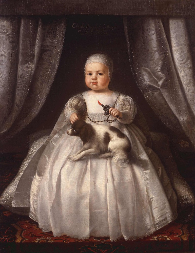
Charles II (29 May 1630 – 6 February 1685) was King of Scotland from 1649 until 1651, and King of England, Scotland and Ireland from the 1660 Restoration of the monarchy until his death in 1685. Charles II was the eldest surviving child of Charles I of England, Scotland and Ireland and Henrietta Maria of France. After Charles I's execution at Whitehall on 30 January 1649, at the climax of the English Civil War, the Parliament of Scotland proclaimed Charles II king on 5 February 1649. But England entered the period known as the English Interregnum or the English Commonwealth, and the country was a de facto republic led by Oliver Cromwell. Cromwell defeated Charles II at the Battle of Worcester on 3 September 1651, and Charles fled to mainland Europe. Cromwell became virtual dictator of England, Scotland and Ireland. Charles spent the next nine years in exile in France, the Dutch Republic and the Spanish Netherlands. The political crisis that followed Cromwell's deat ... [...More Info...] [...Related Items...] OR: [Wikipedia] [Google] [Baidu] |


