|
Clariden
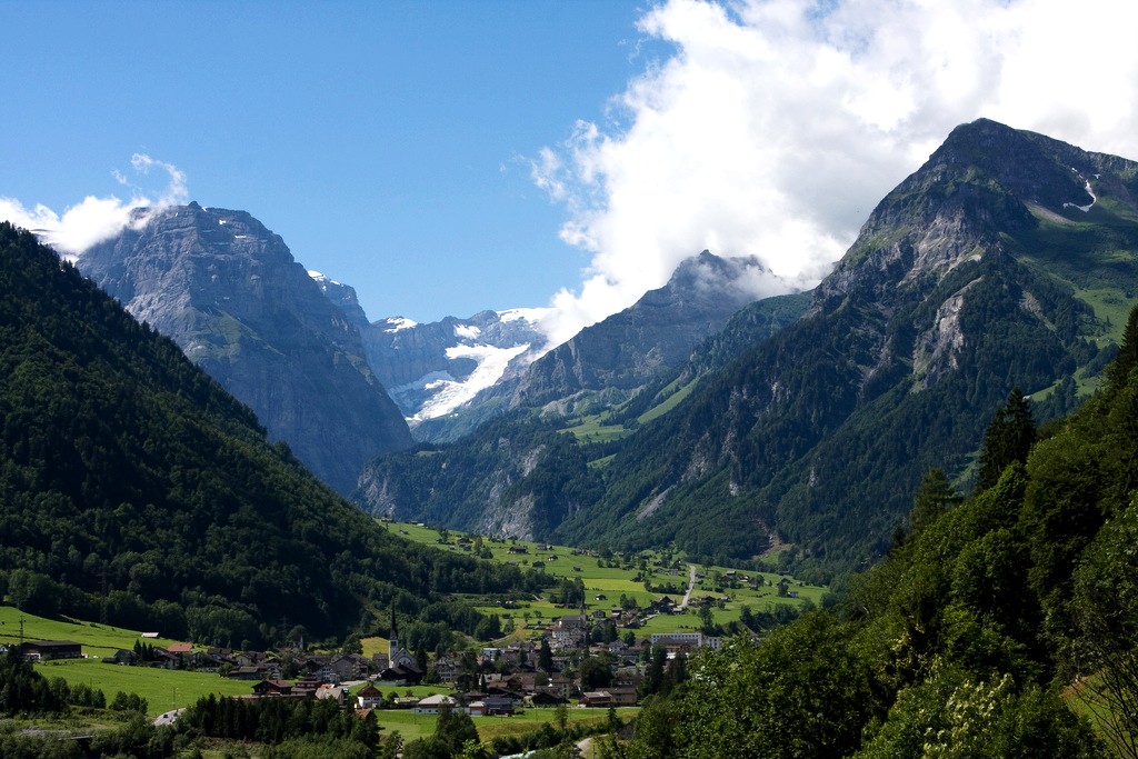
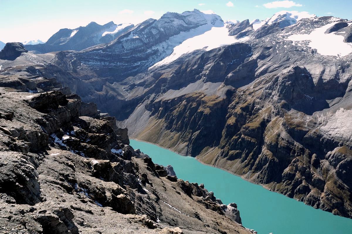
The Clariden is a mountain in the Glarus Alps, located at an elevation of between the Swiss cantons of Uri and Glarus. While on the north the Clariden overlooks the high Klausen Pass, the south side is covered by large glaciers. The Hüfifirn on the west is drained by the Chärstelenbach, a tributary of the Reuss that eventually flows into Lake Lucerne. The Claridenfirn on the east is drained by the Linth that eventually flows into Lake Zürich. The mountain lies in the municipalities of Silenen and Spiringen, in the canton of Schwyz, and Glarus Süd, in the canton of Glarus. The nearest settlements are the villages of Unterschächen Unterschächen is a municipality in the canton of Uri in Switzerland, situated in the upper Schächental. Geography Unterschächen has an area, , of . Of this area, 35.6% is used for agricultural purposes, while 9.4% is forested. Of the rest ... to the north-west, and Linthal to the north-east, which lie at each end of the Klausen Pass. ... [...More Info...] [...Related Items...] OR: [Wikipedia] [Google] [Baidu] |
Linthal, Glarus
Linthal is a village and former municipality in the municipality of Glarus Süd and canton of Glarus in Switzerland. The village lies near the head of the valley of the Linth river, and at the foot of the Klausen Pass into the canton of Uri. It is the terminus of the railway line that traverses the length of Glarus. History Linthal is first mentioned in 1289 as ''Lintal''. In 1879, Linthal was connected to the Swiss railway network by the opening of the Swiss Northeastern Railway line from Weesen. The road over the Klausen Pass was built between 1895 and 1900. Construction of the Linth–Limmern Power Stations, Linth–Limmern hydro-electric power scheme, in the mountains above Linthal, commenced in 1957, and was fully operational by 1968. In 2011, the municipality of Linthal was merged into the new municipality of Glarus Süd. Geography The village Linthal lies at the head of the valley of the Linth river, at an altitude of approximately . It is surrounded by mountains, incl ... [...More Info...] [...Related Items...] OR: [Wikipedia] [Google] [Baidu] |
Glarus Alps
The Glarus Alps () are a mountain range in central Switzerland. They are bordered by the Uri Alps and the Schwyz Alps to the west, the Lepontine Alps to the south, the Appenzell Alps to the northeast. The eastern part of the Glarus Alps contains a major thrust fault that was declared a geologic UNESCO World Heritage Site (the Swiss Tectonic Arena Sardona). The Glarus Alps extend well beyond the canton of Glarus, including parts of the cantons of Canton of Uri, Uri, Graubünden, and Canton of St Gallen, St Gallen. Conversely, not all the mountains in the canton of Glarus are part of the Glarus Alps, with those to the north of the Urner Boden and to the west of the valley of the river Linth considered to be part of the Schwyz Alps. Geography The main chain of the Glarus Alps can be divided into six minor groups, separated from each other by passes, the lowest of which exceeds 7,500 ft. The westernmost of these is the Crispalt, a rugged range including many peaks of nearly e ... [...More Info...] [...Related Items...] OR: [Wikipedia] [Google] [Baidu] |
List Of Mountains Of The Alps Above 3000 M
This page tabulates only the most prominent mountains of the Alps, selected for having a topographic prominence of ''at least'' , all exceeding in height. Although the list contains 537 summits, some significant alpine mountains are necessarily excluded for failing to meet the stringent prominence criterion. The list of these most prominent mountains is continued down to 2500 m elevation at List of prominent mountains of the Alps (2500–2999 m) and down to 2000 m elevation on List of prominent mountains of the Alps (2000–2499 m). All such mountains are located in France, Italy, Switzerland, Liechtenstein, Austria, Germany or Slovenia, even in some lower regions. Together, these lists include all 44 List of Alpine peaks by prominence, ultra-prominent peaks of the Alps, with 19 ultras over 3000m on this page. For a definitive list of all 82 of the highest peaks of the Alps, as identified by the International Climbing and Mountaineering Federation (UIAA), and often referred to ... [...More Info...] [...Related Items...] OR: [Wikipedia] [Google] [Baidu] |
Linth
The Linth (pronounced "lint") is a Switzerland, Swiss river that rises near the Linthal, Glarus, village of Linthal in the mountains of the cantons of Switzerland, canton of canton of Glarus, Glarus, and eventually flows into the Obersee (Zürichsee), Obersee section of Lake Zurich. It is about in length. The water power of the Linth was a main factor in the creation of the textile industry of the canton Glarus, and is today used to drive the Linth–Limmern Power Stations, Linth–Limmern power stations in its upper reaches. The river and its upper valley forms the boundary between the mountain ranges of the Glarus Alps, to its east and south, and the Schwyzer Alps, to its west. In its lower part, in the Linth plain (), the Linth Canal forms the boundary between the cantons of Glarus and canton of St. Gallen, St. Gallen and part of the boundary between the cantons of St. Gallen and canton of Schwyz, Schwyz. The river lends its name to the former canton of Linth (1798–1803) ... [...More Info...] [...Related Items...] OR: [Wikipedia] [Google] [Baidu] |
Mountains Of Switzerland
This article contains a sortable table of many of the major mountains and hills of Switzerland. The table only includes those summits that have a topographic prominence of at least above other points, and ranks them by height and prominence. Therefore it only includes mountains that might generally be regarded as 'independent' and covers most of the country, even lower areas. For a fuller list of mountains, including subsidiary points, see List of mountains of Switzerland above 3000 m and List of mountains of Switzerland above 3600 m. For a list of just the most isolated mountains, see List of most isolated mountains of Switzerland. Along with the lakes, mountains constitute a major natural feature of Switzerland with most of the cantons having summits exceeding and three of them having summits exceeding . The two main mountain ranges are the Alps (south and east) and the Jura (north and west), separated by the Swiss Plateau which also includes a large number of hills. T ... [...More Info...] [...Related Items...] OR: [Wikipedia] [Google] [Baidu] |
Glarus Süd
Glarus Süd is a municipality in the Switzerland, Swiss canton of Glarus. It comprises the upper Linth valley, and the entire Sernf valley, and includes the villages of Betschwanden, Braunwald, Glarus, Braunwald, Diesbach, Glarus, Diesbach, Elm, Switzerland, Elm, Engi, Switzerland, Engi, Haslen, Glarus, Haslen, Hätzingen, Leuggelbach, Linthal, Glarus, Linthal, Luchsingen, Matt, Switzerland, Matt, Mitlödi, Nidfurn, Rüti, Glarus, Rüti, Schwanden, Glarus, Schwanden, Schwändi, near Schwanden, Glarus, Schwändi and Sool, Glarus, Sool. Glarus Süd is one of three municipalities of the canton of Glarus, the others being Glarus and Glarus Nord. History The municipality of Glarus Süd was created on 1 January 2011, incorporating the former municipalities of Betschwanden, Braunwald, Glarus, Braunwald, Elm, Glarus, Elm, Engi, Glarus, Engi, Haslen, Glarus, Haslen, Linthal, Glarus, Linthal, Luchsingen, Matt, Glarus, Matt, Mitlödi, Rüti, Glarus, Rüti, Schwanden, Glarus, Schwanden, Sc ... [...More Info...] [...Related Items...] OR: [Wikipedia] [Google] [Baidu] |
Chärstelenbach
The Maderanertal is an Alpine valley of the canton of Uri in Central Switzerland. It is drained by the Chärstelenbach, a stream that is a right tributary of the Reuss at Amsteg. The highest mountain in the Maderanertal is the Oberalpstock with a height of 3,328 metres above sea level. Other important summits are the Schärhorn, the Clariden, the Düssi, the Gross Windgällen, the Gross Ruchen, Piz Giuv and the Bristen. The Maderanertal include two large lateral valleys: the Etzlital and the Brunnital, drained by the Etzlibach and the Brunnibach respectively (both left tributaries). The upper valley is heavily glaciated, the largest glacier being the Hüfi Glacier. The Maderanertal belongs to the municipality of Silenen. The main locality is Bristen, at an elevation of 770 metres. The locality of Golzern, located near the Golzernsee at 1,400 metres, is a popular destination in the valley. It can be reached by a cable car. References *Swisstopo Swisstopo is the official name ... [...More Info...] [...Related Items...] OR: [Wikipedia] [Google] [Baidu] |
Klausen Pass
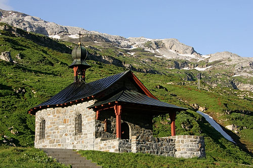
Klausen Pass (German: ''Klausenpass''; elevation: ) is a high mountain pass in the Swiss Alps connecting Altdorf in the canton of Uri with Linthal in the canton of Glarus. Somewhat unusually, the boundary between the two cantons does not lie at the summit of the pass, but some down the slope towards Linthal, with the summit being in Uri. The Klausen Pass is crossed by a paved road, which has a length, between Altdorf and Linthal, of . The road approaches the summit from Altdorf via the Schächen Valley communities of Bürglen, Spiringen and Unterschächen, and descends to Linthal via the Urnerboden. The road is normally closed between October and May, due to the high snowfall on the pass. During the open period, a PostBus Switzerland service crosses the pass several times a day, connecting Fluelen station, on the Gotthard railway and Lake Lucerne, with Linthal station, the terminus of the railway line through Glarus. At the top of the pass is a historic chapel, the '' ... [...More Info...] [...Related Items...] OR: [Wikipedia] [Google] [Baidu] |
Alpine Three-thousanders
Three-thousanders are mountains with a height of between , but less than above sea level. Similar terms are commonly used for mountains of other height brackets e. g. four-thousanders or eight-thousanders. In Britain, the term refers to mountains above . Climatological significance In temperate latitudes three-thousanders play an important role, because even in summer they lie below the zero degree line for weeks. Thus the chains of three-thousanders always form important climatic divides and support glaciation - in the Alps the contour is roughly the general limit of the "nival step"; only a few glaciated mountains are under (the Dachstein, the easternmost glaciated mountain in the Alps, is, at , not a three-thousander). In the Mediterranean, however, the three-thousanders remain free of ice and, in the tropics, they are almost insignificant from a climatic perspective; here the snow line lies at around to , and in the dry continental areas (Trans-Himalayas, Andes) it ... [...More Info...] [...Related Items...] OR: [Wikipedia] [Google] [Baidu] |
Mountains Of The Canton Of Uri
A mountain is an elevated portion of the Earth's crust, generally with steep sides that show significant exposed bedrock. Although definitions vary, a mountain may differ from a plateau in having a limited summit area, and is usually higher than a hill, typically rising at least above the surrounding land. A few mountains are isolated summits, but most occur in mountain ranges. Mountains are formed through tectonic forces, erosion, or volcanism, which act on time scales of up to tens of millions of years. Once mountain building ceases, mountains are slowly leveled through the action of weathering, through slumping and other forms of mass wasting, as well as through erosion by rivers and glaciers. High elevations on mountains produce colder climates than at sea level at similar latitude. These colder climates strongly affect the ecosystems of mountains: different elevations have different plants and animals. Because of the less hospitable terrain and climate, mountains te ... [...More Info...] [...Related Items...] OR: [Wikipedia] [Google] [Baidu] |
Unterschächen
Unterschächen is a municipality in the canton of Uri in Switzerland, situated in the upper Schächental. Geography Unterschächen has an area, , of . Of this area, 35.6% is used for agricultural purposes, while 9.4% is forested. Of the rest of the land, 0.8% is settled (buildings or roads) and the remainder (54.2%) is non-productive (rivers, glaciers or mountains). , 5.6% of the total land area was heavily forested, while 2.1% is covered in small trees and shrubbery. Of the agricultural land, 4.3% is used for orchards or vine crops and 31.3% is used for alpine pastures. Of the settled areas, 0.3% is covered with buildings, and 0.5% is transportation infrastructure. Of the unproductive areas, 0.5% is unproductive flowing water (rivers), 40.4% is too rocky for vegetation, and 13.2% is other unproductive land. [...More Info...] [...Related Items...] OR: [Wikipedia] [Google] [Baidu] |


