|
Ciénaga Grande De Santa Marta
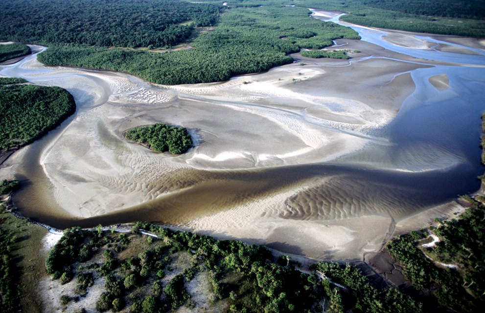
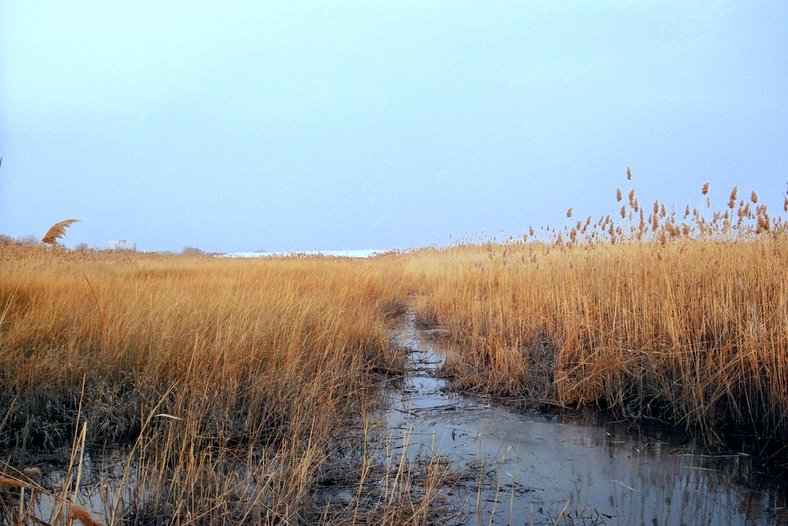
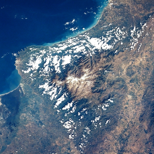
The Ciénaga Grande de Santa Marta ( Spanish for Large Marsh of Saint Martha) is the largest of the swampy marshes located in Colombia between the Magdalena River and the Sierra Nevada de Santa Marta. It has an area of and belongs to the outer delta system of the Madgalena River. It is separated from the Caribbean Sea by a narrow, sandy artificial spit built in the 1950s,http://www.unesco.org/mabdb/br/brdir/directory/biores.asp?mode=all&code=COL+04 UNESCO on which is situated coastal route 90 from Barranquilla to Santa Marta. The marsh's large lagoon is connected to the Caribbean Sea via a narrow strait A strait is a water body connecting two seas or water basins. The surface water is, for the most part, at the same elevation on both sides and flows through the strait in both directions, even though the topography generally constricts the ... (the La Barra channel) located between the town of Pueblo Viejo and the city of Ciénaga. References External links UNES ... [...More Info...] [...Related Items...] OR: [Wikipedia] [Google] [Baidu] |
Ramsar Convention
The Ramsar Convention on Wetlands of International Importance Especially as Waterfowl Habitat is an international treaty for the conservation and sustainable use of Ramsar site, Ramsar sites (wetlands). It is also known as the Convention on Wetlands. It is named after the city of Ramsar, Mazandaran, Ramsar in Iran, where the convention was signed in 1971. Every three years, representatives of the contracting parties meet as the Ramsar Convention#Conference of the Contracting Parties, Conference of the Contracting Parties (COP), the policy-making organ of the wetland conservation, convention which adopts decisions (site designations, resolutions and recommendations) to administer the work of the convention and improve the way in which the parties are able to implement its objectives. In 2022, COP15 was held in Montreal, Canada. List of wetlands of international importance The list of wetlands of international importance included 2,531 Ramsar site, Ramsar sites in Februa ... [...More Info...] [...Related Items...] OR: [Wikipedia] [Google] [Baidu] |
Lagoon
A lagoon is a shallow body of water separated from a larger body of water by a narrow landform, such as reefs, barrier islands, barrier peninsulas, or isthmuses. Lagoons are commonly divided into ''coastal lagoons'' (or ''barrier lagoons'') and ''atoll lagoons''. They have also been identified as occurring on mixed-sand and gravel coastlines. There is an overlap between bodies of water classified as coastal lagoons and bodies of water classified as Estuary, estuaries. Lagoons are common coastal features around many parts of the world. Definition and terminology Lagoons are shallow, often elongated bodies of water separated from a larger body of water by a shallow or exposed shoal, reef, coral reef, or similar feature. Some authorities include fresh water bodies in the definition of "lagoon", while others explicitly restrict "lagoon" to bodies of water with some degree of salinity. The distinction between "lagoon" and "estuary" also varies between authorities. Richard A. Davis J ... [...More Info...] [...Related Items...] OR: [Wikipedia] [Google] [Baidu] |
Biosphere Reserves Of Colombia
The biosphere (), also called the ecosphere (), is the worldwide sum of all ecosystems. It can also be termed the zone of life on the Earth. The biosphere (which is technically a spherical shell) is virtually a closed system with regard to matter,"Biosphere" in ''The Columbia Encyclopedia'', 6th ed. (2004) Columbia University Press. with minimal inputs and outputs. Regarding , it is an open system, with capturing |
Geography Of Magdalena Department
Geography (from Ancient Greek ; combining 'Earth' and 'write', literally 'Earth writing') is the study of the lands, features, inhabitants, and phenomena of Earth. Geography is an all-encompassing discipline that seeks an understanding of Earth and its human and natural complexities—not merely where objects are, but also how they have changed and come to be. While geography is specific to Earth, many concepts can be applied more broadly to other celestial bodies in the field of planetary science. Geography has been called "a bridge between natural science and social science disciplines." Origins of many of the concepts in geography can be traced to Greek Eratosthenes of Cyrene, who may have coined the term "geographia" (). The first recorded use of the word γεωγραφία was as the title of a book by Greek scholar Claudius Ptolemy (100 – 170 AD). This work created the so-called "Ptolemaic tradition" of geography, which included "Ptolemaic cartographic theory." ... [...More Info...] [...Related Items...] OR: [Wikipedia] [Google] [Baidu] |
Wetlands Of Colombia
A wetland is a distinct semi-aquatic ecosystem whose groundcovers are flooded or saturated in water, either permanently, for years or decades, or only seasonally. Flooding results in oxygen-poor (anoxic) processes taking place, especially in the soils. Wetlands form a transitional zone between waterbodies and dry lands, and are different from other terrestrial or aquatic ecosystems due to their vegetation's roots having adapted to oxygen-poor waterlogged soils. They are considered among the most biologically diverse of all ecosystems, serving as habitats to a wide range of aquatic and semi-aquatic plants and animals, with often improved water quality due to plant removal of excess nutrients such as nitrates and phosphorus. Wetlands exist on every continent, except Antarctica. The water in wetlands is either freshwater, brackish or saltwater. The main types of wetland are defined based on the dominant plants and the source of the water. For example, ''marshes'' are wetlands d ... [...More Info...] [...Related Items...] OR: [Wikipedia] [Google] [Baidu] |
Marshes Of Colombia
In ecology, a marsh is a wetland that is dominated by herbaceous plants rather than by woody plants.Keddy, P.A. 2010. Wetland Ecology: Principles and Conservation (2nd edition). Cambridge University Press, Cambridge, UK. 497 p More in general, the word can be used for any low-lying and seasonally waterlogged terrain. In Europe and in agricultural literature low-lying meadows that require draining and embanked polderlands are also referred to as marshes or marshland. Marshes can often be found at the edges of lakes and streams, where they form a transition between the aquatic and terrestrial ecosystems. They are often dominated by grasses, rushes or reeds. If woody plants are present they tend to be low-growing shrubs, and the marsh is sometimes called a carr. This form of vegetation is what differentiates marshes from other types of wetland such as swamps, which are dominated by trees, and mires, which are wetlands that have accumulated deposits of acidic peat. Marshes pro ... [...More Info...] [...Related Items...] OR: [Wikipedia] [Google] [Baidu] |
Palafitos
Stilt houses (also called pile dwellings or lake dwellings) are houses raised on stilts (or piles) over the surface of the soil or a body of water. Stilt houses are built primarily as a protection against flooding; they also keep out vermin. The shady space under the house can be used for work or storage. Stilt houses are commonly found in Southeast Asia, Oceania, Central America, the Caribbean, northern parts of South America, the Comoros, Madagascar, Mauritius, Seychelles, Sri Lanka and the Maldives. Africa Stilted granaries are also a common feature in West Africa, e.g., in the Malinke language regions of Mali and Guinea. Americas Stilt houses were also built by Amerindians in pre-Columbian times. ''Palafitos'' are especially widespread along the banks of the tropical river valleys of South America, notably the Amazon and Orinoco river systems. Stilt houses were such a prevalent feature along the shores of Lake Maracaibo that Amerigo Vespucci was inspired to name the region ... [...More Info...] [...Related Items...] OR: [Wikipedia] [Google] [Baidu] |
Ciénaga, Magdalena
Ciénaga () is a municipality and city in the Magdalena Department, Colombia, the second largest population center in this department, after the city of Santa Marta. It is situated at 11° 00' North, 74° 15' West, between the Sierra Nevada de Santa Marta, the Caribbean Sea and the Ciénaga Grande de Santa Marta marsh in northern Colombia. The city is situated in the northern part of Magdalena, 35 km from Santa Marta. According to estimations in 2020, the city had a population of 110,303. The mean annual temperature is 34 °C. History Prior to the arrival of the Spanish colonizers the area was vastly populated by Chimila indigenous people and a village known as ''Pongueyca''. The foundation of Ciénaga has always been a matter of dispute due to many different historical theories and the lack of documented sources. It is believed to be founded first in what is now a small village known as Pueblo Viejo and the site of a former Chimila tribe. In 1529 monk Fray Tomás Ort ... [...More Info...] [...Related Items...] OR: [Wikipedia] [Google] [Baidu] |
Pueblo Viejo, Magdalena
Puebloviejo is a town and municipality of the Colombian Department of Magdalena. It was founded in 1526 by friar Tomas Ortíz. It was erected a municipality on May 3, 1929. The town lies on a natural thin division between the Ciénaga Grande de Santa Marta marshes and the Caribbean Sea The Caribbean Sea is a sea of the Atlantic Ocean, North Atlantic Ocean in the tropics of the Western Hemisphere, located south of the Gulf of Mexico and southwest of the Sargasso Sea. It is bounded by the Greater Antilles to the north from Cuba .... Politics Administrative divisions Corregimientos: * Bocas de Aracataca * Islas del Rosario * Palmira * Tasajera * Palos * Prietos References External links *Pueblo Viajo official website*Gobernacion del Maagdalena - Municipios: Puebloviejo Municipalities of Magdalena Department Populated places established in 1526 {{Magdalena-geo-stub ... [...More Info...] [...Related Items...] OR: [Wikipedia] [Google] [Baidu] |
Strait
A strait is a water body connecting two seas or water basins. The surface water is, for the most part, at the same elevation on both sides and flows through the strait in both directions, even though the topography generally constricts the flow somewhat. In some straits there is a dominant directional current. Most commonly, the strait is a narrowing channel that lies between two land masses. Straits are loci for sediment accumulation, with sand-size deposits usually occurring on the two strait exits, forming subaqueous fans or deltas. Some straits are not navigable because, for example, they are too narrow or too shallow, or because of an unnavigable reef or archipelago. Terminology The terms '' channel'', ''pass'', or ''passage'' can be synonymous and used interchangeably with ''strait'', although each is sometimes differentiated with varying senses. In Scotland, '' firth'' or ''Kyle'' are also sometimes used as synonyms for strait. Many straits are economically impor ... [...More Info...] [...Related Items...] OR: [Wikipedia] [Google] [Baidu] |
Santa Marta
Santa Marta (), officially the Distrito Turístico, Cultural e Histórico de Santa Marta (), is a port List of cities in Colombia, city on the coast of the Caribbean Sea in northern Colombia. It is the capital of Magdalena Department and the fourth-largest urban city of the Caribbean Region of Colombia, after Barranquilla, Cartagena, Colombia, Cartagena, and Soledad, Atlantico, Soledad. Founded on July 29, 1525, by the Spanish conqueror Rodrigo de Bastidas, it was one of the first Spanish settlements in Colombia, its oldest surviving city, and second-oldest in South America. This city is situated on a bay by the same name and as such, it is a prime tourist destination in the Caribbean region. History Pre-Columbian times Before the arrival of Europeans, the South American continent was inhabited by a number of Indigenous peoples of the Americas, indigenous groups. Due to a combination of tropical weather, significant rainfall, and the destruction and misrepresentation of man ... [...More Info...] [...Related Items...] OR: [Wikipedia] [Google] [Baidu] |
Rio Magdalena Mundung
Rio or Río is the Portuguese and Spanish word for "river". The word also exists in Italian, but is largely obsolete and used in a poetical or literary context to mean "stream". Rio, RIO or Río may also refer to: Places United States * Rio, Florida, a census-designated place * Rio, Georgia, an unincorporated community * Rio, Illinois, a village * Rio, a location in Deerpark, New York * Rio, Virginia, a community * Rio, West Virginia, a village * Rio, Wisconsin, a village * El Río, Las Piedras, Puerto Rico, a barrio Elsewhere * Rio de Janeiro, Brazil, often referred to as simply Rio * Rio, Italy, a municipality on the island of Elba in Tuscany * Rio, Greece, a community in suburban Patras People * Rio (given name) * Rio (surname) * Tina Yuzuki (born 1986), also known as Rio, Japanese AV idol Arts and entertainment Films * ''Rio'' (1939 film), starring Basil Rathbone * ''Rio'' (franchise), a film series and related media * ''Rio'' (2011 film), an animated film from 20t ... [...More Info...] [...Related Items...] OR: [Wikipedia] [Google] [Baidu] |


