|
Citlaltépetl, Veracruz
Citlaltépetl (Nahuatl: "star mountain") is a municipality in the Mexican state of Veracruz, located northwest of the state capital of Xalapa and south of the city of Tampico, Tamaulipas. Geography The municipality of Citlaltépetl is located in central Veracruz at an altitude between , with the south being higher in elevation. It borders the municipalities of Ozuluama to the northwest, Tantima to the northeast and east, Tancoco to the southeast, and Chontla to the west. The municipality covers an area of and comprises 0.1% of the state's area. The majority of the land in Citlaltépetl (65.55%) is pastureland. The dominant soils in the municipality are vertisols and regosols. Citlaltépetl's climate is warm with rain falling mostly in the summer. Average temperatures in the municipality range between , and average annual precipitation ranges between . History In pre-Hispanic times the area was inhabited by the Huastec people, and the Mexica also kept a military presenc ... [...More Info...] [...Related Items...] OR: [Wikipedia] [Google] [Baidu] |
Municipalities Of Mexico
Municipalities () are the administrative divisions under the List of states of Mexico, states of Mexico according to the Constitution of Mexico, constitution. Municipalities are considered as the second-level administrative divisions by the Federal government of Mexico, federal government. However, some state regulations have designed intrastate regions to administer their own municipalities. Municipalities are further divided into Localities of Mexico, localities in the structural hierarchy of administrative divisions of Mexico. As of December 2024, there are 2,462 municipalities in Mexico. In Mexico, municipalities should not be confused with cities (). Cities are Localities of Mexico, locality-level divisions that are administered by the municipality. Although some List of cities in Mexico, larger cities are consolidated with its own municipality and form a single level of governance. In addition, the 16 Boroughs of Mexico City, boroughs of Mexico City are considered municipali ... [...More Info...] [...Related Items...] OR: [Wikipedia] [Google] [Baidu] |
Tampico
Tampico is a city and port in the southeastern part of the Mexican state of Tamaulipas. It is located on the north bank of the Pánuco River, about inland from the Gulf of Mexico, and directly north of the state of Veracruz. Tampico is the fifth-largest city in Tamaulipas, with a population of 314,418 in the city proper and 929,174 in the metropolitan area. During the period of Mexico's first oil boom in the early 20th century, the city was the "chief oil-exporting port of the Americas" and the second-busiest in the world, yielding great profits that were invested in the city's famous architecture, often compared to that of Venice and New Orleans.Dave Graham, "Crime-ridden state poses acid test for Mexican oil reform" ''Reuters,'' 25 June 2014, acces ... [...More Info...] [...Related Items...] OR: [Wikipedia] [Google] [Baidu] |
Afro-Mexicans
Afro-Mexicans (), also known as Black Mexicans (), are Mexicans of total or predominantly Sub-Saharan African ancestry. As a single population, Afro-Mexicans include individuals descended from both free and enslaved Africans who arrived to Mexico during the colonial era, as well as post-independence migrants. This population includes Afro-descended people from neighboring English, French, and Spanish-speaking countries of the Caribbean and Central America, descendants of enslaved Africans in Mexico and those from the Deep South during Slavery in the United States, and to a lesser extent recent migrants directly from Africa. Today, there are localized communities in Mexico with significant although not predominant African ancestry. These are mostly concentrated in specific communities, including populations in the states of Oaxaca, Michoacán, Guerrero, and Veracruz. Throughout the century following the Spanish conquest of the Aztec Empire of 1519, a significant number of Af ... [...More Info...] [...Related Items...] OR: [Wikipedia] [Google] [Baidu] |
Indigenous Peoples Of Mexico
Indigenous peoples of Mexico (), Native Mexicans () or Mexican Native Americans (), are those who are part of communities that trace their roots back to populations and communities that existed in what is now Mexico before the arrival of Europeans. The number of Indigenous Mexicans is defined through the second article of the Constitution of Mexico, Mexican Constitution. The Censo General de Población y Vivienda, Mexican census does not classify individuals by race, using the Culture, cultural-Ethnic group, ethnicity of Indigenous communities that preserve their Indigenous languages, traditions, beliefs, and cultures. As a result, the count of Indigenous peoples in Mexico does not include those of mixed Indigenous and European heritage who have not preserved their Indigenous cultural practices. Genetic studies have found that most Mexicans are of partial Indigenous heritage. According to the National Indigenous Institute (INI) and the National Institute of Indigenous Peoples (C ... [...More Info...] [...Related Items...] OR: [Wikipedia] [Google] [Baidu] |
Spanish Language
Spanish () or Castilian () is a Romance languages, Romance language of the Indo-European languages, Indo-European language family that evolved from the Vulgar Latin spoken on the Iberian Peninsula of Europe. Today, it is a world language, global language with 483 million native speakers, mainly in the Americas and Spain, and about 558 million speakers total, including second-language speakers. Spanish is the official language of List of countries where Spanish is an official language, 20 countries, as well as one of the Official languages of the United Nations, six official languages of the United Nations. Spanish is the world's list of languages by number of native speakers, second-most spoken native language after Mandarin Chinese; the world's list of languages by total number of speakers, fourth-most spoken language overall after English language, English, Mandarin Chinese, and Hindustani language, Hindustani (Hindi-Urdu); and the world's most widely spoken Romance language ... [...More Info...] [...Related Items...] OR: [Wikipedia] [Google] [Baidu] |
Mexica
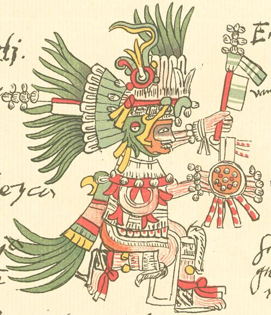
The Mexica (Nahuatl: ; singular ) are a Nahuatl-speaking people of the Valley of Mexico who were the rulers of the Triple Alliance, more commonly referred to as the Aztec Empire. The Mexica established Tenochtitlan, a settlement on an island in Lake Texcoco, in 1325. A dissident group in Tenochtitlan separated and founded the settlement of Tlatelolco with its own dynastic lineage. In 1521, their empire was overthrown by an alliance of Spanish conquistadors and rival indigenous nations, most prominently the Tlaxcaltecs. The Mexica were subjugated under the Spanish Empire for 300 years, until the Mexican War of Independence overthrew Spanish dominion in 1821. Today, descendants of the Mexica and other Aztecs are among the Nahua people of Mexico. Since 1810, the broader term ''Aztec'' is often used to describe the Mexica. When a distinction is made, Mexica are one (dominant) group within the Aztecs. Names The ''Mexica'' are eponymous of the place name Mexico (''Mēxihco ... [...More Info...] [...Related Items...] OR: [Wikipedia] [Google] [Baidu] |
Huastec People
The Huastec or Téenek (contraction of ''Te' Inik'', "people from here"; also known as Huaxtec, Wastek or Huastecos) are an Indigenous people of Mexico, living in the La Huasteca region including the Mexican state, states of Hidalgo (Mexico), Hidalgo, Veracruz, San Luis Potosí and Tamaulipas concentrated along the route of the Pánuco River and along the coast of the Gulf of Mexico. There are approximately 66,000 Huastec speakers today, of which two-thirds are in San Luis Potosí and one-third in Veracruz, although their population was probably much higher, as much as half a million, when the Spanish arrived in 1529. The ancient Huastec civilization is one of the pre-Columbian Mesoamerican cultures. Judging from archaeological remains, they are thought to date back to approximately the 10th century BCE, although their most productive period of civilization is usually considered to be the Mesoamerican chronology, Postclassic era between the fall of Teotihuacan and the rise of the ... [...More Info...] [...Related Items...] OR: [Wikipedia] [Google] [Baidu] |
Servicio Meteorológico Nacional (Mexico)
The Servicio Meteorológico Nacional (SMN; "National Meteorological Service") is Mexico's national weather organization. It collects data and issues forecasts, advisories, and warnings for the entire country. History A presidential decree founded El Observatorio Meteorológico y Astrónomico de México (The Meteorological and Astronomical Observatory of Mexico) on February 6, 1877 as part of the Geographic Exploring of the National Territory commission. By 1880, it became an independent agency located at Chapultepec Castle, then encompassing six observatories. In 1901, the Servicio Meteorologia Nacional was formed with 31 sections for each state and 18 independent observatories which reported back to the central office in Tacubaya via telegraph. It joined the World Meteorological Organization in 1947. By 1980, the organization included 72 observatories, of which eight launched weather balloons and radiosondes, and five radars serviced the country. In 1989, it became a subagency ... [...More Info...] [...Related Items...] OR: [Wikipedia] [Google] [Baidu] |
Regosol
A Regosol in the World Reference Base for Soil Resources (WRB) is very weakly developed mineral soil in Soil consolidation, unconsolidated materials. Regosols are extensive in erosion, eroding lands, in particular in arid and semi-arid areas and in mountain regions. Internationally, Regosols correlate with soil taxa that are marked by incipient soil formation such as Entisols in the USDA soil taxonomy or Rudosols and possibly some Tenosols in the Australian Soil Classification. The group of Regosols is a taxonomic rest group containing all soils that could not be accommodated in any of the other groups. Excluded from the Regosols are weakly developed soils that classify as Leptosols (very shallow soils), Arenosols (sandy soils) or Fluvisols (in recent alluvial sediment, deposits). These soils have AC-soil profile, profiles. Profile development is minimal as a consequence of young age and/or slow soil formation. Land use and management of Regosols vary widely. Some Regosols are us ... [...More Info...] [...Related Items...] OR: [Wikipedia] [Google] [Baidu] |
Vertisol
A vertisol is a Soil Order in the USDA soil taxonomy and a Reference Soil Group in the World Reference Base for Soil Resources (WRB). It is also defined in many other soil classification systems. In the Australian Soil Classification it is called vertosol. The natural vegetation of vertisols is grassland, savanna, or grassy woodland. The heavy texture and unstable behaviour of the soil makes it difficult for many tree species to grow, and forest is uncommon. Composition Vertisols have a high content of expansive clay minerals (many of them belonging to the montmorillonites) that form deep cracks in drier seasons or years. In a phenomenon known as argillipedoturbation, alternate shrinking and swelling causes ''self-ploughing'', where the soil material consistently mixes itself, causing some vertisols to have an extremely deep A horizon and no B horizon. (A soil with no B horizon is called an ''A/C soil''). This heaving of the underlying material to the surface often create ... [...More Info...] [...Related Items...] OR: [Wikipedia] [Google] [Baidu] |
Chontla
Chontla is a municipality in the Mexican state of Veracruz. It is located in the northern part of the state, about 220 km from the state capital Xalapa. It has a surface of 361.09 km2. It is located at . Geography Borders Chontla is delimited to the west by Tantoyuca, to the south by Ixcatepec and Tepetzintla, and to the east by Citlaltépetl and Ozuluama. Settlements Weather The weather in Chontla is warm all year with rains in summer. Products It produces principally maize, beans and chili pepper Chili peppers, also spelled chile or chilli ( ), are varieties of fruit#Berries, berry-fruit plants from the genus ''Capsicum'', which are members of the nightshade family Solanaceae, cultivated for their pungency. They are used as a spice to ...s. Events In November the celebration in honor of Santa Catarina takes place. References External links *Official website {{Veracruz Municipalities of Veracruz ... [...More Info...] [...Related Items...] OR: [Wikipedia] [Google] [Baidu] |
Tancoco
Tancoco is a municipality in the Mexican state of Veracruz, about 210 km from the state capital Xalapa. It has a surface of 145.59 km2. It is located at . On the occasion of the development reached by the camp petroleum of Zacamixtle, the municipal head-board was moved to this place. For Decree of December 26, 1929 it returns to the village of Tancoco, its category of Municipality. Geography The municipality of Tancoco is delimited to the north by Tamalín and Naranjos Amatlán, to the east by Tamiahua, to the south by Cerro Azul and Tepetzintla, to the west by Chontla. It is watered by small creeks, which end in Tamiahua's lagoon. The weather in Tancoco is warm and wet all year with rains in summer and autumn. Agriculture It produces principally maize, beans and orange fruit The orange, also called sweet orange to distinguish it from the bitter orange (''Citrus × aurantium''), is the fruit of a tree in the family Rutaceae. Botanically, this is the hybrid ''Cit ... [...More Info...] [...Related Items...] OR: [Wikipedia] [Google] [Baidu] |


