|
Chulu East
Chulu, also known as Chulu East, is a mountain in Nepal. Description Chulu is a glaciated summit in the Nepalese Himalayas. It is situated north of Manang in Gandaki Province. Precipitation runoff from the mountain's slopes drains into tributaries of the Marshyangdi River. Topographic relief is significant as the west face rises 1,300 metres (4,265 ft) in . The Annapurna Circuit traverses the valley below the west slopes of this peak. This peak along with outliers Chulu West (6,419 m) and Chulu Far East (6,060 m) are on the list of permitted trekking peaks. The first ascent of the summit was made on July 23, 1955, by Heinz Steinmetz, Harald Biller, Fritz Lobbichler, and Jürgen Wellenkamp. The first ascent of Chulu West was made on October 23, 1952, by Kinji Imanishi, Kazuhiko Hayashi, Sasuke Nakao, Jiro Taguchi, Masataka Takagi, and Sakuta Takebushi. [...More Info...] [...Related Items...] OR: [Wikipedia] [Google] [Baidu] |
Nemjung
Nemjung is a mountain in the Himalayas of Nepal. It is located approximately northwest of the Nepalese capital Kathmandu and about northwest of the eight-thousander, Manaslu. Its summit has an elevation of . This mountain was once called Himlung Himal. In the 1990s, a few years after the first ascent in 1983, when demarcating the border with China, the Nepalese government changed the traditional name of Himlung Himal to another mountain about 4 kilometres north. The peak between them is properly called Himjung. It is the highest among the three peaks of Nemjung (east), Himjung (centre) and Himlung Himal range (west). Nemjung was first climbed via the east ridge on October 27, 1983 by a Joint expedition from Nepal and the Hirosaki University Alpine Club led by Junji Kurotaki. English synopsis page 9. Previous attempts had been made in 1963 by a Japanese expedition from the Den Den Kyushu Alpine Club led by Hisachika Zengyou; in 1994 by a British expedition; and in 2009 by a Frenc ... [...More Info...] [...Related Items...] OR: [Wikipedia] [Google] [Baidu] |
Köppen Climate Classification
The Köppen climate classification divides Earth climates into five main climate groups, with each group being divided based on patterns of seasonal precipitation and temperature. The five main groups are ''A'' (tropical), ''B'' (arid), ''C'' (temperate), ''D'' (continental), and ''E'' (polar). Each group and subgroup is represented by a letter. All climates are assigned a main group (the first letter). All climates except for those in the ''E'' group are assigned a seasonal precipitation subgroup (the second letter). For example, ''Af'' indicates a tropical rainforest climate. The system assigns a temperature subgroup for all groups other than those in the ''A'' group, indicated by the third letter for climates in ''B'', ''C'', ''D'', and the second letter for climates in ''E''. Other examples include: ''Cfb'' indicating an oceanic climate with warm summers as indicated by the ending ''b.'', while ''Dwb'' indicates a semi-Monsoon continental climate, monsoonal continental climate ... [...More Info...] [...Related Items...] OR: [Wikipedia] [Google] [Baidu] |
Mountains Of The Himalayas
A mountain is an elevated portion of the Earth's crust, generally with steep sides that show significant exposed bedrock. Although definitions vary, a mountain may differ from a plateau in having a limited summit area, and is usually higher than a hill, typically rising at least above the surrounding land. A few mountains are isolated summits, but most occur in mountain ranges. Mountains are formed through tectonic forces, erosion, or volcanism, which act on time scales of up to tens of millions of years. Once mountain building ceases, mountains are slowly leveled through the action of weathering, through slumping and other forms of mass wasting, as well as through erosion by rivers and glaciers. High elevations on mountains produce colder climates than at sea level at similar latitude. These colder climates strongly affect the ecosystems of mountains: different elevations have different plants and animals. Because of the less hospitable terrain and climate, mountains te ... [...More Info...] [...Related Items...] OR: [Wikipedia] [Google] [Baidu] |
Mountains Of The Gandaki Province
A mountain is an elevated portion of the Earth's crust, generally with steep sides that show significant exposed bedrock. Although definitions vary, a mountain may differ from a plateau in having a limited summit area, and is usually higher than a hill, typically rising at least above the surrounding land. A few mountains are isolated summits, but most occur in mountain ranges. Mountains are formed through tectonic forces, erosion, or volcanism, which act on time scales of up to tens of millions of years. Once mountain building ceases, mountains are slowly leveled through the action of weathering, through slumping and other forms of mass wasting, as well as through erosion by rivers and glaciers. High elevations on mountains produce colder climates than at sea level at similar latitude. These colder climates strongly affect the ecosystems of mountains: different elevations have different plants and animals. Because of the less hospitable terrain and climate, mountains ... [...More Info...] [...Related Items...] OR: [Wikipedia] [Google] [Baidu] |
Annapurna
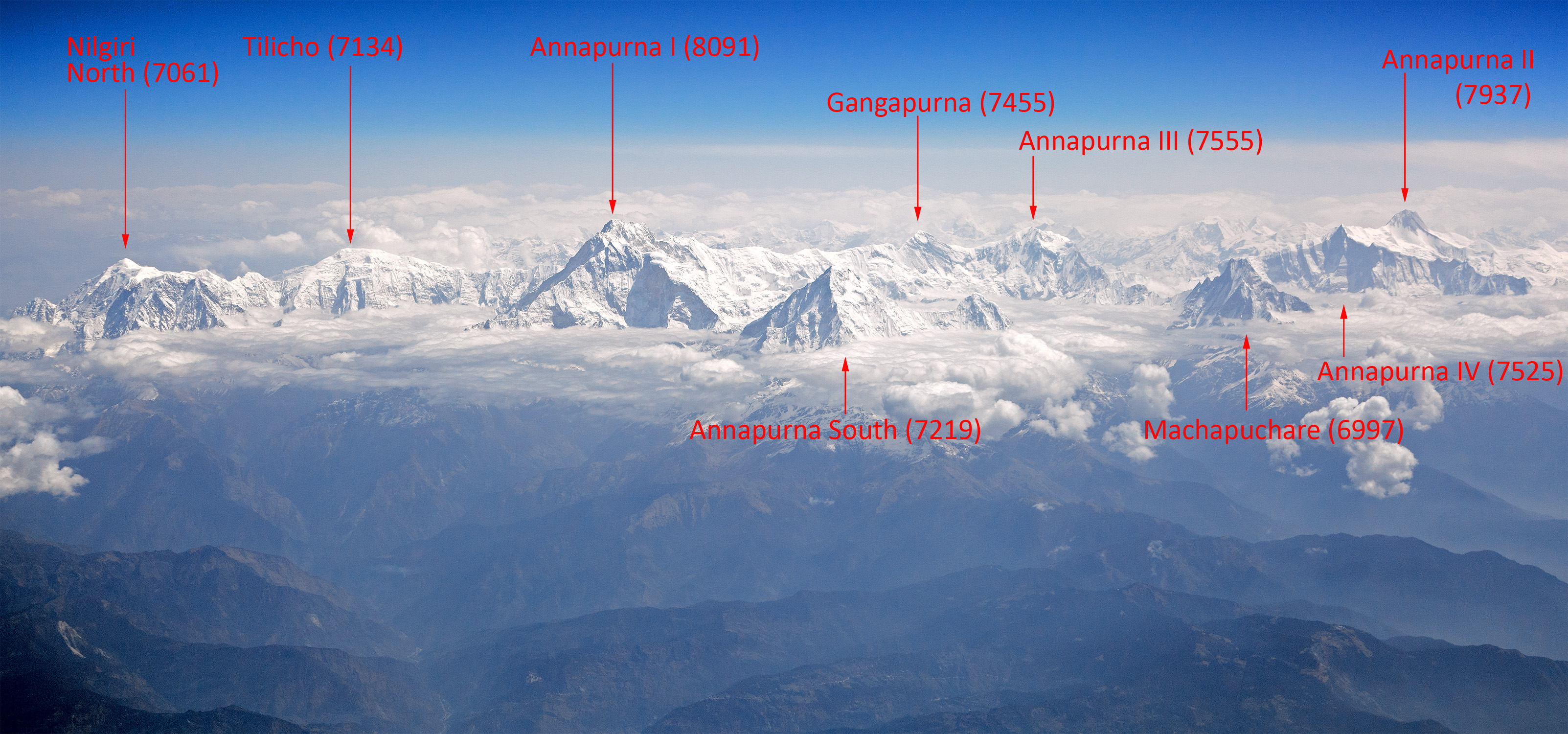
Annapurna (; ) is a mountain situated in the Annapurna mountain range of Gandaki Province, north-central Nepal. It is the 10th highest mountain in the world at above sea level and is well known for the difficulty and danger involved in its ascent. Maurice Herzog led a French expedition to its summit through the north face in 1950, making it the first eight-thousander to be successfully climbed. The entire massif and surrounding area are protected within the Annapurna Conservation Area, the first and largest conservation area in Nepal. The Annapurna Conservation Area is home to several world-class treks, including Annapurna Sanctuary and Annapurna Circuit. For decades, Annapurna I held the highest fatality-to-summit rate of all principal eight-thousander summits; it has, however, seen great climbing successes in recent years, with the fatality rate falling from 32% to under 20% from 2012 to 2022. This figure places it just under the most recent fatality rate estimates fo ... [...More Info...] [...Related Items...] OR: [Wikipedia] [Google] [Baidu] |
Purbung
Purbung (also Putrung) is a mountain in the Himalayas of Nepal in the province of Gandaki Pradesh. Located in the Damodar range it has a height of 6,465 m.''Purbung Overview'' Nepal Himal Peak Profile, Retrieved May 6, 2025. Jost Kobusch and Nicolas Scheidtweiler made the first successful ascent on November 30, 2021. See also *Geology of the Himalayas
The geology of the Himalayas is a record of the most dramatic and visible creations of the immense mountain range formed by plate tectonic f ...
[...More Info...] [...Related Items...] OR: [Wikipedia] [Google] [Baidu] |
Geology Of The Himalayas
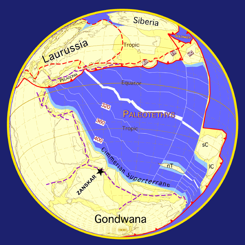
The geology of the Himalayas is a record of the most dramatic and visible creations of the immense mountain range formed by plate tectonic forces and sculpted by weathering and erosion. The Himalayas, which stretch over 2400 km between the Namcha Barwa syntaxis at the eastern end of the mountain range and the Nanga Parbat syntaxis at the western end, are the result of an ongoing orogeny — the collision of the continental crust of two tectonic plates, namely, the Indian Plate thrusting into the Eurasian Plate. The Himalaya-Tibet region supplies fresh water for more than one-fifth of the world population, and accounts for a quarter of the global sedimentary budget. Topographically, the belt has many superlatives: the highest rate of uplift (nearly 10 mm/year at Nanga Parbat), the highest relief (8848 m at Mt. Everest Chomolangma), among the highest erosion rates at 2–12 mm/yr, the source of some of the greatest rivers and the highest concentratio ... [...More Info...] [...Related Items...] OR: [Wikipedia] [Google] [Baidu] |
Orographic Lift
Orographic lift occurs when an air mass is forced from a low elevation to a higher elevation as it moves over rising terrain. As the air mass gains altitude it quickly cools down adiabatically, which can raise the relative humidity to 100% and create clouds and, under the right conditions, precipitation. Orographic lifting can have a number of effects, including precipitation, rain shadowing, leeward winds, and associated clouds. Precipitation Precipitation induced by orographic lift occurs in many places throughout the world. Examples include: * The Mogollon Rim in central Arizona * The western slope of the Sierra Nevada range in California. * The western slope of the Wasatch Range in Utah. Specifically the Little and Big Cottonwood Canyons. * The mountains near Baja California North – specifically La Bocana to Laguna Hanson. * The windward slopes of Khasi and Jayantia Hills (see Mawsynram) in the state of Meghalaya in India. * The Western Highlands of Yemen, which rece ... [...More Info...] [...Related Items...] OR: [Wikipedia] [Google] [Baidu] |
Tundra Climate
The tundra climate is a polar climate sub-type located in high latitudes and high mountains. It is classified as ET according to the Köppen climate classification. It is a climate which at least one month has an average temperature high enough to melt snow (), but no month with an average temperature in excess of . If the climate occurs at high elevations, it is known as alpine climate. Despite the potential diversity of climates in the ''ET'' category involving precipitation, extreme temperatures, and relative wet and dry seasons, this category is rarely subdivided. Rainfall and snowfall are generally slight due to the low vapor pressure of water in the chilly atmosphere, but as a rule potential evapotranspiration is extremely low, allowing soggy terrain of swamps and bogs even in places that get precipitation typical of deserts of lower and middle latitudes. The amount of native tundra biomass depends more on the local temperature than the amount of precipitation. Tundra ... [...More Info...] [...Related Items...] OR: [Wikipedia] [Google] [Baidu] |
Trekking Peak
The term "Trekking Peak" is a commonly misunderstood colloquial term which may refer to a variety of types of peaks in the Himalayas, Himalayan Region. The term is most often associated with Group "B" NMA Climbing Peaks classified by the Nepal Mountaineering Association or easier. Some may use the term "Trekking Peak" to solely describe peaks requiring little to no technical climbing experience. Others may use the term to describe all mountains regulated by the Nepal Mountaineering Association including Group "A" NMA Expedition Peaks which may require considerable difficulties and technical climbing skill. Because of the term's loose classification of peaks it can be misleading, encompassing peaks of significant varying difficulties. There is less general consensus for the use of the term in this context of Group "A" NMA Expedition Peaks. Nepal Fifteen peaks classified as Group "B" NMA Climbing Peaks are generally considered "trekking" peaks. These peaks do not exceed in elevatio ... [...More Info...] [...Related Items...] OR: [Wikipedia] [Google] [Baidu] |
Himalayas
The Himalayas, or Himalaya ( ), is a mountain range in Asia, separating the plains of the Indian subcontinent from the Tibetan Plateau. The range has some of the Earth's highest peaks, including the highest, Mount Everest. More than list of highest mountains on Earth, 100 peaks exceeding elevations of above sea level lie in the Himalayas. The Himalayas abut on or cross territories of Himalayan states, six countries: Nepal, China, Pakistan, Bhutan, India and Afghanistan. The sovereignty of the range in the Kashmir region is disputed among India, Pakistan, and China. The Himalayan range is bordered on the northwest by the Karakoram and Hindu Kush ranges, on the north by the Tibetan Plateau, and on the south by the Indo-Gangetic Plain. Some of the world's major rivers, the Indus River, Indus, the Ganges river, Ganges, and the Yarlung Tsangpo River, Tsangpo–Brahmaputra River, Brahmaputra, rise in the vicinity of the Himalayas, and their combined drainage basin is home to some 6 ... [...More Info...] [...Related Items...] OR: [Wikipedia] [Google] [Baidu] |


