|
Chisworth
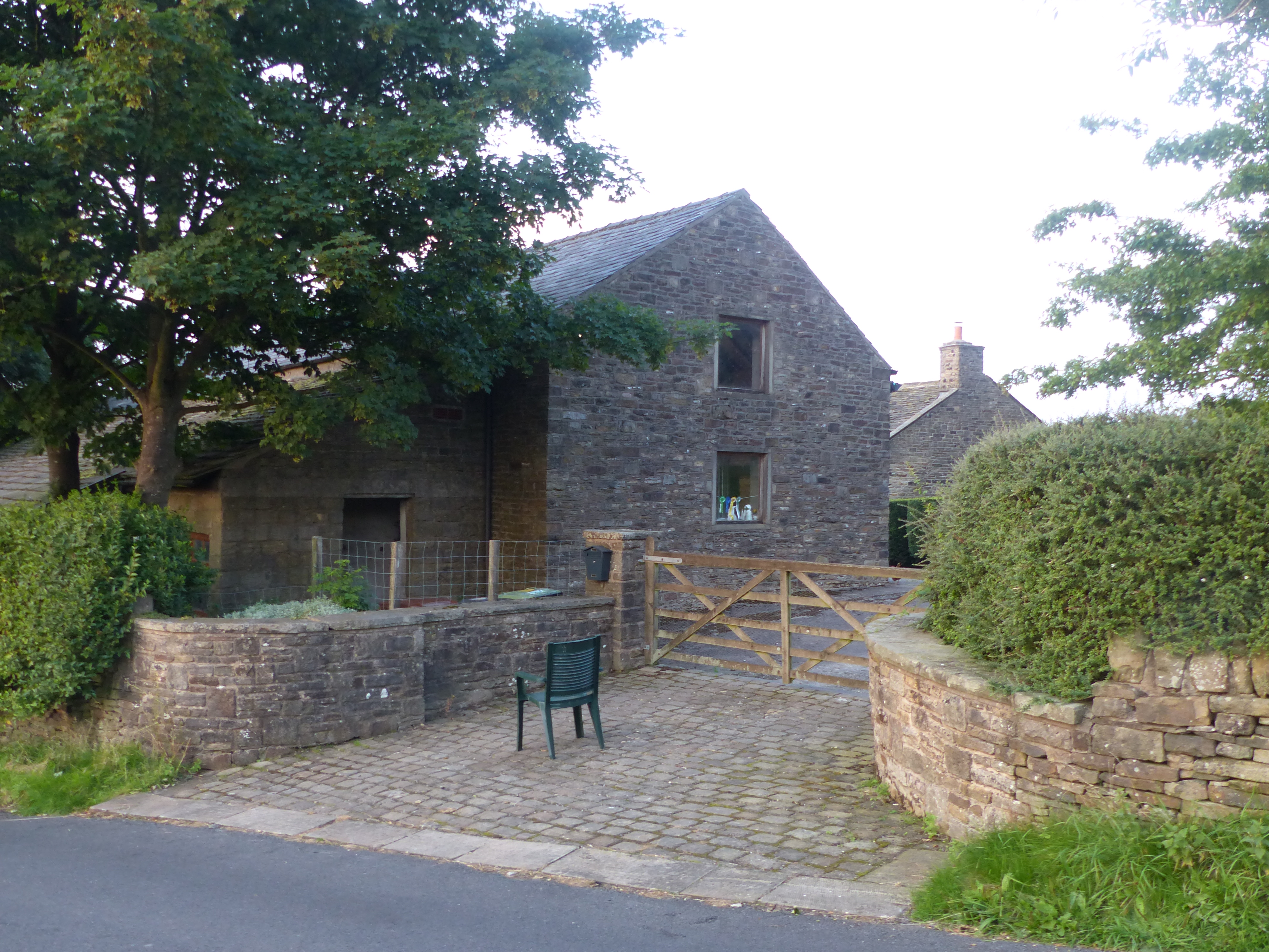
Chisworth is a hamlet near Glossop, Derbyshire, England. It is south-west of Glossop town centre, on the south side of the Etherow valley. The parish of Chisworth was formed in 1896, out of the parish of Chisworth and Ludworth. In 1901, it had a population of 409. From 1896 until 1934 it was in the Glossop Rural District, when it was placed with Ludworth into the Chapel en le Frith Rural District.Vision of Britain Accessed 22 June 2008. The village possesses a Methodist chapel. The A626 road passes through the hamlet. In June 1930, a local cloudburst caused flooding that killed one man and destroyed equipment at the mills, one of which never reopened. [...More Info...] [...Related Items...] OR: [Wikipedia] [Google] [Baidu] |
Chisworth Kinderlee 3829
Chisworth is a hamlet near Glossop Glossop is a market town in the Borough of High Peak, Derbyshire, England. It is located east of Manchester, north-west of Sheffield and north of the county town, Matlock. Glossop lies near Derbyshire's borders with Cheshire, Greater Manches ..., Derbyshire, England. It is south-west of Glossop town centre, on the south side of the Etherow valley. The parish of Chisworth was formed in 1896, out of the parish of Chisworth and Ludworth. In 1901, it had a population of 409. From 1896 until 1934 it was in the Glossop Rural District, when it was placed with Ludworth into the Chapel en le Frith Rural District.Vision of Britain Accessed 22 June 2008. The village possesses a Methodist chapel. The A626 road passes through the hamlet. In June 1930 ... [...More Info...] [...Related Items...] OR: [Wikipedia] [Google] [Baidu] |
Listed Buildings In Chisworth
Chisworth is a civil parish in the High Peak district of Derbyshire, England. The parish contains six listed buildings that are recorded in the National Heritage List for England. All the listed buildings are designated at Grade II, the lowest of the three grades, which is applied to "buildings of national importance and special interest". The parish contains the small settlements of Chisworth Chisworth is a hamlet near Glossop, Derbyshire, England. It is south-west of Glossop town centre, on the south side of the Etherow valley. The parish of Chisworth was formed in 1896, out of the parish of Chisworth and Ludworth. In 1901, it had a ... and Higher Chisworth, and is otherwise rural. The listed buildings consist of four farmhouses, a house, and a barn. __NOTOC__ Buildings References Citations Sources * * * * * * * * {{DEFAULTSORT:Chisworth Lists of listed buildings in Derbyshire ... [...More Info...] [...Related Items...] OR: [Wikipedia] [Google] [Baidu] |
Glossop
Glossop is a market town in the Borough of High Peak, Derbyshire, England. It is located east of Manchester, north-west of Sheffield and north of the county town, Matlock. Glossop lies near Derbyshire's borders with Cheshire, Greater Manchester, South Yorkshire and West Yorkshire. It is between above sea level and is bounded by the Peak District National Park to the south, east and north. Historically, the name ''Glossop'' refers to the small hamlet that gave its name to an ancient parish recorded in the Domesday Book of 1086 and then the manor given by William I of England to William Peverel. A municipal borough was created in 1866, which encompassed less than half of the manor's territory.The Ancient Parish of Glossop Retrieved 18 June 2008 The area now known as Glossop approximates to the villages that u ... [...More Info...] [...Related Items...] OR: [Wikipedia] [Google] [Baidu] |
High Peak, Derbyshire
High Peak is a local government district with borough status in Derbyshire, England. The borough compromises high moorland plateau in the Dark Peak area of the Peak District National Park. The district stretches from Holme Moss in the north to Sterndale Moor in the south, and from Hague Bar in the west to Bamford in the east. The population of the borough taken at the 2011 Census was 90,892. The borough is unusual in having two administrative centres for its council, High Peak Borough Council; the offices are based in both Buxton and Glossop. The borough also contains other towns including Chapel-en-le-Frith, Hadfield, New Mills and Whaley Bridge. High Peak was the name of a hundred of the ancient county of Derbyshire covering roughly the same area as the current district. It may have derived its name from the ancient Forest of High Peak, a royal hunting reserve administered by William Peverel, a favourite of William I, who was based at Peak Castle. High Peak contains ... [...More Info...] [...Related Items...] OR: [Wikipedia] [Google] [Baidu] |
River Etherow
The River Etherow is a river in northern England, and a tributary of the River Goyt. Although now passing through South Yorkshire, Derbyshire and Greater Manchester, it historically formed the ancient county boundary between Cheshire and Derbyshire. The upper valley is known as Longdendale. The river has a watershed of approximately , and the area an annual rainfall of . Course Rising in the Redhole Spring and Wike Head area of Pikenaze Moor in Derbyshire, the river broadens into the Longdendale Chain of reservoirs in the Peak District National Park. It emerges again in Tintwistle, Derbyshire, at the foot of Bottoms Reservoir dam and passes Melandra Castle in Gamesley, where it is joined by Glossop Brook.This brook takes in waters from the Shelf Brook, Hurst Brook and others. The Etherow enters the borough of Tameside at Hollingworth in Greater Manchester, passing into Stockport where it passes through Etherow Country Park. It flows into the River Goyt at Brabyns ... [...More Info...] [...Related Items...] OR: [Wikipedia] [Google] [Baidu] |
Derbyshire
Derbyshire ( ) is a ceremonial county in the East Midlands, England. It includes much of the Peak District National Park, the southern end of the Pennine range of hills and part of the National Forest. It borders Greater Manchester to the north-west, West Yorkshire to the north, South Yorkshire to the north-east, Nottinghamshire to the east, Leicestershire to the south-east, Staffordshire to the west and south-west and Cheshire to the west. Kinder Scout, at , is the highest point and Trent Meadows, where the River Trent leaves Derbyshire, the lowest at . The north–south River Derwent is the longest river at . In 2003, the Ordnance Survey named Church Flatts Farm at Coton in the Elms, near Swadlincote, as Britain's furthest point from the sea. Derby is a unitary authority area, but remains part of the ceremonial county. The county was a lot larger than its present coverage, it once extended to the boundaries of the City of Sheffield district in South Yorkshire ... [...More Info...] [...Related Items...] OR: [Wikipedia] [Google] [Baidu] |
High Peak (UK Parliament Constituency)
High Peak is a United Kingdom Parliament constituencies, parliamentary constituency represented in the House of Commons of the United Kingdom, House of Commons of the Parliament of the United Kingdom, UK Parliament since 2019 United Kingdom general election, 2019 by Robert Largan, a Conservative Party (UK), Conservative. The constituency is in north west Derbyshire and based in the heart of the Peak District, including the towns of Buxton, Glossop and New Mills. Since the 1966 United Kingdom general election, 1966 general election, the seat has been somewhat of a bellwether, with only three exceptions: at the February 1974 United Kingdom general election, February and October 1974 United Kingdom general election, October 1974 general elections the seat was won by the Conservative Party (UK), Conservative Party when the Labour Party (UK), Labour Party won the most seats nationally, and at the 2017 United Kingdom general election, 2017 general election when the seat was won by Labo ... [...More Info...] [...Related Items...] OR: [Wikipedia] [Google] [Baidu] |
Historic England
Historic England (officially the Historic Buildings and Monuments Commission for England) is an executive non-departmental public body of the British Government sponsored by the Department for Digital, Culture, Media and Sport. It is tasked with protecting the historic environment of England by preserving and listing historic buildings, scheduling ancient monuments, registering historic Parks and Gardens and by advising central and local government. The body was officially created by the National Heritage Act 1983, and operated from April 1984 to April 2015 under the name of English Heritage. In 2015, following the changes to English Heritage's structure that moved the protection of the National Heritage Collection into the voluntary sector in the English Heritage Trust, the body that remained was rebranded as Historic England. The body also inherited the Historic England Archive from the old English Heritage, and projects linked to the archive such as Britain from Above ... [...More Info...] [...Related Items...] OR: [Wikipedia] [Google] [Baidu] |
Cup And Ring Mark
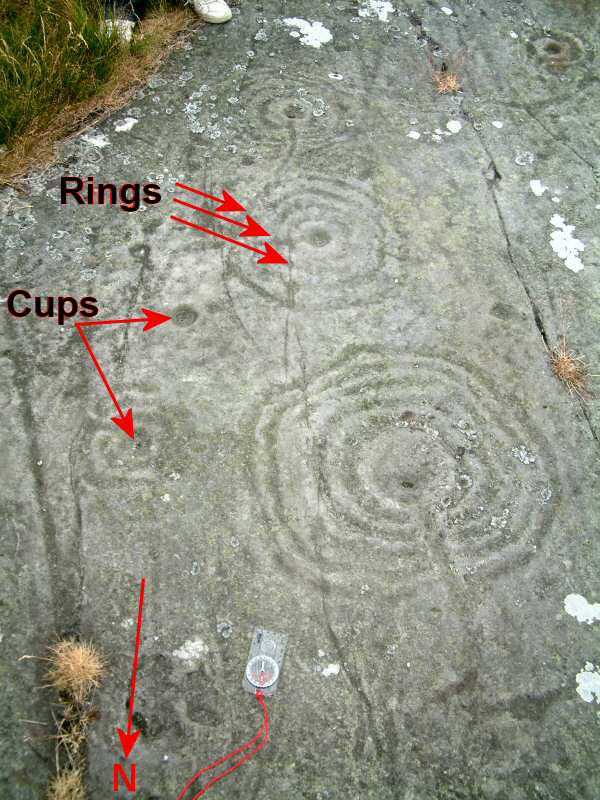
Cup and ring marks or cup marks are a form of prehistoric art found in the Atlantic seaboard of Europe (Ireland, Wales, Northern England, Scotland, France ( Brittany), Portugal, and Spain (Galicia) – and in Mediterranean Europe – Italy (in Alpine valleys and Sardinia), Azerbaijan and Greece ( Thessaly and Irakleia (Cyclades)), as well as in Scandinavia (Denmark, Sweden, Norway and Finland) and in Switzerland (at Caschenna in Grisons). Similar forms are also found throughout the world including Australia, Gabon, Greece, Hawaii, India ( Daraki-Chattan), Israel, Mexico, Mozambique and the Americas. The oldest known forms are found from the Fertile Crescent to India. They consist of a concave depression, no more than a few centimetres across, pecked into a rock surface and often surrounded by concentric circles also etched into the stone. Sometimes a linear channel called a gutter leads out from the middle. The decoration occurs as a petroglyph on natural boulders ... [...More Info...] [...Related Items...] OR: [Wikipedia] [Google] [Baidu] |
Hamlets In Derbyshire
A hamlet is a human settlement that is smaller than a town or village. Its size relative to a parish can depend on the administration and region. A hamlet may be considered to be a smaller settlement or subdivision or satellite entity to a larger settlement. The word and concept of a hamlet has roots in the Anglo-Norman settlement of England, where the old French ' came to apply to small human settlements. Etymology The word comes from Anglo-Norman ', corresponding to Old French ', the diminutive of Old French ' meaning a little village. This, in turn, is a diminutive of Old French ', possibly borrowed from (West Germanic) Franconian languages. Compare with modern French ', Dutch ', Frisian ', German ', Old English ' and Modern English ''home''. By country Afghanistan In Afghanistan, the counterpart of the hamlet is the Qila, qala (Dari language, Dari: قلعه, Pashto: کلي) meaning "fort" or "hamlet". The Afghan ''qala'' is a fortified group of houses, gener ... [...More Info...] [...Related Items...] OR: [Wikipedia] [Google] [Baidu] |
Towns And Villages Of The Peak District
A town is a human settlement. Towns are generally larger than villages and smaller than city, cities, though the criteria to distinguish between them vary considerably in different parts of the world. Origin and use The word "town" shares an origin with the German language, German word , the Dutch language, Dutch word , and the Old Norse . The original Proto-Germanic language, Proto-Germanic word, *''tūnan'', is thought to be an early borrowing from Proto-Celtic language, Proto-Celtic *''dūnom'' (cf. Old Irish , Welsh language, Welsh ). The original sense of the word in both Germanic and Celtic was that of a fortress or an enclosure. Cognates of ''town'' in many modern Germanic languages designate a fence or a hedge. In English and Dutch, the meaning of the word took on the sense of the space which these fences enclosed, and through which a track must run. In England, a town was a small community that could not afford or was not allowed to build walls or other larger fort ... [...More Info...] [...Related Items...] OR: [Wikipedia] [Google] [Baidu] |


.jpg)