|
Chiconquiaco
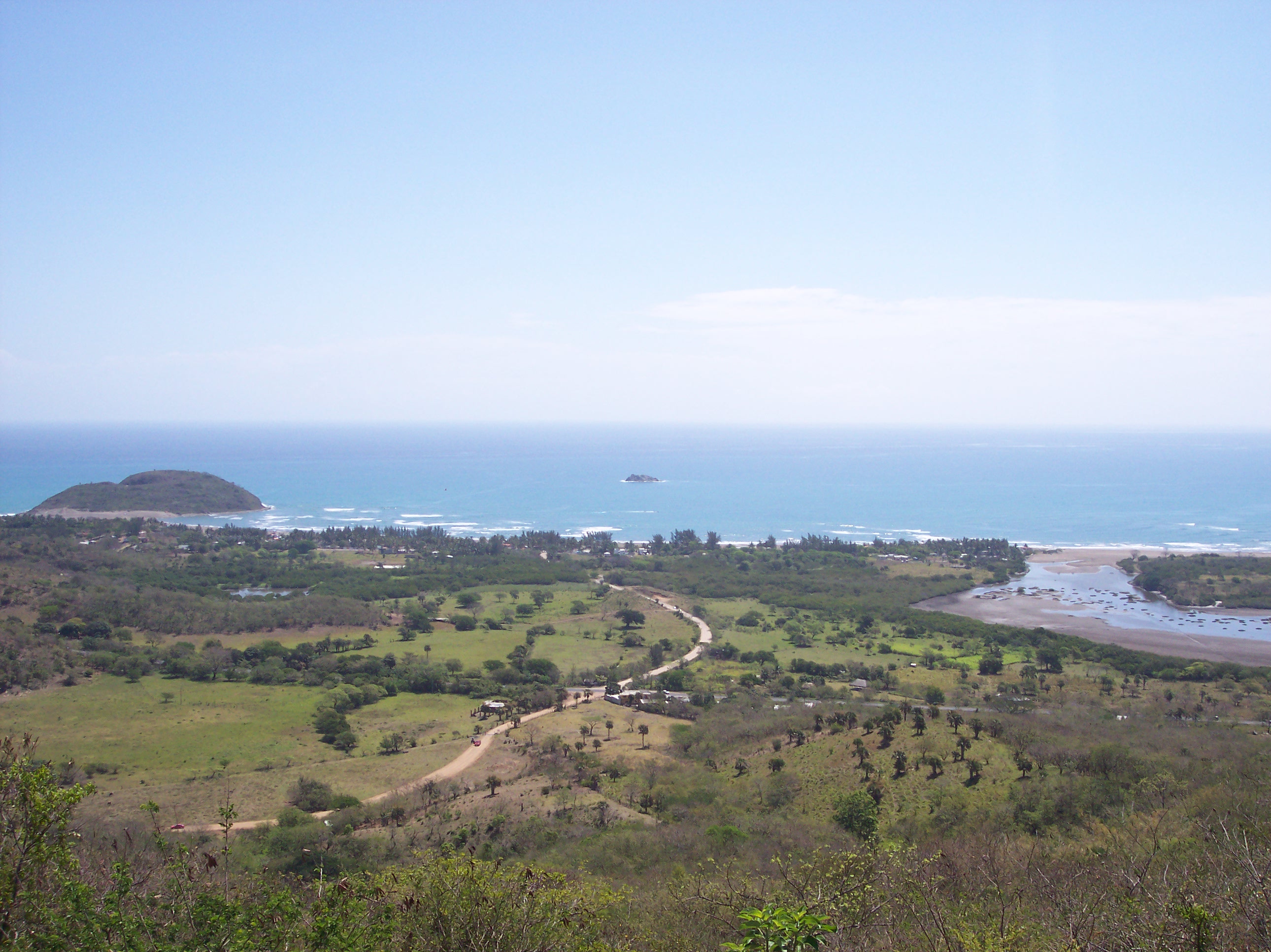
Chiconquiaco is a municipality in the Mexican state of Veracruz. It is located in the Sierra de Chiconquiaco in the middle of the State of Veracruz. It has a surface of 68.27 km2. It is located at . Demographics As 2020, the municipality had a population of 13,881 inhabitants in 52 localities. About, 3,500 inhabitants resides in the municipal seat, other localities include El Huérfano (1,694 hab.), El Capulín (937 hab.), La Sombra (901 hab.) and Las Paredes (694 hab.). Economy It produces principally maize, beans and coffee. Culture In Chiconquiaco, in June takes place the celebration in honor to San Pedro and San Pablo Patrons of the place. Geography The municipality of Chiconquiaco is delimited to the north-west by Misantla, to the north by Yecuatla, to the east by Juchique de Ferrer, to the south-east by Tepetlán, to the south by Acatlán and to the west by Landero y Coss. Climate According to the Köppen climate classification system, Chiconquiaco has a ... [...More Info...] [...Related Items...] OR: [Wikipedia] [Google] [Baidu] |
Municipalities Of Veracruz
Veracruz is a state in central eastern Mexico that is divided into 212 municipalities. According to the 2020 Mexican census, it is the fourth most populated state with inhabitants and the 11th largest by land area spanning . Municipalities in Veracruz are administratively autonomous of the state according to the 115th article of the 1917 Constitution of Mexico. Every four years, citizens elect a municipal president (Spanish: ''presidente municipal'') by a plurality voting system who heads a concurrently elected municipal council (''ayuntamiento'') responsible for providing all the public services for their constituents. The municipal council consists of a variable number of trustees and councillors (''regidores y síndicos''). Municipalities are responsible for public services (such as water and sewage), street lighting, public safety, traffic, and the maintenance of public parks, gardens and cemeteries. They may also assist the state and federal governments in education, ... [...More Info...] [...Related Items...] OR: [Wikipedia] [Google] [Baidu] |
Sierra De Chiconquiaco
The Sierra de Chiconquiaco is a coastal mountain range in Veracruz, Eastern Mexico. Geography The Sierra extends generally east-west. It is bounded on the north by the plain of the Nautla River, which empties eastwards into the Gulf of Mexico. On the west, the canyon of the Bobos River, a northward-flowing tributary of the Nautla, separates the Sierra from the eastern end of the Trans-Mexican Volcanic Belt. On the northeast and east, a narrow portion of the Gulf Coastal Plain lies between the Sierra and the Gulf of Mexico. On the south, it is bounded by the Actopan basin, which includes the state capital, Xalapa. The Misantla and Colipa rivers originate in the range, and flow northeastwards to empty into the Gulf of Mexico.Lascurain Rangel, M., Avendaño-Reyes, S., Cházaro-Basañez, M., Geissert-Kientz, D., Villegas-Patraca, R., Gallo-Gómez, C. A., & Gutiérrez-Báez, C. (2017). Floristic, vegetational and geographic characteristics of the Sierra de Chiconquiaco, Veracruz, Me ... [...More Info...] [...Related Items...] OR: [Wikipedia] [Google] [Baidu] |
Veracruz
Veracruz, formally Veracruz de Ignacio de la Llave, officially the Free and Sovereign State of Veracruz de Ignacio de la Llave, is one of the 31 states which, along with Mexico City, comprise the 32 Political divisions of Mexico, Federal Entities of Mexico. Located in eastern Mexico, Veracruz is bordered by seven states, which are Tamaulipas, San Luis Potosí, Hidalgo (state), Hidalgo, Puebla, Oaxaca, Chiapas, and Tabasco. Veracruz is divided into Municipalities of Veracruz, 212 municipalities, and its capital city is Xalapa, Xalapa-Enríquez. Veracruz has a significant share of the coastline of the Gulf of Mexico on the east of the state. The state is noted for its mixed ethnic and indigenous populations. Cuisine of Veracruz, Its cuisine reflects the many cultural influences that have come through the state because of the importance of the port of Veracruz (city), Veracruz. In addition to the capital city, the state's largest cities include Veracruz, Coatzacoalcos, Córdoba, V ... [...More Info...] [...Related Items...] OR: [Wikipedia] [Google] [Baidu] |
Misantla
Misantla is a city in the Mexican state of Veracruz, the administrative seat of the municipality ''(municipio)'' of the same name. The municipality is bordered by Martínez de la Torre, Colipa and Papantla. Misantla is located in the valley of the Misantla River in the Sierra de Chiconquiaco. Travelwise, Misantla is about from the beaches of the Gulf of Mexico; however, the roads to the coast are not reliable. Misantla is located two hours north of Xalapa (the capital of the state) on Veracruz State Highway 65, a most scenic mountain route, well-paved. Federal Highways 180 and 129 are on either side of it. Misantla has Pre-Columbian pyramid, located northwest of town. It is the municipal seat of several different communities such as Morelos, Guerrero, el Pozón, Buenos Aires, Arroyo Hondo, etc. In the local Native American Totonac language it means "place of the deer", although there are no longer deer in the wild. Misantla is over 450 years old, it was founded by the ... [...More Info...] [...Related Items...] OR: [Wikipedia] [Google] [Baidu] |
Acatlán, Veracruz
Acatlán is a municipality and village located in the central zone of the Mexican state of Veracruz, about 35 km from the state capital Xalapa Xalapa or Jalapa (, ), officially Xalapa-Enríquez (), is the capital city of the Mexico, Mexican List of states of Mexico, state of Veracruz and the name of the surrounding municipality. In 2020 census the city reported a population of 443,063 .... The municipality has an area of 18.1 km². As 2020, the municipality had a population of 3'441 inhabitants, more than 94 % of the population resided in the municipal seat. Geography The municipality of Acatlán is delimited to the east by the Tepetlán, to the south by the Naolinco, to the west by the Miahuatlán, and to the north by Chiconquiaco. It is watered by the rivers Actopan and Pájaro Verde. References External links *Municipal Official Site*Municipal Official Information Municipalities of Veracruz {{Veracruz-geo-stub ... [...More Info...] [...Related Items...] OR: [Wikipedia] [Google] [Baidu] |
Tepetlán
Tepetlán is a municipality located in the montane central zone in the Mexican state of Veracruz. It has a surface of 83.90 km2. During the Pre-Hispanic epoch it was inhabited by the Totonac, the most ancient date in the one that one alludes as municipality in that of the 1 °. Of December, 1868 In the Cologne it named the village San Antonio Tepetlán, for decree of November 5, 1932, the head-board is called Tepetlán, remaining suppressed the first part of the name. Geography The municipality of Tepetlán is delimited by Acatlán, Chiconquiaco, Alto Lucero de Gutiérrez Barrios and Naolinco. The territory of the municipality is watered by small tributary rivers of the river Actópan. The weather in Tepetlán is very cold and wet all year with rains in summer and autumn. Agriculture It produces principally maize, beans, green chile, sugarcane and coffee Coffee is a beverage brewed from roasted, ground coffee beans. Darkly colored, bitter, and slightly acid ... [...More Info...] [...Related Items...] OR: [Wikipedia] [Google] [Baidu] |
Yecuatla
Yecuatla is a Municipalities of Veracruz, municipality located in the north zone in the List of states of Mexico, Mexican state of Veracruz, about 40 km from the state capital Xalapa. It has a surface of 135.72 km2. It is located at . Name The name comes from the language Náhuatl, Yec-uauh-tlan; that means “Place of three snakes ". Geography The municipality of Yecuatla is bordered to the north-east by Colipa (municipality), Colipa, to the south by Chiconquiaco, to the west by Misantla (municipality), Misantla and to the north-west by Colipa (municipality), Colipa. The climate in Yecuatla is warm-regular with an average temperature of 22.5°C, with rains in summer and autumn. Agriculture It produces principally maize, bean, green chile, orange fruit and coffee. Celebrations Every Augusts, a festival is held to celebrate Virgen de la Asunción, patron of the town and in December there is a festival held in honor of the Virgin of Guadalupe. References External ... [...More Info...] [...Related Items...] OR: [Wikipedia] [Google] [Baidu] |
Municipalities Of Mexico
Municipalities () are the administrative divisions under the List of states of Mexico, states of Mexico according to the Constitution of Mexico, constitution. Municipalities are considered as the second-level administrative divisions by the Federal government of Mexico, federal government. However, some state regulations have designed intrastate regions to administer their own municipalities. Municipalities are further divided into Localities of Mexico, localities in the structural hierarchy of administrative divisions of Mexico. As of December 2024, there are 2,462 municipalities in Mexico. In Mexico, municipalities should not be confused with cities (). Cities are Localities of Mexico, locality-level divisions that are administered by the municipality. Although some List of cities in Mexico, larger cities are consolidated with its own municipality and form a single level of governance. In addition, the 16 Boroughs of Mexico City, boroughs of Mexico City are considered municipali ... [...More Info...] [...Related Items...] OR: [Wikipedia] [Google] [Baidu] |
Oceanic Climate
An oceanic climate, also known as a marine climate or maritime climate, is the temperate climate sub-type in Köppen climate classification, Köppen classification represented as ''Cfb'', typical of west coasts in higher middle latitudes of continents, generally featuring cool to warm summers and cool to mild winters (for their latitude), with a relatively narrow annual temperature range and few extremes of temperature. Oceanic climates can be found in both hemispheres generally between 40 and 60 degrees latitude, with subpolar versions extending to 70 degrees latitude in some coastal areas. Other varieties of climates usually classified together with these include subtropical highland climates, represented as ''Cwb'' or ''Cfb'', and subpolar oceanic or cold subtropical highland climates, represented as ''Cfc'' or ''Cwc''. Subtropical highland climates occur in some mountainous parts of the subtropics or tropics, some of which have monsoon influence, while their cold variants an ... [...More Info...] [...Related Items...] OR: [Wikipedia] [Google] [Baidu] |
Landero Y Coss
Landero is a surname. People with this name include: * Humberto Gómez Landero (1904–1968), Mexican screenwriter and film director * José Francisco Landero (b. 1971), Mexican politician * Leticia López Landero (b. 1962), Mexican politician * Tomás López Landero (b. 1950), Mexican politician * Toto Landero (1995–2022), Filipino professional boxer * Alejandro Landero Gutiérrez (b. 1975), Mexican politician See also * Landeros surname page {{surname ... [...More Info...] [...Related Items...] OR: [Wikipedia] [Google] [Baidu] |
Coffee
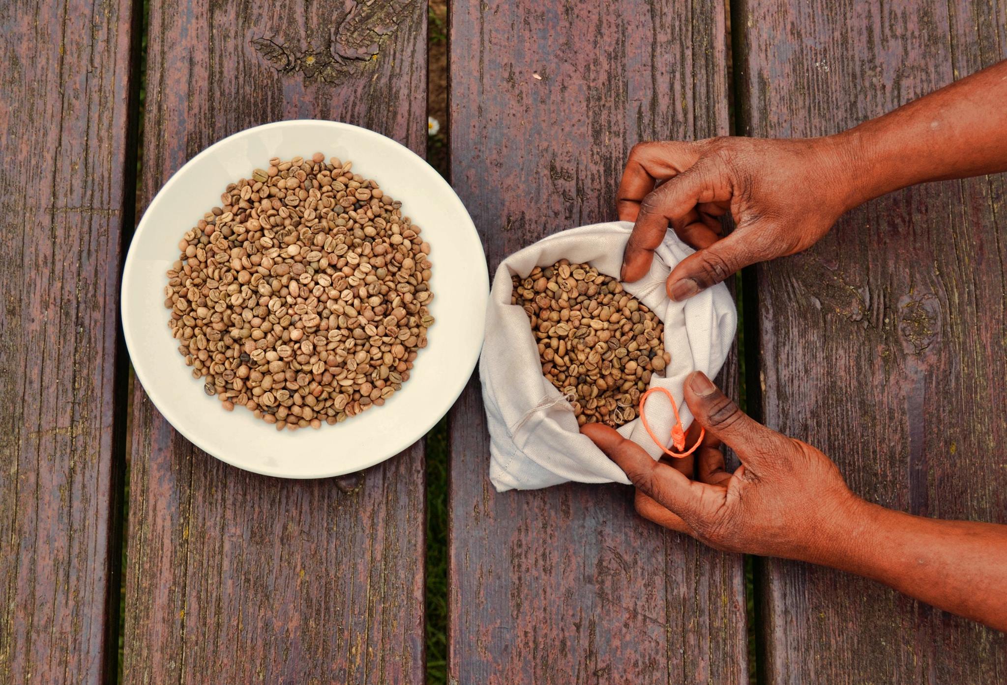
Coffee is a beverage brewed from roasted, ground coffee beans. Darkly colored, bitter, and slightly acidic, coffee has a stimulating effect on humans, primarily due to its caffeine content, but decaffeinated coffee is also commercially available. There are also various coffee substitutes. Typically served hot, coffee has the highest sales in the world market for hot drinks. Coffee production begins when the seeds from coffee cherries (the '' Coffea'' plant's fruits) are separated to produce unroasted green coffee beans. The "beans" are roasted and then ground into fine particles. Coffee is brewed from the ground roasted beans, which are typically steeped in hot water before being filtered out. It is usually served hot, although chilled or iced coffee is common. Coffee can be prepared and presented in a variety of ways (e.g., espresso, French press, caffè latte, or already-brewed canned coffee). Sugar, sugar substitutes, milk, and cream are often added to mask ... [...More Info...] [...Related Items...] OR: [Wikipedia] [Google] [Baidu] |


