|
Chibed
Chibed (, Hungarian pronunciation: ) is a commune in Mureș County, Transylvania, Romania, composed of a single village, Chibed. It lies in the Székely Land, an ethno-cultural region in eastern Transylvania. The village is famous for the onion produced in the village and sold in front of the houses along the main road. History The village was historically part of the Székely Land in Transylvania and belonged to Marosszék in the Middle Ages. In the mid-1780s as part of the Josephine administrative reform, Marosszék was integrated into Küküllő County, however, the szék-system was restored in 1790. After the suppression of the Hungarian Revolution in 1849, the village formed part of the Kibéd military sub-division of the Marosvásárhely division in the Udvarhely military district. Between 1861 and 1876, the former Marosszék was restored. As a result of the administrative reform in 1876, the village fell within Maros-Torda County in the Kingdom of Hungary. In the immed ... [...More Info...] [...Related Items...] OR: [Wikipedia] [Google] [Baidu] |
Mureș County
Mureș County (, , ) is a county (''județ'') of Romania, in the Historical regions of Romania, historical region of Transylvania, with the administrative centre in Târgu Mureș. The county was established in 1968, after the administrative reorganization that re-introduced the historical ''județ'' (Counties of Romania, county) system, still used today. This reform eliminated the previous Magyar Autonomous Region, Mureș-Magyar Autonomous Region, which had been created in 1952 within the People's Republic of Romania. Mureș County has a vibrant multicultural fabric that includes Székely Land, Hungarian-speaking Székelys and Transylvanian Saxons, with a rich heritage of Villages with fortified churches in Transylvania, fortified churches and towns. Name In Hungarian language, Hungarian, it is known as ''Maros megye'' (), and in German language, German as ''Kreis Mieresch''. Under Kingdom of Hungary, a county with a similar name (Maros-Torda County, ) was created in 1876. There ... [...More Info...] [...Related Items...] OR: [Wikipedia] [Google] [Baidu] |
Ghindari
Ghindari (, Hungarian pronunciation: ; ) is a commune in Mureș County, Romania. It lies in the Székely Land, an ethno-cultural region in eastern Transylvania. The commune is composed of five villages: Abud (''Székelyabod''), Ceie (''Cséje''), Ghindari, Solocma (''Szolokma''), and Trei Sate (''Hármasfalu''). The latter village, in turn, is composed of three hamlets: Cioc (''Csókfalva''), Hotești (''Atosfalva''), and Ștefănești (''Székelyszentistván''). History Until 1918, the villages belonged to the Maros-Torda County of the Kingdom of Hungary. After the Hungarian–Romanian War of 1918–19 and the Treaty of Trianon of 1920, the area became part of the Romania. In 2004, Chibed broke away to form an independent commune. Demographics The commune has an absolute Székely Hungarian majority. According to the 2011 census, it had a population of 3,250, of which 88.43% were Hungarians, 7.08% Roma, and 0.7% Romanians. At the 2021 census, Ghindari had a population of ... [...More Info...] [...Related Items...] OR: [Wikipedia] [Google] [Baidu] |
Communes Of Romania
A commune (''comună'' in Romanian language, Romanian) is the lowest level of administrative subdivision in Romania. There are 2,686 communes in Romania. The commune is the rural subdivision of a Counties of Romania, county. Urban areas, such as towns and cities within a county, are given the status of ''Cities in Romania, city'' or ''Municipality in Romania, municipality''. In principle, a commune can contain any size population, but in practice, when a commune becomes relatively urbanised and exceeds approximately 10,000 residents, it is usually granted city status. Although cities are on the same administrative level as communes, their local governments are structured in a way that gives them more power. Some urban or semi-urban areas of fewer than 10,000 inhabitants have also been given city status. Each commune is administered by a mayor (''primar'' in Romanian). A commune is made up of one or more villages which do not themselves have an administrative function. Communes ... [...More Info...] [...Related Items...] OR: [Wikipedia] [Google] [Baidu] |
Székelys
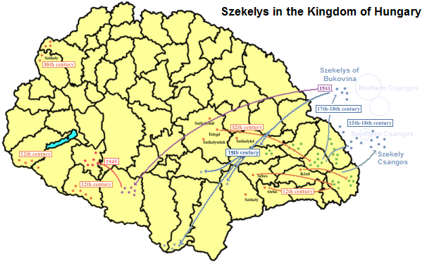
The Székelys (, Old Hungarian script, Székely runes: ), also referred to as Szeklers, are a Hungarians, Hungarian subgroup living mostly in the Székely Land in Romania. In addition to their native villages in Suceava County in Bukovina, a significant population descending from the Székelys of Bukovina currently lives in Tolna County, Tolna and Baranya County, Baranya counties in Hungary and certain districts of Vojvodina, Serbia. In the Middle Ages, the Székelys played a role in the defense of the Kingdom of Hungary#Middle Ages, Kingdom of Hungary against the Ottoman Empire, Ottomans in their posture as guards of the eastern border. With the Treaty of Trianon of 1920, Transylvania (including the Székely Land) became part of Romania, and the Székely population was a target of Romanianization efforts. In 1952, during the Socialist Republic of Romania, communist rule of Romania, the former counties with the highest concentration of Székely population – Mureș County#His ... [...More Info...] [...Related Items...] OR: [Wikipedia] [Google] [Baidu] |
2011 Romanian Census
The 2011 Romanian census was a census held in Romania between 20 and 31 October 2011. It was performed by some 120,000 census takers in around 101,000 statistic sectors throughout the country established by the National Institute of Statistics (INS) of Romania. Preparations started already in 2009, and it was announced that the process would not end until 2014. Anyone who did not answer questions in the census questionnaire would be fined between 1,500 and 4,500 Romanian lei, although 4 of the 100 questions related to the respondent's ethnicity, mother language, religion, and possible disabilities were not mandatory. Preliminary results were released once on 2 February 2012 and again on 20 August 2012. The final definitive result of the census came out on 4 July 2013, showing that, among other things, Romania had lost 1,559,300 people since the 2002 census, consequently having 20,121,641 inhabitants. Some people like sociologist Vasile Ghețău, director of the Center of Demog ... [...More Info...] [...Related Items...] OR: [Wikipedia] [Google] [Baidu] |
Magyar Autonomous Region
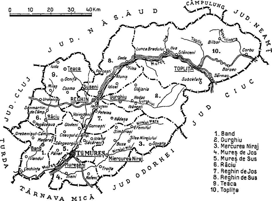
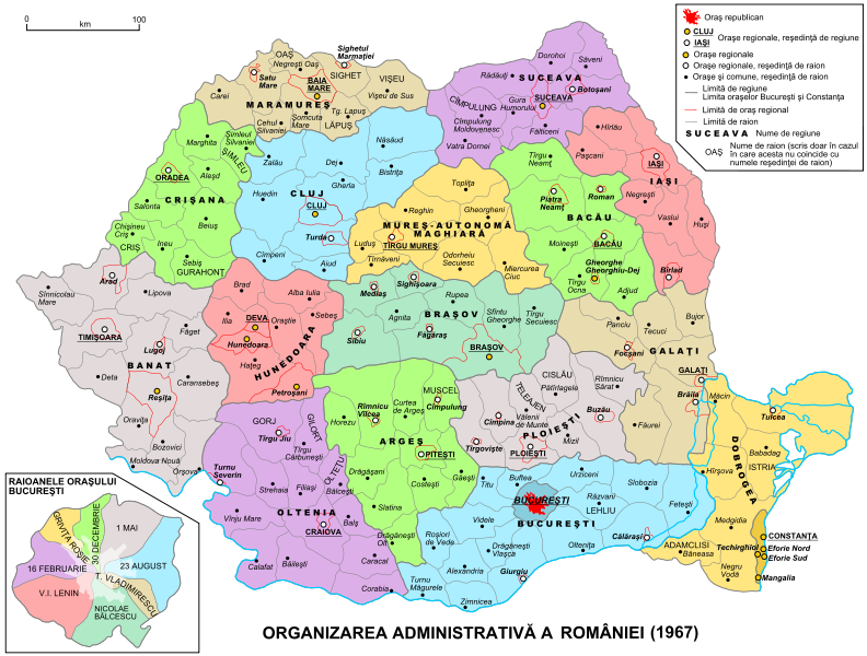
The Magyar Autonomous Region (1952–1960) (; ) and Mureș-Magyar Autonomous Region (1960–1968) were autonomous Regions of the People's Republic of Romania, regions in the Romanian People's Republic (later the Socialist Republic of Romania). History One of the key factors behind the autonomous region was the desire of the communist Romanian government to win over the Hungarian population in Transylvania. Support for the Romanian Communist Party was very strong in ethnically Hungarian areas, and Hungarian communists made up 26% of all communists in Romania before World War II. Following the Hungarian Northern Transylvania, rule of Northern Transylvania during World War II, ethnic Hungarians now made up 10% of Romanian population, and the communist government adopted a policy of appeasement towards the Hungarian minority; this was a pragmatic stance as in contrast to largely pro-socialist Hungarians in Romania, ethnic Romanians were unsupportive of the Communist Party and the com ... [...More Info...] [...Related Items...] OR: [Wikipedia] [Google] [Baidu] |
Stalin Region
Regiunea Stalin (Stalin Region) was one of the administrative divisions of the People's Republic of Romania. It was established in 1950, in the Soviet style of territorial organization, and was named after Joseph Stalin. Its name was changed to Brașov Region in 1960, and it was disestablished in 1968. History In 1950, the capital of the region was Orașul Stalin (''Stalin City'', now Brașov) and its territory comprised an area similar to what are nowadays the eastern part of Brașov County, together with Covasna County and part of Harghita County. Initially, the Stalin Region comprised 6 raions: Ciuc, Odorhei, Racoș, Sfântu Gheorghe, Stalin, and Târgu Secuiesc. In 1952, the Ciuc, Odorhei, Sfântu Gheorghe, and Târgu Secuiesc raions were transferred to the newly established Magyar Autonomous Region, while the raions Sibiu, Făgăraș, Mediaș, Agnita, Sighișoara, and Târnăveni were included in the Stalin Region. In 1960, the region was renamed Brașov Region, while ... [...More Info...] [...Related Items...] OR: [Wikipedia] [Google] [Baidu] |
Raion
A raion (also spelt rayon) is a type of administrative unit of several post-Soviet states. The term is used for both a type of subnational entity and a division of a city. The word is from the French (meaning 'honeycomb, department'), and is commonly translated as ' district' in English. A raion is a standardized administrative entity across most of the former Soviet Union and is usually a subdivision two steps below the national level, such as a subdivision of an oblast. However, in smaller USSR republics, it could be the primary level of administrative division. After the fall of the Soviet Union, some of the republics kept the ''raion'' (e.g. Azerbaijan, Belarus, Ukraine, Russia, Moldova, Kazakhstan, Kyrgyzstan) while others dropped it (e.g. Georgia, Uzbekistan, Estonia, Latvia, Armenia, Tajikistan, Turkmenistan). In Bulgaria, it refers to an internal administrative subdivision of a city not related to the administrative division of the country as a whole, or, in the ca ... [...More Info...] [...Related Items...] OR: [Wikipedia] [Google] [Baidu] |
Odorheiu Secuiesc
Odorheiu Secuiesc (; , ; ) is the second largest municipality in Harghita County, Transylvania, Romania. In its short form, it is also known as ''Odorhei'' in Romanian and ''Udvarhely'' in Hungarian. The Hungarian name of the town "Udvarhely" means "courtyard place". Demographics At the 2011 census, the city had a population of 34,257; among those for whom data were available, 95.8% were ethnic Hungarians, making it the urban settlement with the third-highest proportion of Hungarians in Romania. The city was also home to communities of ethnic Romanians (2.6%) and Roma (1.5%). According to the 2021 census, Odorheiu Secuiesc had a population of 31,335; of those, 87.29% were Hungarians, 2.3% Romanians, and 1.58% Roma. As of 2011, half the population of the town professed Roman Catholicism (50.05%), while the remaining half was primarily divided between Hungarian Reformed (30.14%), Unitarian (14.71%), and Romanian Orthodox (2.54%) communities. History A Roman fortress was f ... [...More Info...] [...Related Items...] OR: [Wikipedia] [Google] [Baidu] |
Socialist Republic Of Romania
The Socialist Republic of Romania (, RSR) was a Marxism–Leninism, Marxist–Leninist One-party state, one-party socialist state that existed officially in Romania from 1947 to 1989 (see Revolutions of 1989). From 1947 to 1965, the state was known as the Romanian People's Republic (, RPR). The country was an Eastern Bloc state and a member of the Warsaw Pact with a dominant role for the Romanian Communist Party enshrined in :Template:RomanianConstitutions, its constitutions. Geographically, RSR was bordered by the Black Sea to the east, the Soviet Union (via the Ukrainian Soviet Socialist Republic, Ukrainian and Moldavian Soviet Socialist Republic, Moldavian SSRs) to the north and east, Hungarian People's Republic, Hungary and Socialist Federal Republic of Yugoslavia, Yugoslavia (via Socialist Republic of Serbia, SR Serbia) to the west, and People's Republic of Bulgaria, Bulgaria to the south. As World War II ended, Kingdom of Romania, Romania, a former Axis powers, Axis membe ... [...More Info...] [...Related Items...] OR: [Wikipedia] [Google] [Baidu] |
Soviet Union
The Union of Soviet Socialist Republics. (USSR), commonly known as the Soviet Union, was a List of former transcontinental countries#Since 1700, transcontinental country that spanned much of Eurasia from 1922 until Dissolution of the Soviet Union, it dissolved in 1991. During its existence, it was the list of countries and dependencies by area, largest country by area, extending across Time in Russia, eleven time zones and sharing Geography of the Soviet Union#Borders and neighbors, borders with twelve countries, and the List of countries and dependencies by population, third-most populous country. An overall successor to the Russian Empire, it was nominally organized as a federal union of Republics of the Soviet Union, national republics, the largest and most populous of which was the Russian SFSR. In practice, Government of the Soviet Union, its government and Economy of the Soviet Union, economy were Soviet-type economic planning, highly centralized. As a one-party state go ... [...More Info...] [...Related Items...] OR: [Wikipedia] [Google] [Baidu] |
Nazi Germany
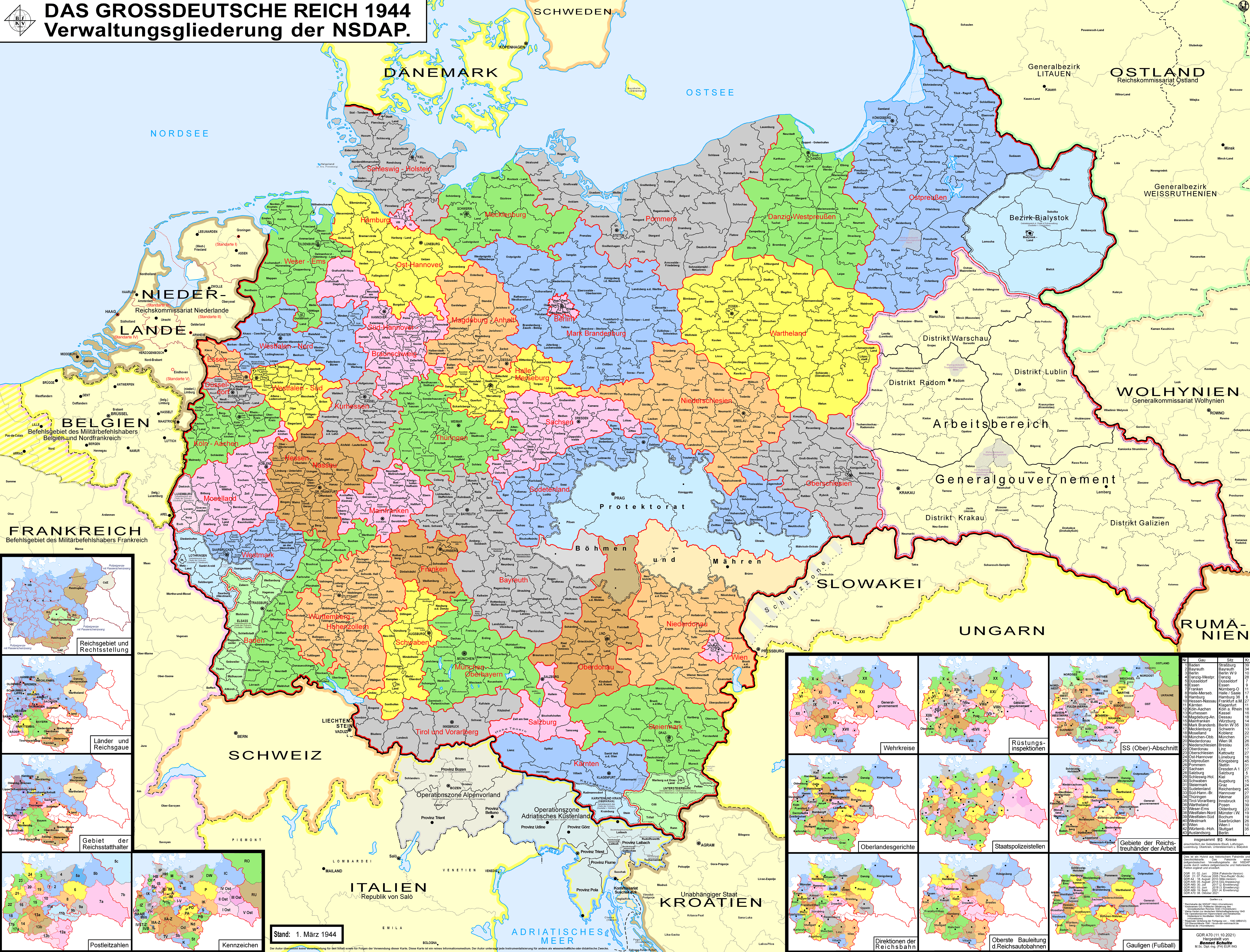
Nazi Germany, officially known as the German Reich and later the Greater German Reich, was the German Reich, German state between 1933 and 1945, when Adolf Hitler and the Nazi Party controlled the country, transforming it into a Totalitarianism, totalitarian dictatorship. The Third Reich, meaning "Third Realm" or "Third Empire", referred to the Nazi claim that Nazi Germany was the successor to the earlier Holy Roman Empire (800–1806) and German Empire (1871–1918). The Third Reich, which the Nazis referred to as the Thousand-Year Reich, ended in May 1945, after 12 years, when the Allies of World War II, Allies defeated Germany and entered the capital, Berlin, End of World War II in Europe, ending World War II in Europe. After Hitler was appointed Chancellor of Germany in 1933, the Nazi Party began to eliminate political opposition and consolidate power. A 1934 German referendum confirmed Hitler as sole ''Führer'' (leader). Power was centralised in Hitler's person, an ... [...More Info...] [...Related Items...] OR: [Wikipedia] [Google] [Baidu] |


