|
Chassepierre
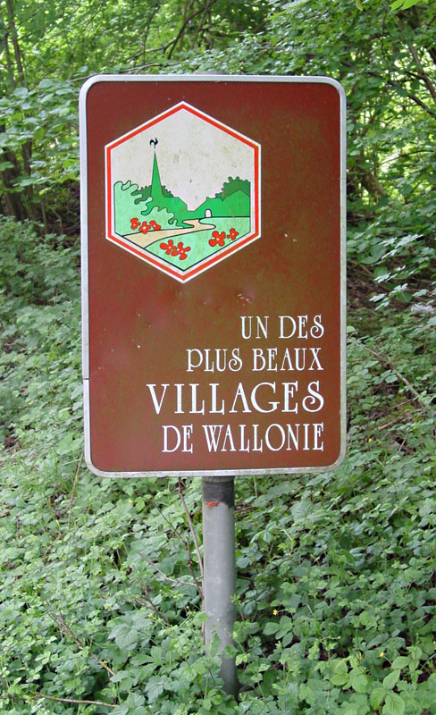
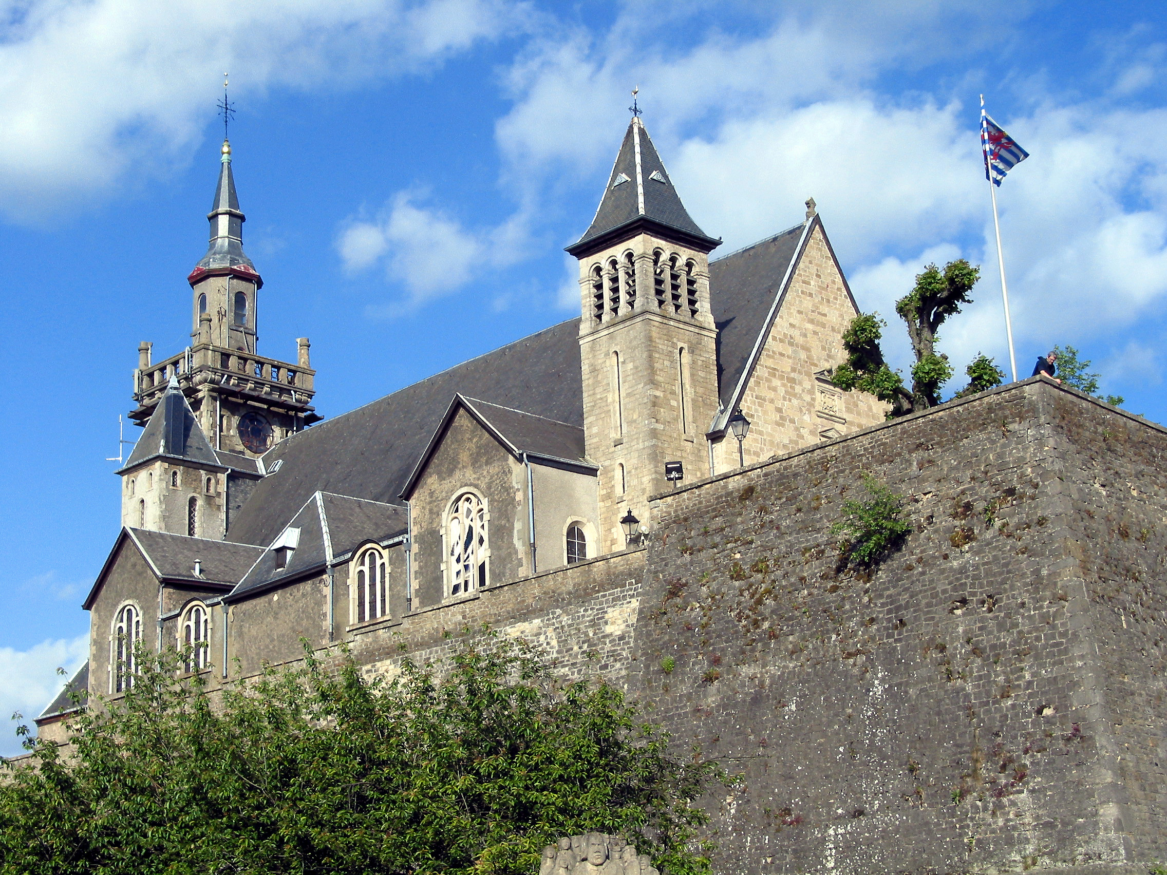
Chassepierre ( Gaumais: ''Tchespire'') is a village of Wallonia and a district of the municipality of Florenville, located in the province of Luxembourg, Belgium. It was a fully-fledged municipality before the 1977 fusion of the Belgian municipalities. The village is a member of the non-profit organization Les Plus Beaux Villages de Wallonie ("The Most Beautiful Villages of Wallonia"). Geography The main road N83 between Arlon and Bouillon runs along the west side, above the village. The east side of the village is bordered by the Semois, a tributary of the Meuse. Chassepierre is bounded on the south by the French border. Name The name ''Chassepierre'' comes from ''Casa petrea'', the Latin for "stone house". Indeed, the houses of the village are mostly made of stones from the 18th and 19th century. Architectural heritage The church of Saint Martin was built in 1702. Festival The village, considered one of the most charming of Belgium, is mainly famous for its inte ... [...More Info...] [...Related Items...] OR: [Wikipedia] [Google] [Baidu] |
Les Plus Beaux Villages De Wallonie
''Les Plus Beaux Villages de Wallonie'' (French; in English: "The Most Beautiful Villages of Wallonia") is a non-profit organisation formed in 1994 to promote, protect and develop a number of villages in Wallonia, Belgium. The association is inspired by the organisation ''Les plus beaux villages de France'' and is established as an ASBL in Belgium. ''Les Plus Beaux Villages de Wallonie'' organises events such as ''Un Dimanche, un Beau Village'' ("one Sunday, one beautiful village"), where one village is highlighted and promoted each week, and activities take place to allow visitors to explore the culture and heritage of the village. List of villages The following villages are presently members of Les Plus Beaux Villages de Wallonie: See also * Les Plus Beaux Villages de France * I Borghi più belli d'Italia * Association des plus beaux villages du Québec The Association of the Most Beautiful Villages of Quebec (french: Association des plus beaux villages du Québec) is a ... [...More Info...] [...Related Items...] OR: [Wikipedia] [Google] [Baidu] |
Florenville
Florenville (; Gaumais: ''Floravile'') is a city and municipality of Wallonia located in the province of Luxembourg, Belgium. On 1 January 2016 the municipality had 5,639 inhabitants. The total area is 146.91 km², giving a population density of 38.38 inhabitants per km². It is located on the Semois River, facing the French border. The municipality consists of the following districts: Chassepierre, Florenville, Fontenoille, Lacuisine, Muno, Sainte-Cécile, and Villers-devant-Orval Florenville (; Gaumais: ''Floravile'') is a city and municipality of Wallonia located in the province of Luxembourg, Belgium. On 1 January 2016 the municipality had 5,639 inhabitants. The total area is 146.91 km², giving a populatio .... Other population centers include: Azy, Conques, Laiche, Martué, Lambermont, Le Ménil, and Watrinsart. Orval Abbey is located in Villers-devant-Orval. See also * List of protected heritage sites in Florenville ReferencesUnion des ... [...More Info...] [...Related Items...] OR: [Wikipedia] [Google] [Baidu] |
Communities, Regions And Language Areas Of Belgium
Belgium is a federal state comprising three communities and three regions that are based on four language areas. For each of these subdivision types, the subdivisions together make up the entire country; in other words, the types overlap. The language areas were established by the Second Gilson Act, which entered into force on 2 August 1963. The division into language areas was included in the Belgian Constitution in 1970. Through constitutional reforms in the 1970s and 1980s, regionalisation of the unitary state led to a three-tiered federation: federal, regional, and community governments were created, a compromise designed to minimize linguistic, cultural, social, and economic tensions. Schematic overview This is a schematic overview of the basic federal structure of Belgium as defined by Title I of the Belgian Constitution. Each of the entities either have their own parliament and government (for the federal state, the communities and the regions) or their own counc ... [...More Info...] [...Related Items...] OR: [Wikipedia] [Google] [Baidu] |
Fire Breathing 2 Luc Viatour
Fire is the rapid oxidation of a material (the fuel) in the exothermic chemical process of combustion, releasing heat, light, and various reaction products. At a certain point in the combustion reaction, called the ignition point, flames are produced. The ''flame'' is the visible portion of the fire. Flames consist primarily of carbon dioxide, water vapor, oxygen and nitrogen. If hot enough, the gases may become ionized to produce plasma. Depending on the substances alight, and any impurities outside, the color of the flame and the fire's intensity will be different. Fire in its most common form can result in conflagration, which has the potential to cause physical damage through burning. Fire is an important process that affects ecological systems around the globe. The positive effects of fire include stimulating growth and maintaining various ecological systems. Its negative effects include hazard to life and property, atmospheric pollution, and water contamination. If fire re ... [...More Info...] [...Related Items...] OR: [Wikipedia] [Google] [Baidu] |
Meuse
The Meuse ( , , , ; wa, Moûze ) or Maas ( , ; li, Maos or ) is a major European river, rising in France and flowing through Belgium and the Netherlands before draining into the North Sea from the Rhine–Meuse–Scheldt delta. It has a total length of . History From 1301 the upper Meuse roughly marked the western border of the Holy Roman Empire with the Kingdom of France, after Count Henry III of Bar had to receive the western part of the County of Bar (''Barrois mouvant'') as a French fief from the hands of King Philip IV. In 1408, a Burgundian army led by John the Fearless went to the aid of John III against the citizens of Liège, who were in open revolt. After the battle which saw the men from Liège defeated, John ordered the drowning in the Meuse of suspicious burghers and noblemen in Liège. The border remained stable until the annexation of the Three Bishoprics Metz, Toul and Verdun by King Henry II in 1552 and the occupation of the Duchy of Lorraine b ... [...More Info...] [...Related Items...] OR: [Wikipedia] [Google] [Baidu] |
Tributary
A tributary, or affluent, is a stream or river that flows into a larger stream or main stem (or parent) river or a lake. A tributary does not flow directly into a sea or ocean. Tributaries and the main stem river drain the surrounding drainage basin of its surface water and groundwater, leading the water out into an ocean. The Irtysh is a chief tributary of the Ob river and is also the longest tributary river in the world with a length of . The Madeira River is the largest tributary river by volume in the world with an average discharge of . A confluence, where two or more bodies of water meet, usually refers to the joining of tributaries. The opposite to a tributary is a distributary, a river or stream that branches off from and flows away from the main stream. PhysicalGeography.net, Michael Pidwirny ... [...More Info...] [...Related Items...] OR: [Wikipedia] [Google] [Baidu] |
Semois
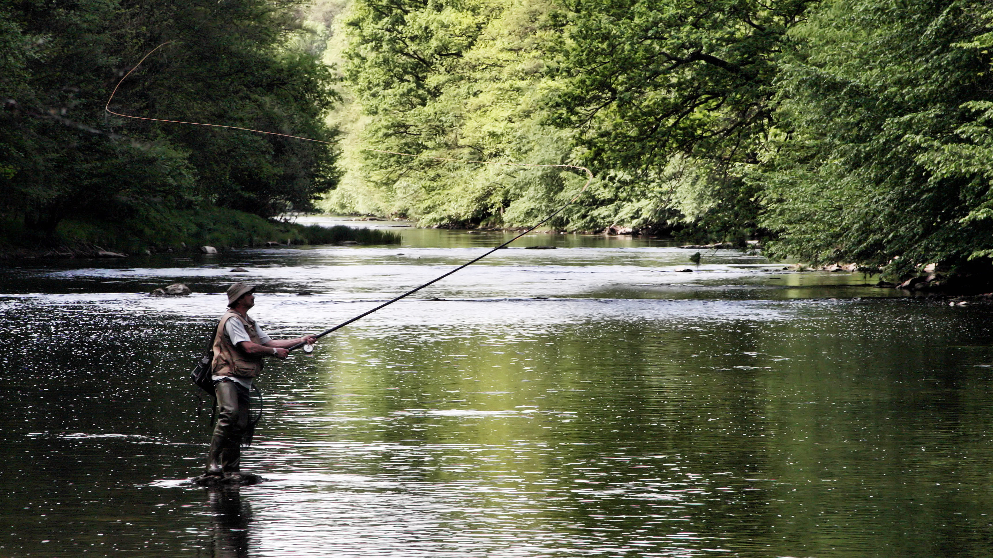
The Semois (; ''Simwès'' in Walloon, often under elided form ''Smwès''; ''Semoy'', ''Sesbach'' in German, ''Setzbaach'' in Luxemburgish of Arlon; and known as the ''Semoy'' in France) is a river flowing from the Ardennes uplands of Belgium and France towards the Meuse, of which it is a right tributary. The source of the Semois is in Arlon, Wallonia, in the Belgian province of Luxembourg, close to the border with the Grand Duchy of Luxembourg. Flowing in a roughly westerly direction, it enters France after passing through the Belgian village of Bohan-sur-Semois and forms about of the Belgian–French border. It joins the Meuse further downstream in Monthermé. The total length of the river is . Other places on the banks of the Semois are Chiny, Florenville, Herbeumont, Bouillon (including the localities of Dohan Dohan ( wa, Dôhan), sometimes known as Dohan-sur-Semois, is a village of Wallonia and a district of the municipality of Bouillon, located in the pro ... [...More Info...] [...Related Items...] OR: [Wikipedia] [Google] [Baidu] |
Bouillon, Belgium
Bouillon (; wa, Bouyon) is a city and municipality of Wallonia located in the province of Luxembourg in the Ardennes, Belgium. The municipality, which covers 149.09 km2, had 5,477 inhabitants, giving a population density of 36.7 inhabitants per km2. The municipality consists of the following districts: Bellevaux, Bouillon, Corbion, Dohan, Les Hayons, Noirefontaine, Poupehan, Rochehaut, Sensenruth, Ucimont, and Vivy. History In the Middle Ages Bouillon was a lordship within the Duchy of Lower Lorraine and the principal seat of the Ardennes-Bouillon dynasty in the 10th and 11th century. In the 11th century they dominated the area, and held the ducal title along with many other titles in the region. Bouillon was the location of the ducal mint and the dominant urban concentration in the dukes' possession.Murray, p. 10. There is a common misconception that Bouillon was a county. While the lords of Bouillon often were counts and dukes, Bouillon itself was not a c ... [...More Info...] [...Related Items...] OR: [Wikipedia] [Google] [Baidu] |
Arlon
Arlon (; lb, Arel ; nl, Aarlen ; german: Arel ; wa, Årlon; la, Orolaunum) is a city and municipality of Wallonia located in and capital of the province of Luxembourg in the Ardennes, Belgium. With a population of just over 28,000, it is the smallest provincial capital in Belgium. Arlon is also the capital of its cultural region: the Arelerland (Land of Arlon in Luxemburgish). The municipality consists of the following districts: Arlon, Autelbas, Barnich, Bonnert, Guirsch, Heinsch, and Toernich. Other population centers include: * Autelhaut * Clairefontaine * Fouches * Frassem * Freylange * Hachy * Heckbous * Rosenberg * Sampont * Schoppach * Sesselich * Seymerich * Stehnen * Sterpenich * Stockem * Udange * Viville * Waltzing * Weyler * Wolberg History Roman and medieval times Before the Roman conquests of Gaul, the territory of Arlon and a vast area to the southeast were settled by the Treveri, a Celtic tribe. The local population adapted relatively easi ... [...More Info...] [...Related Items...] OR: [Wikipedia] [Google] [Baidu] |
Fusion Of The Belgian Municipalities
The fusion of the Belgian municipalities (French: ''fusion des communes'', Dutch: ''fusie van Belgische gemeenten'') was a Belgian political process that rationalized and reduced the number of municipalities in Belgium between 1975 and 1983. In 1961, there were 2,663 such municipalities; by 1983, these had been re-arranged and combined into 589 municipalities. The project of merging a number of local authorities to improve service delivery by streamlining administration and creating economies of scale was the work of the government headed by Leo Tindemans (1974–1978), and in particular of Interior Minister Joseph Michel. The legal framework in which the mergers would be implemented was laid out in an act passed by the Belgian Parliament on 30 December 1975.M. Lazzari, P. Verjans and A.-L. DurviauxLa fusion des communes: une réforme trentenaire (Merger of municipalities: a thirty-year old reform) ''Territoire(s) wallon(s)'', special issue (August 2008), pp. 27-34. 21st centu ... [...More Info...] [...Related Items...] OR: [Wikipedia] [Google] [Baidu] |
Provinces Of Belgium
The Kingdom of Belgium is divided into three regions. Two of these regions, Flanders and Wallonia, are each subdivided into five provinces. The third region, Brussels, does not belong to any province and nor is it subdivided into provinces. Instead, it has amalgamated both regional and provincial functions into a single "Capital Region" administration. Most of the provinces take their name from earlier duchies and counties of similar location, while their territory is mostly based on the departments installed during French annexation. At the time of the creation of Belgium in 1830, only nine provinces existed, including the province of Brabant, which held the City of Brussels. In 1995, Brabant was split into three areas: Flemish Brabant, which became a part of the region of Flanders; Walloon Brabant, which became part of the region of Wallonia; and the Brussels-Capital Region, which became a third region. These divisions reflected political tensions between the French-sp ... [...More Info...] [...Related Items...] OR: [Wikipedia] [Google] [Baidu] |


.jpg)


.png)