|
Chamarel
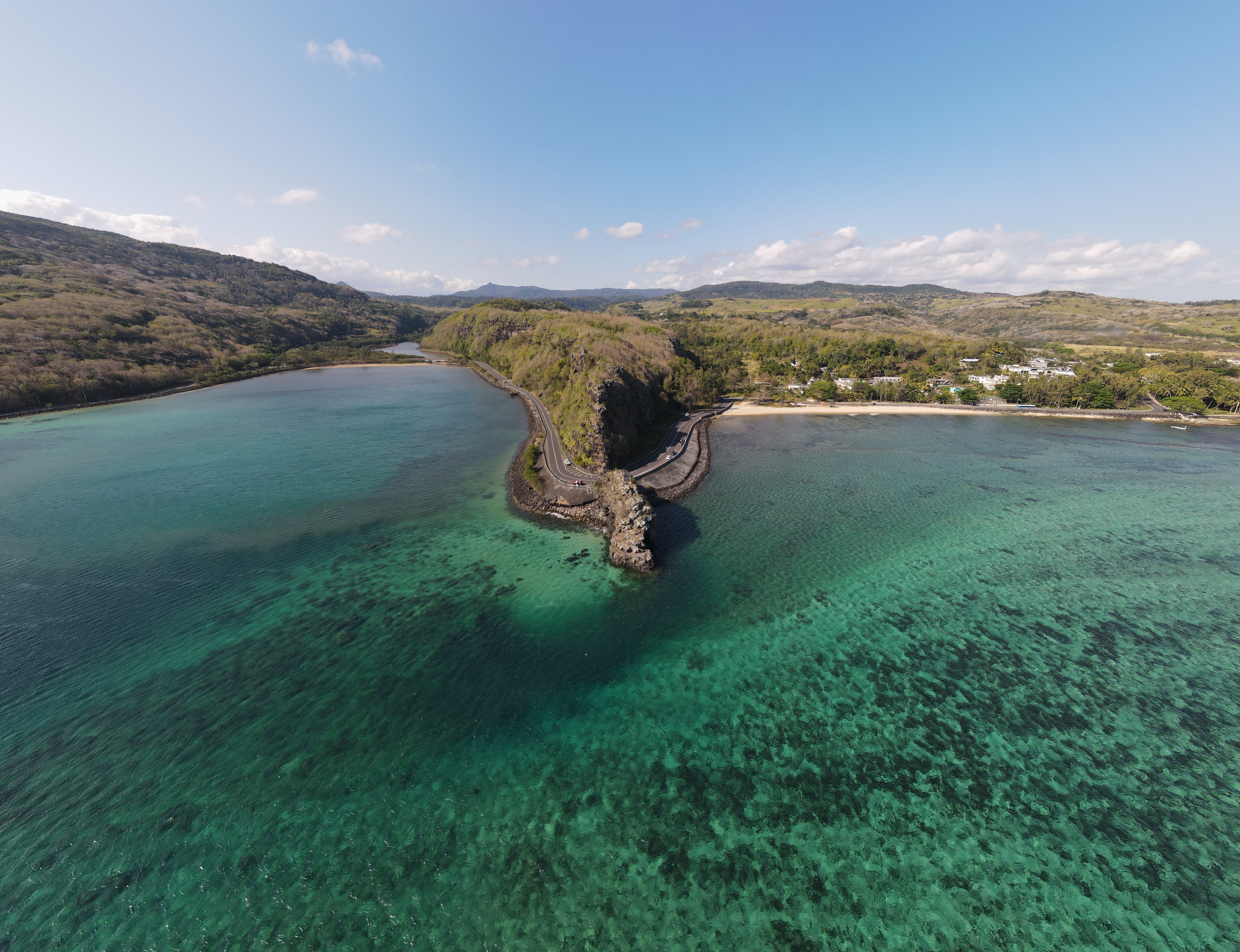
Chamarel is a village in Mauritius mainly located in Rivière Noire District. The eastern part of the village lies in the Savanne District. The village is administered by the Chamarel Village Council under the aegis of the Rivière Noire District Council. Today it is primarily known for its scenic locations and nature attractions in its neighbourhood, among them are the Seven Coloured Earths, the Chamarel Falls, Ebony Forest Chamarel and the Black River Gorges National Park. The surrounding area is also known for its locally grown coffee. Chamerel's church Saint Anna was built is 1876 and is subject to a pilgrimage on the Assumption of Mary (15 August), during which the village hosts a fair associated with the pilgrimage as well.Wolfgang Därr: ''Mauritius''. DuMont Reiseverlag 2010, , p. 192 (German)Rosabelle Boswell: ''Challenges to identifying and managing intangible cultural heritage in Mauritius, Zanzibar and Seychelles''. African Book Collective 2008, , p. 45–46 ... [...More Info...] [...Related Items...] OR: [Wikipedia] [Google] [Baidu] |
Ebony Forest Chamarel
Ebony Forest Reserve Chamarel or just the Ebony Forest is a registered non-profit organisation, registration number: NSIF/2024/0016 conserving Mauritian endemism, endemic species with a rehabilitated indigenous forest (including rare semi-dry forest types), situated in Chamarel, in the south-west of Mauritius. Establishment It was established in June 2017, after 10 years of work in restoring habitats and planting 130,000 endemic plants. In addition to the reintroduced endemic species, the area is home to some of the few remaining stands of original mature endemic Diospyros tessellaria, ebony trees. At present more than 154,000 plants have been planted and 34 ha have been weeded from invasive plant species. Wildlife Birds Birds commonly found nearby are the Mauritius paradise flycatcher (''Terpsiphone bourbonnensis''), the echo parakeet (''Psittacula eques echo''), the pink pigeon (''Nesoenas mayeri''), the Mauritius kestrel (''Falco punctatus''), the Mauritius bulbul (''Hypsipet ... [...More Info...] [...Related Items...] OR: [Wikipedia] [Google] [Baidu] |
Seven Coloured Earths
The Seven Coloured Earths are a geological formation and prominent tourist attraction found in the Chamarel plain of the Rivière Noire District in south-western Mauritius. It is a relatively small area of sand dunes comprising sand of seven distinct colours (approximately red, brown, violet, green, blue, purple and yellow). The main feature of the place is that since these differently coloured sands spontaneously settle in different layers, dunes acquire a surrealistic, striped colouring. Since the earth was first exposed, rains have carved beautiful patterns into the hillside, creating an effect of earthen meringue. Description The sands formed from the decomposition of volcanic rock ( basalt) gullies into clay, further transformed into ferralitic soil by total hydrolysis; the two main elements of the resulting soil, iron and aluminium Aluminium (or aluminum in North American English) is a chemical element; it has chemical symbol, symbol Al and atomic numb ... [...More Info...] [...Related Items...] OR: [Wikipedia] [Google] [Baidu] |
Savanne District
Savanne () or Savannah is a Districts of Mauritius, district of Mauritius, situated in the south of the island. The district has an area of . , the estimated population was 68,585. Places The Savanne District include different regions. Some regions are further divided into suburbs. * Baie-du-Cap * Bel-Ombre, Mauritius, Bel-Ombre * Bénarès, Mauritius, Bénarès * Batimarais, Mauritius, Batimarias * Bois-Chéri * Britannia, Mauritius, Britannia * Camp Diable * Chamouny * Chemin-Grenier * Grand Bois, Mauritius, Grand Bois * La Flora, Mauritius, La Flora * Rivière-des-Anguilles * Rivière Du Poste * Saint-Aubin, Mauritius, Saint-Aubin * Souillac, Mauritius, Souillac * Surinam, Mauritius, Surinam Places of interest * Ganga Talao * Trou aux Cerfs#Bassin Blanc, Bassin Blanc * The World of Seashells * Bel Ombre, Mauritius#Bel Ombre Nature Reserve, Bel Ombre Nature Reserve * Chazal Ecotourism * Domaine du Cerf d’Or * Macondé View Point * Valle Advenature Park Savanne Mountai ... [...More Info...] [...Related Items...] OR: [Wikipedia] [Google] [Baidu] |
Rivière Noire District
Rivière Noire () or Black River () is a district on the western side of the island of Mauritius. Rivière Noire translates to Black River. This region receives less rainfall than the others. The district has an area of and the population was estimated to be 80,939 as of 31 December 2015. It is the third largest district of Mauritius in area, but the smallest in terms of population. The district is mostly rural, but it also include the western part of the city of Port Louis and western part of Quatre Bornes. Places of interest Famous areas include Tamarin Falls and the Chamarel coloured earth. The name Black River derives from the fact that it is the driest district of the island. Flic en Flac is one of the most beautiful beaches on the island, and the longest. It is known for its natural beauty. Mission Blue Hope Spot In 2019, Mauritius recognised one of its new Hope Spots, the Black River District Hope Spot, in support of unifying the local marine conservation communi ... [...More Info...] [...Related Items...] OR: [Wikipedia] [Google] [Baidu] |
Districts Of Mauritius
The Districts of the Republic of Mauritius are the second-level administrative divisions after the Outer Islands of Mauritius. Mauritius Island Mauritius Island is divided into nine districts which consist of one city, four towns, and 130 villages. Its capital is Port Louis. The Plaines Wilhems District consists mainly of four towns: Beau Bassin-Rose Hill, Curepipe, Quatre Bornes, and Vacoas-Phoenix. The other districts consist of different villages, some of which are further divided into suburbs. As of 31 December 2012, the urban population stood at 536,086 and the rural population was 718,925. Autonomous region and Villages Rodrigues used to be the tenth district of Mauritius, until the island gained autonomy in 2002. Its capital is Port Mathurin. Dependencies of Mauritius # Agaléga. # Saint Brandon # Chagos Archipelago The capital of Agaléga is Vingt-Cinq. Saint Brandon is sparsely populated, its main settlement is Île Raphael (pop. 40). Chagos Arc ... [...More Info...] [...Related Items...] OR: [Wikipedia] [Google] [Baidu] |
List Of Places In Mauritius ...
This is a list of populated places in Mauritius and Agaléga. Mauritius Cities Towns Villages Agaléga See also * Outer islands of Mauritius * Districts of Mauritius * Geography of Mauritius * ISO 3166-2:MU References {{DEFAULTSORT:Places in Mauritius Mauritius geography-related lists Mauritius Mauritius Mauritius, officially the Republic of Mauritius, is an island country in the Indian Ocean, about off the southeastern coast of East Africa, east of Madagascar. It includes the main island (also called Mauritius), as well as Rodrigues, Ag ... [...More Info...] [...Related Items...] OR: [Wikipedia] [Google] [Baidu] |
Black River Gorges National Park
Black River Gorges National Park is a national park in the hilly south-western part of Mauritius. It was proclaimed on June 15, 1994 and is managed by the National Parks and Conservation Service. It covers an area of 67.54 km2 including humid upland forest, drier lowland forest and marshy heathland. Facilities for visitors include two information centres, picnic areas and 60 kilometres of trails. There are four field stations in the park which are used for National Parks and Conservation Service and Mauritian Wildlife Foundation research and conservation projects. It is the largest national park in Mauritius. Wildlife The park protects most of the island's remaining rainforest although much of this has been degraded by introduced plants such as Chinese guava and privet and animals such as rusa deer and wild pigs. Several areas have been fenced off and invasive species have been eradicated from them to preserve native wildlife. Many endemic plants and animals still occur ... [...More Info...] [...Related Items...] OR: [Wikipedia] [Google] [Baidu] |
Arabica Coffee
''Coffea arabica'' (), also known as the Arabica coffee, is a species of flowering plant in the coffee and madder family Rubiaceae. It is believed to be the first species of coffee to have been cultivated and is the dominant cultivar, representing about 60% of global production. Coffee produced from the less acidic, more bitter, and more highly caffeinated robusta bean ('' C. canephora'') makes up most of the remaining coffee production. The natural populations of ''Coffea arabica'' are restricted to the forests of South Ethiopia and Yemen. Taxonomy ''Coffea arabica'' was first described scientifically by Antoine de Jussieu, who named it ''Jasminum arabicum'' after studying a specimen from the Botanic Gardens of Amsterdam. Linnaeus placed it in its own genus ''Coffea'' in 1737. ''Coffea arabica'' is one of the polyploid species of the genus ''Coffea'', as it carries four copies of the eleven chromosomes (44 total) instead of the 2 copies of diploid species. Specifically, '' ... [...More Info...] [...Related Items...] OR: [Wikipedia] [Google] [Baidu] |
Abseiling
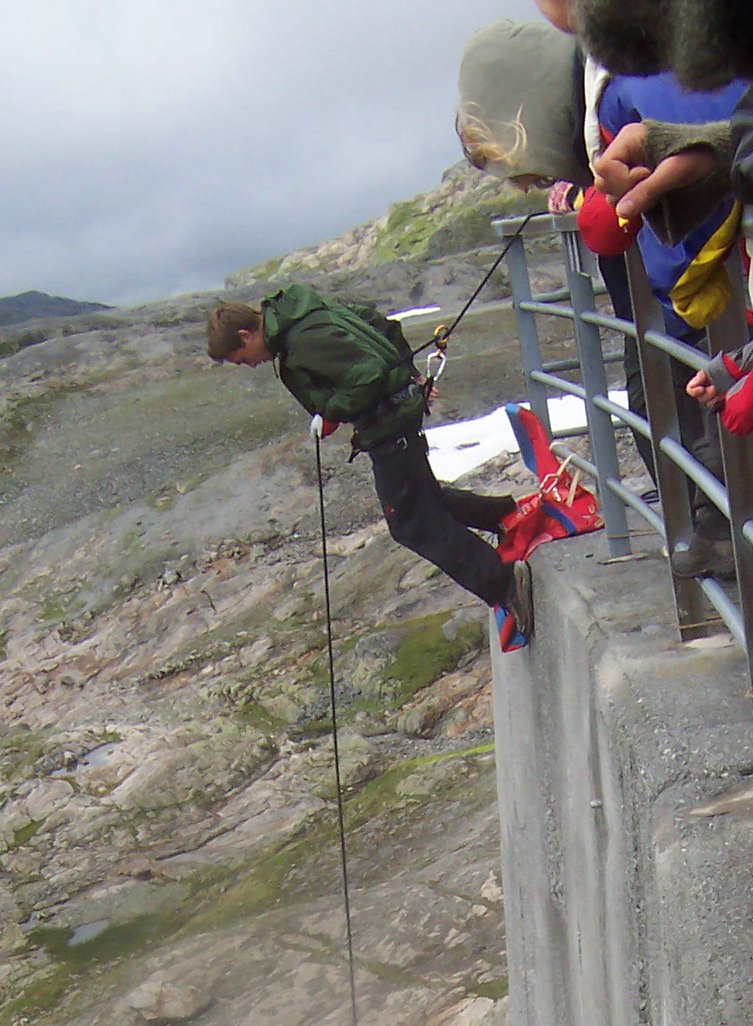
Abseiling ( ; ), also known as rappelling ( ; ), is the controlled descent of a steep slope, such as a rock face, by moving down a rope. When abseiling, the person descending controls their own movement down a static or fixed rope, in contrast to Belaying, lowering off, in which the rope attached to the person descending is paid out by their belayer. Description The technique is used by Climbing, climbers, mountaineers, Caving, cavers, Canyoning, canyoners, search and rescue and rope access technicians to descend cliffs or slopes when they are too steep or dangerous to descend without protection. Many climbers use this technique to protect established Anchor (climbing), anchors from damage. Rope access technicians also use this as a method to access difficult-to-reach areas from above for various industrial applications like maintenance, construction, inspection and welding. To descend safely, abseilers use a variety of techniques to increase the friction on the rope to t ... [...More Info...] [...Related Items...] OR: [Wikipedia] [Google] [Baidu] |


