|
Chadiza
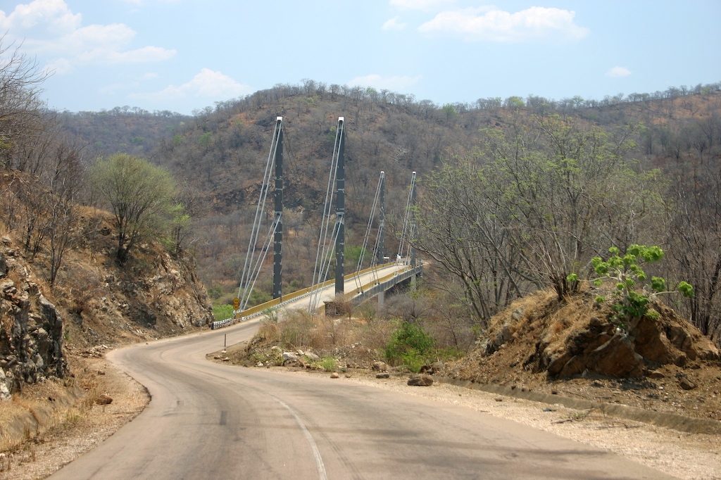
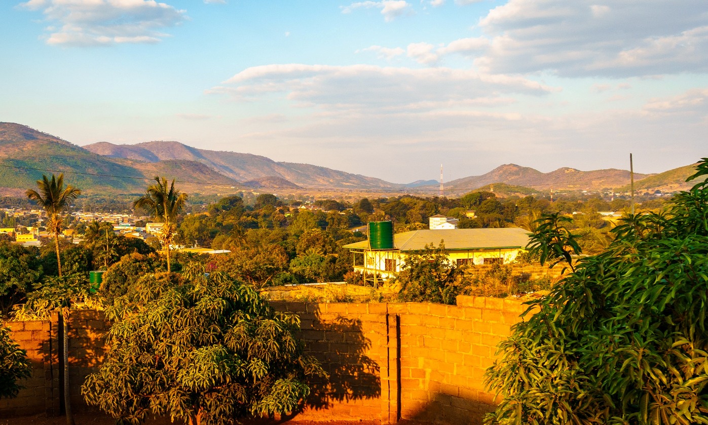
Chadiza is a town in the Eastern Province of Zambia. Its headquarters are located in Chadiza District. It lies 35 km south of the Great East Road and about 80 km south-south-west of Chipata, on a plateau (elevation 1050 m) studded by isolated rocky hills, between the middle Luangwa valley and the Zambezi. It is also 35 kilometres north-north-east of the Chimefusa Border (the main border crossing between Mozambique Mozambique, officially the Republic of Mozambique, is a country located in Southeast Africa bordered by the Indian Ocean to the east, Tanzania to the north, Malawi and Zambia to the northwest, Zimbabwe to the west, and Eswatini and South Afr ... and Zambia). References *Terracarta/International Travel Maps, Vancouver Canada: "Zambia, 2nd edition", 2000 Populated places in Eastern Province, Zambia {{Zambia-geo-stub ... [...More Info...] [...Related Items...] OR: [Wikipedia] [Google] [Baidu] |
Chadiza District
Chadiza District with the headquarters at Chadiza lies in the extreme south-east corner of Zambia, bordering Mozambique to its south. The eastern half of the district is characterised by wooded rocky hills rising to 1330 m while the western half has the same character as the land around Chadiza town. This part of the district has been almost completely deforested and suffers soil erosion Soil erosion is the denudation or wearing away of the Topsoil, upper layer of soil. It is a form of soil degradation. This natural process is caused by the dynamic activity of erosive agents, that is, water, ice (glaciers), snow, Atmosphere of Ea .... In 2012, most of the eastern part of the district was declared its own district, namely Vubwi District. As of the 2022 Zambian Census, the district had a population of 111,069 people. [...More Info...] [...Related Items...] OR: [Wikipedia] [Google] [Baidu] |
Great East Road (Zambia)
The Great East Road is a major road in Zambia and the main route linking its Eastern Province, Zambia, Eastern Province with the rest of the country. It is also the major link between Zambia and Malawi and between Zambia and northern Mozambique.Terracarta: ''Zambia, 2nd edition'', International Travel Maps, Vancouver, Canada, 2000. However, the route does not carry as much traffic as many of the other regional arterial roads and between the main cities it serves, Lusaka and Chipata, it passes through rural and wilderness areas. In Lusaka the road forms the main arterial road for the eastern suburbs. The entire route from Lusaka to Chipata and the border with Malawi is designated the T4 road on Zambia's road network. History Chipata, the capital of the Eastern Province was an early outpost of the British Empire, British Colonialism, colonial administration as Fort Jameson when Zambia was Northern Rhodesia. Like most of the Eastern Province, it had much easier access to Malawi, then ... [...More Info...] [...Related Items...] OR: [Wikipedia] [Google] [Baidu] |
List Of Populated Places In Zambia
This is a list of cities, towns, villages and Mission (station), missions in Zambia. Cities Other towns, villages and missions *Chadiza *Chama, Zambia, Chama *Chambishi *Chavuma *Chembe *Chibombo *Chiengi *Chilanga (Lusaka), Zambia, Chilanga, Lusaka *Chilanga, Zambia, Chilanga, Muchinga *Chilonga *Chilubi *Chililabombwe *Chingola *Chinsali *Chinyingi *Chirundu, Zambia, Chirundu *Chisamba *Choma, Zambia, Choma *Chozi, Zambia, Chozi *Gwembe *Isoka *Kabompo *Kabwe *Kafue *Kafulwe *Kalabo *Kalene Hill *Kalomo *Kalulushi *Kanyembo *Kaoma, Zambia, Kaoma *Kapiri Mposhi *Kasama, Zambia, Kasama *Kasempa *Kashikishi *Kataba *Katete *Kawambwa *Kazembe (Mwansabombwe) *Kazungula *Luangwa, Zambia, Luangwa *Luanshya *Lufwanyama *Lukulu *Lundazi *Maamba *Macha Mission *Mansa, Zambia, Mansa *Mazabuka *Mbala, Zambia, Mbala *Mbereshi *Mfuwe *Milenge, Zambia, Milenge *Mkushi *Mongu *Monze *Mpika *Mporokoso *Mpulungu *Mufulira *Mumbwa *Muyombe *Mwandi *Mwinilunga *Nakonde *Nchelenge *Ngoma, Zambia ... [...More Info...] [...Related Items...] OR: [Wikipedia] [Google] [Baidu] |
Eastern Province, Zambia
Eastern Province is one of Zambia's ten provinces. The province lies between the Luangwa River and borders with Malawi to the east and Mozambique to the south, from Isoka in the northeast to the north of Luangwa in the south. The provincial capital is Chipata. The Eastern province has an area of about , locally shares border with three other provinces of the country and is divided into fifteen districts. As per the 2010 Zambian census, the Eastern Province had a population of 1,592,661, accounting to 12.16% of the total Zambian population. The sex ratio was 1,030 females for every 1,000 males. The Chewa, Tumbuka and Nsenga people are the largest communities in the region. Chichewa and Chitumbuka are the most widely spoken languages. On the tourism front, the province has four national parks. The province has several significant traditional ceremonies such as Zengani, Vimkakanimba, Nc'wala and Kulamba. Agriculture is the major occupation in the province which accounts ... [...More Info...] [...Related Items...] OR: [Wikipedia] [Google] [Baidu] |
Districts Of Zambia
The Provinces of Zambia, ten provinces of Zambia are divided into a total of 116 districts as of 2018. Article 109 in part VIII of the constitution of Zambia deals with local government. It states only that there should be some form of local government, and that this local government should be based on democracy, democratically elected councils on the basis of universal suffrage, universal adult suffrage. Provincial districts in Zambia Until 2011, Zambia was Subdivisions of Zambia, subdivided into 72 districts. However, since 2011, a number of new districts have been created, bringing the total to 116 as of 2018. ;Total Districts by Province as of 2021: # Central Province, Zambia, Central Province (11 districts) # Copperbelt Province (10 districts) # Eastern Province, Zambia, Eastern Province (15 districts) # Luapula Province (12 districts) # Lusaka Province (6 districts) # Muchinga Province (8 districts) # Northern Province, Zambia, Northern Province (12 districts) # North-W ... [...More Info...] [...Related Items...] OR: [Wikipedia] [Google] [Baidu] |
Chipata
Chipata is a city and administrative centre of the Eastern Province of Zambia and Chipata District. It was declared the 5th city of the country, after Lusaka, Ndola, Kitwe and Livingstone, by President Edgar Lungu on 24 February 2017. The city has undergone rapid economic and infrastructure growth in the years, leading up to city status. Location Chipata is located on the Great East Road, approximately east of Lusaka, the capital city of Zambia. This is about west of Lilongwe, the capital city of Malawi. The geographical coordinates of Chipata are 13°38′43.0″S, 32°38′47.0″E. The average elevation of Chipata is , above sea level. Overview Having a modern market, a central hospital, shopping malls, a university, some colleges and a number of schools, Chipata is the business and administrative hub of the region. The town boasts a four star hotel, a golf course, an airport, and a "welcome arch". Developed areas includes Kalongwezi, Moth, and Little Bombay. Chipata ... [...More Info...] [...Related Items...] OR: [Wikipedia] [Google] [Baidu] |
Flag Of Zambia
The national flag of Zambia was adopted upon independence on 24 October 1964, by the first Republican president, Dr. Kenneth David Kaunda. Before that, Zambia was the British protectorate of Northern Rhodesia and used a Blue Ensign as its flag. The current flag is used as both national flag and ensign. It is green with an orange-coloured African fish eagle in flight over a rectangular block of three vertical stripes, coloured, from left to right: red, black and orange. The placement of the eagle and block of stripes at the flag's fly is notable as most emblems and devices on flags are placed at centre or at the hoist. Green stands for the nation's agriculture and lush flora, red for the nation's struggle for freedom, black for the Zambian people and all black Africans, and orange for the land's copper, natural resources in general, and mineral wealth. Additionally, the eagle flying above the coloured stripes is intended to represent freedom and the people's ability to rise a ... [...More Info...] [...Related Items...] OR: [Wikipedia] [Google] [Baidu] |
Zambia
Zambia, officially the Republic of Zambia, is a landlocked country at the crossroads of Central Africa, Central, Southern Africa, Southern and East Africa. It is typically referred to being in South-Central Africa or Southern Africa. It is bordered to the north by the Democratic Republic of the Congo, Tanzania to the north-east, Malawi to the east, Mozambique to the southeast, Zimbabwe and Botswana to the south, Namibia to the southwest, and Angola to the west. The capital city of Zambia is Lusaka, located in the south-central part of Zambia. The population is concentrated mainly around Lusaka in the south and the Copperbelt Province to the north, the core economic hubs of the country. Originally inhabited by Khoisan peoples, the region was affected by the Bantu expansion of the thirteenth century. Following European colonization of Africa, European colonisers in the 18th century, the British colonised the region into the British protectorates of Barotziland–North-Western Rho ... [...More Info...] [...Related Items...] OR: [Wikipedia] [Google] [Baidu] |
Provinces Of Zambia
Zambia is divided into ten provinces. The provinces are further subdivided into districts. The Provincial Administration is headed by a Provincial Minister, who is appointed by the President, and is responsible for overseeing the implementation of government policies and coordinating the activities of various government departments within the province. The Provincial Minister is supported by a Provincial Permanent Secretary, who handles the day-to-day administration. Each province has a Provincial Development Coordinating Committee (PDCC) that plays a key role in development planning and coordinating projects within the province. The current provinces were established following Zambia's independence in 1964, although their borders and functions have evolved over time to support the country’s decentralization efforts. List of provinces Administration The provincial government in Zambia is primarily established for administrative purposes. Each province is headed by a Provinci ... [...More Info...] [...Related Items...] OR: [Wikipedia] [Google] [Baidu] |
Central Africa Time
Central Africa Time or CAT, is a time zone used in north central, east central and southern Africa. Central Africa Time is two hours ahead of Coordinated Universal Time ( UTC+02:00), which is the same as the adjacent South Africa Standard Time, Egypt Standard Time, Eastern European Time, Kaliningrad Time and Central European Summer Time. As this time zone is in the equatorial and tropical regions, there is little change in day length throughout the year and so daylight saving time is not observed. Central Africa Time is observed by the following countries: * * * (eastern provinces) * * * * * * * * The following countries in Africa also use an offset of UTC+02:00 all-year round: * (observes South African Standard Time) * (observes South African Standard Time) * (observes Eastern European Time) * (observes South African Standard Time) See also * Egypt Standard Time, an equivalent (except during daylight savings) time zone covering Egypt, also at UTC+02:00 * Kaliningrad T ... [...More Info...] [...Related Items...] OR: [Wikipedia] [Google] [Baidu] |
Luangwa River
The Luangwa River is one of the major Tributary, tributaries of the Zambezi River, and one of the four biggest rivers of Zambia. The river generally floods in the rainy season (December to March) and then falls considerably in the dry season. It is one of the biggest unaltered rivers in Southern Africa and the that make up the surrounding valley are home to abundant wildlife. Source and upper-middle course ''Note: distances stated are approximate straight-line distances from source''. The Luangwa rises in the Lilonda and Mafinga Hills in north-east Zambia at an elevation of around , near the border with Tanzania and Malawi, and flows in a southwesterly direction through a broad valley. About from its source it has dropped to an elevation of about and becomes a meandering river with a floodplain several kilometres wide. Over the next the meanders increase, with many oxbow lakes and Meander#Abandoned meander, abandoned meanders. Near Mfuwe, the river's elevation has dropped ... [...More Info...] [...Related Items...] OR: [Wikipedia] [Google] [Baidu] |


