|
Cerro San Javier
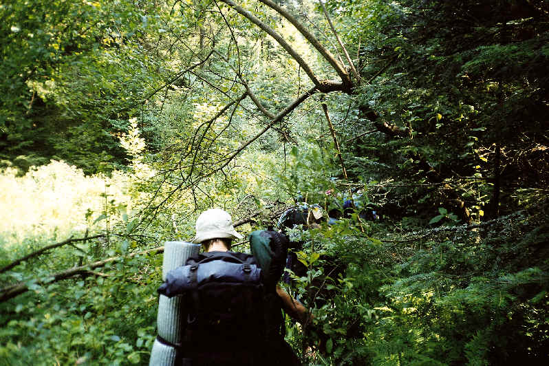
San Javier Hill is a geographical feature, located in the province of Tucumán, Argentina. Geography It is about 24 km (15 miles) from the provincial capital, San Miguel de Tucumán. The road to the hill has more than 100 curves and at is bordered by tropical vegetation typical to the region. The mountain range occupies more than 19,000 hectares. The summit of Taficillo to the north has a maximum altitude of about 1876 meter (6155 feet). The dominant vegetation includes cloud forests, jungles, and mountain forests or ''yungas'' that host summer villages closest to the city: Villa Nougués, El Siambón, Raco, and San Javier. Amenities Sporting activities include paragliding, trekking, horseback riding, mountain biking, hiking, etc. It offers a beautiful view: towards the west, the capital and its surrounding plain, and on the other side, the green mesas that have the Calchaquíes summits as a background. The summer village of San Javier is on the ridge of the moun ... [...More Info...] [...Related Items...] OR: [Wikipedia] [Google] [Baidu] |
Tucumán Province
Tucumán () is the most densely populated, and the second-smallest by land area, of the provinces of Argentina. Located in the northwest of the country, the province has the capital of San Miguel de Tucumán, often shortened to Tucumán. Neighboring provinces are, clockwise from the north: Salta Province, Salta, Santiago del Estero Province, Santiago del Estero and Catamarca Province, Catamarca. It is nicknamed El Jardín de la República (''The Garden of the Republic''), as it is a highly productive agricultural area. Etymology The word ''Tucumán'' probably originated from the Quechua languages. It may represent a deformation of the term ''Yucumán'', which denotes the "place of origin of several rivers". It can also be a deformation of the word ''Tucma'', which means "the end of things". Before Spanish colonization, the region lay in the outer limits of the Inca empire. History Before the Spanish colonization of the Americas, Spanish colonization, this land was inhabited ... [...More Info...] [...Related Items...] OR: [Wikipedia] [Google] [Baidu] |
San Miguel De Tucumán
San Miguel de Tucumán (), usually called simply Tucumán, is the capital and largest city of Tucumán Province, located in northern Argentina from Buenos Aires. It is the fifth-largest city of Argentina after Buenos Aires, Córdoba, Argentina, Córdoba, Rosario and Mendoza, Argentina, Mendoza and the most important city of the northern region. The Spanish conquistador :es:Diego de Villarroel, Diego de Villarroel founded the city in 1565 in the course of an expedition from present-day Peru. Tucumán moved to its present site in 1685. Overview The city is bordered on the north by Las Talitas (Tafí Viejo, Tucumán, Tafí Viejo), on the east by Banda del Río Salí and Alderetes (Tucumán), Alderetes (Cruz Alta), on the west by the city of Yerba Buena, Tucumán, Yerba Buena, and on the south by Lules. The city is located on the slopes of the Aconquija mountains, the easternmost mountain range before the large Gran Chaco, Chaco-Pampas, Pampean flats. It is the commercial center ... [...More Info...] [...Related Items...] OR: [Wikipedia] [Google] [Baidu] |
Hectare
The hectare (; SI symbol: ha) is a non-SI metric unit of area equal to a square with 100-metre sides (1 hm2), that is, square metres (), and is primarily used in the measurement of land. There are 100 hectares in one square kilometre. An acre is about and one hectare contains about . In 1795, when the metric system was introduced, the ''are'' was defined as 100 square metres, or one square decametre, and the hectare (" hecto-" + "are") was thus 100 ''ares'' or km2 ( square metres). When the metric system was further rationalised in 1960, resulting in the International System of Units (), the ''are'' was not included as a recognised unit. The hectare, however, remains as a non-SI unit accepted for use with the SI and whose use is "expected to continue indefinitely". Though the dekare/decare daa () and are (100 m2) are not officially "accepted for use", they are still used in some contexts. Description The hectare (), although not a unit of SI, is ... [...More Info...] [...Related Items...] OR: [Wikipedia] [Google] [Baidu] |
Cloud Forest
A cloud forest, also called a water forest, primas forest, or tropical montane cloud forest, is a generally tropical or subtropical, evergreen, Montane forest, montane, Tropical and subtropical moist broadleaf forests, moist forest characterized by a persistent, frequent or seasonal low-level cloud cover, usually at the canopy level, formally described in the ''International Cloud Atlas'' (2017) as silvagenitus. Cloud forests often exhibit an abundance of mosses covering the ground and vegetation, in which case they are also referred to as mossy forests. Mossy forests usually develop on the mountain pass, saddles of mountains, where moisture introduced by settling clouds is more effectively retained. Cloud forests are among the most biodiversity-rich ecosystems in the world, with a large number of species directly or indirectly depending on them. Other moss forests include black spruce/feathermoss Climax community, climax forest, with a moderately dense canopy and a forest fl ... [...More Info...] [...Related Items...] OR: [Wikipedia] [Google] [Baidu] |
Mountain Forests
Montane ecosystems are found on the slopes of mountains. The alpine climate in these regions strongly affects the ecosystem because temperatures fall as elevation increases, causing the ecosystem to stratify. This stratification is a crucial factor in shaping plant community, biodiversity, metabolic processes and ecosystem dynamics for montane ecosystems. Dense montane forests are common at moderate elevations, due to moderate temperatures and high rainfall. At higher elevations, the climate is harsher, with lower temperatures and higher winds, preventing the growth of trees and causing the plant community to transition to montane grasslands and shrublands or alpine tundra. Due to the unique climate conditions of montane ecosystems, they contain increased numbers of endemic species. Montane ecosystems also exhibit variation in ecosystem services, which include carbon storage and water supply. Life zones As elevation increases, the climate becomes cooler, due to a decrease in ... [...More Info...] [...Related Items...] OR: [Wikipedia] [Google] [Baidu] |
Yungas
The Yungas ( Aymara ''yunka'' warm or temperate Andes or earth, Quechua ''yunka'' warm area on the slopes of the Andes) is a bioregion of a narrow band of forest along the eastern slope of the Andes Mountains from Peru and Bolivia, and extends into Northwest Argentina at the slope of the Andes pre-cordillera. It is a transitional zone between the Andean highlands and the eastern forests. Like the surrounding areas, the Yungas belong to the Neotropical realm; the climate is rainy, humid, and warm. History During the Inca Empire, the term ''yunga'' referred to both the western and eastern slopes of the Andes and their inhabitants. In the Spanish colonial era, it became primarily associated with the western foothills near the desert coast and the local Indians. Today, ''yunga'' can refer to the lower slopes on both sides of the Andes, though ''yungas'' mostly denotes the eastern foothills between the Andes and the Amazon basin, with both having mostly lost their ethnic associatio ... [...More Info...] [...Related Items...] OR: [Wikipedia] [Google] [Baidu] |
Villa Nougués
Villa Nougués is a settlement in Lules Department, Tucumán Province, in northern Argentina. Overview Situated along the eastern face of San Javier Hill, at 1,350 m (4,450 ft), the settlement was established where a Jesuit reduction operated until the order's suppression in 1767. Prominent Tucumán landowner Luis Francisco Nougués chose the site as the location of his summer house in 1899, and his brothers, Juan Calos and Alberto, followed suit, as did University of Tucumán founder Luis Francisco Nougués. These initial proprietors then resolved to create a community for administrative employees of Nougués' important San Pablo sugar plantation and mill, and founded the town in 1904; Luis Nougués served as Governor of Tucumán from 1906 to 1909. The town's early structures were designed by Polish Argentine architect Juan Hlawascek in the Norman style favored by the Nougués family, originally from the French region of Haute-Garonne, and among the most noteworthy of th ... [...More Info...] [...Related Items...] OR: [Wikipedia] [Google] [Baidu] |
Paragliding
Paragliding is the recreational and competitive adventure sport of flying paragliders: lightweight, free-flying, foot-launched glider aircraft with no rigid primary structure. The pilot sits in a harness or in a cocoon-like 'pod' suspended below a fabric wing. Wing shape is maintained by the suspension lines, the pressure of air entering vents in the front of the wing, and the aerodynamic forces of the air flowing over the outside. Despite not using an engine, paraglider flights can last many hours and cover many hundreds of kilometres, though flights of one to five hours and covering some tens of kilometres are more the norm. By skillful exploitation of sources of lift, the pilot may gain height, often climbing to altitudes of a few thousand metres. History In 1966, Canadian Domina Jalbert was granted a patent for a ''multi-cell wing type aerial device—''"a wing having a flexible canopy constituting an upper skin and with a plurality of longitudinally extending ribs form ... [...More Info...] [...Related Items...] OR: [Wikipedia] [Google] [Baidu] |
Backpacking (hiking)
Backpacking is the outdoor recreation of carrying gear on one's back while hiking for more than a day. It is often an extended journey and may involve camping outdoors. In North America, tenting is common, where simple shelters and mountain huts, widely found in Europe, are rare. In New Zealand, hiking is called Tramping in New Zealand, tramping, and tents are used alongside a nationwide network of huts. Hill walking is equivalent in Britain (but this can also refer to a day walk), though backpackers make use of a variety of accommodation, in addition to camping. Backpackers use simple huts in South Africa. Trekking and bushwalking are other words used to describe such multi-day trips. The terms walking tour or Long distance path , long distance hike are also used. Backpacking backpacking (travel), as a method of travel is a different activity, which mainly uses public transport during a journey that can last months. It is, however, similar to bikepacking, bicycle touring, Canoe ... [...More Info...] [...Related Items...] OR: [Wikipedia] [Google] [Baidu] |
Mountain Biking
Mountain biking (MTB) is a sport of riding bicycles off-road, often over rough terrain, usually using specially designed mountain bikes. Mountain bikes share similarities with other bikes but incorporate features designed to enhance durability and performance in rough terrain, such as air or coil-sprung shocks used as suspension, larger and wider wheels and tires, stronger frame materials, and mechanically or hydraulically actuated disc brakes. Mountain biking can generally be broken down into distinct categories: Cross-country cycling, cross country, trail riding#Mountain biking, trail, all mountain, Enduro (mountain biking), enduro, Downhill cycling, downhill and freeride (mountain biking), freeride. About The sport requires endurance, core and back strength, balance, bike handling skills, and self-reliance. Advanced riders pursue both steep technical descents and high-incline climbs. In the case of freeride, downhill, and dirt jumping, aerial maneuvers are performed off bo ... [...More Info...] [...Related Items...] OR: [Wikipedia] [Google] [Baidu] |
Mesa
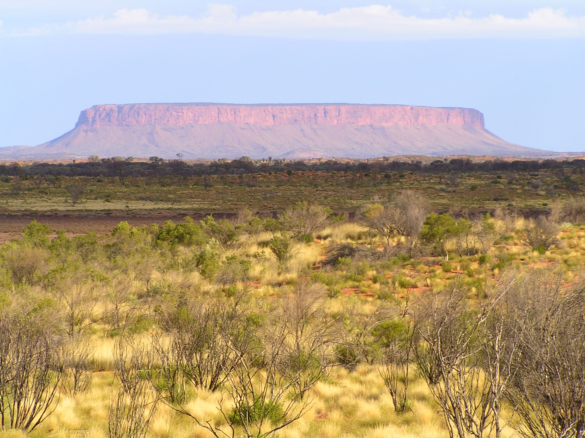
A mesa is an isolated, flat-topped elevation, ridge, or hill, bounded from all sides by steep escarpments and standing distinctly above a surrounding plain. Mesas consist of flat-lying soft sedimentary rocks, such as shales, capped by a resistant layer of harder rock, like sandstone or limestone, forming a caprock that protects the flat summit. The caprock may also include dissected lava flows or eroded duricrust. Unlike a ''plateau'', which is a broader, elevated region that may not have horizontal bedrock (e.g., Tibetan Plateau), a mesa is defined by flat-lying strata and steep-sided isolation. Large, flat-topped plateaus with horizontal strata, less isolated and often part of extensive plateau systems, are called '' tablelands''. A ''butte'' is a smaller, eroded mesa with a limited summit, while a '' cuesta'' has a gentle dip slope and one steep escarpment due to tilted strata.Duszyński, F., Migoń, P. and Strzelecki, M.C., 2019. ''Escarpment retreat in sedim ... [...More Info...] [...Related Items...] OR: [Wikipedia] [Google] [Baidu] |


