|
Central, Zurich
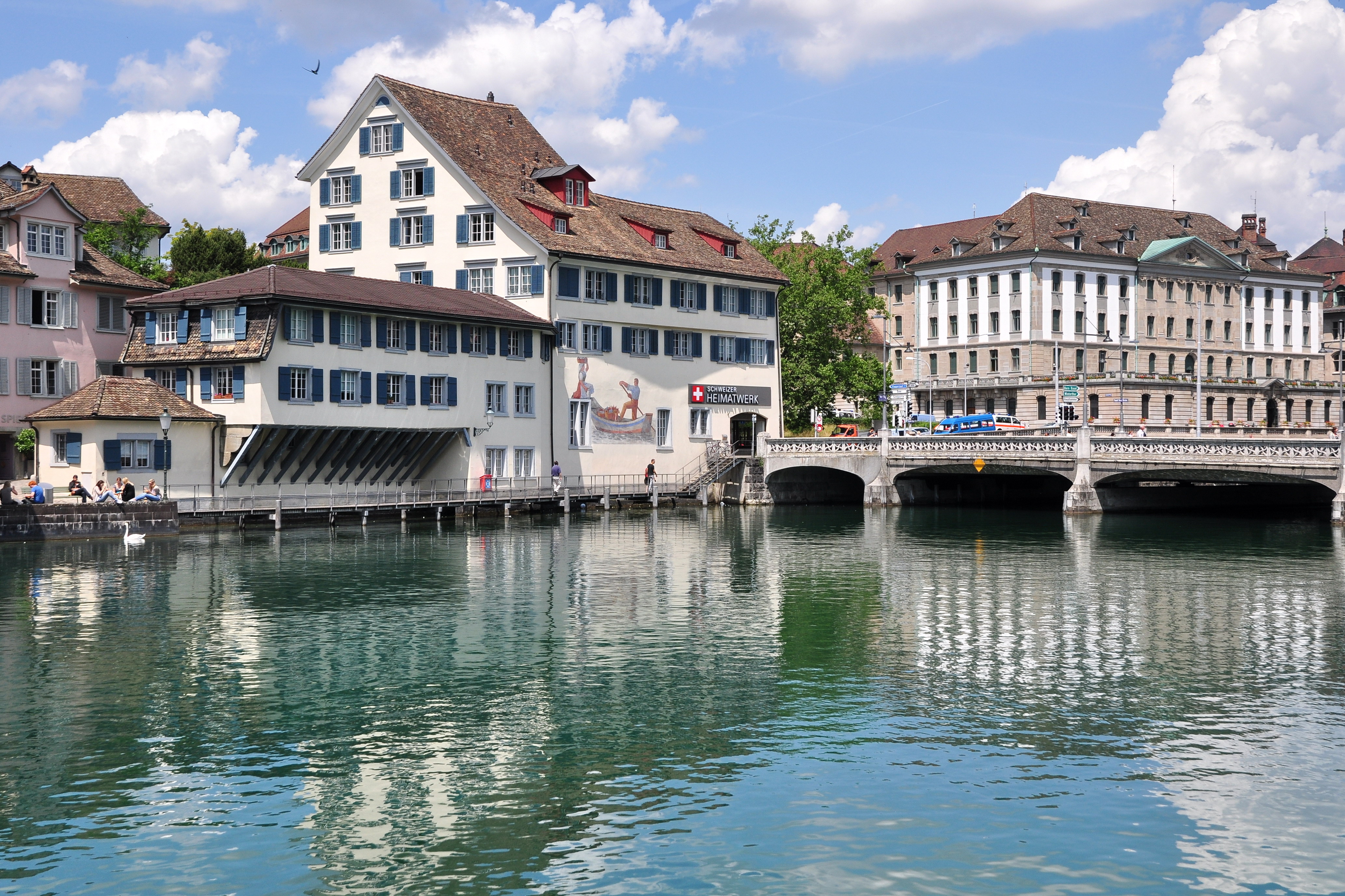
Central is a public square at the northern end of Limmatquai in Zürich, Switzerland. It is one of the city's public transport nodes, housing an interchange station for tram and bus lines run by the Verkehrsbetriebe Zürich. It was formerly known as Leonhardplatz or Leonhardsplatz. Geography Central is in fact outside of the historical core of the medieval town of Zürich, previously the Celtic-Roman ''Turicum''. It is situated at the right-hand (eastern) bank of the Limmat, the principal river flowing through the city of Zürich. It is opposite of the Zürich Hauptbahnhof and connected by Bahnhofbrücke, a road and tramway bridge crossing the Limmat, and connecting ''Rathaus'' and ''Lindenhof'' respectively the ''City'' and ''Unterstrass'' quarters. Situated nearby the historical Neumarkt and Niederdorf, the most remarkable landmark is the Prediger church. The former ''Leonhardplatz'' is named after the ''Central'' hotel situated there. The ''Seilergraben'', ''Weinberg ... [...More Info...] [...Related Items...] OR: [Wikipedia] [Google] [Baidu] |
Lindenhof Hill
The Lindenhof (lit.: ''courtyard of the lime'') is a moraine hill and a public square in the historic center of Zürich, Switzerland. It is the site of the Roman and Carolingian era Kaiserpfalz around which the city has historically grown. The hilltop area—including its prehistoric, Roman, and medieval remains—is listed as a Swiss heritage site of national significance. Topography Lindenhof (its northern part is called ''Sihlbühl'') dominates the Lindenhof quarter in district 1 (Altstadt), the historical center of Zürich's Altstadt. To the North, it ends at ''Uraniastrasse'' (City police station) and to the South, it ends near St. Peter church. In the West, the hill is limited by the Bahnhofstrasse, and in the east, it ends at the Limmat and the Schipfe quarter. Lindenhof sits atop the remains of a glacier. The hill and its public square are part of the Linth Glacier's moraines in the area of Zürich. The now largely flattened Lindenhof (428 m ü. M) rises about 25 met ... [...More Info...] [...Related Items...] OR: [Wikipedia] [Google] [Baidu] |
Predigerkirche Zürich
Predigerkirche is one of the four main churches of the old town of Zürich, Switzerland, besides Fraumünster, Grossmünster and St. Peter. First built in 1231 AD as a Romanesque church of the then Dominican ''Predigerkloster'', the Basilica was converted in the first half of the 14th century, the choir between 1308 and 1350 rebuilt, and a for that time unusual high bell tower was built, regarded as the highest Gothic edifice in Zürich. History Located nearby the medieval ''Neumarkt'' quarter, the church that commonly is named ''Predigerkirche'' was mentioned for the first time in 1234 AD as the Predigerkloster monastery of the Dominican Order. The first Dominican friars settled, according to the chronicler Heinrich Brennwald, outside of the city walls of medieval Zürich at Stadelhofen in 1230, and the construction of a new convent in Zürich was first mentioned in 1231. Initially, against the resistance of the Grossmünster canons, the Dominican's inclusion in Zürich was ... [...More Info...] [...Related Items...] OR: [Wikipedia] [Google] [Baidu] |
Altstadt (Zurich)
The Altstadt (German for "old town") in the Swiss city of Zurich encompasses the area of the entire historical city before 1893, before the incorporation of what are now districts 2 to 12 into the municipality, over the period 1893 to 1934. ''Die Altstadt'' approximately corresponds to the area enclosed by the former city ramparts, and is today within the administrative area of the city called Kreis 1 (District 1). With a population of 5,617 (as of 2015), it houses about 1.4% of the city's total population. Administratively, District 1 is divided into four parts or quarters by the Zürich statistical office, Rathaus (town hall), Hochschulen (universities), Lindenhof ("lime trees courtyard") and City. ''Lindenhof'' and ''Rathaus'' correspond to the parts of the medieval city left (west) and right (east) of the Limmat, respectively, while ''City'' and ''Hochschulen'' include the area of the Early Modern city west and east of the medieval walls, respectively. Lindenhof Der L ... [...More Info...] [...Related Items...] OR: [Wikipedia] [Google] [Baidu] |
Oetenbach Nunnery
Oetenbach was a Dominican nunnery in the medieval municipality of Zürich in Switzerland. Oetenbach was named after the small stream of the same name at its first location at Zürichhorn, situated outside of the European Middle Ages town walls, but moved to the present Sihlbühl. The nunnery was abolished on occasion of the Reformation in Zürich – the Waisenhaus building is its only remained structure, now the headquarters of Stadtpolizei Zürich. Location The ''Oetenbach'' nunnery was first mentioned in 1237 AD at its first location at the present Zürichhorn. Because the swampy area at the ''Oetenbach'' stream was a bad place for the construction of a permanently inhabited convent, some decades later, it was built on the northern slope ''Sihlbühl'' of the present Lindenhof hill. On the so-called Murerplan map of 1576, the central ''Lindenhof–Sihlbühl'' hill area is illustrated, surrounded by the Limmat river – at the top, in fact in the east and not in the north � ... [...More Info...] [...Related Items...] OR: [Wikipedia] [Google] [Baidu] |
Urania Sternwarte
Urania Sternwarte is a public observatory in the Lindenhof quarter of Zurich, Zürich, Switzerland. Its name ''Urania'' refers to the muse of astronomy in Greek mythology. History Its origins base on a first observatory on the roof of the Zunfthaus zur Meisen. In 1759, so called «Astronomische Kommission» succeeded from this location for the first time, to define ''Culmination, Culminatio solis'' and thus calculated the exact global location of the city of Zurich. In later years, astronomical observations were done from the Grossmünster's southern "Karl's tower", followed by scientific observations (not for public use by interested enthusiasts) from the Federal observatory, built 1861/64 for ETH Zürich by Gottfried Semper. In 1899, the Zürich merchant Abraham Weill Einstein initiated the oldest observatory in Switzerland, situated near ''Werdmühleplatz'' (''Uraniastrasse''). On June 15, 1907, the observatory was given to operational use. Its tower dominates the western e ... [...More Info...] [...Related Items...] OR: [Wikipedia] [Google] [Baidu] |
Trolleybus
A trolleybus (also known as trolley bus, trolley coach, trackless trolley, trackless tramin the 1910s and 1920sJoyce, J.; King, J. S.; and Newman, A. G. (1986). ''British Trolleybus Systems'', pp. 9, 12. London: Ian Allan Publishing. .or trolleyDunbar, Charles S. (1967). ''Buses, Trolleys & Trams''. Paul Hamlyn Ltd. (UK). Republished 2004 with or 9780753709702.) is an electric bus that draws power from dual overhead wires (generally suspended from roadside posts) using spring-loaded trolley poles. Two wires, and two trolley poles, are required to complete the electrical circuit. This differs from a tram or streetcar, which normally uses the track as the return path, needing only one wire and one pole (or pantograph). They are also distinct from other kinds of electric buses, which usually rely on batteries. Power is most commonly supplied as 600- volt direct current, but there are exceptions. Currently, around 300 trolleybus systems are in operation, in cities and towns ... [...More Info...] [...Related Items...] OR: [Wikipedia] [Google] [Baidu] |
Tram
A tram (called a streetcar or trolley in North America) is a rail vehicle that travels on tramway tracks on public urban streets; some include segments on segregated right-of-way. The tramlines or networks operated as public transport are called tramways or simply trams/streetcars. Many recently built tramways use the contemporary term light rail. The vehicles are called streetcars or trolleys (not to be confused with trolleybus) in North America and trams or tramcars elsewhere. The first two terms are often used interchangeably in the United States, with ''trolley'' being the preferred term in the eastern US and ''streetcar'' in the western US. ''Streetcar'' or ''tramway'' are preferred in Canada. In parts of the United States, internally powered buses made to resemble a streetcar are often referred to as "trolleys". To avoid further confusion with trolley buses, the American Public Transportation Association (APTA) refers to them as " trolley-replica buses". In the ... [...More Info...] [...Related Items...] OR: [Wikipedia] [Google] [Baidu] |
Seebach (Zürich)
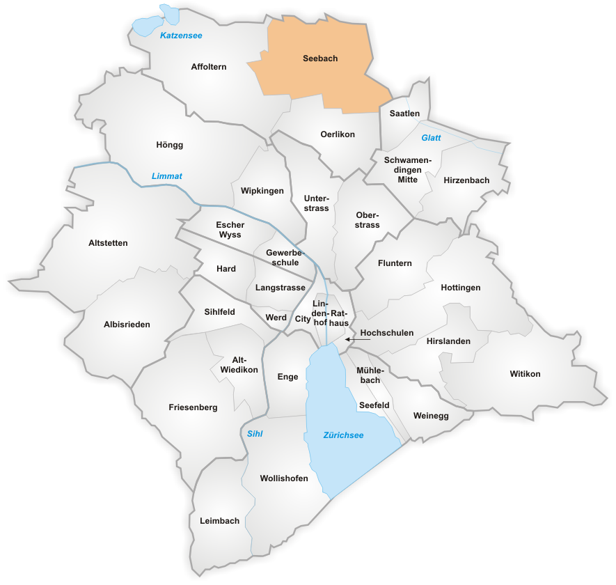
Seebach is a quarter in the district 11 of Zürich, located in the Glatt Valley (German: ''Glattal''). It was formerly a municipality in its own right, but was incorporated into the city of Zürich in 1934. In contrast to the innercity neighborhoods, Zürich-Seebach is known as an area with a vast number of immigrants, in particular from the Balkans, Subsaharan Africa and the Indian subcontinent. The area is also known for some social housing projects. Areas with similar ethnic compositions exist in suburban areas around Zürich as well, like Schlieren or Dietikon where immigrants form the majority of the population. The quarter has a population of 19,879 distributed on an area of . Transportation Zürich Seebach railway station is a stop on service S6 of the Zürich S-Bahn, which provides a half-hourly connection to Zürich Oerlikon and Zürich Hauptbahnhof stations, taking respectively 5 and 12 minutes for the journey. The quarter is also linked to central Zürich ... [...More Info...] [...Related Items...] OR: [Wikipedia] [Google] [Baidu] |
Oerlikon (Zürich)
Oerlikon is a quarter in the northern part of the city of Zürich, Switzerland. A formerly independent municipality, Oerlikon was merged with Zürich in 1934 and forms today, together with Affoltern and Seebach, the city district 11. History The name Oerlikon goes back to the Alemannic settlement founder Orilo. Oerlikon was mentioned for the first time in the year 946 (other source: 942) as ''Orlinchowa''. At that time the town consisted of no more than one dozen houses. Later on it was part of the municipality of Schwamendingen, where the inhabitants of Oerlikon went to school and attended church. In 1855 the line from Oerlikon to Winterthur via Wallisellen was established by the ''Schweizerische Nordostbahn'' (NOB). The following year the line was extended to Zürich Hauptbahnhof through the Wipkingen Tunnel. Lines from Wallisellen to Uster (1856) and Oerlikon to Bülach via Glattbrugg (1865) followed. The opening of these lines triggered the industrialisation of ... [...More Info...] [...Related Items...] OR: [Wikipedia] [Google] [Baidu] |


