|
Centennial Voyageur Canoe Pageant
The Centennial Voyageur Canoe Pageant was a canoe race started on May 24, 1967 in the Rocky Mountains by ten teams representing eight provinces and the Yukon Territory and Northwest Territories. Prince Edward Island and Newfoundland, the two remaining provinces were not entered. were paddled and portaged in 104 days by 100 men using six man shifts per team. They arrived in Montreal on September 4. Other privately sponsored canoes from across the country made similar trips. As of March 2012, it still holds the Guinness record for longest canoeing race in history. Beginnings The Centennial Commission was started in 1963, with the mandate of organizing numerous projects to promote the first Canadian Centennial. Regional governments advertised for participants. Every man that officially completed the trip would receive $1000 (CDN$ in dollars). The winning team an additional $1,500 per man and $500 for 2nd/3rd. There were other contests along the route as well. The canoes Twelve ... [...More Info...] [...Related Items...] OR: [Wikipedia] [Google] [Baidu] |
Rocky Mountain House
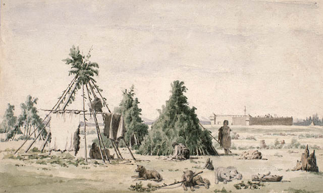
Rocky Mountain House is a town in west-central Alberta, Canada. It is approximately west of Red Deer at the confluence of the Clearwater and North Saskatchewan Rivers, and at the crossroads of Highway 22 (Cowboy Trail) and Highway 11 (David Thompson Highway). The surrounding Clearwater County's administration office is located in Rocky Mountain House. History The town has a long history dating to the 18th century with the presence of British and Canadian fur traders during the westward Canadian expansion. In 1799, the Hudson's Bay Company and the North West Company each established the Rocky Mountain House and Acton House fur trading posts. Trade with the local aboriginal peoples continued until 1821 when the companies merged, they continued to trade until 1875 and closed the Rocky Mountain House post. The name of the settlement however remained. The Rocky Mountain House settlement also served as a launching point for many explorers such as David Thompson, in search f ... [...More Info...] [...Related Items...] OR: [Wikipedia] [Google] [Baidu] |
The Pas
The Pas ( , ) is a town in Manitoba, Canada, at the confluence of the Pasquia River and the Saskatchewan River and surrounded by the unorganized Northern Region of the province. It is approximately northwest of the provincial capital, Winnipeg, and from the border of Saskatchewan. It is sometimes still called ''Paskoyac'' by locals after the first trading post, called Fort Paskoya, constructed in the 1740s by French and Canadian traders. The Pasquia River begins in the Pasquia Hills in east central Saskatchewan. The French in 1795 knew the river as Basquiau. Known as "The Gateway to the North", The Pas is a multi-industry northern Manitoba town serving the surrounding region. The main components of the region's economy are agriculture, forestry, commercial fishing, tourism, transportation, and services (especially health and education). The main employer is a paper mill operated by Canadian Kraft Paper Industries Ltd. The Pas contains one of the two main campuses of the ... [...More Info...] [...Related Items...] OR: [Wikipedia] [Google] [Baidu] |
Quebec
Quebec is Canada's List of Canadian provinces and territories by area, largest province by area. Located in Central Canada, the province shares borders with the provinces of Ontario to the west, Newfoundland and Labrador to the northeast, New Brunswick to the southeast and a coastal border with the territory of Nunavut. In the south, it shares a border with the United States. Between 1534 and 1763, what is now Quebec was the List of French possessions and colonies, French colony of ''Canada (New France), Canada'' and was the most developed colony in New France. Following the Seven Years' War, ''Canada'' became a Territorial evolution of the British Empire#List of territories that were once a part of the British Empire, British colony, first as the Province of Quebec (1763–1791), Province of Quebec (1763–1791), then Lower Canada (1791–1841), and lastly part of the Province of Canada (1841–1867) as a result of the Lower Canada Rebellion. It was Canadian Confederation, ... [...More Info...] [...Related Items...] OR: [Wikipedia] [Google] [Baidu] |
Campbell's Bay, Quebec
Campbell's Bay is a municipality (Quebec), municipality in Pontiac Regional County Municipality in western Quebec, Canada. Its population in 2021 was 705. It is the county seat and is home to most government offices for the county, including the Sûreté du Québec, and has French and English elementary schools. Campbell's Bay is in the heart of the Pontiac, as it is situated between Shawville, Quebec, Shawville and Fort-Coulonge. It also lies completely enclosed by the municipality of Litchfield, Quebec, Litchfield on all sides, with the exception of the Ottawa River to the west. Campbell's Bay is the seat of the Judicial districts of Quebec, judicial district of Pontiac. History In 1851, Lieutenant Donald Campbell (Quebec settler), Donald Campbell, a member of the Scottish Regiment, received a large tract of land along a bay of the Ottawa River (now known as ''Lac à Campbell''), which was named after him. He settled there and operated a sawmill. In 1888, the Campbell's Bay ... [...More Info...] [...Related Items...] OR: [Wikipedia] [Google] [Baidu] |
Pembroke, Ontario
Pembroke ( ) is a city in the Canadian province of Ontario at the confluence of the Muskrat River (Ontario), Muskrat River and the Ottawa River in the Ottawa Valley, northwest of Ottawa. Though containing the administrative headquarters of Renfrew County, it is an independent city. History The first European settler to the area now known as Pembroke was Daniel Fraser in 1823, who squatted on land that was discovered to have been granted to a man named Abel Ward. Ward later sold the land (where Moncion's Metro Supermarket is located) to Fraser, and nearby Fraser Street is named after the family. Peter White (Canadian politician), Peter White, a veteran of the Royal Navy arrived in 1828, squatting beside Fraser on the land where Dairy Queen is now located. Other settlers followed, attracted by the growing Lumber industry on the Ottawa River, lumbering operations of the area. Originally named Miramichi, The hamlet was later renamed Moffat, and then Sydenham. In 1856, it merged with ... [...More Info...] [...Related Items...] OR: [Wikipedia] [Google] [Baidu] |
Deep River, Ontario
Deep River is a town in Renfrew County, Ontario, Canada. Located along the Ottawa River, it lies about north-west of Ottawa on the Trans-Canada Highway. Deep River is opposite the Laurentian Mountains and the Province of Quebec. The name "Deep River" purportedly derives from the notion that the Ottawa River reaches its greatest depth of just outside the township. Although this is not official, the Ottawa River reaches a depth of in Moose Bay, which is located on the Holden Lake reservoir from the Des Joachim dam, west of Deux-Rivières. The primary industry centres on research at the Chalk River location of Canadian Nuclear Laboratories (CNL), a facility of the Chalk River Laboratories about 10 km east of Deep River on Highway 17. The facility is named for and primarily accessed via the nearby town of Chalk River although the site is technically in Deep River. History Plans for the construction of this planned community began in 1944 by the federal government as par ... [...More Info...] [...Related Items...] OR: [Wikipedia] [Google] [Baidu] |
North Bay, Ontario
North Bay is a city in Northeastern Ontario, Canada. It is the seat of Nipissing District and takes its name from its position on the shore of Lake Nipissing. It developed as a railroad centre and its airport was an important military location during the Cold War. History The site of North Bay is part of a historic canoe route where Samuel de Champlain took a party up the Ottawa River, through present-day Mattawa, on to Trout Lake and via the La Vase Creek to Lake Nipissing. Apart from Indigenous people, voyageurs and surveyors, there was little activity in the Lake Nipissing area until the arrival of the Canadian Pacific Railway (CPR) in 1882. That was the point where the Canada Central Railway (CCR) extension ended. The CCR was owned by Duncan McIntyre who amalgamated it with the CPR and became one of the handful of officers of the newly formed CPR. The CCR started in Brockville and extended to Pembroke. It then followed a westward route along the Ottawa River pas ... [...More Info...] [...Related Items...] OR: [Wikipedia] [Google] [Baidu] |
Sault Ste
Sault may refer to: Places in Europe * Sault, Vaucluse, France * Saint-Benoît-du-Sault, France * Canton of Sault, France * Canton of Saint-Benoît-du-Sault, France * Sault-Brénaz, France * Sault-de-Navailles, France * Sault-lès-Rethel, France * Sault-Saint-Remy, France Places in North America * Sault Ste. Marie, a cross-border region in Canada and the United States ** Sault Ste. Marie, Ontario, Canada ** Sault Ste. Marie, Michigan, United States * Sault College, Ontario, Canada * Sault Ste. Marie Canal, a National Historic Site of Canada in Sault Ste. Marie, Ontario * Sault Locks or Soo Locks, a set of parallel locks which enable ships to travel between Lake Superior and the lower Great Lakes operated and maintained by the United States Army Corps of Engineers * Long Sault, a rapid in the St. Lawrence River * Long Sault, Ontario, Canada * Sault-au-Récollet, Montreal, Quebec, Canada * Grand Sault or Grand Falls, New Brunswick, Canada People with the surnam ... [...More Info...] [...Related Items...] OR: [Wikipedia] [Google] [Baidu] |
Fort William, Ontario
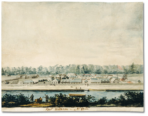
Fort William was a city in Ontario, Canada, located on the Kaministiquia River, at its entrance to Lake Superior. Incorporated as a town in 1892 and as a city in 1907, it was amalgamated with Port Arthur and the townships of Neebing and McIntyre to form the city of Thunder Bay in January 1970. Coat of arms and motto The city's Latin motto was ''A posse ad esse'' (''From a possibility to an actuality''), featured on its coat of arms designed in 1900 by town officials, "On one side of the shield stands an Indian dressed in the paint and feathers of the early days; on the other side is a French voyageur; the cent econtains a grain elevator, a steamship and a locomotive, while the beaver surmounts the whole." History Fur trade era 1671–1884 Fort William and Grand Portage were the two starting points for the canoe route from the Great Lakes to Western Canada. For details of the route inland see Kaministiquia River. French regime (Fort Kamanistigouian, Caministogoyan) Kamanistigo ... [...More Info...] [...Related Items...] OR: [Wikipedia] [Google] [Baidu] |
Fort Frances
Fort Frances is a town in, and the seat of, Rainy River District in Northwestern Ontario, Canada. The population as of the Canada 2021 Census, 2021 census was 7,466 Fort Frances is a popular fishing destination. It hosts the annual Fort Frances Canadian Bass Championship. Located on the international border with the United States where Rainy Lake narrows to become Rainy River (Minnesota–Ontario), Rainy River, it is connected to International Falls, Minnesota by the Fort Frances–International Falls International Bridge. The town is the fourth-largest community in Northwestern Ontario after Thunder Bay, Kenora and Dryden, Ontario, Dryden. The Fort Frances Paper Mill was formerly the main employer and industry in the town until its closure in January 2014. Today, there is no manufacturing or major industry in Fort Frances. Healthcare, social services and the town corporation make up the majority of the top tier employers, with big box retail coming in second. New Gold, a Canadia ... [...More Info...] [...Related Items...] OR: [Wikipedia] [Google] [Baidu] |
Kenora
Kenora (), previously named Rat Portage (), is a city situated on the Lake of the Woods in Ontario, Canada, close to the Manitoba boundary, and about east of Winnipeg by road. It is the seat of Kenora District. The history of the name extends beyond the time of French settlers arriving in the region. The name Rat Portage had its origin in the Ojibwe language, Ojibwe name ''Wazhashk-Onigam'', which, roughly translated, means portage to the country of the muskrats. A shortened and somewhat corrupted version, Rat Portage, was adopted by the Hudson's Bay Company in naming their post, then located on Old Fort Island on the Winnipeg River. When the post was moved to the mainland and a town grew up around it, the name Rat Portage was assumed by the community. The town of Rat Portage was renamed in 1905 by using the first two letters of itself and the neighbouring towns of Keewatin and Norman to form the present-day City of Kenora. In 2001, the towns of Kenora (including Norman) and ... [...More Info...] [...Related Items...] OR: [Wikipedia] [Google] [Baidu] |
Selkirk, Manitoba
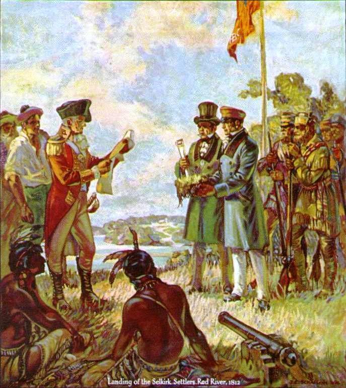
Selkirk is a city in the western Provinces and territories of Canada, Canadian province of Manitoba, located on the Red River of the North, Red River about northeast of Winnipeg, the provincial capital. It has a population of 10,504 as of the 2021 census. The mainstays of the local economy are tourism, a steel mill, and a psychiatric hospital. A vertical lift bridge over the Red River connects Selkirk with the smaller town of East Selkirk, Manitoba, East Selkirk. The city is connected to Winnipeg via Manitoba Provincial Highway 9, Highway 9 and is served by the Canadian Pacific Railway. The city was named in honour of the Scotsman Thomas Douglas, 5th Earl of Selkirk, who obtained the grant to establish a colony in the Red River area in 1813. History The present-day city is near the centre of the area purchased by the Earl of Selkirk from the Hudson's Bay Company. The first settlers of the Red River Colony arrived in 1813. Although the settlers negotiated a treaty with the Sau ... [...More Info...] [...Related Items...] OR: [Wikipedia] [Google] [Baidu] |


