|
Ceibwr Bay
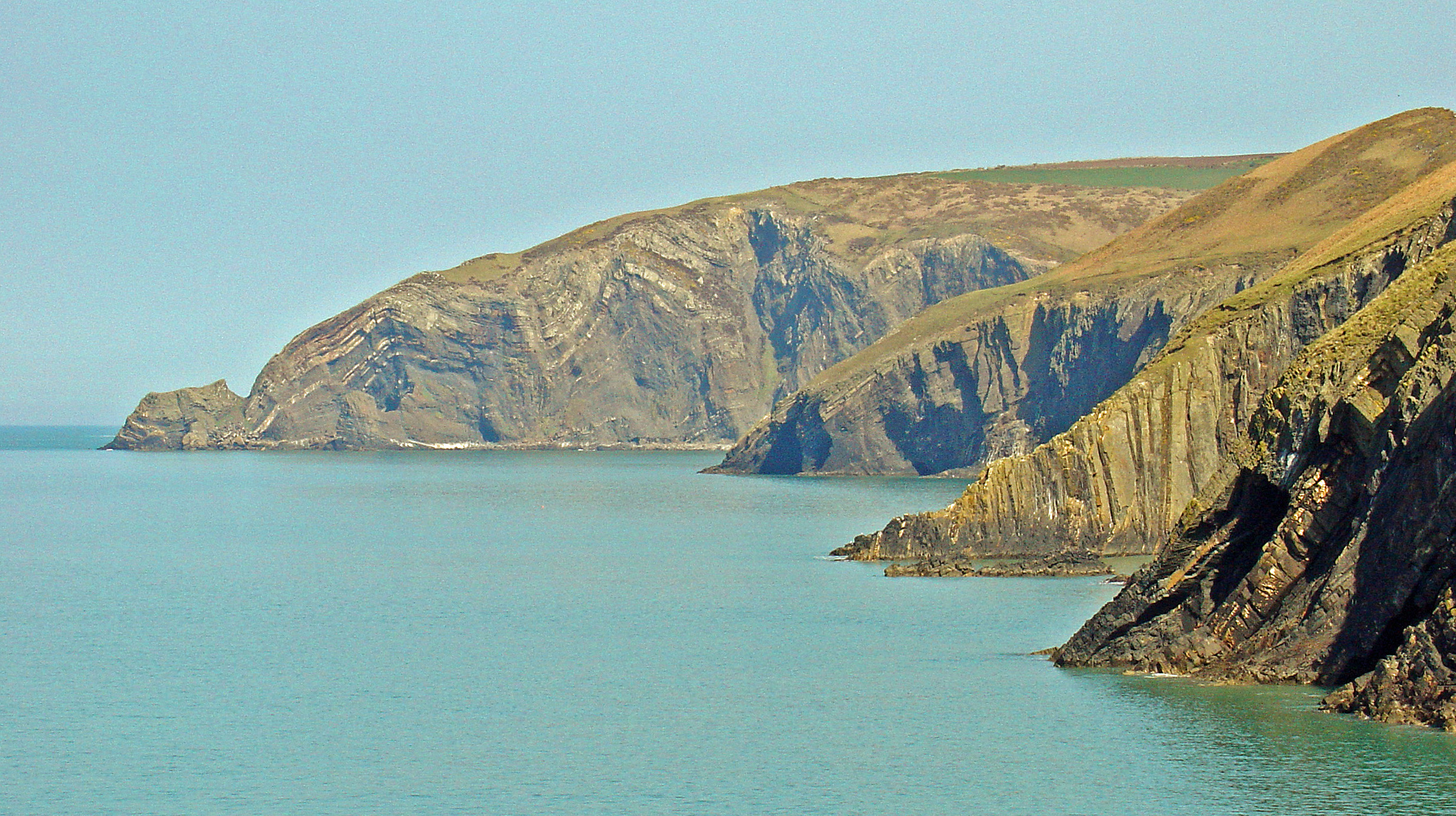
Ceibwr Bay ( cy, Bae Ceibwr) is a bay opening into the Irish Sea in Pembrokeshire, west Wales. It is about 7 km west of Cardigan, and 3 km south of the headland of Cemaes Head. It is owned by the National Trust, within the Pembrokeshire Coast National Park and on the Pembrokeshire Coast Path. Geology The elevated landscape at Ceibwr Bay is made up of spectacular cliff folds, part of the Nant Ceibwr valley leading through the village of Moylegrove, originally formed by glacial erosion. The river runs out into the Irish Sea through Ceibwr Bay. The Ceibwr Bay Fault is a WSW-ENE-trending fault zone, that extends from the coast at Ceibwr Bay at its western end to the coast at Aberporth at its eastern end. Features Ceibwr Bay is in the Pembrokeshire Coast National Park and is owned by the National Trust. The landscape is a significant bird habitat (gulls, fulmar, shag, cormorant and chough) and its natural environment and geological features attract visitors all year roun ... [...More Info...] [...Related Items...] OR: [Wikipedia] [Google] [Baidu] |
Ceibwr Bay Fault
The Ceibwr Bay Fault is a WSW-ENE trending fault zone that cuts Ordovician rocks of the Ashgill Nantmel Mudstones Formation and the Caradoc Dinas Island Formation. The fault is exposed on the south side of Cardigan Bay in Wales and forms part of the Fishguard-Cardigan Fault Zone. It extends from the coast at Ceibwr Bay at its western end to the coast at Aberporth at its eastern end. The fault zone is thought to have been active as a normal fault throughout the deposition of the Ordovician sequence. See also *List of geological faults of Wales This is a list of the named geological faults affecting the rocks of Wales. See the main article on faults for a fuller treatment of fault types and nomenclature but in brief, the main types are normal faults, reverse faults, thrusts or thrust fa ... References Geology of Wales Cardigan Bay {{Wales-geo-stub ... [...More Info...] [...Related Items...] OR: [Wikipedia] [Google] [Baidu] |
Bays Of Pembrokeshire
A bay is a recessed, coastal body of water that directly connects to a larger main body of water, such as an ocean, a lake, or another bay. A large bay is usually called a gulf, sea, sound, or bight. A cove is a small, circular bay with a narrow entrance. A fjord is an elongated bay formed by glacial action. A bay can be the estuary of a river, such as the Chesapeake Bay, an estuary of the Susquehanna River. Bays may also be nested within each other; for example, James Bay is an arm of Hudson Bay in northeastern Canada. Some large bays, such as the Bay of Bengal and Hudson Bay, have varied marine geology. The land surrounding a bay often reduces the strength of winds and blocks waves. Bays may have as wide a variety of shoreline characteristics as other shorelines. In some cases, bays have beaches, which "are usually characterized by a steep upper foreshore with a broad, flat fronting terrace".Maurice Schwartz, ''Encyclopedia of Coastal Science'' (2006), p. 129. Bays were sig ... [...More Info...] [...Related Items...] OR: [Wikipedia] [Google] [Baidu] |
Cardigan Bay
Cardigan Bay ( cy, Bae Ceredigion) is a large inlet of the Irish Sea, indenting the west coast of Wales between Bardsey Island, Gwynedd in the north, and Strumble Head, Pembrokeshire at its southern end. It is the largest bay in Wales. Geography Cardigan Bay has numerous beaches, and marine life. Much of the coast surrounding the bay is fertile farmland, dotted with towns and seaside resorts such as Fishguard, New Quay, Aberaeron, Llanon, Aberystwyth, Borth, Aberdyfi, Tywyn, Barmouth, Porthmadog, Criccieth and Pwllheli on the Cambrian Coast. Smaller coastal villages include Cwmtydu, Nanternis and Llangrannog. Major rivers flowing into the bay include the Glaslyn, Mawddach, Dysynni, Dyfi, Rheidol, Ystwyth, Aeron and Teifi. History Until the early 20th century, Cardigan Bay supported a strong maritime industry. Cardigan is located at the mouth of the River Teifi; hence the Welsh name, Aberteifi (''Mouth of the Teifi''). At the turn of the 19th century, ... [...More Info...] [...Related Items...] OR: [Wikipedia] [Google] [Baidu] |
Cardigan Bay Special Area Of Conservation
Cardigan Bay Special Area of Conservation (SAC), in Cardigan Bay, West Wales, UK, has been designated under European Union law to protect a variety of important species and habitats. Located between Ceibwr Bay in Pembrokeshire and Aberarth in Ceredigion, and extending almost 20 km from the coast, the SAC protects the wildlife of some 1000 km² of sea.Cardigan Bay Special Area of Conservation (SAC) Management Scheme compiled by the Relevant Authorities Group for Cardigan Bay SAC, 2008 Conservation aims The protected area supports a large variety of marine animals and plants, from reef-building worms to bottlenose dolphins—Europe’s largest population of the latter, there being few places where they are more ea ...[...More Info...] [...Related Items...] OR: [Wikipedia] [Google] [Baidu] |
Gray Seal
The grey seal (''Halichoerus grypus'') is found on both shores of the North Atlantic Ocean. In Latin Halichoerus grypus means "hook-nosed sea pig". It is a large seal of the family Phocidae, which are commonly referred to as "true seals" or "earless seals". It is the only species classified in the genus ''Halichoerus''. Its name is spelled gray seal in the US; it is also known as Atlantic seal and the horsehead seal. Taxonomy There are two recognized subspecies of this seal: The type specimen of ''H. g. grypus'' ( Zoological Museum of Copenhagen specimen ZMUC M11-1525, caught off the island of Amager, Danish part of the Baltic Sea) was believed lost for many years but was rediscovered in 2016, and a DNA test showed it belonged to a Baltic Sea specimen rather than from Greenland, as had previously been assumed (because it was first described in Otto Fabricius' book on the animals in Greenland: ''Fauna Groenlandica''). The name ''H. g. grypus'' was therefore transferred to th ... [...More Info...] [...Related Items...] OR: [Wikipedia] [Google] [Baidu] |
Bottlenose Dolphin
Bottlenose dolphins are aquatic mammals in the genus ''Tursiops.'' They are common, cosmopolitan members of the family Delphinidae, the family of oceanic dolphins. Molecular studies show the genus definitively contains two species: the common bottlenose dolphin (''Tursiops truncatus'') and the Indo-Pacific bottlenose dolphin (''Tursiops aduncus''). Others, like the Burrunan dolphin (''Tursiops (aduncus) australis''), may be alternately considered their own species or be subspecies of ''T. aduncus''. Bottlenose dolphins inhabit warm and temperate seas worldwide, being found everywhere except for the Arctic and Antarctic Circle regions. Their name derives from the Latin ''tursio'' (dolphin) and ''truncatus'' for their characteristic truncated teeth. Numerous investigations of bottlenose dolphin intelligence have been conducted, examining mimicry, use of artificial language, object categorization, and self-recognition. They can use tools (sponging; using marine sponges ... [...More Info...] [...Related Items...] OR: [Wikipedia] [Google] [Baidu] |
Vertigo
Vertigo is a condition where a person has the sensation of movement or of surrounding objects moving when they are not. Often it feels like a spinning or swaying movement. This may be associated with nausea, vomiting, sweating, or difficulties walking. It is typically worse when the head is moved. Vertigo is the most common type of dizziness. The most common disorders that result in vertigo are benign paroxysmal positional vertigo (BPPV), Ménière's disease, and labyrinthitis. Less common causes include stroke Stroke (also known as a cerebrovascular accident (CVA) or brain attack) is a medical condition in which poor blood flow to the brain causes cell death. There are two main types of stroke: ischemic, due to lack of blood flow, and hemorrhagic ..., brain tumors, brain injury, multiple sclerosis, vestibular migraine, migraines, trauma, and alternobaric vertigo, uneven pressures between the middle ears. Physiologic vertigo may occur following being exposed to mo ... [...More Info...] [...Related Items...] OR: [Wikipedia] [Google] [Baidu] |
Wales Coast Path
The Wales Coast Path ( cy, Llwybr Arfordir Cymru) is a designated long-distance trail which follows, or runs close to, the coastline of Wales. Launched in 2012, the footpath is long and was heralded as the first dedicated coast path in the world to cover the entire length of a country's coastline. The Wales Coast Path runs through eleven national nature reserves and other nature reserves such as those managed by the Royal Society for the Protection of Birds and The Wildlife Trusts.www.firstnature.com - wales Coast Path . Retrieved 2 January 2012. 
[...More Info...] [...Related Items...] OR: [Wikipedia] [Google] [Baidu] |
Aberporth
Aberporth is a seaside village, community and electoral ward in Ceredigion, Wales. The population at the 2001 Census, was 2,485, of whom 49 per cent could speak the Welsh language. At the 2011 Census, the population of the community was 2,374 and of the village 1241. Aberporth's beaches have earned Blue Flag status. Location Aberporth is on the Ceredigion Coast Path, part of the Wales Coast Path, at the southern end of Cardigan Bay, about northeast of Cardigan and southwest of New Quay. The Fishguard to Bangor Trunk Road ( A487) is reached via the B4333 road in about . Etymology The name Aberporth is first recorded in 1284, and is derived from the Old Welsh “aber” (mouth) and “porth” (port). History In the 16th century, boats, nets and salt for preserving were brought in from Ireland. Aberporth became a subsidiary port of Cardigan. The landing point developed rapidly in the late 17th and early 18th centuries as local people began to take part in the marit ... [...More Info...] [...Related Items...] OR: [Wikipedia] [Google] [Baidu] |
Fault (geology)
In geology, a fault is a planar fracture or discontinuity in a volume of rock across which there has been significant displacement as a result of rock-mass movements. Large faults within Earth's crust result from the action of plate tectonic forces, with the largest forming the boundaries between the plates, such as the megathrust faults of subduction zones or transform faults. Energy release associated with rapid movement on active faults is the cause of most earthquakes. Faults may also displace slowly, by aseismic creep. A ''fault plane'' is the plane that represents the fracture surface of a fault. A '' fault trace'' or ''fault line'' is a place where the fault can be seen or mapped on the surface. A fault trace is also the line commonly plotted on geologic maps to represent a fault. A ''fault zone'' is a cluster of parallel faults. However, the term is also used for the zone of crushed rock along a single fault. Prolonged motion along closely spaced faults can bl ... [...More Info...] [...Related Items...] OR: [Wikipedia] [Google] [Baidu] |


