|
Caubian Gamay Island
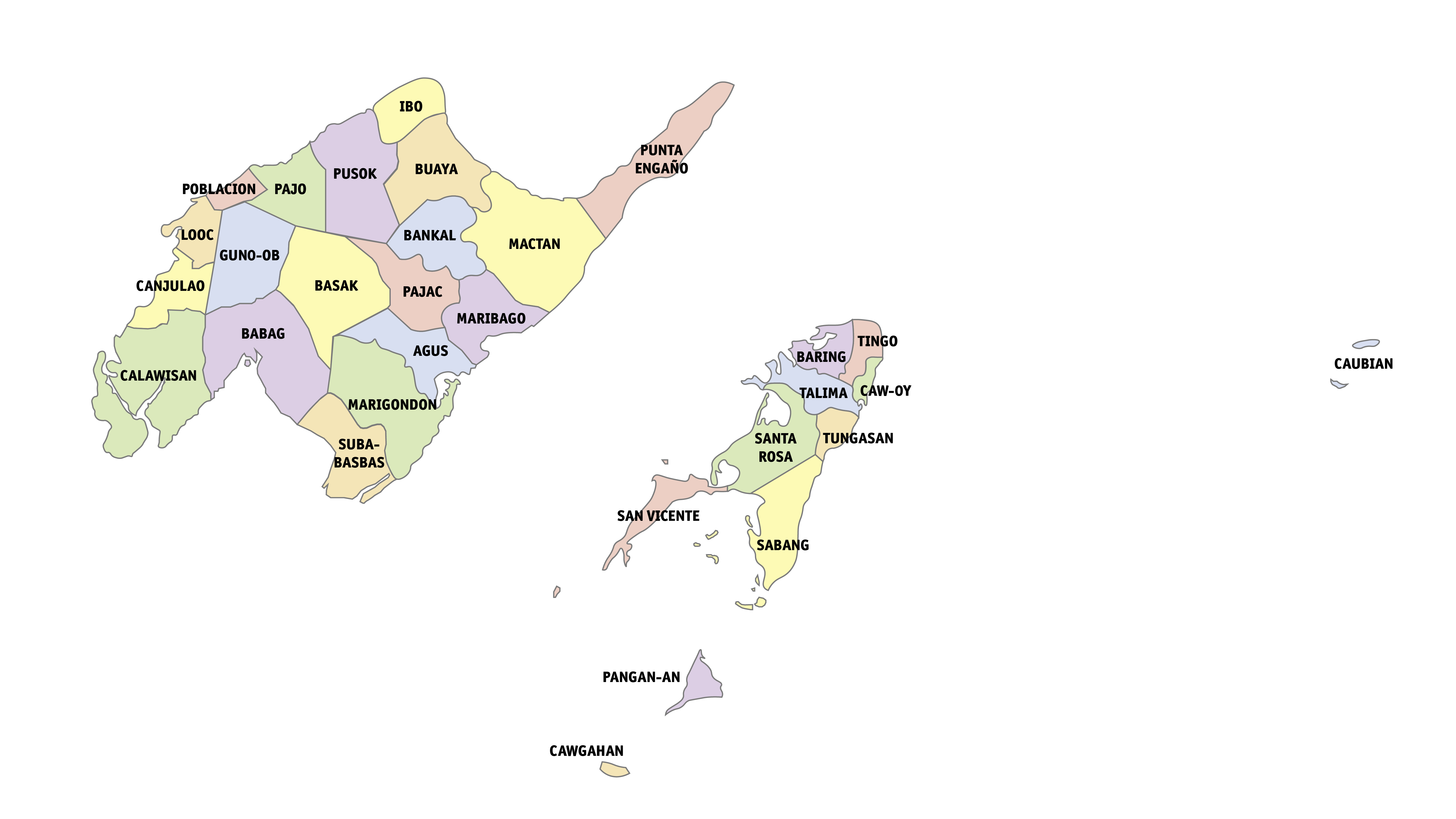
Caubian Islands is a group of islands of Lapu-Lapu City, Philippines. Located in the Camotes Sea, it is approximately north from Getafe, Bohol, and east from Mactan Island. The group consists of two small islands: the bigger uninhabited Caubian Daku, also called Poo, and the smaller but densely populated Caubian Gamay. Both islands are located in the Danajon Bank, the only double barrier reef in the Philippines and known to be one of the richest fishing grounds in the country. It is part of the Olango Island Group. Most of the families depend on fishing and speak the Cebuano language. According to the 2020 census, the islands has a population of 2,429. With an area of around 0.06km2, Caubian Gamay has an estimated population density of 60,725/km2. It is regarded to be one of the densest populated islands in the world. Facilities Currently, the islands has an elementary school and a basketball court. Grade 7 to 12 students have to travel to the nearest high school in Olango ... [...More Info...] [...Related Items...] OR: [Wikipedia] [Google] [Baidu] |
List Of Islands Of The Philippines
As an archipelago, the Philippines comprises about 7,641 islands clustered into Island groups of the Philippines, three major island groups: Luzon, the Visayas, and Mindanao. Only about 2,000 islands are inhabited,Magical Islands , Philippine Tourism, retrieved 2012 and more than 5,000 are yet to be officially named. The following list breaks the islands down by Regions of the Philippines, region and smaller Island groups of the Philippines, island group for easier reference. Luzon Babuyan group * Babuyan Island * Balintang Islands * Barit Island * Calayan Island * Camiguin de Babuyanes, Camiguin Island * Dalupiri Island (Cagayan), Dalupiri Island * Didicas Volcano, Didicas Island * Fuga Island * Iroo Island * Maybag Island * Pamoctan Island * Pan de Azucar Isl ...[...More Info...] [...Related Items...] OR: [Wikipedia] [Google] [Baidu] |
List Of Islands By Population Density
The following is a list of islands, sorted by population density, and including islands that are connected to other land masses by a route other than sea or air, such as a bridge or a tunnel. Continental landmasses Continental landmasses are not usually classified as islands despite being completely surrounded by water. Nevertheless, for the purposes of this list, mainland Australia along with the other major landmasses have been listed as continental landmasses for comparison. The figures are approximations and are for the four major continental landmasses only. Most densely populated islands (over 1,000 people per km2) Accurate density estimates for the very small islands (less than ) are hard to obtain because population as well as landmass are often only estimates. Additionally, the populations of these islands are often highly transient, with many residents also maintaining a residence on a larger landmass and only living on the island seasonally. Densely populated ... [...More Info...] [...Related Items...] OR: [Wikipedia] [Google] [Baidu] |
El Niño
EL, El or el may refer to: Arts and entertainment Fictional entities * El, a character from the manga series ''Shugo Chara!'' by Peach-Pit * Eleven (''Stranger Things'') (El), a fictional character in the TV series ''Stranger Things'' * El, family name of Kal-El (Superman) and his father Jor-El in the Superman dynasty * E.L. Faldt, character in the road comedy film '' Road Trip'' Music * Él Records, an independent record label from the UK founded by Mike Alway * ''Él ''(Lucerito album), a 1982 album by Lucerito * "Él", Spanish song by Rubén Blades from the album '' Caminando'' * "Él" (Lucía song), the Spanish entry performed by Lucía in the Eurovision Song Contest 1982 Other media * ''Él'', 1926 autobiographical novel by Mercedes Pinto * ''Él'' (film), a 1953 film by Luis Buñuel based on the 1926 novel * ''Él'' (visual novel), a 1991 Japanese adult visual novel * EL TV, an Azerbaijani regional television channel Companies and organizations * Estée Lauder Co ... [...More Info...] [...Related Items...] OR: [Wikipedia] [Google] [Baidu] |
Typhoon Rai
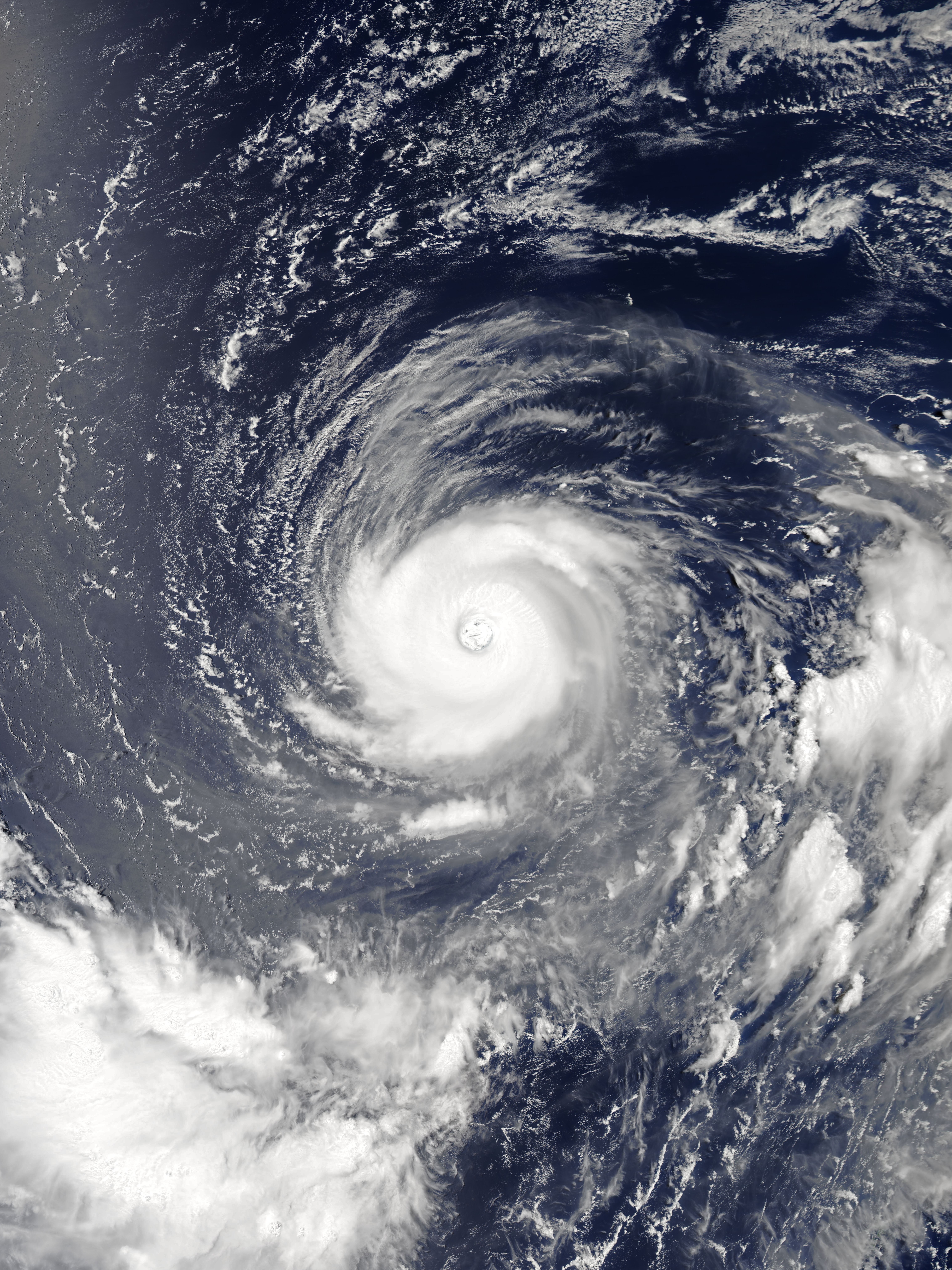
Typhoon Rai, known in the Philippines as Super Typhoon Odette, was a deadly and extremely destructive super typhoon, which was the second costliest typhoon in Philippine history behind Typhoon Haiyan in 2013. Rai was a powerful rare tropical cyclone that struck the Philippines in mid-December 2021. Rai became the first Category 5-equivalent super typhoon to develop in the month of December since Nock-ten in 2016, and the third of four Category 5 super typhoons recorded in the South China Sea, along with Pamela in 1954, Rammasun in 2014 and Yagi in 2024. Rai, named after an artifact called ''Rai stones'', is the 22nd and final named tropical storm, the ninth typhoon, and the fifth super typhoon of the 2021 Pacific typhoon season. The system originated from a tropical disturbance near the equator on December 10, forming near the site of another low-pressure area that had dissipated on the previous day. Conditions around the system were favorable for further development, an ... [...More Info...] [...Related Items...] OR: [Wikipedia] [Google] [Baidu] |
Climate Change
Present-day climate change includes both global warming—the ongoing increase in Global surface temperature, global average temperature—and its wider effects on Earth's climate system. Climate variability and change, Climate change in a broader sense also includes previous long-term changes to Earth's climate. The current rise in global temperatures is Scientific consensus on climate change, driven by human activities, especially fossil fuel burning since the Industrial Revolution. Fossil fuel use, Deforestation and climate change, deforestation, and some Greenhouse gas emissions from agriculture, agricultural and Environmental impact of concrete, industrial practices release greenhouse gases. These gases greenhouse effect, absorb some of the heat that the Earth Thermal radiation, radiates after it warms from sunlight, warming the lower atmosphere. Carbon dioxide, the primary gas driving global warming, Carbon dioxide in Earth's atmosphere, has increased in concentratio ... [...More Info...] [...Related Items...] OR: [Wikipedia] [Google] [Baidu] |
Sea Level Rise
The sea level has been rising from the end of the last ice age, which was around 20,000 years ago. Between 1901 and 2018, the average sea level rose by , with an increase of per year since the 1970s. This was faster than the sea level had ever risen over at least the past 3,000 years. The rate accelerated to /yr for the decade 2013–2022. Climate change due to human activities is the main cause. Between 1993 and 2018, melting ice sheets and glaciers accounted for 44% of sea level rise, with another 42% resulting from thermal expansion of water. Sea level rise lags behind changes in the Earth's temperature by decades, and sea level rise will therefore continue to accelerate between now and 2050 in response to warming that has already happened. What happens after that depends on future human greenhouse gas emissions. If there are very deep cuts in emissions, sea level rise would slow between 2050 and 2100. The reported factors of increase in flood hazard potential are often e ... [...More Info...] [...Related Items...] OR: [Wikipedia] [Google] [Baidu] |
Typhoon
A typhoon is a tropical cyclone that develops between 180° and 100°E in the Northern Hemisphere and which produces sustained hurricane-force winds of at least . This region is referred to as the Northwestern Pacific Basin, accounting for almost one third of the world's tropical cyclones. For organizational purposes, the northern Pacific Ocean is divided into three regions: the eastern (North America to 140°W), central (140°W to 180°), and western (180° to 100°E). The Regional Specialized Meteorological Center (RSMC) for tropical cyclone forecasts is in Japan, with other tropical cyclone warning centres for the northwest Pacific in Hawaii (the Joint Typhoon Warning Center), the Philippines, and Hong Kong. Although the RSMC names each system, the main name list itself is coordinated among 18 countries that have territories threatened by typhoons each year. Within most of the northwestern Pacific, there are no official typhoon seasons as tropical cyclones form througho ... [...More Info...] [...Related Items...] OR: [Wikipedia] [Google] [Baidu] |
Bangka (boat)
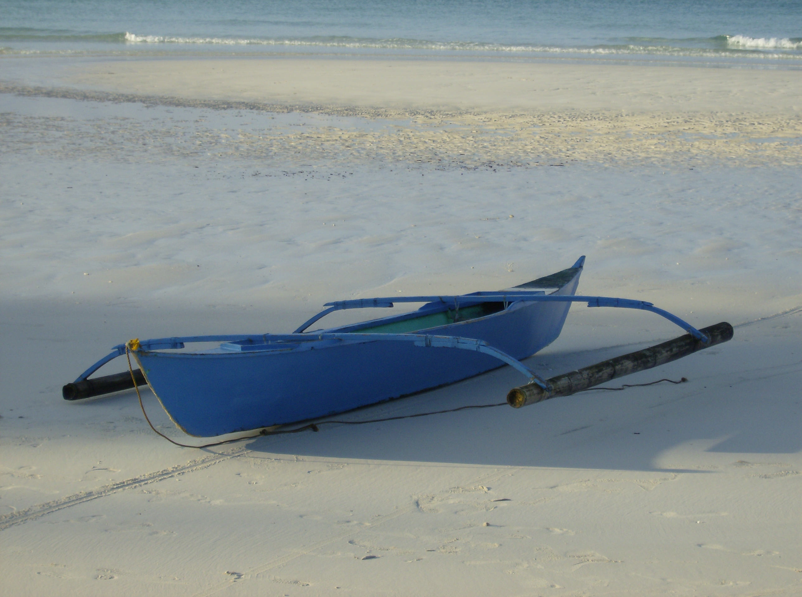
Bangka are various native watercraft of the Philippines. It originally referred to small double-outrigger dugout canoes used in rivers and shallow coastal waters, but since the 18th century, it has expanded to include larger lashed-lug ships, with or without outriggers. Though the term used is the same throughout the Philippines, "bangka" can refer to a very diverse range of boats specific to different regions. Bangka was also spelled as banca, panca, or panga (Grammatical gender, m. banco, panco, pango) in Spanish language, Spanish. It is also known archaically as wikt:sakayan, sakayan (also spelled sacayan). Etymology ''Bangka'' is derived from Proto-Malayo-Polynesian ''*baŋkaʔ'', with cognates including Kavalan language, Kavalan ''bangka'', Mori language, Mori ''bangka'', and Sumbawa language, Sumbawa ''bangka''. It is a Doublet (linguistics), doublet of two other protoforms referring to boats: Proto-Austronesian ''*qabaŋ'' and Proto-Central-Malayo-Polynesian ''*waŋka'' ... [...More Info...] [...Related Items...] OR: [Wikipedia] [Google] [Baidu] |
Olango Island Group
The Olango Island Group is a group of islands found in the Central Visayas region of the Philippines. It comprises Olango island and 6 satellite islets namely: Caubian, Camungi, Caohagan, Gilutongan, Nalusuan, Pangan-an, and Sulpa. The island group has a total land area of approximately . It is divided under the jurisdiction of the city of Lapu-Lapu and the municipality of Cordova, Cebu. It lies east of Mactan and is a major tourist destination in Cebu. It is known for its wildlife sanctuary. The entire area is the first declared Ramsar Wetland Site in the Philippines, as recognized in 1994. Geography The Olango Group of islands consists of seven islands. Located east of Mactan Island, Olango Island and its satellite islets lies between the Cebu Strait to the south and the Camotes Sea to the north. To the west is the Hilutangan Channel (which separates it from Mactan Island) while to the east is the Olango Channel (which separates it from Bohol). Land area Olango Islands ... [...More Info...] [...Related Items...] OR: [Wikipedia] [Google] [Baidu] |
Camotes Sea
The Camotes Sea is a small sea within the Philippine archipelago, situated between the Central Visayan and the Eastern Visayan regions. It separates Cebu from Leyte hence is bordered by Cebu to the west, Leyte to the east and north, and Bohol to the south. At its center are the Camotes Islands, but it also contains Mactan Island, Olango Island, Lapinig Island (in Bohol), and various other small islets. Northwards, the sea is connected to the Visayan Sea. Southwards, it is connected to the Bohol Sea (also called the ''Mindanao Sea'') in two ways: to the southwest by the Cebu Strait (and its three channels, the Mactan, the Olango, and the Hilutangan), and to the southeast by the Canigao Channel. The Camotes Sea also contains the Danajon Bank, which is a double barrier reef in the Philippines, which is a very rare geological formation, and there are only 6 double barrier reefs in the world. It comprises two sets of large coral reefs that formed offshore on a submar ... [...More Info...] [...Related Items...] OR: [Wikipedia] [Google] [Baidu] |
Danajon Bank
The Danajon Bank is the only double barrier reef in the Philippines, which is a very rare geological formation, which is located in the Camotes Sea. It comprises two sets of large coral reefs that formed offshore on a submarine ridge due to a combination of favorable tidal currents and coral growth in the area. Overview One of only six double barrier reefs in the world, Danajon Bank runs for 156 kilometers 7 milesin the Central Visayas, between the following islands: Bohol, Cebu, and Leyte. There are onl3 major passagesthrough this double reef — the NorthWest Pass, the Middle Pass, & the NorthEast Pass. The Danajon Bank's overall area is 272 square kilometers 05 square miles with an aggregate coastline of 699 kilometers 34 miles which includes 40 islands. The Danajon Bank makes up over 1% of the total coral reef area of the Philippines, which is estimated at 27,000 square kilometers 0,424 square miles Conservation efforts Due to overfishing, the Danajon Bank has a de ... [...More Info...] [...Related Items...] OR: [Wikipedia] [Google] [Baidu] |


