|
Castlefore Lough
Castlefore Lough () is a mesotrophic freshwater lake in County Leitrim, Ireland. Known for good coarse fishing, the lake has limited bank fishing. The ecology of Castlefore Lough, and other county waterways, is threatened by curly waterweed, zebra mussel, and freshwater clam invasive species. Etymology The lake takes its name from the district of "Castlefore" ( ga, Baile Choille Fóir), meaning the "". Geography Castlefore Lough lies due east of Keshcarrigan village, and due west of Fenagh in south County Leitrim. The lake has a tilted cone shape, a surface-area of and depths to . Ecology Fish present in Castlefore Lough include "roach- bream hybrids", roach, perch, bream, tench, and pike. The pike population is the "native Irish strain" ( ga, liús meaning 'Irish pike') not the other European pike strain ( ga, gailliasc meaning 'strange or foreign fish'). The lake has stocks of pike up to . Human settlement From Prehistoric Ireland times, lake dwellers settled o ... [...More Info...] [...Related Items...] OR: [Wikipedia] [Google] [Baidu] |
County Leitrim
County Leitrim ( ; gle, Contae Liatroma) is a county in Ireland. It is in the province of Connacht and is part of the Northern and Western Region. It is named after the village of Leitrim. Leitrim County Council is the local authority for the county, which had a population of 35,087 according to the 2022 census. The county encompasses the historic Gaelic territory of West Breffny () corresponding to the northern part of the county, and Muintir Eolais or Conmaicne Réin, corresponding to the southern part. Geography Leitrim is the 26th largest of the 32 counties by area (the 21st largest of the 26 counties of the Republic) and the smallest by population. It is the smallest of Connacht's five counties in both size and population. Leitrim is bordered by the counties of Donegal to the north, Fermanagh to the north-east, Cavan to the east, Longford to the south, Roscommon to the south-west and Sligo to the west. Fermanagh is in Northern Ireland while all the other ... [...More Info...] [...Related Items...] OR: [Wikipedia] [Google] [Baidu] |
Common Bream
The common bream, freshwater bream, bream, bronze bream, carp bream or sweaty bream (''Abramis brama''), is a European species of freshwater fish in the family Cyprinidae. It is now considered to be the only species in the genus ''Abramis''. Range and habitat The common bream's home range is Europe north of the Alps and Pyrenees, as well as the Balkans. They are found as far east as the Caspian Sea, the Black Sea, and the Aral Sea. The common bream lives in ponds, lakes, canals, and slow-flowing rivers. Description The bream is usually long, though some specimens of have been recorded; it usually weighs . Its maximum length is 90 cm (35.5 in),the recorded weight is around 9.1 kg (20 lb). The common bream has a laterally flattened and high-backed body and a slightly undershot mouth. It is a silvery grey colour, though older fish can be bronze-coloured, especially in clear waters. The fins are greyish to black, but never reddish. Similar-looking fish ... [...More Info...] [...Related Items...] OR: [Wikipedia] [Google] [Baidu] |
Townlands
A townland ( ga, baile fearainn; Ulster-Scots: ''toonlann'') is a small geographical division of land, historically and currently used in Ireland and in the Western Isles in Scotland, typically covering . The townland system is of Gaelic origin, pre-dating the Norman invasion, and most have names of Irish origin. However, some townland names and boundaries come from Norman manors, plantation divisions, or later creations of the Ordnance Survey.Connolly, S. J., ''The Oxford Companion to Irish History, page 577. Oxford University Press, 2002. ''Maxwell, Ian, ''How to Trace Your Irish Ancestors'', page 16. howtobooks, 2009. The total number of inhabited townlands in Ireland was 60,679 in 1911. The total number recognised by the Irish Place Names database as of 2014 was 61,098, including uninhabited townlands, mainly small islands. Background In Ireland a townland is generally the smallest administrative division of land, though a few large townlands are further divided into ... [...More Info...] [...Related Items...] OR: [Wikipedia] [Google] [Baidu] |
Human Settlement
In geography, statistics and archaeology, a settlement, locality or populated place is a community in which people live. The complexity of a settlement can range from a minuscule number of dwellings grouped together to the largest of cities with surrounding urbanized areas. Settlements may include hamlets, villages, towns and cities. A settlement may have known historical properties such as the date or era in which it was first settled, or first settled by particular people. In the field of geospatial predictive modeling, settlements are "a city, town, village or other agglomeration of buildings where people live and work". A settlement conventionally includes its constructed facilities such as roads, enclosures, field systems, boundary banks and ditches, ponds, parks and woods, wind and water mills, manor houses, moats and churches. History The earliest geographical evidence of a human settlement was Jebel Irhoud, where early modern human remains of eigh ... [...More Info...] [...Related Items...] OR: [Wikipedia] [Google] [Baidu] |
Crannog
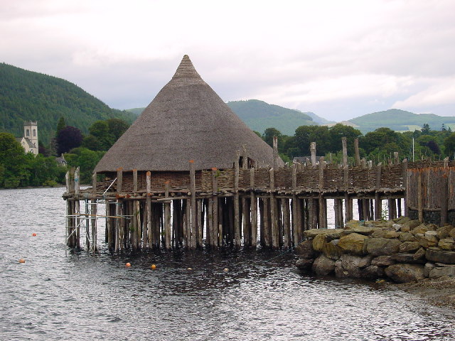
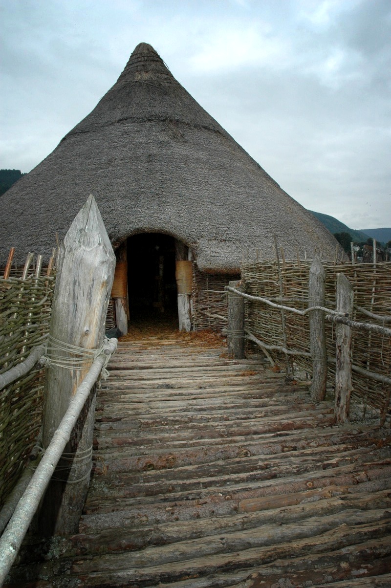
A crannog (; ga, crannóg ; gd, crannag ) is typically a partially or entirely artificial island, usually built in lakes and estuarine waters of Scotland, Wales, and Ireland. Unlike the prehistoric pile dwellings around the Alps, which were built on the shores and not inundated until later, crannogs were built in the water, thus forming artificial islands. Crannogs were used as dwellings over five millennia, from the European Neolithic Period to as late as the 17th/early 18th century. In Scotland there is no convincing evidence in the archaeological record of Early and Middle Bronze Age or Norse Period use. The radiocarbon dating obtained from key sites such as Oakbank and Redcastle indicates at a 95.4 per cent confidence level that they date to the Late Bronze Age to Early Iron Age. The date ranges fall ''after'' around 800 BC and so could be considered Late Bronze Age by only the narrowest of margins. Crannogs have been variously interpreted as free-standing wooden stru ... [...More Info...] [...Related Items...] OR: [Wikipedia] [Google] [Baidu] |
Prehistoric Ireland
The prehistory of Ireland has been pieced together from archaeological evidence, which has grown at an increasing rate over the last decades. It begins with the first evidence of permanent human residence in Ireland around 10,500 BC (although there is evidence of human presence as early as 31,000 BC) and finishes with the start of the historical record around 400 AD. Both the beginning and end dates of the period are later than for much of Europe and all of the Near East. The prehistoric period covers the Palaeolithic, Mesolithic, Neolithic, Bronze Age and Iron Age societies of Ireland. For much of Europe, the historical record begins when the Romans invaded; as Ireland was not invaded by the Romans its historical record starts later, with the coming of Christianity. The two periods that have left the most spectacular groups of remains are the Neolithic, with its megalithic tombs, and the gold jewellery of the Bronze Age, when Ireland was a major centre of gold mining. ... [...More Info...] [...Related Items...] OR: [Wikipedia] [Google] [Baidu] |
Crannog At The Eastern End Of Castlefore Lough - Geograph
A crannog (; ga, crannóg ; gd, crannag ) is typically a partially or entirely artificial island, usually built in lakes and estuarine waters of Scotland, Wales, and Ireland. Unlike the prehistoric pile dwellings around the Alps, which were built on the shores and not inundated until later, crannogs were built in the water, thus forming artificial islands. Crannogs were used as dwellings over five millennia, from the European Neolithic Period to as late as the 17th/early 18th century. In Scotland there is no convincing evidence in the archaeological record of Early and Middle Bronze Age or Norse Period use. The radiocarbon dating obtained from key sites such as Oakbank and Redcastle indicates at a 95.4 per cent confidence level that they date to the Late Bronze Age to Early Iron Age. The date ranges fall ''after'' around 800 BC and so could be considered Late Bronze Age by only the narrowest of margins. Crannogs have been variously interpreted as free-standing woode ... [...More Info...] [...Related Items...] OR: [Wikipedia] [Google] [Baidu] |
Northern Pike
The northern pike (''Esox lucius'') is a species of carnivorous fish of the genus ''Esox'' (the pikes). They are typical of brackish water, brackish and fresh waters of the Northern Hemisphere (''i.e.'' holarctic in distribution). They are known simply as a pike in Great Britain, Britain, Ireland, and most of Eastern Europe, Canada and the United States. Pike can grow to a relatively large size: the average length is about , with maximum recorded lengths of up to and published weights of . The International Game Fish Association, IGFA currently recognizes a pike caught by Lothar Louis on Greffern Lake, Germany, on 16 October 1986, as the all-tackle world-record northern pike. Northern pike grow to larger sizes in Eurasia than in North America, and typically grow to larger sizes in coastal than inland regions of Eurasia. Etymology The northern pike gets its common name from its resemblance to the pole-weapon known as the Pike (weapon), pike (from the Middle English for 'point ... [...More Info...] [...Related Items...] OR: [Wikipedia] [Google] [Baidu] |
Tench
The tench or doctor fish (''Tinca tinca'') is a fresh- and brackish-water fish of the order Cypriniformes found throughout Eurasia from Western Europe including the British Isles east into Asia as far as the Ob and Yenisei Rivers. It is also found in Lake Baikal. It normally inhabits slow-moving freshwater habitats, particularly lakes and lowland rivers.B. Whitton (1982). ''Rivers, Lakes and Marshes'' p 163. Hodder & Staughton, London. Taxonomy The tench was formerly classified in the subfamily Leuciscinae with other Eurasian minnows, but more recent phylogenetic studies have supported it belonging to its own family Tincidae. Ecology The tench is most often found in still waters with a clay or muddy substrate and abundant vegetation.A. F. Magri MacMahon (1946). ''Fishlore'', pp 156-158. Pelican Books. This species is rare in clear waters across stony substrate, and is absent altogether from fast-flowing streams. It tolerates water with a low oxygen concentration, being ... [...More Info...] [...Related Items...] OR: [Wikipedia] [Google] [Baidu] |
European Perch
The European perch (''Perca fluviatilis''), also known as the common perch, redfin perch, big-scaled redfin, English perch, Euro perch, Eurasian perch, Eurasian river perch, Hatch, poor man’s rockfish or in Anglophone parts of Europe, simply the perch, is a predatory species of the freshwater perch native to Europe and northern Asia. The species is a popular quarry for anglers, and has been widely introduced beyond its native area, into Australia, New Zealand and South Africa. They have caused substantial damage to native fish populations in Australia and have been proclaimed a noxious species in New South Wales. Description European perch are greenish with red pelvic, anal and caudal fins. They have five to eight dark vertical bars on their sides. When the perch grows larger, a hump grows between its head and dorsal fin. European perch can vary greatly in size between bodies of water. They can live for up to 22 years, and older perch are often much larger than average; ... [...More Info...] [...Related Items...] OR: [Wikipedia] [Google] [Baidu] |


