|
Castle Rock (volcano)
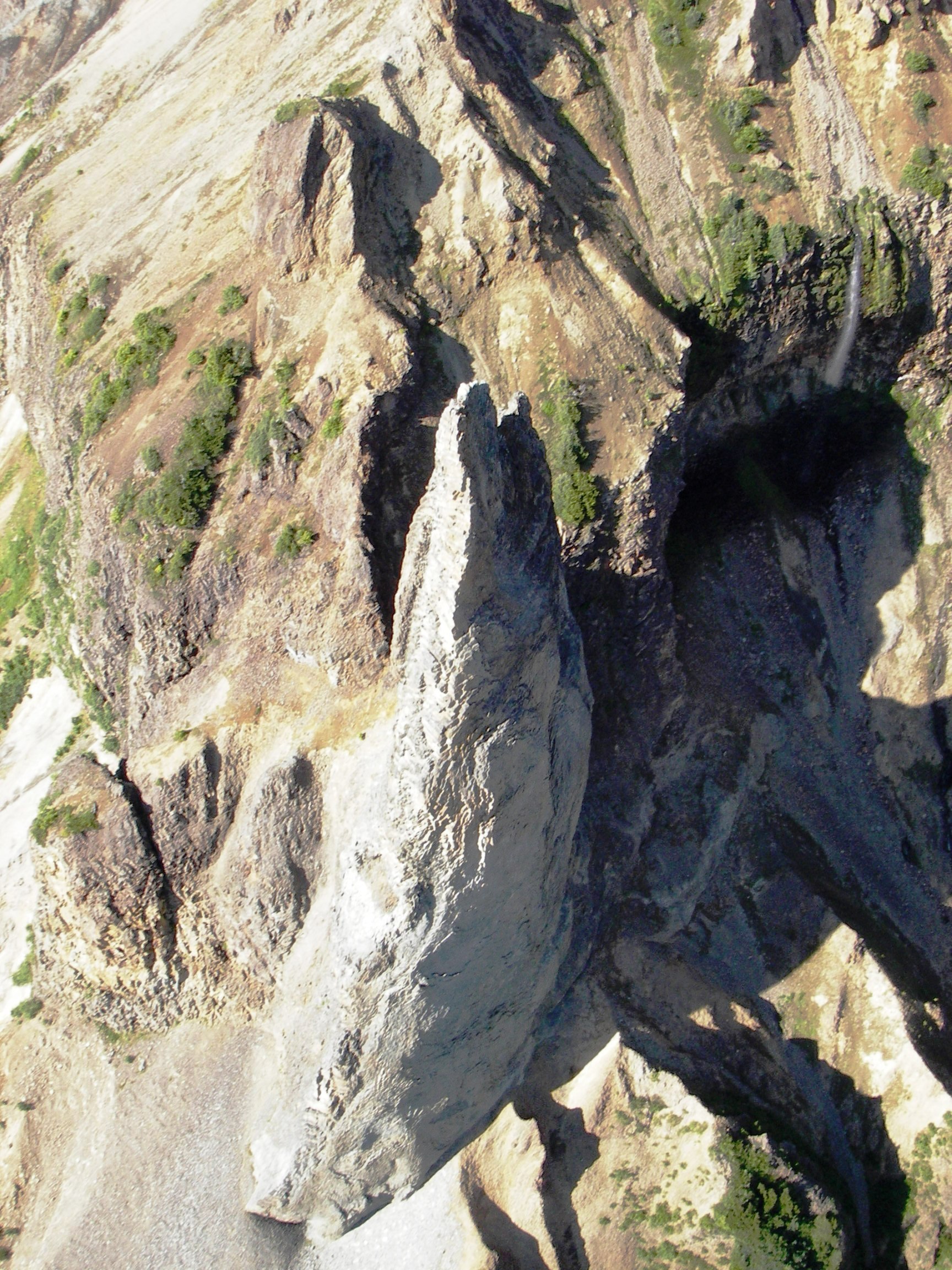
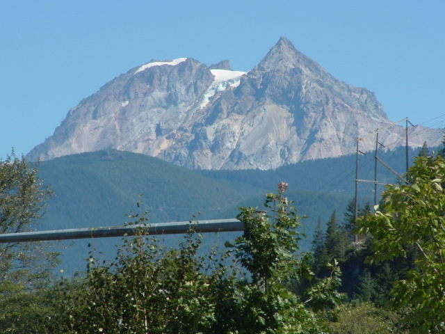
Castle Rock is a volcanic plug located west of Iskut and northwest of Tuktsayda Mountain in British Columbia, Canada. Castle Rock is part of the Pacific Ring of Fire that includes over 160 active volcanoes and is in the Klastline Group of the Northern Cordilleran Volcanic Province and last erupted in the Pleistocene. Castle Rock is one of ten major Canadian volcanoes with recent seismic activity, the others being the Mount Edziza volcanic complex, Mount Cayley, Hoodoo Mountain, The Volcano, Crow Lagoon, Mount Silverthrone, the Mount Meager massif, the Wells Gray-Clearwater volcanic field and Mount Garibaldi. See also *Northern Cordilleran Volcanic Province *List of volcanoes in Canada *List of Northern Cordilleran volcanoes *Volcanism in Canada *Volcanism of Western Canada Volcanism of Western Canada has produced lava flows, lava plateaus, lava domes, cinder cones, stratovolcanoes, shield volcanoes, greenstone belts, submarine volcanoes, calderas, diatremes and maars, al ... [...More Info...] [...Related Items...] OR: [Wikipedia] [Google] [Baidu] |
Stikine Country
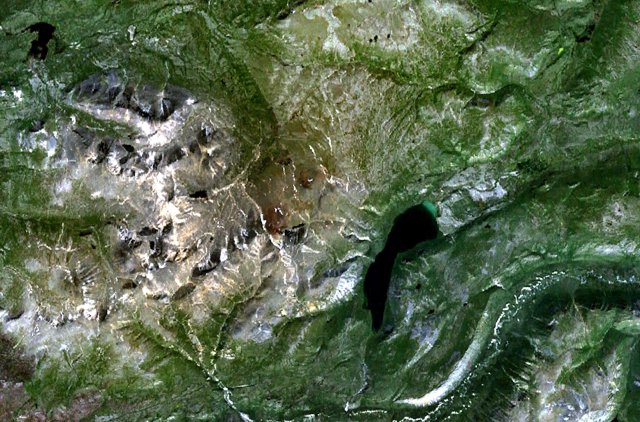
The Stikine Country , also referred to as the Stikine District or simply "the Stikine", is one of the historical geographic regions of the Canadian province of British Columbia, located inland from the central Alaska Panhandle and comprising the basin of the Stikine River and its tributaries. The term Stikine–Iskut (alone or in various combination forms "District", "Country", "Region") is also fairly common to describe the area, and references the Iskut River, the Stikine's largest tributary and describable as its south fork. Geography The basin of the Stikine is sparsely populated, mostly by members of the Tahltan people, though the lower reaches are the territory of group of the Tlingit people centred on Wrangell, Alaska, which is on Etolin Island just outside the mouth of the Stikine. The region is noted for its rugged and unusual mix of glaciated ranges, semi-arid subarctic volcanic plateaux and cones, and deep river canyons, most of all the Grand Canyon of the Stikine, ... [...More Info...] [...Related Items...] OR: [Wikipedia] [Google] [Baidu] |
Hoodoo Mountain
Hoodoo Mountain, sometimes referred to as Hoodoo Volcano, is a potentially active stratovolcano in the Northern Interior of British Columbia, Canada. It is located northeast of the Alaska–British Columbia border on the north side of the Iskut River opposite of the mouth of the Craig River. With a summit elevation of and a topographic prominence of , Hoodoo Mountain is one of many prominent peaks within the Boundary Ranges of the Coast Mountains. Its flat-topped summit is covered by an ice cap more than thick and at least in diameter. Two valley glaciers surrounding the northwestern and northeastern sides of the mountain have retreated significantly over the last hundred years. They both originate from a large icefield to the north and are the sources of two meltwater streams. These streams flow along the western and eastern sides of the volcano before draining into the Iskut River. Much of Hoodoo Mountain was formed beneath glacial ice and it has been overlain by glacier ... [...More Info...] [...Related Items...] OR: [Wikipedia] [Google] [Baidu] |
Volcanic Plugs Of British Columbia
A volcano is commonly defined as a vent or fissure in the crust of a planetary-mass object, such as Earth, that allows hot lava, volcanic ash, and gases to escape from a magma chamber below the surface. On Earth, volcanoes are most often found where tectonic plates are diverging or converging, and because most of Earth's plate boundaries are underwater, most volcanoes are found underwater. For example, a mid-ocean ridge, such as the Mid-Atlantic Ridge, has volcanoes caused by divergent tectonic plates whereas the Pacific Ring of Fire has volcanoes caused by convergent tectonic plates. Volcanoes resulting from divergent tectonic activity are usually non-explosive whereas those resulting from convergent tectonic activity cause violent eruptions."Mid-ocean ridge tectonics, volcanism and geomorphology." Geology 26, no. 455 (2001): 458. https://macdonald.faculty.geol.ucsb.edu/papers/Macdonald%20Mid-Ocean%20Ridge%20Tectonics.pdf Volcanoes can also form where there is stretching an ... [...More Info...] [...Related Items...] OR: [Wikipedia] [Google] [Baidu] |
Volcanic History Of The Northern Cordilleran Volcanic Province
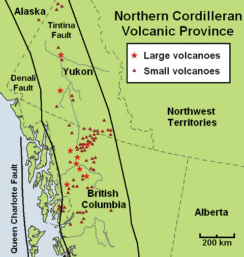
The volcanic history of the Northern Cordilleran Volcanic Province presents a record of volcanic activity in northwestern British Columbia, central Yukon and the U.S. state of easternmost Alaska. The volcanic activity lies in the northern part of the Western Cordillera of the Pacific Northwest region of North America. Extensional cracking of the North American Plate in this part of North America has existed for millions of years. Continuation of this continental rifting has fed scores of volcanoes throughout the Northern Cordilleran Volcanic Province over at least the past 20 million years (see Geology of the Pacific Northwest) and occasionally continued into geologically recent times. Eruptive activity in the Northern Cordilleran Volcanic Province throughout its 20 million year history has been mainly the production of alkaline lavas, including alkaline basalts. A range of alkaline rock types not commonly found in the Western Cordillera are regionally widespread in ... [...More Info...] [...Related Items...] OR: [Wikipedia] [Google] [Baidu] |
Volcanism Of Western Canada
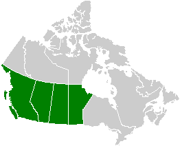
Volcanism of Western Canada has produced lava flows, lava plateaus, lava domes, cinder cones, stratovolcanoes, shield volcanoes, greenstone belts, submarine volcanoes, calderas, diatremes and maars, along with examples of more less common volcanic forms such as tuya A tuya is a flat-topped, steep-sided volcano formed when lava erupts through a thick glacier or ice sheet. They are rare worldwide, being confined to regions which were covered by glaciers and had active volcanism during the same period. As lava ...s and subglacial mounds. Volcanic belts * * * * * * * * * External links Erica A. Massey: A Comparative Study of Glaciovolcanic Palagonitization of Tholeitic and Alkaline Sideromelane in Helgafell, Icland, and Wells Gray-Clearwater Volcanic Filed, BC, Canada. B.Sc., The University of British Columbia, 2014 Volcanic fields * * * See also * * * * ReferencesVolcanoes of Canada . . . . {{Manitoba-stub ... [...More Info...] [...Related Items...] OR: [Wikipedia] [Google] [Baidu] |
Volcanism In Canada
Volcanism, Volcanic activity is a major part of the geology of Canada and is characterized by many types of volcanic landform, including lava flows, volcanic plateaus, lava domes, cinder cones, stratovolcanoes, shield volcanoes, submarine volcanoes, calderas, diatremes, and maars, along with less common volcanic forms such as tuyas and subglacial mounds. Though Canada's volcanic history dates back to the Precambrian eon, at least 3.11 billion years ago, when its part of the North American continent began to form, volcanism continues to occur in Western Canada, Western and Northern Canada in modern times, where it forms part of an encircling chain of volcanoes and frequent earthquakes around the Pacific Ocean called the Pacific Ring of Fire. Because volcanoes in Western and Northern Canada are in relatively remote and sparsely populated areas and their activity is less frequent than with other volcanoes around the Pacific Ocean, Canada is commonly thought to occupy a gap in t ... [...More Info...] [...Related Items...] OR: [Wikipedia] [Google] [Baidu] |
List Of Northern Cordilleran Volcanoes
The geography of northwestern British Columbia and Yukon, Canada is dominated by volcanoes of the Northern Cordilleran Volcanic Province formed due to continental rifting of the North American Plate. It is the most active volcanic region in Canada. Some of the volcanoes are notable for their eruptions, for instance, Tseax Cone for its catastrophic eruption estimated to have occurred in the 18th century which was responsible for the death of at least 2,000 Nisga'a people from poisonous volcanic gases, the Mount Edziza volcanic complex for at least 20 eruptions throughout the past 10,000 years, and The Volcano (British Columbia), The Volcano (also known as Lava Fork volcano) for the most recent eruption in Canada during 1904. The majority of volcanoes in the Northern Cordilleran Volcanic Province lie in Canada while a very small portion of the volcanic province lies in the U.S. state of Alaska. Volcanoes of the Northern Cordilleran Volcanic Province are a part of the Paci ... [...More Info...] [...Related Items...] OR: [Wikipedia] [Google] [Baidu] |
List Of Volcanoes In Canada
List of volcanoes in Canada is an incomplete list of volcanoes found in Geography of Canada, mainland Canada, in the Islands of Canada, Canadian islands and in Canadian waters. All but two Provinces of Canada, provinces, Prince Edward Island and Manitoba, have at least one volcano. Alberta British Columbia New Brunswick Newfoundland and Labrador Northwest Territories Nova Scotia Nunavut Ontario Quebec Saskatchewan Yukon See also * Outline of Canada * Bibliography of Canada * Index of Canada-related articles * Volcanism of Canada ** Volcanism of Northern Canada ** Volcanism of Western Canada ** Volcanism of Eastern Canada ** List of Northern Cordilleran volcanoes * List of mountains in Canada * List of Cascade volcanoes External links Catalogue of Canadian Volcanoes {{Canadian volcanism Volcanoes of Canada, Lists of volcanoes, Canada Lists of mountains of Canada, Volcanoes Lists of landforms of Canada, Volcanoes Canada geology-related li ... [...More Info...] [...Related Items...] OR: [Wikipedia] [Google] [Baidu] |
Mount Garibaldi
Mount Garibaldi (, ) is a dormant stratovolcano in the Garibaldi Ranges of the Pacific Ranges in southwestern British Columbia, Canada. It has a maximum elevation of and rises above the surrounding landscape on the east side of the Cheakamus River in New Westminster Land District. In addition to the main peak, Mount Garibaldi has two named sub-peaks. Atwell Peak is a sharp, conical peak slightly higher than the more rounded peak of Dalton Dome. Both were volcanically active at different times throughout Mount Garibaldi's eruptive history. The northern and eastern flanks of Mount Garibaldi are obscured by the Garibaldi Névé, a large snowfield containing several radiating glaciers. Flowing from the steep western face of Mount Garibaldi is the Cheekye River, a tributary of the Cheakamus River. Opal Cone on the southeastern flank is a small volcanic cone from which a lengthy lava flow descends. The western face is a volcanic landslide, landslide feature that formed in a series of c ... [...More Info...] [...Related Items...] OR: [Wikipedia] [Google] [Baidu] |
Wells Gray-Clearwater Volcanic Field
The Wells Gray-Clearwater volcanic field, also called the Clearwater Cone Group, is a potentially active monogenetic volcanic field in east-central British Columbia, Canada, located approximately north of Kamloops, British Columbia, Kamloops. It is situated in the Cariboo Mountains of the Columbia Mountains and on the Quesnel Highland, Quesnel and Shuswap Highlands. As a monogenetic volcanic field, it is a place with numerous small basaltic volcanoes and extensive lava flows. Most of the Wells Gray-Clearwater volcanic field is encompassed within a large wilderness park called Wells Gray Provincial Park. This park was established in 1939 to protect Helmcken Falls and the unique features of the Clearwater River (British Columbia), Clearwater River drainage basin, including this volcanic field. Five roads enter the park and provide views of some of the field's volcanic features. Short hikes lead to several other volcanic features, but some areas are accessible only by aircraft. Ge ... [...More Info...] [...Related Items...] OR: [Wikipedia] [Google] [Baidu] |
Mount Meager Massif
The Mount Meager massif is a group of volcanic peaks in the of the Coast Mountains in southwestern British Columbia, Canada. Part of the Cascade Volcanic Arc of western North America, it is located north of Vancouver at the northern end of the Pemberton Valley and reaches a maximum elevation of . The massif is capped by several eroded volcanic edifices, including , volcanic plugs and overlapping piles of lava flows; these form at least six major summits including Mount Meager which is the second highest of the massif. The Garibaldi Volcanic Belt (GVB) has a long history of eruptions and poses a threat to the surrounding region. Any volcanic hazard ranging from landslides to eruptions could pose a significant risk to humans and wildlife. Although the massif has not erupted for more than 2,000 years, it could produce a major eruption; if this were to happen, relief efforts would be quickly organized. Teams such as the Interagency Volcanic Event Notification Plan (IVENP) are ... [...More Info...] [...Related Items...] OR: [Wikipedia] [Google] [Baidu] |
