|
Carpathian Euroregion
The Carpathian Euroregion is an international association formed on February 14, 1993, by the representatives of the regional administrations of Poland, Ukraine, Slovakia and Hungary in the city of Debrecen. In 2000, the request from several regional administrations of Romania to join the Euroregion was accepted. The region The Carpathian Euroregion comprises 19 administrative units of five countries from Central and East Europe, which are Poland, Slovakia, Hungary, Ukraine and Romania. Its total area is about 160 000 km2 or over 60 thousands square miles. It is inhabited by over 15 million people. The Carpathian Euroregion is designed to bring together the people who inhabit the region of the Carpathian Mountains and to facilitate their cooperation in the fields of science, culture, education, trade, tourism and economy. Due to its size, another Euroregion was created within it: the Biharia Euroregion, centered in Oradea. It covers two neighboring counties of Bihor in R ... [...More Info...] [...Related Items...] OR: [Wikipedia] [Google] [Baidu] |
Botoșani County
Botoșani County () is a county (județ) of Romania, in Western Moldavia (encompassing a few villages in neigbhouring Suceava County from Bukovina to the west as well), with the capital town ( ro, Oraș reședință de județ) at Botoșani. Demographics As of 31 October 2011, it had a population of 412,626 and the population density was 83/km2. * Romanians – 94.1% * Romani – 1% * Ukrainians – 0.2% * Lipovans – 0.1% * Other ethnicities – 0.1% * Unknown ethnicity – 4.6% Geography * Botoșani County is situated between the rivers Siret and Prut, in the northeastern part of Romania, bordering Ukraine to the north and Moldova to the east. To the west and south it has borders with Suceava and Iași counties. * It has a total area of , comprising 2.1% of the Romanian territory. * The relief is a high plain, between the valleys of the Siret and the Prut, and the latter's affluent, the Jijia River. * It has a temperate climate, influenced by the eastern air mas ... [...More Info...] [...Related Items...] OR: [Wikipedia] [Google] [Baidu] |
Zakarpattya Oblast
The Zakarpattia Oblast ( uk, Закарпатська область, Zakarpatska oblast) is an Administrative divisions of Ukraine, administrative oblast located in western Ukraine, mostly coterminous with the historical region of Carpathian Ruthenia. Its Capital (political), administrative centre is the city of Uzhhorod, Other major cities within the oblast include Mukachevo, Khust, Berehove, and Chop, Ukraine, Chop, the last of which is home to railroad transport infrastructure. Zakarpattia Oblast was established on 22 January 1946, after Czechoslovakia gave up its claim to the territory of ''Carpathian Ruthenia, Subcarpathian Ruthenia'' ( cs, Podkarpatská Rus) under a treaty between Czechoslovakia and the Soviet Union. The territory of ''Carpathian Ruthenia, Subcarpathian Ruthenia'' was then taken over by the Soviet Union and became part of the Ukrainian Soviet Socialist Republic. Some scholars say that during the 1991 Ukrainian independence referendum, Ukrainian independe ... [...More Info...] [...Related Items...] OR: [Wikipedia] [Google] [Baidu] |
Lviv Oblast
Lviv Oblast ( uk, Льві́вська о́бласть, translit=Lvivska oblast, ), also referred to as Lvivshchyna ( uk, Льві́вщина, ), ). The name of each oblast is a relational adjective—in English translating to a noun adjunct which otherwise serves the same function—formed by adding a feminine suffix to the name of the respective center city: ''Lʹvív'' is the center of the ''Lʹvívsʹka óblastʹ'' (Lviv Oblast). Most oblasts are also sometimes referred to in a feminine noun form, following the convention of traditional regional place names, ending with the suffix "-shchyna", as is the case with the Lviv Oblast, ''Lvivshchyna''. is an oblast (province) in western Ukraine. The administrative center of the oblast is the city of Lviv. The current population is History The oblast was created as part of the Ukrainian Soviet Socialist Republic on December 4, 1939 following the Soviet invasion of Poland. The territory of the former Drohobych Oblast was incorpo ... [...More Info...] [...Related Items...] OR: [Wikipedia] [Google] [Baidu] |
Ivano-Frankivsk Oblast
Ivano-Frankivsk Oblast ( uk, Іва́но-Франкі́вська о́бласть, translit=Ivano-Frankivska oblast), also referred to as Ivano-Frankivshchyna ( uk, Іва́но-Франкі́вщина), is an oblast (region) in western Ukraine. Its administrative center is the city of Ivano-Frankivsk. As is the case with most other oblasts of Ukraine this region has the same name as its administrative center – which was renamed by the Soviet Ukrainian authorities after the Ukrainian writer Ivan Franko on 9 November 1962. It has a population of Ivano-Frankivsk Oblast is also known to Ukrainians by a deep-rooted alternative name: ''Prykarpattia'' (although some sources may also consider the southern Lviv Oblast including such cities as Stryi, Truskavets, and Drohobych, as also part of Prykarpattia). Prykarpattia, together with Lviv and Ternopil regions, was the main body of the historic region of eastern Halychyna; which in the 13th century was a part of the Kingdom ... [...More Info...] [...Related Items...] OR: [Wikipedia] [Google] [Baidu] |
Chernivtsi Oblast
Chernivtsi Oblast ( uk, Черніве́цька о́бласть, Chernivetska oblast), also referred to as Chernivechchyna ( uk, Чернівеччина) is an oblast (province) in Western Ukraine, consisting of the northern parts of the regions of Bukovina and Bessarabia. It has an international border with Romania and Moldova. The oblast is the smallest in Ukraine by area and second smallest by population. Chernivtsi was part of Romania. In 1408, when it was a town in Moldavia and the chief centre of the area known as Bukovina. Chernivtsi later passed to the Turks and then in 1774 to Austria. After World War I it was ceded to Romania, and in 1940 the town was acquired by the Ukrainian SSR. The oblast has a large variety of landforms: the Carpathian Mountains and picturesque hills at the foot of the mountains gradually change to a broad partly forested plain situated between the Dniester and Prut rivers. It has a population of 896,566 as of 2020, and its capital is the ... [...More Info...] [...Related Items...] OR: [Wikipedia] [Google] [Baidu] |
Szabolcs-Szatmár-Bereg County
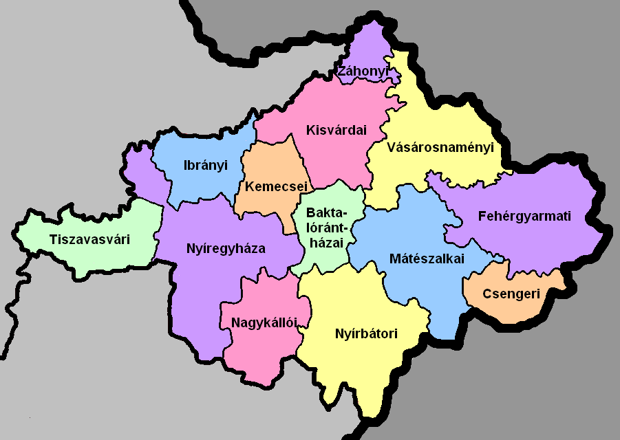
Szabolcs-Szatmár-Bereg ( hu, Szabolcs-Szatmár-Bereg megye, ) is an administrative county (Hungarian: ''megye'') in north-eastern Hungary, bordering Slovakia (Košice Region), Ukraine (Zakarpattia Oblast), and Romania ( Bihor and Satu Mare counties). It shares borders with the Hungarian counties Hajdú-Bihar and Borsod-Abaúj-Zemplén. The capital of Szabolcs-Szatmár-Bereg county is Nyíregyháza. Szabolcs-Szatmár-Bereg County was organised after World War II from the previous counties Szatmár-Ugocsa-Bereg and Szabolcs. Before 1991, it was called Szabolcs-Szatmár County. Geography Szabolcs-Szatmár-Bereg is located in the north-eastern tip of Hungary. It borders Ukraine (Zakarpattia Oblast), Slovakia (Košice Region), and Romania ( Bihor and Satu Mare counties), and has good connections both by road and rail. Within Hungary, the county is bordered by Borsod-Abaúj-Zemplén County and the Tisza River to the north-west and Hajdú-Bihar County to the south-west. The earl ... [...More Info...] [...Related Items...] OR: [Wikipedia] [Google] [Baidu] |
Jász-Nagykun-Szolnok County
Jász-Nagykun-Szolnok ( hu, Jász-Nagykun-Szolnok megye, ) is the name of an administrative county (comitatus or ''megye'') in Hungary. It lies in central Hungary and shares borders with the Hungarian counties Pest, Heves, Borsod-Abaúj-Zemplén, Hajdú-Bihar, Békés, Csongrád, and Bács-Kiskun. The rivers Tisza and Körös flow through the county. The capital of Jász-Nagykun-Szolnok county is Szolnok. Its area is 5582 km². The county is named after the Ossetians (Jasz) and Cumans (Kun) who settled there, along with Szolnok. The county was part of the Danube–Criș–Mureș–Tisa Euroregion between 1997 and 2004. Geography This county has a total area of – 6,00% of Hungary. Neighbouring counties * Heves and Borsod-Abaúj-Zemplén County in the North. * Hajdú-Bihar and Békés County in the East. * Csongrád County in the South. * Bács-Kiskun and Pest County in the West. Symbols Coat of arms and flag The county's coat of arms was recreated in 1991 from t ... [...More Info...] [...Related Items...] OR: [Wikipedia] [Google] [Baidu] |
Heves County
Heves county ( hu, Heves megye, ) lies in northern Hungary, between the right bank of the river Tisza and the Mátra and Bükk mountains. It shares borders with the Hungarian counties Pest, Nógrád, Borsod-Abaúj-Zemplén and Jász-Nagykun-Szolnok. Eger is the county seat. Tourist sights * Lake Tisza * Bükk National Park * Bélapátfalva, abbey * Castle and City of Eger * Erdőtelek Arboretum * Feldebrő, 11th century Romanesque church * Gyöngyös, Mátra Museum * Hatvan, Grassalkovich mansion * Kisnána castle * Noszvaj, De la Motte mansion * Parád * Sirok castle * Szilvásvárad, Szalajka Valley * Szarvaskő, castle ruins Geography Heves county is a geographically diverse area; its northern part is mountainous (the Mátra and Bükk are the two highest mountain ranges in Hungary), while at south it includes a part of the Great Hungarian Plain. From south it is bordered by Lake Tisza, the largest artificial lake in Hungary. The average temperature is between 8 and 10 ... [...More Info...] [...Related Items...] OR: [Wikipedia] [Google] [Baidu] |
Borsod-Abaúj-Zemplén County
Borsod-Abaúj-Zemplén ( hu, Borsod-Abaúj-Zemplén megye, ; sk, Boršodsko-abovsko-zemplínska) is an administrative county ( comitatus or ''megye)'' in north-eastern Hungary (commonly called "Northern Hungary"), on the border with Slovakia (Košice Region). It shares borders with the Hungarian counties Nógrád, Heves, Hajdú-Bihar and Szabolcs-Szatmár-Bereg. The capital of Borsod-Abaúj-Zemplén county is Miskolc. Of the seven statistical regions of Hungary it belongs to the region Northern Hungary. Borsod-Abaúj-Zemplén is the second largest county of Hungary both by area (after Bács-Kiskun) and by population (after Pest County). It is the only Hungarian county with two UNESCO World Heritage Sites (the Caves of Aggtelek Karst and Slovak Karst and the Tokaj Wine Region Historic Cultural Landscape). Origins and meanings of name The county bears the name of three historic counties of Hungary, each of them was centered around a castle. * Borsod is named after the ... [...More Info...] [...Related Items...] OR: [Wikipedia] [Google] [Baidu] |
Suceava County
Suceava County () is a county ('' ro, județ'') of Romania. Most of its territory lies in the southern part of the historical region of Bukovina, while the remainder forms part of Western Moldavia proper. The county seat is the historical town of Suceava (german: Suczawa, also Sotschen or Sutschawa; historically known in Old High German as ''Sedschopff'' as well) which was the capital of the Principality of Moldavia during the late Middle Ages and then a pivotal, predominantly German-speaking commercial town of the Habsburg/Austrian Empire and Austria-Hungary at the border with the Kingdom of Romania throughout the late Modern Age up until 1918. Suceava County, as part of the historical and geographical region of Bukovina, had been sometimes described as " Switzerland of the East". It has also been known as "Switzerland of Eastern Europe" in the minds of the educated public. Demographics In 2011, Suceava County had a population of 634,810, with a population density o ... [...More Info...] [...Related Items...] OR: [Wikipedia] [Google] [Baidu] |
Satu Mare County
Satu Mare County ( ro, Județul Satu Mare, ) is a county (județ) of Romania, on the border with Hungary and Ukraine. The capital city is Satu Mare. Name In Hungarian, it is known as ''Szatmár megye'', in German as ''Kreis Sathmar'', in Ukrainian as Сату-Маре, and in Slovak as ''Satmárska župa''. Demographics Satu Mare is a multicultural city, with a population mix of Romanian, Hungarian, Roma, German, and other ethnicities. In 2002, Satu Mare County had a population of 367,281 and the population density was .National Institute of Statistics, "Populația după etnie"'' * Romanians – 58.8% * Hungarians – 35.2% * Roma – 3.7% * Germans (Sathmar Swabians) – 1.7% * Ukrainians, Slovaks, other In 2011, its population was 329,079 and population density was . * Romanians – 57.73% * Hungarians – 34.5% * Roma – 5.32% * Germans (Sathmar Swabians) – 1.51% * Rusyns, Ukrainians, Slovaks, other Hungarians mostly reside along the border with Hungary, but some ar ... [...More Info...] [...Related Items...] OR: [Wikipedia] [Google] [Baidu] |


