|
Carnduff
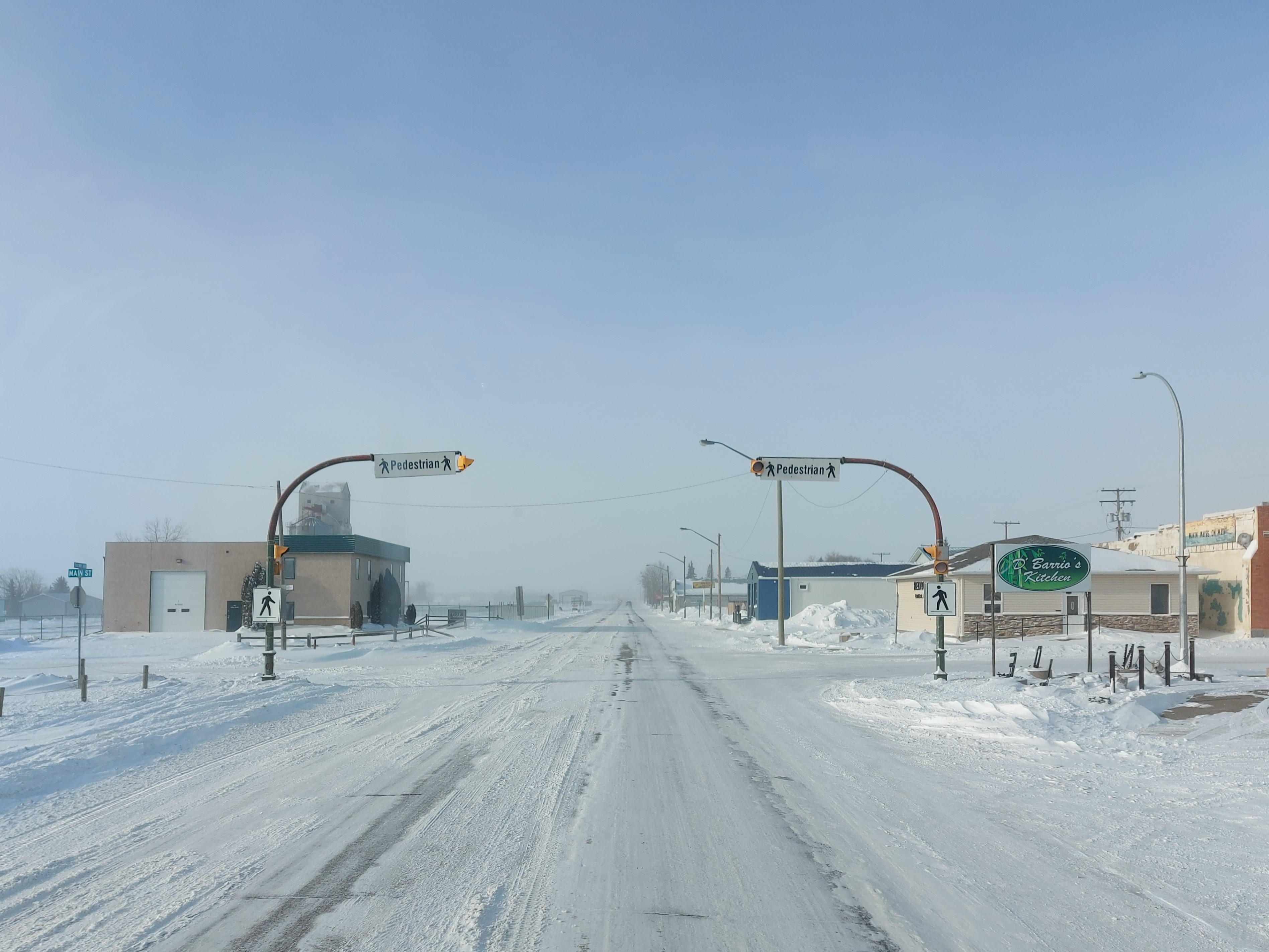
Carnduff is a small agricultural town in southeast Saskatchewan, Canada. History Carnduff is named after its first postmaster, John Carnduff. It was marked on early CPR maps, though that location did not exactly correspond to the present town site later surveyed in 1891. Though Saskatchewan is in the CST Zone, since 1967 it has not observed daylight saving time and the local clocks are not changed in summer. A practical effect on border towns like Carnduff is that they only align with neighbouring communities in Manitoba and North Dakota for half the year, which may lead to misunderstandings regarding the timing of scheduled inter-community events. In 2001, the town was noted as having trees affected by Dutch Elm Disease. Geography The town lies at the intersection of Highway 318 and Highway 18. The Canadian Pacific Railway runs parallel to Highway 18 and their combined thoroughfare splits the town into a north half and a south half. The majority of housing and businesse ... [...More Info...] [...Related Items...] OR: [Wikipedia] [Google] [Baidu] |
Antler River
The Antler River is located in the Prairie Pothole Region of North America's Great Plains in south-eastern Saskatchewan and south-western Manitoba in Canada in an area known as Palliser's Triangle. Its source is in Saskatchewan's Moose Mountain Upland and it is a major tributary of the Souris River. As a result, its flood levels are monitored by the United States Geological Survey. In 2011, several communities along the river experienced abnormally severe spring flooding that resulted in damage to many bridges crossing the river. Near Carnduff, repairs were still ongoing months after the water level had subsided. The Antler River Recreation District is an association of communities in the south-western corner of Manitoba that are on or near the river and its related branches. Towns involved include Melita and Pierson. Course The river starts on the eastern side of Moose Mountain Upland, north-east of the lakes of Kenosee and White Bear (Carlyle). and drains much of ... [...More Info...] [...Related Items...] OR: [Wikipedia] [Google] [Baidu] |
Saskatchewan Highway 18
Highway 18 is a highway in the Canadian province of Saskatchewan. It runs from Highway 13 near Robsart, approximately east of the Alberta border, to the Manitoba border near Gainsborough, where it becomes Highway 3. It passes through three major communities, all in the eastern quarter of Saskatchewan – Estevan, Oxbow, and Carnduff; it also passes north of the west and east blocks of Grasslands National Park. Highway 18 is about long, which is the longest east-west highway and second longest highway in Saskatchewan. History The original segment of Highway 18 ran from the Manitoba border, through Estevan, to Lake Alma, before turning north, passing through Radville, and terminating at Highway 13 approximately west of Weyburn. In the 1960s, Highway 18 was extended west to Highway 6 near Minton along an upgraded grid road, resulting in the north-south section between Lake Alma and Highway 13 being renumbered as Highway 28 ... [...More Info...] [...Related Items...] OR: [Wikipedia] [Google] [Baidu] |
Saskatchewan Wheat Pool
The Saskatchewan Wheat Pool was a grain handling, agri-food processing and marketing company based in Regina, Saskatchewan. The Pool created a network of marketing alliances in North America and internationally which made it the largest agricultural grain handling operation in the province of Saskatchewan. Before becoming Viterra, SWP had operated 276 retail outlets and more than 100 grain handling and marketing centres. The Saskatchewan Wheat Pool operated under the name of AgPro in the prairie provinces of Manitoba and Alberta. Begun as a co-operative in the 1920s, the company became a publicly traded corporation in the 1990s. After the 2007 takeover of its competitor, Winnipeg-based Agricore United, the Pool name was retired. The merged company operated under the name Viterra until 2013, when it was acquired by Glencore International. Establishment and growth 180px, A now-obsolete wooden grain elevator once owned by SWP in Gainsborough. Farmers, frustrated in their att ... [...More Info...] [...Related Items...] OR: [Wikipedia] [Google] [Baidu] |
Saskatchewan Highway 318
Highway 318 is a provincial highway in the Canadian province of Saskatchewan Saskatchewan ( ; ) is a province in western Canada, bordered on the west by Alberta, on the north by the Northwest Territories, on the east by Manitoba, to the northeast by Nunavut, and on the south by the U.S. states of Montana and North .... It runs from Saskatchewan Highway 18, Highway 18 near Carnduff to Saskatchewan Highway 361, Highway 361 near Alida, Saskatchewan, Alida. It is about long. See also * Roads in Saskatchewan * Transportation in Saskatchewan References Saskatchewan provincial highways, 318 {{Saskatchewan-road-stub ... [...More Info...] [...Related Items...] OR: [Wikipedia] [Google] [Baidu] |
2011 Souris River Flood
The 2011 Souris/Mouse River flood in Canada and the United States occurred in June and was greater than a hundred-year flooding event for the river. The US Army Corps of Engineers estimated the flood to have a recurrence interval of two to five centuries. The Souris River begins in southeastern Saskatchewan, flows southeast into North Dakota, then to southwestern Manitoba. It is a tributary of the Assiniboine River, which it meets near Treesbank, Manitoba, and flows east to meet the Red River of the North in Winnipeg. The flooding affected Saskatchewan and North Dakota; notably in Minot, where it overtopped levees and caused the evacuation of about 11,000 residents. The flooding in Minot was worse than the 1969 and 1881 floods; many other towns along the river were affected and many acres of farmland were inundated. Background Flooding in Saskatchewan the previous summer, in addition to heavy snowfall and a thick snowpack from the previous La Niña winter added to overflow on ... [...More Info...] [...Related Items...] OR: [Wikipedia] [Google] [Baidu] |
Tennis Court
A tennis court is the venue where the sport of tennis is played. It is a firm rectangular surface with a low net stretched across the centre. The same surface can be used to play both doubles and singles matches. A variety of surfaces can be used to create a tennis court, each with its own characteristics which affect the playing style of the game. Dimensions The dimensions of a tennis court are defined and regulated by the International Tennis Federation (ITF) governing body and are written down in the annual 'Rules of Tennis' document. The court is long. Its width is for singles matches and for doubles matches. The service line is from the net. Additional clear space around the court is needed in order for players to reach overrun balls for a total of wide and long. A net is stretched across the full width of the court, parallel with the baselines, dividing it into two equal ends. The net is high at the posts, and high in the center. The net posts are outside the ... [...More Info...] [...Related Items...] OR: [Wikipedia] [Google] [Baidu] |
Bakken Formation
The Bakken Formation () is a rock unit from the Late Devonian to Early Mississippian age occupying about of the subsurface of the Williston Basin, underlying parts of Montana, North Dakota, Saskatchewan and Manitoba. The formation was initially described by geologist J. W. Nordquist in 1953. The formation is entirely in the subsurface, and has no surface outcrop. It is named after Henry O. Bakken (1901–1982), a farmer in Tioga, North Dakota, who owned the land where the formation was initially discovered while drilling for oil. Besides the Bakken formation being a widespread prolific source rock for oil when thermally mature, significant producible oil reserves exist within the rock unit itself. Oil was first discovered within the Bakken in 1951, but past efforts to produce it have faced technical difficulties. In April 2008, a USGS report estimated the amount of recoverable oil using technology readily available at the end of 2007 within the Bakken Formation at 3. ... [...More Info...] [...Related Items...] OR: [Wikipedia] [Google] [Baidu] |
Grain Elevator
A grain elevator is a facility designed to stockpile or store grain. In the grain trade, the term "grain elevator" also describes a tower containing a bucket elevator or a pneumatic conveyor, which scoops up grain from a lower level and deposits it in a silo or other storage facility. In most cases, the term "grain elevator" also describes the entire elevator complex, including receiving and testing offices, weighbridges, and storage facilities. It may also mean organizations that operate or control several individual elevators, in different locations. In Australia, the term describes only the lifting mechanism. Before the advent of the grain elevator, grain was usually handled in bags rather than in bulk (large quantities of loose grain). Dart's Elevator was a major innovation. It was invented by Joseph Dart, a merchant, and Robert Dunbar, an engineer, in 1842 and 1843, in Buffalo, New York. Using the steam-powered flour mills of Oliver Evans as their model, they invented t ... [...More Info...] [...Related Items...] OR: [Wikipedia] [Google] [Baidu] |
Statistics Canada
Statistics Canada (StatCan; french: Statistique Canada), formed in 1971, is the agency of the Government of Canada commissioned with producing statistics to help better understand Canada, its population, resources, economy, society, and culture. It is headquartered in Ottawa.Statistics Canada, 150 Tunney's Pasture Driveway Ottawa, Ontario K1A 0T6; Statistique Canada 150, promenade du pré Tunney Ottawa, Ontario K1A 0T6 The agency is led by the chief statistician of Canada, currently Anil Arora, who assumed the role on September 19, 2016. StatCan is responsible to Parliament through the Minister of Innovation, Science and Industry, currently François-Philippe Champagne. Statistics Canada acts as the national statistical agency for Canada, and Statistics Canada produces statistics for all the provinces as well as the federal government. In addition to conducting about 350 active surveys on virtually all aspects of Canadian life, the ''Statistics Act'' mandates that Statisti ... [...More Info...] [...Related Items...] OR: [Wikipedia] [Google] [Baidu] |
2021 Canadian Census
The 2021 Canadian census was a detailed enumeration of the Canadian population with a reference date of May 11, 2021. It follows the 2016 Canadian census, which recorded a population of 35,151,728. The overall response rate was 98%, which is slightly lower than the response rate for the 2016 census. It recorded a population of 36,991,981, a 5.2% increase from 2016. Planning Consultation on census program content was from September 11 to December 8, 2017. The census was conducted by Statistics Canada, and was contactless as a result of the COVID-19 pandemic in Canada. The agency had considered delaying the census until 2022. About 900 supervisors and 31,000 field enumerators were hired to conduct the door-to-door survey of individuals and households who had not completed the census questionnaire by late May or early June. Canvassing agents wore masks and maintained a physical distance to comply with COVID-19 safety regulations. Questionnaire In early May 2021, Statistics Ca ... [...More Info...] [...Related Items...] OR: [Wikipedia] [Google] [Baidu] |
Regina, Saskatchewan
Regina () is the capital city of the Canadian province of Saskatchewan. The city is the second-largest in the province, after Saskatoon, and is a commercial centre for southern Saskatchewan. As of the 2021 census, Regina had a city population of 226,404, and a Metropolitan Area population of 249,217. It is governed by Regina City Council. The city is surrounded by the Rural Municipality of Sherwood No. 159. Regina was previously the seat of government of the North-West Territories, of which the current provinces of Saskatchewan and Alberta originally formed part, and of the District of Assiniboia. The site was previously called Wascana ("Buffalo Bones" in Cree), but was renamed to Regina (Latin for "Queen") in 1882 in honour of Queen Victoria. This decision was made by Queen Victoria's daughter Princess Louise, who was the wife of the Governor General of Canada, the Marquess of Lorne. Unlike other planned cities in the Canadian West, on its treeless flat plain Regina h ... [...More Info...] [...Related Items...] OR: [Wikipedia] [Google] [Baidu] |


