|
Carl Friedrich Alexander Hartmann
Carl Friedrich Alexander Hartmann (8 January 1796 – 3 August 1863) was a German mineralogist, geologist and a mining engineer who wrote several books on geology and mining. His knowledge of French and English allowed him to translate several works into German including ''Elements of Geology'' by Charles Lyell. Hartmann was born in Zorge in the Harz mountains where his father worked in a foundry in the region known for its mining and smelting industry. With an early interest in metallurgy, he was educated at Zorge before going to Blankenburg studying under an uncle who was the abbott of Ziegenbein. He then went to study at the mining school in Clausthal. He was conscripted during the War of Liberation between 1813 and 1815 and after discharge in 1816 he became an assistant in a foundry at Zorge. He then made visits to foundries in Silesia and then to Berlin in 1818 where his studied under Christian Weiss and worked as an assistant. He worked after his marriage in 1821 as an ac ... [...More Info...] [...Related Items...] OR: [Wikipedia] [Google] [Baidu] |
Charles Lyell
Sir Charles Lyell, 1st Baronet, (14 November 1797 – 22 February 1875) was a Scottish geologist who demonstrated the power of known natural causes in explaining the earth's history. He is best known today for his association with Charles Darwin and as the author of ''Principles of Geology'' (1830–33), which presented to a wide public audience the idea that the earth was shaped by the same natural processes still in operation today, operating at similar intensities. The philosopher William Whewell dubbed this gradualism, gradualistic view "uniformitarianism" and contrasted it with catastrophism, which had been championed by Georges Cuvier and was better accepted in Europe. The combination of evidence and eloquence in ''Principles'' convinced a wide range of readers of the significance of "deep time" for understanding the earth and environment. Lyell's scientific contributions included a pioneering explanation of climate change, in which shifting boundaries between oceans ... [...More Info...] [...Related Items...] OR: [Wikipedia] [Google] [Baidu] |
Zorge, Walkenried
Zorge is a village and a former municipality in the district of Göttingen, in Lower Saxony, Germany. Since 1 November 2016 it has been part of the municipality of Walkenried. The river Zorge rises in the village. Sights There is a good view of Zorge from the ''Pferdchen'' viewpoint, which is about 430 metres above sea level and is checkpoint 58 in the Harzer Wandernadel The Harzer Wandernadel is a system of hiking awards in the Harz mountains in central Germany. Hikers (or mountain bikers) can earn awards at different levels of challenge by walking to the various checkpoints in the network and stamping their ... hiking network. at www.harzer-wandernadel.de. Retrieved 1 Nov 2017. [...More Info...] [...Related Items...] OR: [Wikipedia] [Google] [Baidu] |
Blankenburg (Harz)
Blankenburg (Harz) () is a town and health resort in the Harz (district), district of Harz in Saxony-Anhalt, Germany, at the north foot of the Harz Mountains, southwest of Halberstadt. It has been largely rebuilt since an 1836 fire, and possesses a castle with various collections, a museum of antiquities, an old town hall and churches. There are pine-needle baths and a psychiatric hospital. The nearby ridge of rocks called the ''Teufelsmauer'' ('Devil's Wall') offers views across the plain and into the deep gorges of the Harz. Geography The town of Blankenburg (Harz) lies on the northern edge of the Harz mountains at a height of about 234 metres. It is located west of Quedlinburg, south of Halberstadt and east of Wernigerode. The stream known as the Goldbach (Bode), Goldbach flows through the district of Oesig northwest of the town centre. Divisions The town Blankenburg (Harz) consists of Blankenburg proper and the following ''Ortschaften'' or municipal divisions: [...More Info...] [...Related Items...] OR: [Wikipedia] [Google] [Baidu] |
Clausthal-Zellerfeld
Clausthal-Zellerfeld () is a town in Lower Saxony, Germany. It is located in the southwestern part of the Harz mountains. Its population is approximately 15,000. The town hosts the Clausthal University of Technology. The health resort is located in the Upper Harz at an altitude between 390 and 821 m Metres above sea level, above sea level. Geography Clausthal-Zellerfeld is located on the Upper Harz Plateau. The surrounding area is less mountainous compared to most of the Harz. As a result, the adjacent area is less wooded and there is more pasture land. Scattered in and around Clausthal-Zellerfeld are numerous dams and streams belonging to the Upper Harz Water Regale. The depression between Clausthal and Zellerfeld marks a natural "borderline". Southwest extends the "Small Clausthal valley". City districts * Altenau, Lower Saxony, Altenau-Schulenberg im Oberharz (since 2015) * Buntenbock (since 1972) * Clausthal-Zellerfeld * Wildemann (since 2015) History Clausthal-Zel ... [...More Info...] [...Related Items...] OR: [Wikipedia] [Google] [Baidu] |
Christian Samuel Weiss
Christian Samuel Weiss (26 February 1780 – 1 October 1856) was a German mineralogist born in Leipzig. Following graduation, he worked as a physics instructor in Leipzig from 1803 until 1808. and in the meantime, conducted geological studies of mountain formations in Tyrol, Switzerland and France (1806–08).Christian Samuel Weiss — Humboldt-Universität zu Berlin biographical information In 1810 he became a professor of at the , where in 1818/19 and 1832/33, he served as university [...More Info...] [...Related Items...] OR: [Wikipedia] [Google] [Baidu] |
Rübeland
Rübeland is a village in the district of Harz in the German state of Saxony-Anhalt. Since 2004, it has been given the additional description of ''Höhlenort'' ("cave site"). The sub-districts of Rübeland are Susenburg, Kaltes Tal, Kreuztal and Neuwerk. Since 1 January 2010, it is part of the town Oberharz am Brocken. Its population is 424 (2021). Location Rübeland lies in the Harz mountains on the river Bode. The Rübeland Railway and B 27 federal road run through it, a link road to the B 81 branching off in the centre of the village. South of the village stretches the Rappbode Reservoir. The bedrock in the region around Rübeland consists of Middle to Upper Devonian limestones of the Elbingerode Complex, that break the surface as crags in the area of the Bode Valley.Béatrice Oesterreich: ''Geologische Wanderung um Rübeland''. In: Friedhart Knolle, Béatrice Oesterreich, Rainer Schulz und Volker Wrede: ''Der Harz - Geologische Exkursionen''. Perthes, Gotha 1997, ISB ... [...More Info...] [...Related Items...] OR: [Wikipedia] [Google] [Baidu] |
Erfurt
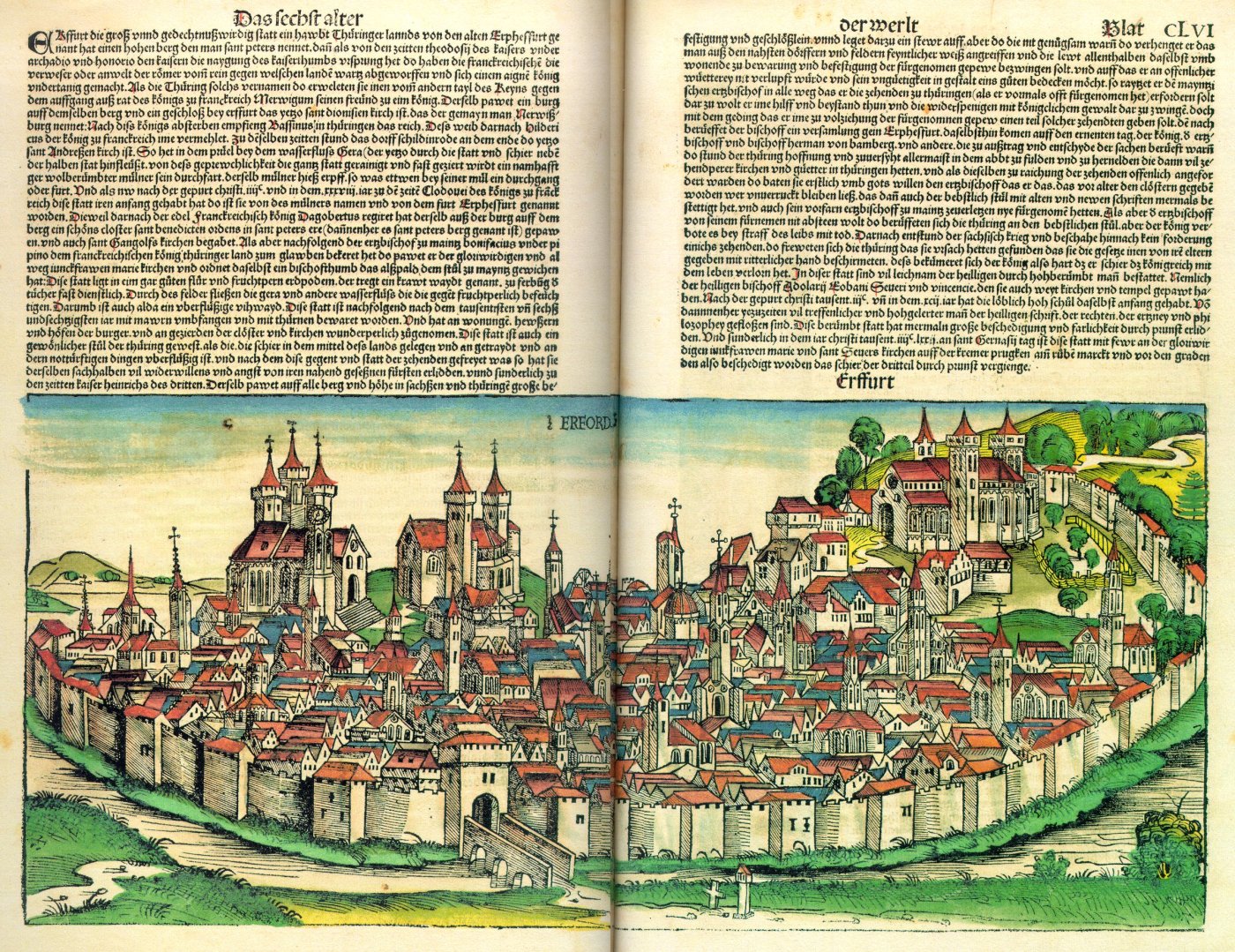
Erfurt () is the capital (political), capital and largest city of the Central Germany (cultural area), Central German state of Thuringia, with a population of around 216,000. It lies in the wide valley of the Gera (river), River Gera, in the southern part of the Thuringian Basin, north of the Thuringian Forest, and in the middle of a line of the six largest Thuringian cities ('':de:Thüringer Städtekette, Thüringer Städtekette''), stretching from Eisenach in the west, via Gotha, Erfurt, Weimar and Jena, to Gera in the east. Together with Kassel and Göttingen, it is one of the cities with more than 100,000 inhabitants lying closest to the geographic centre of Germany. Erfurt is south-west of Leipzig, north-east of Frankfurt, south-west of Berlin and north of Munich. Erfurt's old town is one of the best preserved medieval city centres in Germany. The Gera (river), Gera is spanned by the Krämerbrücke, Merchants' Bridge (''Krämerbrücke''), one of the rare bridges with ho ... [...More Info...] [...Related Items...] OR: [Wikipedia] [Google] [Baidu] |
1796 Births
Events January–March * January 16 – The first Dutch (and general) elections are held for the National Assembly of the Batavian Republic. (The next Dutch general elections are held in 1888.) * February 1 – The capital of Upper Canada is moved from Newark, Upper Canada, Newark to York, Upper Canada, York. * February 9 – The Qianlong Emperor of China abdicates at age 84 to make way for his son, the Jiaqing Emperor. * February 15 – French Revolutionary Wars: The Invasion of Ceylon (1795) ends when Johan van Angelbeek, the Batavian Republic, Batavian governor of Ceylon, surrenders Colombo peacefully to British forces. * February 16 – The Kingdom of Great Britain is granted control of Ceylon by the Dutch. * February 29 – Ratifications of the Jay Treaty between Great Britain and the United States are officially exchanged, bringing it into effect.''Harper's Encyclopaedia of United States History from 458 A. D. to 1909'', ed. by Benson John Lossing and, Woodrow Wils ... [...More Info...] [...Related Items...] OR: [Wikipedia] [Google] [Baidu] |
1863 Deaths
Events January * January 1 – Abraham Lincoln signs the Emancipation Proclamation during the third year of the American Civil War, making the abolition of slavery in the Confederate States of America an official war goal. The signing proclaimed the freedom of 3.1 million of the nation's four million slaves and immediately frees 50,000 of them, with the rest freed as the Union Army advances. This event marks the start of America's Reconstruction Era. * January 2 – Master Lucius Tar Paint Company (''Teerfarbenfabrik Meister Lucius''), predecessor of Hoechst, as a worldwide chemical manufacturing brand, founded in a suburb of Frankfurt am Main, Germany. * January 4 – Founding date of the New Apostolic Church, a Christian and chiliastic church, in a schism with the Catholic Apostolic Church in Hamburg, Germany. * January 7 – In the Swiss canton of Ticino, the village of Bedretto is partly destroyed and 29 killed by an avalanche. * January 8 ** ... [...More Info...] [...Related Items...] OR: [Wikipedia] [Google] [Baidu] |
19th-century German Geologists
The 19th century began on 1 January 1801 (represented by the Roman numerals MDCCCI), and ended on 31 December 1900 (MCM). It was the 9th century of the 2nd millennium. It was characterized by vast social upheaval. Slavery was abolished in much of Europe and the Americas. The First Industrial Revolution, though it began in the late 18th century, expanded beyond its British homeland for the first time during the 19th century, particularly remaking the economies and societies of the Low Countries, France, the Rhineland, Northern Italy, and the Northeastern United States. A few decades later, the Second Industrial Revolution led to ever more massive urbanization and much higher levels of productivity, profit, and prosperity, a pattern that continued into the 20th century. The Catholic Church, in response to the growing influence and power of modernism, secularism and materialism, formed the First Vatican Council in the late 19th century to deal with such problems and confirm cer ... [...More Info...] [...Related Items...] OR: [Wikipedia] [Google] [Baidu] |


