|
Cape Wallace
Cape Wallace is the Cape (geography), cape marking the northern extremity of Limets Peninsula and the north-west end of Low Island (South Shetland Islands), Low Island in the South Shetland Islands of Antarctica. Though the origin of the name Cape Wallace is unknown, it has appeared on charts for over a hundred years and its usage has been established internationally. Important Bird Area Cape Wallace has been identified as an Important Bird Area (IBA) by BirdLife International because it supports a very large bird colony, breeding colony of about 150,000 pairs of chinstrap penguins. About 250 pairs of gentoo penguins also nest there. References Headlands of Antarctica, Wallace, Cape Important Bird Areas of Antarctica Penguin colonies {{LowIsland-geo-stub ... [...More Info...] [...Related Items...] OR: [Wikipedia] [Google] [Baidu] |
Cape (geography)
In geography, a cape is a headland, peninsula or promontory extending into a body of water, usually a sea. A cape usually represents a marked change in trend of the Coast, coastline, often making them important landmarks in sea navigation. This also makes them prone to natural forms of erosion, mainly tidal actions, resulting in a relatively short geological lifespan. Formation Capes can be formed by Glacier, glaciers, Volcano, volcanoes, and changes in sea level. Erosion plays a large role in each of these methods of formation. Coastal erosion by waves and currents can create capes by wearing away softer rock and leaving behind harder rock formations. Movements of the Earth's crust can uplift land, forming capes. For example, the Cape of Good Hope was formed by tectonic forces. Volcanic eruptions can create capes by depositing lava that solidifies into new landforms. Cape Verde, (also known as Cabo Verde) is an example of a volcanic cape. Glaciers can carve out capes by erod ... [...More Info...] [...Related Items...] OR: [Wikipedia] [Google] [Baidu] |
Limets Peninsula
Limets Peninsula (, ) is the predominantly ice-free peninsula forming the northwest extremity of Low Island in the South Shetland Islands. The feature is projecting 3.3 km northwards and 2.4 km wide. It is bounded by Kazichene Cove and Smochevo Cove to the west and Berraz Bay to the east, and ends in Cape Wallace to the north. The area was visited by early 19th century sealers. The feature is named after the settlement of Limets in Southern Bulgaria. Location Limets Peninsula is centred at . British mapping in 1968 and 2009. Maps * South Shetland Islands: Smith and Low Islands. Scale 1:150000 topographic map No. 13677. British Antarctic Survey, 2009 Antarctic Digital Database (ADD).Scale 1:250000 topographic map of Antarctica. Scientific Committee on Antarctic Research (SCAR). Since 1993, regularly upgraded and updated References Limets Peninsula.SCAR A scar (or scar tissue) is an area of fibrosis, fibrous tissue that replaces normal skin after an injury. ... [...More Info...] [...Related Items...] OR: [Wikipedia] [Google] [Baidu] |
Low Island (South Shetland Islands)
Low Island or ''Isla Baja'', historical names ''Jameson Island'' or ''Jamesons Island,'' is an island long and wide, southeast of Smith Island in the South Shetland Islands. The island is located at and is separated from Smith Island by Osmar Strait. Low Island was so named because of its low elevation. Low Island was known to sealers in 1820, and the name Low Island has been established in international usage for 100 years. Chinstrap penguins breed at Cape Garry on Low island, forming the second largest chinstrap penguin colony on the island at over 100,000 pairs. See also * Composite Antarctic Gazetteer * List of Antarctic islands south of 60° S * SCAR * South Shetland Islands * Territorial claims in Antarctica Maps Chart of South Shetland including Coronation Island, &c.from the exploration of the sloop Dove in the years 1821 and 1822 by George Powell Commander of the same. Scale ca. 1:200000. London: Laurie, 1822. South Shetland Islands: Smith and Low Islands.Scale ... [...More Info...] [...Related Items...] OR: [Wikipedia] [Google] [Baidu] |
South Shetland Islands
The South Shetland Islands are a group of List of Antarctic and subantarctic islands, Antarctic islands located in the Drake Passage with a total area of . They lie about north of the Antarctic Peninsula, and between southwest of the nearest point of the South Orkney Islands. By the Antarctic Treaty System, Antarctic Treaty of 1959, the islands' sovereignty is neither recognized nor disputed by the signatories. According to British government language on the topic, "the whole of Antarctica is protected in the interests of peace and science." The islands have been claimed by three countries, beginning with the United Kingdom since 1908 (since 1962 as part of the equally unrecognized British Antarctic Territory). The islands are also claimed by the governments of Chile (since 1940, as part of the Antártica Chilena province), and by Argentina (since 1943, as part of Argentine Antarctica, Tierra del Fuego Province, Argentina, Tierra del Fuego Province). Several countries ... [...More Info...] [...Related Items...] OR: [Wikipedia] [Google] [Baidu] |
Antarctica
Antarctica () is Earth's southernmost and least-populated continent. Situated almost entirely south of the Antarctic Circle and surrounded by the Southern Ocean (also known as the Antarctic Ocean), it contains the geographic South Pole. Antarctica is the fifth-largest continent, being about 40% larger than Europe, and has an area of . Most of Antarctica is covered by the Antarctic ice sheet, with an average thickness of . Antarctica is, on average, the coldest, driest, and windiest of the continents, and it has the highest average elevation. It is mainly a polar desert, with annual Climate of Antarctica#Precipitation, precipitation of over along the coast and far less inland. About 70% of the world's freshwater reserves are frozen in Antarctica, which, if melted, would raise global sea levels by almost . Antarctica holds the record for the Lowest temperature recorded on Earth, lowest measured temperature on Earth, . The coastal regions can reach temperatures over in the ... [...More Info...] [...Related Items...] OR: [Wikipedia] [Google] [Baidu] |
Important Bird Area
An Important Bird and Biodiversity Area (IBA) is an area identified using an internationally agreed set of criteria as being globally important for the conservation of bird populations. IBA was developed and sites are identified by BirdLife International. There are over 13,000 IBAs worldwide. These sites are small enough to be entirely conserved and differ in their character, habitat or ornithological importance from the surrounding habitat. In the United States the program is administered by the National Audubon Society. Often IBAs form part of a country's existing protected area network, and so are protected under national legislation. Legal recognition and protection of IBAs that are not within existing protected areas varies within different countries. Some countries have a National IBA Conservation Strategy, whereas in others protection is completely lacking. History In 1985, following a specific request from the European Economic Community, Birdlife International dr ... [...More Info...] [...Related Items...] OR: [Wikipedia] [Google] [Baidu] |
BirdLife International
BirdLife International is a global partnership of non-governmental organizations that strives to conserve birds and their habitats. BirdLife International's priorities include preventing extinction of bird species, identifying and safeguarding important sites for birds, maintaining and restoring key bird habitats, and empowering conservationists worldwide. It has a membership of more than 2.5 million people across List of BirdLife International national partner organisations, 116 country partner organizations, including the Royal Society for the Protection of Birds, the Wild Bird Society of Japan, the National Audubon Society, and American Bird Conservancy. BirdLife International has identified 13,000 Important Bird Area, Important Bird and Biodiversity Areas and is the official International Union for Conservation of Nature's IUCN Red List, Red List authority for birds. BirdLife International has established that 1,375 bird species (13% of the total) are threatened with extinc ... [...More Info...] [...Related Items...] OR: [Wikipedia] [Google] [Baidu] |
Bird Colony
A bird colony is a large congregation of individuals of one or more species of bird that nest or roost in proximity at a particular location. Many kinds of birds are known to congregate in groups of varying size; a congregation of nesting birds is called a breeding colony. Colonial nesting birds include seabirds such as auks and albatrosses; wetland species such as herons; and a few passerines such as weaverbirds, certain blackbirds, and some swallows. A group of birds congregating for rest is called a communal roost. Evidence of colonial nesting has been found in non- neornithine birds (Enantiornithes), in sediments from the Late Cretaceous (Maastrichtian) of Romania. Variations on colonial nesting in birds Approximately 13% of all bird species nest colonially. Nesting colonies are very common among seabirds on cliffs and islands. Nearly 95% of seabirds are colonial, leading to the usage, seabird colony, sometimes called a rookery. Many species of terns nest in colonies ... [...More Info...] [...Related Items...] OR: [Wikipedia] [Google] [Baidu] |
Chinstrap Penguin
The chinstrap penguin (''Pygoscelis antarcticus'') is a species of penguin that inhabits a variety of islands and shores in the Southern Pacific and the Antarctic Oceans. Its name stems from the narrow black band under its head, which makes it appear as if it were wearing a black helmet. Other common names include ringed penguin, bearded penguin, and stonecracker penguin, due to its loud, harsh call. Taxonomy This species was originally given the scientific name ''Aptenodytes antarctica'' by Johann Reinhold Forster in 1781, thereby placing it in the same genus as the king and emperor penguins. In 1990, Graham Turbott transferred this species into the genus ''Pygoscelis'', together with the Adélie and gentoo penguins. This gave it the new name ''P. antarctica''. However, this is an orthographic error due to the disagreement in Latin grammar between ''antarctica'' and its assigned genus. The corrected form, ''P. antarcticus'', is the currently accepted name for this species. ... [...More Info...] [...Related Items...] OR: [Wikipedia] [Google] [Baidu] |
Gentoo Penguin
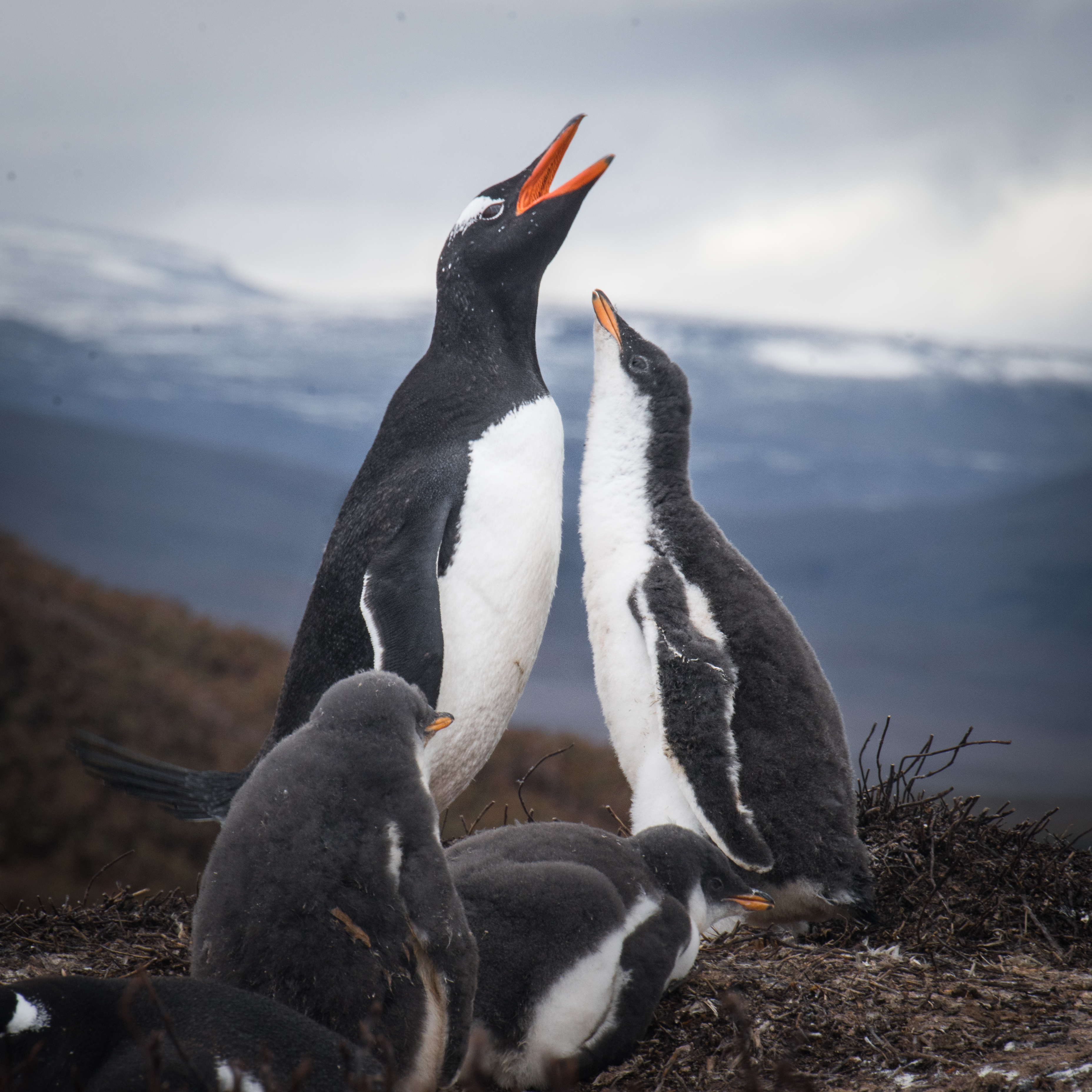
The gentoo penguin ( ) (''Pygoscelis papua'') is a penguin species (or possibly a species complex) in the genus ''Pygoscelis'', most closely related to the Adélie penguin (''P. adeliae'') and the chinstrap penguin (''P. antarcticus''). The earliest scientific description was made in 1781 by Johann Reinhold Forster with a type locality in the Falkland Islands. The species calls in a variety of ways, but the most frequently heard is a loud trumpeting, which the bird emits with its head thrown back. Names The application of "gentoo" to the penguin is unclear. '' Gentoo'' was an Anglo-Indian term to distinguish Hindus from Muslims. The English term may have originated from the Portuguese ''gentio'' ("pagan, gentile"). Some speculate that the white patch on the bird's head was thought to resemble a turban. It may also be a variation of another name for this bird, "Johnny penguin", with Johnny being the Spanish counterpart of and sounding vaguely like gentoo. The Johnny rook, a pr ... [...More Info...] [...Related Items...] OR: [Wikipedia] [Google] [Baidu] |
Headlands Of Antarctica
A headland, also known as a head, is a coastal landform, a point of land usually high and often with a sheer drop, that extends into a body of water. It is a type of promontory. A headland of considerable size often is called a cape.Whittow, John (1984). ''Dictionary of Physical Geography''. London: Penguin, 1984, pp. 80, 246. . Headlands are characterised by high, breaking waves, rocky shores, intense erosion, and steep sea cliff. Headlands and bays are often found on the same coastline. A bay is flanked by land on three sides, whereas a headland is flanked by water on three sides. Headlands and bays form on discordant coastlines, where bands of rock of alternating resistance run perpendicular to the coast. Bays form when weak (less resistant) rocks (such as sands and clays) are eroded, leaving bands of stronger (more resistant) rocks (such as chalk, limestone, and granite) forming a headland, or peninsula. Through the deposition of sediment within the bay and the erosion of th ... [...More Info...] [...Related Items...] OR: [Wikipedia] [Google] [Baidu] |


